Screveton Conservation Area
Screveton Conservation Area Appraisal and Management Plan 2024
Contents
1.1 Conservation Areas
1.2 The Purpose of a Conservation Area Character Appraisal
1.3 The Planning Policy Context
2 Screveton Location and Landscape Setting
2.1 The Screveton Conservation Area
3.1 Location and Historic Activities
3.2 Archaeology
3.3 Historical Mapping
4.1 Plan, Form and Layout
4.2 Landmarks, Focal Points and Views
4.3 Open Spaces, Trees and Landscape
4.3.1 Open Spaces, Trees and Landscape SWOT Analysis
4.4 Public Realm
5 Buildings of the Conservation Area and Key Characteristics
5.1 Building Types and Activity
5.1.1 Building Types and Activity SWOT Analysis
5.2 Key Characteristics and Building Materials
5.2.1 Key Characteristics: Lodge Lane
5.2.2 Key Characteristics: Hawksworth Road
5.2.3 Key Characteristics: Spring Lane / Flintham Lane
5.2.4 Key Characteristics SWOT Analysis
5.3 Listed Buildings
5.4 Key Unlisted Buildings
6.1 Introduction
6.2 National and Local Policies and Guidance
6.3 Article 4 Directions
6.4 Building Design
6.5 Publicity and Knowledge Transfer
6.6 Public Realm
6.7 Boundary Treatments
6.7.1 Walls and Fences
6.7.2 Hedges
6.8 Buildings at risk
6.9 Enforcement
7 Appendix 1 – Listed Buildings
8 Appendix 2 – Conservation Area Boundary and Townscape Appraisal Map
1 Introduction
1.1 Conservation Areas
Rushcliffe Borough Council has an obligation under Section 69 of the Planning (Listed Buildings and Conservation Areas) Act 1990 to review, from time to time, its Conservation Area designations.
A Conservation Area, as defined under Section 69, is ‘an area of special architectural or historic interest the character or appearance of which it is desirable to preserve or enhance’.
Section 71 of the Planning (Listed Buildings and Conservation Areas) Act 1990 highlights the local planning authority’s duty to formulate and publish proposals for the preservation and enhancement of the conservation areas. This document, therefore, aims to identify and
reaffirm (or redefine) the special architectural or historic interest of the area which warrants its designation.
Conservation Area Appraisals are not, and never have been, tools for to fossilise a place against change, instead, the processes of change which allow places to grow and evolve are recognised as being unavoidable, and it is also recognised that change can be a positive and desirable force. The designation instead allows greater scrutiny and control to manage change to positive effect and to ensure that any changes which require planning permission do not harm, and ideally serve to actively enhance, the existing character of the place.
Screveton Conservation Area: Summary of Special Interest
Screveton’s strong rural reflected in its agricultural buildings and open countryside views.
The village has a well-defined, compact centre within a linear layout along four access roads.
Mature native tress and hedgerows create a lush wooded feel.
Most buildings are distinctive in age, design, and layout.
1.2 The Purpose of a Conservation Area Character Appraisal
The purpose of a Conservation Area Character Appraisal is to:
- Identify and record the special interest of the Conservation Area to ensure there is public awareness and understanding of what is
worthy of preservation. - To define and reassess current boundaries to accurately reflect what is now perceived to be of special interest.
- To identify opportunities to safeguard and enhance the special interest of the Conservation Area.
It should be noted that the content in this document is not a comprehensive account of every significant building, structure, tree, wall, feature, or space. Therefore, any omission should not be assumed to imply that they are of no interest.
Generally, the character and appearance of a Conservation Area will be preserved or enhanced by:
- Providing controls and regulating development through the planning system.
- Applying the extra controls that designation provides over demolition, minor development, and the protection of trees.
- Environmental enhancement schemes and possibly providing financial assistance for the repair and restoration of specific buildings.
- Encouraging public bodies such as the local highways authority or utility companies to take opportunities to improve the street scene through the appropriate design and sensitive sighting of street furniture (and retention of historic features of interest), or the removal of eyesores and street features that have a negative impact such as overhead wires.
Screveton Conservation Area: Summary of Key Issues
- Incremental Loss of Rural Character
Modern infill, extensions and outbuildings can erode the village’s traditional agricultural feel if they use incongruous materials or siting.
1.3 The Planning Policy Context
This appraisal provides a firm basis on which applications for development within the Screveton Conservation Area would be assessed. It should be read alongside the wider development plan policy framework produced by Rushcliffe Borough Council and other National Planning Policy Guidance documents. The relevant documents include:
- Rushcliffe Local Plan Part 1: Core Strategy, with a specific focus on:
- Policy 10 (Design and Enhancing Local Identity) [in part]
- Policy 11 (Historic Environment)
- Rushcliffe Local Plan Part 2: Development Policies, with a specific focus on:
- Policy 28 (Conserving and Enhancing Heritage Assets)
- Policy 29 (Development Affecting Archaeological Sites)
- The National Planning Policy Framework (NPPF) (Revised -2021)
- The National Planning Practice Guidance (2015 - Subject to Continual Review)
- By Design: Urban Design in the Planning System – Towards Better Practice (2000)
- The Planning (Listed Buildings and Conservation Areas) Act 1990
2 Screveton Location and Landscape Setting
Rushcliffe Borough forms the southern tip of Nottinghamshire, which borders Leicestershire. It is predominantly a rural Borough that contains a mixture of city suburbs, market towns and villages. Rushcliffe is located about half a mile South of Nottingham city centre, with the River Trent forming the majority of its northern boundary and the River Soar defining its western boundary.
The A46 (Fosse Way), a distinctive Roman Road, runs through the centre of the Borough and leads to Newark in the North and Leicester in the South. In the northern half of the Borough, the A52 forms Nottingham’s primary transport link to Grantham and the East of England. Junction 24 of the M1 and East Midlands Airport are located about 1 mile from the western border.
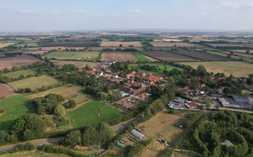
Screveton (pronounced ‘Screveeton’, ‘Screyton’ or ‘Screeton’) is a small village that sits adjacent to the A46 and may be accessed from the north, east, southwest and northwest. All four access roads are narrow mainly hedged and tree lined, single track roads with no central road markings or street lighting. Where views are permitted, they are of open countryside. On three of the approaches, it is not apparent you are entering the village until you are upon it. For the most part, Screveton retains its unity of form and has a rural feel to it. The village is surrounded by agricultural land with the villages of Kneeton to the north-west, Flintham to the north, Hawksworth to the east, Scarrington to the south and Car Colston to the south-west.
Screveton stands on relatively flat ground, sloping down gently to the east of the village at between 40 and 50 metres above sea level. The main rock type below the village is Branscombe Mudstone formation within the Mercia Mudstone Group, which gives the topsoil a clay nature.

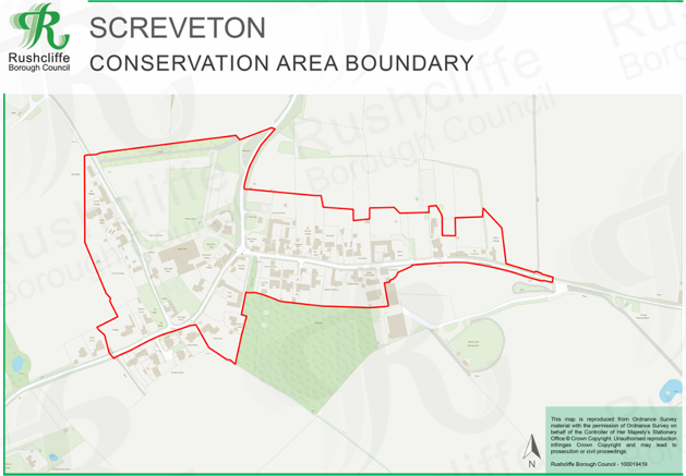
2.1 The Screveton Conservation Area
- Conservation Area Boundary covers: to be confirmed
- Number of Grade I listed buildings: 1
- Number of Grade II* listed buildings: 0
- Number of Grade II listed buildings: 8
A full list of Screveton Conservation Area’s Listed buildings can be found in Appendix 1.
3 Historical Contexts
3.1 Location and Historic Activities
‘From Car Colston, a short drive brought us to Screveton, a village little visited, lying as it does, like Car Colston, off the main road, but full of interest, from its association with the Whalleys, one of the most remarkable of Nottinghamshire families.’ (Thoroton Society Transactions, Vol 1 1897).
Perched on the edge of the Vale of Belvoir, Screveton commands open views southeast across the vale towards Belvoir Castle and the Lincolnshire Ridge, and north towards the parkland of Flintham Hall. Its development as a linear settlement—with most dwellings backing directly onto arable and grazing fields—has shaped the village’s enduring rural character.
The Domesday Book of 1086 records 18 households in Sceveton, held by King William, Bishop Odo of Bayeux and Roger of Bully. Unusually, the village’s value rose after the Conquest, reflecting its fertility and productivity. Among the tenants was Hugh, nephew of Herbert, the Bishop of Bayeux’s steward.
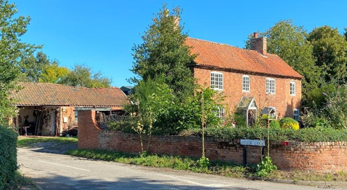
The name “Screveton” derives from “the farm of the sheriff,” and for centuries it remained firmly agricultural. As recently as the 1970s, five working farms—Top Farm, Beans Farm, White House Farm, Manor Farm and Home Farm—formed the backbone of village life; today, only a handful of residents continue to farm locally.
During the Tudor and Stuart eras, the Whalley family were Screveton’s principal landowners. In the parish church, an alabaster tomb beneath the royal arms of Charles II commemorates Richard Whalley in full armour, his feet resting upon a whale, with his three wives and twenty-five children kneeling in prayer. Erected by his third wife, Barbara, it is reckoned among the finest monuments of its kind in the country.
The Whalleys first settled here in the mid-15th century. The effigy honours Richard’s grandson (d. 1583), who served as steward to the Lord Protector Somerset under Edward VI. His younger son, Major-General Edward Whalley—guardian of Charles I at Hampton Court—later became one of the fifty-nine signatories of the King’s death warrant. Alongside his son-in-law, William Goffe, he fled into exile after the Restoration, eventually settling in Hadley, Connecticut, where he is believed to have died in 1675 (Goffe c. 1679). Their exploits inspired Robert Harris’s 2022 novel, Act of Oblivion.
A short walk from the village lies the little 13th-century church of St Wilfrid, set in a charming churchyard. Its varied architectural features hint at an even earlier building on the same site.
Adjacent to the church once stood Kirkton Hall—later known as Screveton Hall—seat of the Kirketon, Leek, Whalley, Thoroton and Hildyard families. Partly constructed from stones quarried from the nearby Roman Fosse Way, it passed in 1685 to Thomas Thoroton, who bought the Manor from Peniston Whalley.
Rebuilt and renamed Screveton Hall, it remained in Thoroton hands until the early 19th century, when Thomas Hildyard demolished it and exchanged the site with the church in 1827. Local lore suggests that the dewpond near the Old Priest’s House may be the very pond in which a 19th-century fisherman once cast his line—perhaps the same figure captured in the village archive photograph. David Willis, one of Screveton’s longest-standing residents, recalls the hall standing close by, and we continue to wonder whether the little building at the edge of that image might be the Old Priest’s House.
3.2 Archaeology
Metal‐detector enthusiasts have recovered a variety of artefacts from the fields surrounding Screveton, ranging from medieval to post-medieval objects. These finds are now catalogued and stored in the FarmEco Screveton Sheds barn. In the 1950s, local farmer Peter Rose unearthed a quern stone while ploughing a field adjacent to the A46, indicating domestic grain-processing on or near the site. Together, these discoveries point to sustained human activity in the parish from at least the medieval period onward.

ploughing near A46
3.3 Historical Mapping
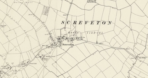
Historic Ordnance Survey Map of Screveton 1883 - 1899
4 Spatial Analysis
The relationship between open spaces and the built form within a conservation area can be central to its character. This section describes the layout of the village, highlights the significant views, landmarks and historical focal points. The contribution of open green spaces, trees and other natural elements to the conservation area’s character is also described within this section.
4.1 Plan, Form and Layout
The village’s simple, linear plan is defined by four roads, all converging close to the historic core:
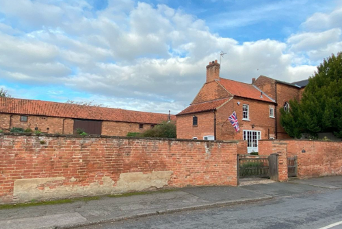
Hawksworth Road (the main street) - This is Screveton’s east–west spine, running from its eastern junction with Flintham Lane straight through the village to its western meeting-point with Car Colston Road and Screveton Road.
Flintham Lane - Approaching from the north-east (linking Screveton to Flintham), Flintham Lane terminates in a T-junction with Hawksworth Road, forming the village’s eastern gateway.
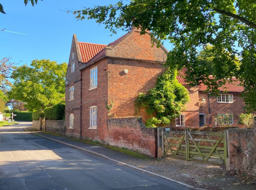
Car Colston Road - Entering from the north-west (towards Car Colston), this road meets Hawksworth Road just beyond the village centre. Along this stretch lie several of the oldest buildings—including The Old Priest’s House and the church boundary wall.
Screveton Road - At the western end of Hawksworth Road, Screveton Road branches off to the south-west, providing the main route toward Scarrington.
Approaching Screveton from any of these roads, the village remains hidden from view until you are actually within it. The surrounding landscape and gentle topography obscure long-distance views, giving the village a secluded, almost hidden character that contributes to its sense of tranquillity and rural isolation.
Below is a map that shows the current plan, form and layout of the village.

Survey on behalf of the Controller of His Majesty’s Stationary Office © Crown Copyright.
Unauthorised reproduction infringes Crown Copyright and may lead to prosecution or
civil proceedings. Rushcliffe Borough Council - 100019419
4.2 Landmarks, Focal Points and Views
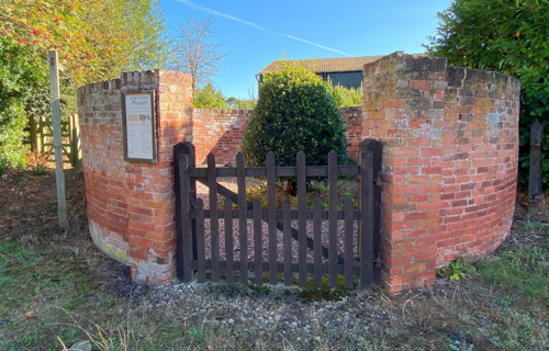
Screveton features several notable landmarks that contribute to its historical and cultural character. Chief among these is St Wilfrid’s Church, a Grade I listed building of 13th-century origin, located just outside the conservation area to the south of the village. Though set apart from the main settlement, the church remains a focal point of local heritage. Other key landmarks include the Old Priest’s House, Top Farmhouse, and the adjacent historic buildings, as well as the distinctive circular pinfold, a traditional feature also seen in nearby
villages.
In more recent years, Home Farm, now home to FarmEco Community Care, has become an informal centre of village activity. It accommodates a café, gym, hairdresser, masseuse, and the pinfold, making it a social and commercial hub for residents.
Screveton also enjoys a number of significant rural views, particularly from the gate just south of Knights Close and from further east along Hawksworth Road, where the surrounding landscape opens out across the Vale of Belvoir. These vistas reinforce the village’s sense of openness and rural seclusion.
4.3 Open Spaces, Trees and Landscape
Screveton has developed coherent green framework throughout the village. Hedgerows are a defining feature of the conservation area, marking historic field boundaries and reinforcing the village’s rural identity. A variety of species enclose many gardens and arable plots.
Beyond the hedgerows, open farmland and paddocks extend from the village edge, offering panoramic vistas of the Vale of Belvoir to the south-east and the Lincolnshire Ridge beyond. These open spaces are integral to the setting of key heritage assets.
Along the highway, few specimens of trees attain great age, the young to semi-mature trees planted within front gardens nonetheless make a valuable contribution to the village’s character. Their seasonal foliage softening building frontages and framing views along the street.
Narrow grass verges line the roads, with pavements limited to only a few stretches. The verges contribute to the rural feel of the village, soften the streetscape and act as important habitats for pollinators.
4.3.1 Open Spaces, Trees and Landscape SWOT Analysis
Strengths - what are the positives of the open spaces, trees, and landscape
- Panoramic views across the fields and mature trees from Lodge Lane, Hawksworth Road, Spring Lane and Car Colston Road.
- Beautiful views and much wildlife. A quarterly FarmEco bird survey and biodiversity survey.
- The peace and quiet. The darkness, the lack of light pollution at night.
- The visible awareness of living of the edge of the Vale of Belvoir with views of the castle on the Lincolnshire Ridge across the vale.
Weaknesses - what are the negatives of the open spaces, trees, and landscape
- Lost views due to developments.
- The encampment for travellers so close to the village.
Opportunities – what could make the open spaces, trees, and landscape better?
- Actions to further increase the biodiversity within the village.
- Actions to allow residents and visitors to appreciate the views and biodiversity.
- The planting of native trees filling in the gaps along the four access roads.
Threats - what would make an open spaces, trees and landscape worse?
- Increasing the size of the travellers’ site.
- Infill developments that diminish our open spaces and do not give space for long lived trees to be planted and nurtured.
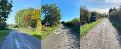
- With any increase in traffic, the speed limit within the village should be reduced from 30mph to 20mph and the four access roads leading into the village from 60mph to 30mph.
Works to Trees
You must contact the Local Planning Authority (LPA), Rushcliffe Borough Council before any works (cutting OR pruning) are carried out to trees within the Screveton Conservation Area.
Six weeks’ notice is required before any works to trees within the Conservation Area is carried out, even if they are not protected by a Tree Preservation Order (TPO).
You can use a Standard notification forms (a section 211 notice), to inform us of the works you would like to undertake.
A flow chart of the decision-making process regarding works to trees.
4.4 Public Realm
Boundary treatments throughout Screveton vary in form and material, including low stone or brick walls, hedges of beech, laurel, hawthorn and privet, and occasional metal railings. Road surfaces are asphalted but often show extensive patch repairs, while private drives—typically laid with gravel—reinforce the village’s informal, rural character.
Street lighting is almost entirely absent, with only a handful of lampposts and minimal street furniture. This lack of illumination maintains Screveton’s intimate, secluded atmosphere after dark.
The churchyard is enclosed by one brick wall alongside three native hedgerows, emphasising its green setting. Meanwhile, Café Velo Verde—Screveton’s cycling café—and the quiet lanes that radiate from the centre draw cyclists to the village, underscoring the importance of well-maintained verges and clear highways for both leisure and day-to-day use.
5 Buildings of the Conservation Area and Key Characteristics
5.1 Building Types and Activity
The majority of Screveton’s buildings are individual in character, with no two properties identical. Some front directly onto the highway, while others sit behind modest forecourts or garden plots. Over 80 per cent of dwellings abut one of the four principal roads; the main exceptions are the newer houses on Hawksworth Road, the units on Knights Close, the three homes at Newfield and Spring View, and the travellers’ site. Red brick walls and pantile roofs dominate the palette of materials, reinforcing the village’s cohesive yet varied
streetscape.
Screveton’s housing stock comprises a surprisingly diverse mix of property types, reflecting its long rural history and more recent infill:
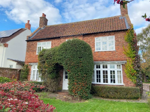
Traditional Farmhouses and Farm Cottages - Often 18th or 19th century red‐brick or rendered buildings, many with pantile roofs, set directly adjacent to the road or backing onto fields.
Detached and Semi‐Detached Village Cottages - Modest two‐ and three‐bedroom homes, varying in plan and elevation, some timber‐framed or with stone detailing.
Converted Agricultural Buildings - Barn and outbuilding conversions that retain original openings and roof forms, often with inserted glazing in former cart‐laden doorways.
Modern Infill and Small Estates - Newer detached and semi‐detached houses on Hawksworth Road, Knights Close and Newfield, generally brick‐built with concrete‐tile roofs and small front gardens.
Bungalows and Single‐Storey Homes - Limited examples, mainly on the edges of the conservation area, offering accessible accommodation set back from the highway.
5.1.1 Building Types and Activity SWOT Analysis
Strengths - what activities/places exist that makes the village/town great?
- Architectural Variety: Almost every building in the village is unique in design, layout, and age. This architectural diversity offers a rich and visually engaging streetscape, in stark contrast to the homogeneity of modern housing developments.
- Historic Linear Layout: As one of the few remaining linear villages, Screveton retains its traditional form, with many properties directly fronting the four principal roads. This pattern supports a strong sense of place and continuity.
- The Natural Setting and Access: Surrounded by open countryside, the village benefits from an attractive rural backdrop that includes arable farmland, nut and fruit orchards, and grazing pastures for cattle and sheep. A network of footpaths and quiet single
track roads is well-used for walking, cycling, and horse riding, offering recreational opportunities and enhancing the village’s rural charm. - Home Farm Hub: Home Farm has become a vibrant hub of activity, housing Café Velo Verde, Thorpe Performance Gym, and the FarmEco community farm, alongside small enterprises such as the Urban Worm Company, Linear Brewery, hairdressing services, a masseuse, and interiors specialist. These businesses provide social, economic, and community value, helping sustain village life.
- The Working Smithy: The continued operation of the village smithy—an increasingly rare example of a functioning rural forge—adds to Screveton’s cultural heritage and contributes to its living history.
Weaknesses - what activities/places exist that detract from making the village/town great?
- Littering: There is a persistent problem with litter, particularly along Spring Lane, which detracts from the rural character and visual quality of the area.
- Unauthorised Stays: Unauthorised stays at the travellers’ site have occasionally caused concern among residents, raising issues around site management and community integration.
Opportunities - what activities/places could exist that would village/town even better?
- Sensitive Residential Development: There is scope for limited residential growth by extending housing boundaries modestly along the four main roads. Careful planning could allow for new homes that complement the existing village character, while maintaining key open spaces, views, and the linear settlement form.
- Establishing a Village Pub: The introduction or return of a village pub could provide a valuable social hub for residents and visitors, helping to strengthen community cohesion and support local enterprise.
Threats - what activities/places would make village/town worse?
- Rural Crime. Incidents of hare coursing and other forms of rural crime remain a concern. Screveton’s relative seclusion, combined with easy access to both the A46 and A52, can make it vulnerable to opportunistic criminal activity.
- Large-Scale Infrastructure: Proposals for solar farms in the surrounding countryside pose a potential threat to the village’s open rural character and long-distance views, particularly if poorly integrated into the landscape. Such developments risk altering the visual setting and agricultural nature of the area.
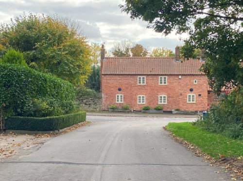
5.2 Key Characteristics and Building Materials
As with many rural Nottinghamshire villages, traditional building materials in Screveton were locally sourced, reflecting what was readily available in the immediate landscape. Bricks were typically produced in small scale brick pits nearby, leading to subtle variations in size, colour, and texture that contribute to the distinctive local character. Roofs were originally thatched, but clay pantiles became the dominant roofing material from the 18th century onwards and now define much of the village roofscape.
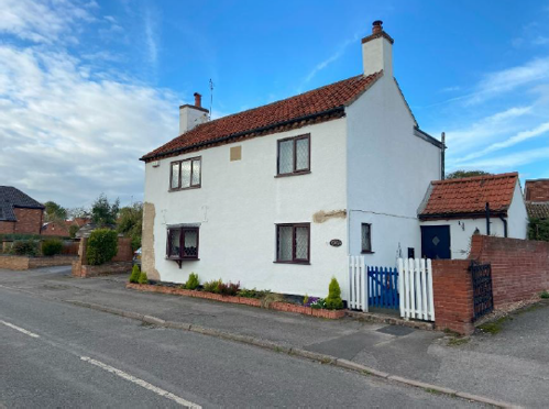
Within the conservation area, building walls are predominantly constructed from warm red or orange brick, often laid in simple stretcher bond. In some cases, older or lower sections of walls use blue lias limestone, usually as a plinth or foundation course. A small number of properties are rendered and painted white, typically to protect or mask ageing brickwork—a common vernacular response in rural areas.
Decorative brickwork is generally restrained. While Screveton lacks the elaborate embellishment seen in larger settlements, occasional details such as dentil eaves courses, brick string courses, and air vents in former agricultural buildings add subtle interest. Bonding styles vary, with stretcher bond the most prevalent, but isolated examples of Flemish bond and older forms such as English bond are present.
5.2.1 Key Characteristics: Lodge Lane
Materials:
Walls: Predominantly red brick with a number of rendered dwellings painted in different colours
Roofs: Red / orange pantiles.
Windows: Painted wood.
Doors: Various.
Key Characteristics / Architectural Features:
Lodge Lane presents a diverse and varied streetscape, with no two houses alike along its entire length—from the historic Smithy near Spring Lane to the more recent residential cluster close to the A46.
At the heart of the lane and central to village life is the working Smithy, a rare surviving example of traditional rural industry. Nearby are the extended Old School House and the distinctive seven-foot high Pinfold, both important heritage features that contribute to the character of this part of the conservation area.
Several former workers’ cottages along the lane have been sympathetically combined to create larger dwellings, retaining their original scale and rural charm.
Among the more contemporary additions is Blackridge, a low-profile, single storey dwelling clad in black metal. Designed in reference to traditional agricultural buildings, it stands out for its modern aesthetic and high environmental performance, offering a successful example of contemporary rural design within a historic context.
5.2.2 Key Characteristics: Hawksworth Road
Materials:
Walls: Many 18th and 19th century orange/red brick in various bonds and patterns. Most buildings have all been altered or extended in some way using brick.
Roofs: Dominated by red / orange clay pantiles with a few examples of plain tiles and slate. Gable ends are mostly plain close verge where the tiles run to the edge of the brick gables.
Windows: Predominantly painted timber window frames or plastic / aluminium. Many ‘front’ doors do not front onto the roadside.
Key Characteristics / Architectural Features:
Hawksworth Road displays a highly varied built form, with each property differing in size, layout, and relationship to the street. Some houses are set well back behind modest front gardens, while others sit directly on the roadside. Plot sizes also vary significantly, ranging from expansive grounds to compact footprints, contributing to an informal and irregular street rhythm.
The predominant building material is red brick with red pantile roofs, consistent with the wider village character. Older properties are typically of solid wall construction, while later buildings maintain the traditional palette but adopt modern methods. Four rendered houses—each painted white—offer visual contrast: The Oaks and Victoria Cottage front directly onto the pavement, while Beans Cottage and Beans House are set back slightly with small front gardens.
A notable recent addition is The Gables, constructed on the footprint of a former agricultural barn. Slightly angled away from the road, its design references the old barn with the use of vertical black brick detailing, echoing traditional ventilation slits and reinforcing the agricultural heritage of the site.
5.2.3 Key Characteristics: Spring Lane
Key Characteristics / Architectural Features:
At the northern entrance to the village, the Beans Farm complex occupies a prominent position at the junction of Spring Lane, Flintham Lane, and Hawksworth Road. This cluster includes Hawthorn Cottage and Beans Croft Barn, both built in the traditional red brick and red pantile style typical of Screveton.
Most properties along Spring Lane share this vernacular, with the exception of a few rendered buildings—Poplars, Home Farm Cottages, and Blackberry Barn—which are painted white and stand out in contrast to their brick neighbours.
Several buildings of architectural or historic note are located in this area, including: – Top Farm (Grade II listed), a fine example of
traditional agricultural architecture – Skerton House, the former village chapel – Amblegate, distinguished by its whimsical clay cat
perched on the roof ridge – Peacock House, the only stone-built property in the village, adding further variety to the material palette.
5.2.4 Key Characteristics SWOT Analysis
Strengths – what is good about most existing buildings that looks good?
- There Coherent Architectural Diversity: Despite each building being unique, there is a strong visual harmony across Screveton due to consistent use of traditional materials such as red brick and pantiles. This coherence within diversity gives the village a distinctive and appealing character.
- Historic Linear Form: Screveton’s layout as a linear village along four access roads is a rare and well preserved example of this traditional settlement pattern. It reinforces the rural identity and allows many properties to maintain a direct relationship with the surrounding open countryside.
Weaknesses – what is it about most existing buildings that does not look so good?
- Buildings in Need of Maintenance: A small number of historic buildings are showing signs of neglect or deterioration. Without timely repair and sensitive maintenance, these properties risk losing their architectural integrity and could detract from the overall character of the village.
Opportunities – what could make existing buildings (or new builds) look good and contribute to the character of the area?
- Individually Designed Dwellings: Carefully considered, one-off dwellings that respect and extend the village's linear form present an opportunity to accommodate modest growth while
preserving Screveton’s distinctive character. Such
developments should maintain gaps between
buildings to protect important glimpses into the
open countryside and reinforce the village’s historic
connection to the landscape.
Threats – what could make existing buildings (or new builds) look worse and detract from the character of the area?
- Uniform Multi-Plot Developments: The construction of more than one dwelling in a similar style and with matching materials risks eroding Screveton's distinctive character, which is defined by its individually unique buildings.
- Estate-Style Development: Any form of estate development that breaks from the village’s linear pattern—particularly where properties do not front directly onto one of the four main roads—would disrupt the historic layout and rural feel.
- Harmful Infill: Infill developments that block or diminish the remaining open views and glipmses into the countryside would have a significant negative impact on the village's visual character and its strong connection to the surrounding landscape.
5.3 Listed Buildings
Buildings on the Government’s List of Buildings of Special Architectural or Historic Interest are called “Listed” buildings and are protected by law. Consent is required from Rushcliffe Borough Council before any works of alteration, extension, or demolition can be carried out on any listed building.
Further information can be found in Rushcliffe Borough Council’s publication Listed Buildings in Rushcliffe. The complete list of the Secretary of State’s Statutory List of Buildings of Special Architectural Interest or Historic Interest can be accessed online.
Names and details of the Listed Buildings and structures in Screveton Conservation Area (correct as of January 2024) are detailed in Appendix 1. All Listed Buildings are shown on the Townscape Appraisal plan, but some smaller structures such as gravestones may not be shown.
Top Farm Cottages are dated 18th-19th century and the building is characteristic of the period. It is not bonded to the house and considered to be later. The bricks are soft red hand-made / wirecut fairy thin bricks, indicative of the 18th century. The roof timbers are a mixture of hand and machine sawn, dating the roof to pre-19th century with 19th-20th century repairs.
Top Farm Cart Shed. Is dated 19th century and characteristic of the 18th-19th centuries. The bricks are handmade / wirecut red bricks, indicative of the date built, but the machine-sawn roof timbers are 19th-20th century. The shed is thought to have been built by roofing over the walls of existing buildings. It became redundant following the mechanisation of farming.
Top Farm Barn is built of fairly soft handmade red bricks, indicating a date in the 18th-19th century. The timbers are machine-sawn with occasional hand-sawn timber and the roof is likely to date to post 1840 with some reused timbers. There is a circa19th century window.
Top Farm Boundary Wall to the left of the farmhouse is a 25-metre boundary wall, composed of brick with a rubble plinth, half round brick coping and a pair of square brick piers. To the right is a five-metre-long brick boundary wall with ramped coping.
Top Farm Eastern Cow House, 19th century and built of hand-made soft red bricks. The roof timbers are post-1840 and machine-sawn, dating the roof to the 19th-20th century. The building abuts The Barn and is considered later but appears to be a single build with the Western Cow House, below.
Top Farm Western Cow House might have been a stable, was more likely a cow house. The bricks are fairly hard red wirecut / machine-made and the roof timbers machine-sawn, dating the building and roof to the 19th-20th century.
Top Farm Pump and trough are located to the south of the Farmhouse. The 1790 water pump is timber with flat wooden top, an iron handle and an ornate lead spout. A lead face plate is decorated with the letters ‘D F’ and a wheatsheaf above the spout, with a figure on either wide of the spout and ‘1790’ below. There is a further lead plate below the spout as a splashback. The stone trough has a square end against the pump case and a rounded end away from it.
Manor Farmhouse is a brick, circa mid-18th century building, extended and re-fronted in the early 19th. There is a brick plinth, first floor band, cogged and dentillated eves and 4 gabled and single ridge stacks. It is L-shaped, 6 bays wide, 4 deep and 2 storeys high, with gabled and hipped slate and pantile roofs.
The Pinfold is about 6 metres (20 ft) in diameter and is a circular gated, seven foot high brick enclosure with buttresses and plain coping at the village end of Lodge Lane where stray animals could be housed. It contains a timber gate with square piers. It appears on the 1882 Ordnance Survey map and sits on common land, in line with the Commons Registration Act of 1965. In 1998-90 Rushcliffe Borough Council restored and renewed the gate and put a bench inside. Flower beds have been established inside and it is kept tidy by the village.
5.4 Key Unlisted Buildings
Contribution to the established character of the place can also come from buildings which are not recognised via listing, or are not old. A plan with all of the positive contributions to the area can be found in Appendix 2 - Conservation Area Boundary and Townscape Appraisal Map.
The Smithy in Screveton is a rare and well-preserved example of a rural blacksmith’s workshop with an attached cottage, dating from the mid-17th century. It represents a traditional working-residential layout that was once common in agricultural villages but is now seldom seen.
Constructed in local red brick with a pantile roof, the building reflects the vernacular style typical of rural Nottinghamshire. Its modest scale, simple openings, and utilitarian character are consistent with its original industrial purpose.
Despite its long-standing use, the Smithy has remained largely unaltered, retaining its architectural integrity and contributing significantly to the historic character of the conservation area.
The Old School House, now renovated and extended, was a two-up, two-down house with a one-room school at the back. When the school closed, the schoolroom was used as a granary.
Skreton Cottage. An 18th century stone and rendered brick cottage. The building by the gate at the roadside is now a garage but was a primitive Methodist Chapel recorded as existing in 1848. This was also a Wesleyan Methodist chapel in the village before 1869.
Beans Farm Complex
Miss Alice Bean, now lying in the churchyard with her many brothers, spurned marriage on her wedding morning because she couldn’t face leaving her brothers to fend for themselves. Beans Farm is now a collection of residential homes, comprising Hawthorne House, Beans Farm Barn, Beans Farm Cottage, Beans Farm House, The Gables and Meadow View. The main living area of the Gables sits on the footprint of the old barn and The Gables black vertical bricks are meant to reflect the former barn’s ventilation holes.
The War Memorial, situated at the top of the Flintham Road and created by local residents (with support from local organisations and Rushcliffe Borough Council), remembers the Bomber Command crews of an R.A.F. Lancaster (from R.A.F. Syerston) and an R.A.F. Airspeed Oxford (from R.A.F. Wymeswold) who died on 14th April 1944.
The two aircraft were involved in a mid-air collision over Screveton and all eleven men on board were killed. The pilots were seen to turn their stricken craft away from the village and, as a result, no one in the village was harmed. The memorial is approximately mid-way between the two crash sites.


6 Generic Management Plan for Conservation Areas in Rushcliffe
6.1 Introduction
In carrying out its planning functions, the Borough Council is required in law to give special attention to the desirability of preserving or enhancing the character or appearance of Conservation Areas. The Management Plan for a Conservation Area is a tool to ensure the special character of the area is preserved and enhanced. The management plans aim to:
- Outline a strategic management proposal for the preservation and enhancement of the Screveton Conservation Area.
- Act as a guide for professionals and residents alike regarding:
- features of value, worthy of preservation;
- characteristics worthy of preservation;
- opportunities for enhancement;
- development proposals which preserve and enhance the special character of the area.
- Inspire community commitment to conservation principles and reporting.
6.2 National and Local Policies and Guidance
There is a duty to formulate and publish management plans setting out policies and proposals for the preservation and enhancement of Conservation Areas. Many of these policies and proposals are common to all Conservation Areas, and these are set out in this document. The Central Government Guidance and Local policies applicable to Conservation Areas include:
- Rushcliffe Local Plan Part 1: Core Strategy, with a specific focus on:
- Design and Enhancing Local Identity [in part]
- Historic Environment
- Rushcliffe Local Plan Part 2: Development Policies, with a specific focus on:
- Conserving and Enhancing Heritage Assets
- Development Affecting Archaeological Sites
- The National Planning Policy Framework (NPPF), particularly, but not exclusively the chapter on Conserving and Enhancing the Historic Environment.
- The National Planning Practice Guidance (NPPG) (updated 2021 and subject to continual review)
- By Design: Urban Design in the Planning System – Towards Better Practice (2000)
- The Planning (Listed Buildings and Conservation Areas) Act 1990
- Historic England “Historic England Advice Note 1: Conservation Area Designation, Appraisal and Management”
The council will utilise the full range of strategic policy and guidance documents to ensure that development in Screveton Conservation Area is of a standard that enhances the amenity of the local area. The council will always look to use the most up-to-date versions of the document.
Supplementary documents may be issued for individual Conservation Areas where specific policies or proposals are needed.
6.3 Article 4 Directions
There are extra consents required in Conservation Areas. For example, in addition to the general control of development, you will
need to get permission for
- Any additions or alterations to the roof (for example, dormer windows)
- The installation of satellite dishes on chimneys, roofs or walls fronting a highway
- Any extension which extends beyond the side of the original dwelling house
- Any extension of more than one storey that extends beyond the rear wall of the original dwelling house
- Cladding the exterior of the dwelling
- Any demolishing of a building or part of a building that has a volume over 115 cubic metres
Article 4 of the Town and Country Planning (General Permitted Development) Order 1995, allows planning authorities to restrict
some permitted development rights within particular areas. This does not necessarily prevent development or change taking place
but enables the Local Authority to manage the design and detailing of the works, and potentially grant permission subject to appropriate conditions. The use of Article 4 Directions will be proposed where it is considered appropriate following the completion of each Area Appraisal across the Borough.
Details of Article 4 Directions for Screveton Conservation Area
There are currently no Article 4 Directions for Screveton Conservation Area.
6.4 Building Design
Mimicking the local vernacular is not the only way to ‘fit in’ with the character of a conservation area. National policy makes clear that contemporary designed, provided it is sympathetically designed, cannot be dismissed as an option. Therefore, good contemporary design will be encouraged where it respects the context’s character, scale and massing. This must be demonstrated in the Design and Access Statement submitted with any planning application.
Extensions to buildings in Conservation Areas should respect:
- The key characteristics of the original building, including scale, mass, materials and proportions
- The contextual setting and character of the Conservation Area
Copying like for like can devalue and destroy the ability to “read” historic change, and dilutes our historic heritage. Pastiche designs, incorporating poor imitations of other styles, will be resisted, particularly where they incorporate details which are not locally appropriate. Careful high-quality replication may be required in a few very sensitive locations.
In particularly sensitive locations, such as uniform terraces, exact replication may be necessary to maintain compositional unity. In that case, attention to details, choice of materials and high-quality workmanship are the keynotes. However, in some cases, a direct relationship is not impossible. For example, Flemish Bond brickwork cannot be replicated in cavity walls, and narrow lime mortar joints cannot be replicated in modern metric brickwork.
Where a new building is appropriate, on infill sites or where an existing building detracts from the character of the area, the opportunity should be taken to re-establish the streetscape, reinforce enclosure, open up distant vistas or views of landmarks or hide unsightly views.
“New and old buildings can coexist happily without disguising one as the other, if the design of the new is a response to urban design objectives” (DETR – “By Design”, p19).
As with extensions, good contemporary design which respects local character, and the context of the site will be encouraged.
All new buildings should respond appropriately to the existing frontage and normally follow the established building line. Development or redevelopment will normally be resisted if:
“it blocks important views identified in the individual appraisals, uses important open spaces identified in the appraisals, adversely affects the setting of any Listed or key buildings, fails to maintain or re-establish the streetscape where appropriate dominates its Conservation Area background fails to recognise the context of the site destroys important features identified in the individual appraisals such as boundary walls, fences, hedgerows or trees”
Where the quantity of contemporary schemes in a small area becomes significant and outnumbers older buildings within the area, further contemporary schemes could fundamentally shift the architectural character of the area and thus be harmful, even if well designed as an individual project.
New development that stands out from the background of buildings may be appropriate in exceptional circumstances if it contributes positively as a landmark to enhance the street scene, to highlight a corner or to signal a visual change of direction such as along a curving vista.
Any external lighting should be carefully designed and sited to minimise light pollution.
Energy producing or saving devices are generally welcomed by the Council, but careful consideration is required when these are to be located in a Conservation Area and some may require planning permission. In particular, they should be positioned to minimise their impact on the building and on the local amenity.
6.5 Publicity and Knowledge Transfer
Ambiguity about additional controls within a Conservation Area raises the likelihood of inappropriate developments occurring which
may damage the integrity of the conservation area designations.
Efforts have been made to engage local community groups in the development and review of the character appraisals. Empowering
communities to define the special architectural and historic interest of the Conservation Area aims to raise awareness.
Whether the appraisal took a community-led or a council-led approach, upon reviewing all Conservation Areas, the public were invited to ask questions and comment during a public consultation.
A consultation event also aimed to diminish any ambiguity about restrictions within a Conservation Area and increase the likelihood of sensitive and appropriate developments, maintaining the character of the area.
The council recognise the potential issues of turnover in residency and ownership of properties in the conservation area. Therefore,
Rushcliffe Borough Council will periodically use their media outlets to highlight conservation area designations and the significant,
related planning controls.
If there are any queries about conservation areas, please email conservationareas@rushcliffe.gov.uk
6.6 Public Realm
General maintenance and upkeep to the public realm may include fixing damage to roads and pavements, and fixing issues with street lighting. Issues such as these can impact the quality of the Conservation Area.
The council aims to encourage works to the public realm that are in keeping with, or actively enhance the conservation area. Rushcliffe Borough Council can only advise on work within the public realm that does not require planning permission (for example work completed by statutory undertakers, such as the Highways Authority). In these instances, Rushcliffe borough council cannot prevent such work.
Nottinghamshire County Council are responsible for repairs to roads, pavements and street lighting. Report issues of repairs to roads, pavements and street lighting to Nottinghamshire County Council online.
Rushcliffe Borough Council will continue to undertake their duties in maintaining the public realm. Vandalism, fly tipping and street cleaning are all the responsibility of Rushcliffe Borough Council. Report issues to Rushcliffe Borough Council online.
Work to Trees
You must contact the Local Planning Authority (LPA), Rushcliffe Borough Council, before any works (cutting OR pruning) are carried out to trees within the Screveton Conservation Area
Six weeks’ notice is required before any works to trees within the Conservation Area is carried out, even if they are not protected by Tree Preservation Order (TPO).
You can use a Standard notification forms (a section 211 notice) to inform us of the works you would like to undertake.
A flow chart of the decision-making process regarding works to trees.
6.7 Boundary Treatments
Where there is a proposal for a new boundary treatment to be installed, the council would encourage the use of boundary treatments within the area.
Within conservation areas, planning permission is required to alter, maintain, improve, take down or build any new gate, fence, wall or other enclosure with:
- A height of one metre or more if next to a highway (including a public footpath or bridleway), waterway or open space; or
- A height of two metres or more elsewhere.
Where planning permission is required to remove a wall, Rushcliffe Borough Council will aim to protect those boundary walls and fences that have been identified as positively contributing to the area.
Hedgerows are significant habitats for wildlife in lowland Britain. Regulations are intended to protect important hedges in the countryside. The policy applies to hedges that are more than 20m long, (or less if connected to another hedge) on or adjacent to:
- Land used for agriculture or forestry, including the keeping of horses or donkeys
- Registered common land and village greens
- Local Nature Reserves and Sites of Special Scientific Interest.
The policy does not apply if the hedge is within or on the boundary of the curtilage of a house.
6.8 Buildings at Risk
A few of the important buildings across the various Conservation Areas are currently vacant or not in regular use, which may lead to some being “at risk” of neglect or decay.
The Council will encourage and advise on renovation and repair work that is sensitive to the original or traditional historic character of the building and retains original features. The council will monitor the opportunity and potential for grant aid schemes to encourage the basic maintenance work necessary to ensure that key buildings within the conservation area are structurally sound and weather tight. However, given the current financial climate and outlook, such schemes are unlikely in the short to medium term.
There is a presumption against the demolition of buildings which contribute to the character of the area unless there are exceptional circumstances. It would benefit both the physical form and the function of the Conservation Area if these buildings were repaired, maintained and brought back into use.
Where the poor condition of a building or structure is as a result of neglect and lack of maintenance by its owner there is no requirement for the Borough Council to take its deteriorated condition into account when deciding whether demolition is appropriate. This is to avoid rewarding the deliberate neglect of buildings by representing such action as a way to obtain planning permission for demolition and redevelopment.
6.9 Enforcement
Rushcliffe Borough Council will, from time to time, assess and monitor changes in the appearance and condition of Screveton Conservation Area. This will ensure that where necessary enforcement action can be taken promptly to deal with problems as they arise.
Where co-operation cannot be gained by any other means, Rushcliffe Borough Council has the ability to use additional enforcement powers to tackle particular issues within conservation areas. The Council may take formal action if the condition of any building (listed or unlisted) which makes a positive contribution to the character of the Conservation Area is considered to be at risk.
The council will work in accordance with their enforcement policy, which aims to provide an efficient enforcement service in support of the Council’s statutory planning service. Rushcliffe Borough Council’s enforcement actions will remain transparent, consistent, and proportionate, as it is recognised that effective controls over unauthorised development assists in conserving the natural and built environment whilst helping to protect the quality of people’s lives and maintaining the Council’s integrity.
7 Appendix 1 – Listed Buildings
Grade: I
Listing entry number: 1243811
National grid reference: SK 72880 43414
Location: St Wilfrid’s Church, Car Colston Road, Screveton
Grade: II
Listing entry number: 1243813
National grid reference: SK 72921 43439
Location: The Old Priest's House, Car Colston Road, Screveton
Top Farmhouse, Adjoining Service Wing and Boundary Walls
Grade: II
Listing entry number: 1244662
National grid reference: SK 73229 43734
Location: Top Farmhouse, Adjoining Service Wing and Boundary Walls, Main Street, Screveton
Grade: II
Listing entry number: 1272715
National grid reference: SK 72873 43402
Location: Sundial, St Wilfrid’s Church, Car Colston Road, Screveton
Grade: II
Listing entry number: 1244654
National grid reference: SK 7350743778
Location: Manor Farmhouse, Hawksworth Road, Screveton
Boundary Wall and Adjoining Stable at St Wilfrid’s Church
Grade: II
Listing entry number: 1244636
National grid reference: SK 72920 43407
Location: Boundary Wall and Adjoining Stable at St Wilfrid’s Church, Car Colston Road, Screveton
Water Pump and Trough, Top Farmhouse
Grade: II
Listing entry number: 1244663
National grid reference: SK 73232 43726
Location: Water Pump and Trough, Top Farmhouse, Main Street, Screveton
Grade: II
Listing entry number: 1243814
National grid reference: SK 73106 43773
Location: Lodge Lane, Screveton
Cartshed, Pigeoncote, Stables and Wall, Top Farm
Grade: II
Listing entry number: 1243815
National grid reference: SK 73257 43712
Location: Cartshed, Pigeoncote, Stables and Wall, Top Farm, Main Street, Screveton
*The titles of these listings may not make it clear that all listed buildings always include all attached structures and extensions, regardless of age, and all detached outbuildings built before 1 June 1948 which are, or were at the time of listing, ancillary to the function of the primary listed building and were in the same ownership at the time of listing.
For example, when a house is listed, the listing will apply to extensions, porches, detached historic stables, barns, wash houses, privies etc. Such outbuildings and extensions are only exempt from the provisions of listing where the listing specifically excludes them. Appendix 2 - Conservation Area Boundary and Townscape Appraisal Map.
8 Appendix 2 – Conservation Area Boundary and Townscape Appraisal Map
Conservation Areas
- Bingham Conservation Area
- East Bridgford Conservation Area
- East Leake Conservation Area
- Hawksworth Conservation Area
- Hickling Conservation Area
- Ruddington Conservation Area
- Thoroton Conservation Area
- Wiverton Conservation Area
- Langar Conservation Area
- West Leake Conservation Area
- Whatton in the Vale Conservation Area
- Costock Conservation Area
- Sutton Bonington Conservation Area
- Upper Saxondale Conservation Area
- Wysall Conservation Area
- Bradmore Conservation Area
- Car Colston Conservation Area
- Scarrington Conservation Area
- Orston Conservation Area
- Flintham Conservation Area
- Edwalton Conservation Area
- Aslockton Conservation Area
- Bunny Conservation Area
- Granby Conservation Area
- Keyworth Conservation Area
- Thrumpton Conservation Area
- Normanton on the Wolds Conservation Area
- Upper Broughton Conservation Area
- Screveton Conservation Area
- Kneeton Conservation Area
- Colston Bassett Conservation Area
- Cropwell Bishop Conservation Area