Ruddington Conservation Area
Ruddington Conservation Area Appraisal and Management Plan November 2022

Contents
1.1 Conservation Areas
1.2 The Purpose of a Conservation Area Character Appraisal
1.3 The Planning Policy Context
2 Ruddington Location and Landscape Setting
3.1 Historical Overview
3.2 Location and Historic Activities
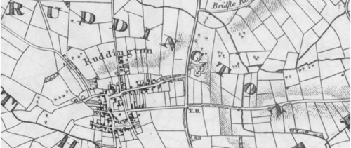
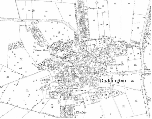
3.3 Historical Mapping
4.1 Plan, Form and Layout
4.2 Landmarks, Focal Points and Views
4.3 Open Spaces, Trees and Landscape
4.3.1 Open Spaces, Trees and Landscape SWOT Analysis
4.4 Public Realm
5 Buildings of the Conservation Area and Key Characteristics
5.1 Building Types and Activity
5.1.1 Building types and Activity SWOT Analysis
5.2 Key Characteristics and Building Materials
5.3 Listed buildings
5.4 Key Unlisted Buildings
6 Building Materials and Local Details
7.1 Introduction
7.2 National and Local Policies and Guidance
7.3 Article 4 Directions
7.4 Building Design
7.5 Publicity and Knowledge Transfer
7.6 Public Realm
7.7 Boundary Treatments
7.7.1 Walls and Fences
7.7.2 Hedges
7.8 Buildings at risk
7.9 Enforcement
8 Appendix 1 – Listed Buildings (as of March 2023)
9 Appendix 2 – Conservation Area Boundary and Townscape Appraisal Map
1 Introduction
1.1 Conservation Areas
Rushcliffe Borough Council has an obligation under Section 69 of the Planning (Listed Buildings and Conservation Areas) Act 1990 to review, from time to time, its Conservation Area designations.
A Conservation Area, as defined under Section 69, is ‘an area of special architectural or historic interest the character or appearance of which it is desirable to preserve or enhance’.
Ruddington Conservation Area was designated in 1970. Prior to this re-appraisal of 2022, the Ruddington Conservation Area was also renewed in 2009.
Section 71 of the Planning (Listed Buildings and Conservation Areas) Act 1990 highlights the local planning authority’s duty to formulate and publish proposals for the preservation and enhancement of the conservation areas. This document, therefore, aims to identify and
reaffirm (or redefine) the special architectural or historic interest of the area which warrants its designation.
Conservation Area Appraisals are not, and never have been, tools for fossilising a place against change, instead, the processes of change which allow places to grow and evolve are recognised as being unavoidable, and it is also recognised that change can be a positive and desirable force. The designation instead allows greater scrutiny and control to manage change to positive effect and to ensure that any changes which require planning permission do not harm, and ideally serve to actively enhance, the existing character of the place.
Ruddington Conservation Area: Summary of Special Interest
Dense village centre with many rows of small terraces each with characteristic chequered, or decorative, brickwork.
The village has a distinct urban feel to the centre. Many buildings provide a strong link with the village’s industrial past.
The Green provides a direct contrast to the density of the village centre to the North.
The main roads into the village have a strong character with properties set in large gardens with matures trees.
1.2 The Purpose of a Conservation Area Character Appraisal
The purpose of a Conservation Area Character Appraisal is to:
- Identify and record the special interest of the Conservation Area to ensure there is public awareness and understanding of what is
worthy of preservation. - To define and reassess current boundaries to accurately reflect what is now perceived to be of special interest.
- To identify opportunities to safeguard and enhance the special interest of the Conservation Area.
It should be noted that the content in this document is not a comprehensive account of every significant building, structure, tree, wall, feature, or space. Therefore, any omission should not be assumed to imply that they are of no interest.
Generally, the character and appearance of a Conservation Area will be preserved or enhanced by:
- Providing controls and regulating development through the planning system.
- Applying the extra controls that designation provides over demolition, minor development, and the protection of trees.
- Environmental enhancement schemes and possibly providing financial assistance for the repair and restoration of specific buildings.
- Encouraging public bodies such as the local highways authority or utility companies to take opportunities to improve the street scene through the appropriate design and sensitive sighting of street furniture (and retention of historic features of interest), or the removal of eyesores and street features that have a negative impact such as overhead wires.
1.3 The Planning Policy Context
This appraisal provides a firm basis on which applications for development within the Ruddington Conservation Area would be
assessed. It should be read alongside the wider development plan policy framework produced by Rushcliffe Borough Council and other
National Planning Policy Guidance documents. The relevant documents include:
- Rushcliffe Local Plan Part 1: Core Strategy, with a specific focus on:
- Policy 10 (Design and Enhancing Local Identity) [in part]
- Policy 11 (Historic Environment)
- Rushcliffe Local Plan Part 2: Development Policies, with a specific focus on:
- Policy 28 (Conserving and Enhancing Heritage Assets)
- Policy 29 (Development Affecting Archaeological Sites)
- The National Planning Policy Framework (NPPF) (Revised -2024)
- The National Planning Practice Guidance (2015 - Subject to Continual Review)
- By Design: Urban Design in the Planning System – Towards Better Practice (2000)
- The Planning (Listed Buildings and Conservation Areas) Act 1990
- The Ruddington Neighbourhood Plan which also comprises the following design guides:
- Part 1: Introduction & Character Assessment
- Part 2: Design Codes for Minor Developments
- Part 3: Design Codes for Major and Strategic Developments
Ruddington Conservation Area: Summary of Key Issues
Alterations to Listed and key unlisted properties - The character of the terraces can be reduced where original details are replaced with unsuitable replacements. The use of PVC doors and windows are the most common cause of loss of character on unlisted buildings.
Development Pressures – The village is keen to remain as such and there is a clear desire to remain separated from the Nottingham suburbs.
Buildings at risk – All properties can be damaged by the removal of original features and inappropriate replacements. However the many terraces in Rushcliffe are particularly at risk due to their collective nature.
Landscape – Where trees need to be felled replacements should be planted. The use of large native species should be encouraged wherever there is sufficient space to help maximise the character of the area.
2 Ruddington Location and Landscape Setting
Rushcliffe Borough forms the southern tip of Nottinghamshire, which borders Leicestershire. It is predominantly a rural Borough that contains a mixture of city suburbs, market towns and villages. Rushcliffe is located about half a mile South of Nottingham city centre, with the River Trent forming the majority of its northern boundary and the River Soar defining its western boundary.
The A46, a distinctive Roman Road, runs through the centre of the Borough and leads to Newark in the North and Leicester in the South. In the northern half of the Borough, the A52 forms Nottingham’s primary transport link to Grantham and the East of England. Junction 24 of the M1 and East Midlands Airport are located about 1 mile from the western border.
Ruddington lies around 5 miles due South of Nottingham. New developments to the north and east of the village have extended the boundaries past the A60. The former Great Central Railway line would have at one time been considered the western boundary, but recent development has seen the village expand beyond this.
The village has a good range of shops and other services many based in the centre of the village. A business park and the Country Park which includes the Nottingham Transport Heritage Centre are located to the South.

- Conservation Area Boundary covers: 47.3 hectares (approximately)
- Number of Grade 1 listed buildings: 0
- Number of Grade 2* listed buildings: 0
- Number of Grade 2 listed buildings: 16
A full list of Ruddington Conservation Area’s Listed buildings can be found in Appendix 1.
3 Historical Contexts
3.1 Historical Overview
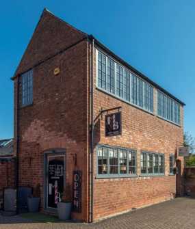
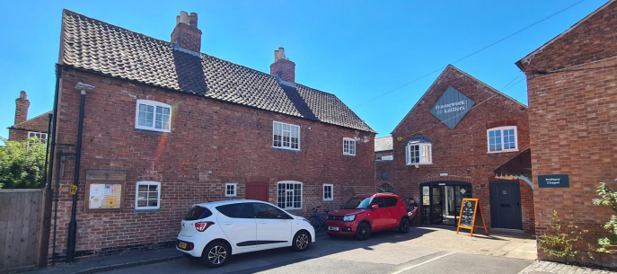
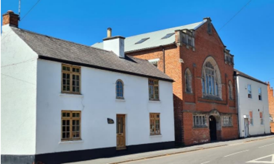
From its Saxon origin, Ruddington grew rapidly during the Industrial Revolution to become the largest frame knitters’ village in Nottinghamshire south of the River Trent. New housing was built to accommodate those involved in subsidiary trades such as framesmiths, needle makers, sink makers, seamers and bobbin-boys at Wilford Lane, The Leys and Chapel Street. A number of the present-day Grade 2 Listed Buildings, were former framework knitters’ workshops, now converted, or have workshops to the rear and provide a definite theme within the village. The most important site, however, is the complex of framework knitters’ cottages, workshops, Chapel and outbuildings which now form a museum on Chapel Street and date from circa 1829 and circa 1840. They provide powerful architectural and social history links with the thriving community of modern Ruddington.
3.2 Location and Historic Activities
It is likely that the current location of Ruddington was first settled by the Saxons in around 550 AD. The name Ruddington comes from the Saxon for homestead (ton) of Ruddingas (Rudda’s people). Prior to the Saxon settlement at Ruddington there is evidence to suggest Bronze and Iron Age occupation at the Flawford Churchyard located about 1.5 miles to the East of Ruddington, this site then became a Roman Villa and eventually the site of a Saxon church.
At the time of the Domesday Book it is estimated the village would have had a population of around 250 and during the Middle Ages would have been farmed on the open field system. This continued into the 17th Century and by 1600 the population was around 320. There were 4 large fields: Micklebarrow field, Mill field, Collicross field and Thornditch field, each would have been divided into narrow strips which would have been divided amongst the village. In 1698 there was a partial enclosure of the Thornditch field which became
pastureland. In 1767 there was a Parliamentary enclosure which resulted in the large fields being split into smaller fields and enclosed with hedgerows. In 1773 the Church at Flawford was demolished and the chapel in Ruddington became the parish church of St Peter.
From this point onwards the village moved away from agriculture towards framework knitting and eventually other trades as the main source of income and employment, this resulted in a dramatic rise in population. By 1801 the population was 868 and over the next Century the population grew to 2500. This period of growth resulted in many of the small terraces which characterise the centre of Ruddington and resulted in a number of Schools and Methodist chapels being built.
The Great Central Railway began running goods in July 1898 and the line was officially opened in March 1899. This attracted the building of a number of textile factories, predominantly for lace and a number of large commuter properties such as those on Manor Park and Clifton Road.
During World War II an Ordnance Supply and Disposal Depot was opened in Ruddington and persisted until the 1980’s. This area was reclaimed and is now the site of the Business and Country Park. Following the Second World War the village again expanded rapidly with the building of a number of Housing Estates. This has continued to this day with further development taking place beyond the railway line.
3.3 Historical Mapping
4 Spatial Analysis
The relationship between open spaces and the built form within a conservation area can be central to its character. This section describes the village’s layout, highlighting the significant views, landmarks and historical focal points. The contribution of open green spaces, trees and other natural elements to the conservation area’s character is also described within this section.
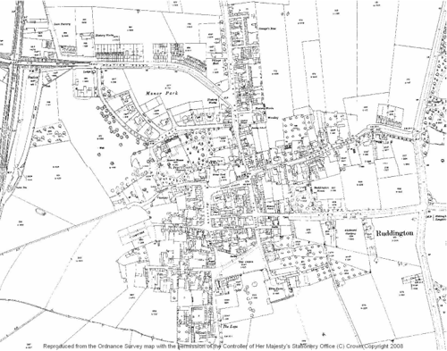
4.1 Plan, Form and Layout
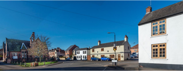
The centre of the village has developed with a distinctive grid layout and has a very compact centre with a number of narrow streets and roads. These contrast with The Green which acts as the southern boundary to the commercial centre of the village. Outside of the village centre there are 4 main roads that provide access to the village, 2 link with the A60 Nottingham to Loughborough Road and the others with Wilford and Clifton. Between these is late 20th Century residential infill.
Below is a map that describes the current plan, form and layout of the village/town.
This map is reproduced from Ordnance Survey material with the permission of Ordnance Survey on behalf of the Controller of Her Majesty’s Stationary Office © Crown Copyright. Unauthorised reproduction infringes Crown Copyright and may lead to prosecution or civil proceedings. Rushcliffe Borough Council - 100019419
4.2 Landmarks, Focal Points and Views
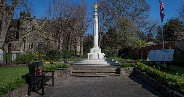
It is believed St Peter’s Church’s history traces back to Saxon times. While there is mention of a priest within the Domesday Book of 1086, it’s unclear whether the reference is to the church in Ruddington or a nearby church in Flawforth.
Initially linked to the manor, St Peter’s church evolved into a chapel connected to the manor house.
Around the late 13th century, Ruddington acquired its chapel, sparking disputes and leadership changes amidst legal entanglements and tensions with ecclesiastical authorities. Flawforth's church demolition in 1773 led St Mary's in Ruddington to become the parish church.
Throughout the 19th century, the church underwent gradual changes and renovations, until a complete rebuild was decided in 1884, taking place from 1887-1888. Named St Peter's, the new Gothic-style church featured stone facades and notable elements like oak flooring, a chancel arch, and a carved oak cross. Over time, the church underwent further enhancements, including an organ, a Lady Chapel, floodlighting, and a 2006-2008 Hermitage Development project.
Adjacent to St Peter’s Church is Ruddington’s War Memorial that commemorates village residents who were killed in the First and Second World Wars, and the Korean War.
Ruddington Village Museum delves into the commercial landscape of late Victorian and early Edwardian Ruddington by presenting a collection of exhibits that faithfully recreate the village's historic shops. Housed within a section of the former Victorian school building in Ruddington, this museum is situated across from St Peter's Church, adding to its notable presence.
Nestled into the village and not an elaborate or obvious landmark, the Ruddington Framework Knitters' Cottages are historical cottages that provide a glimpse into the past, and the daily lives of Ruddington’s framework knitters. The cottages now form Ruddington Framework Knitters Museum.
Ruddington also has a number of charming pubs, cafes, and shops that contribute to the village's character and atmosphere. These establishments often serve as gathering places for residents.
4.3 Open Spaces, Trees and Landscape
The village green serves as a focal point for community gatherings, events, and recreational activities. It often plays a central role in local celebrations, markets, and festivals, contributing to the social and cultural life of the village.
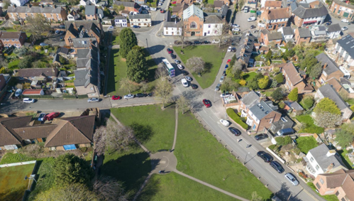
With very few trees within the centre of the village, the mature trees which surround many parts of it become all the more important.
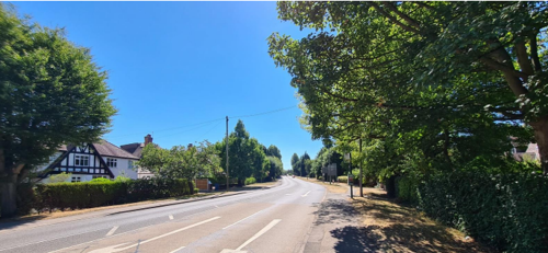
The mature trees along Loughborough Road and Kirk Lane are vital to the character of both roads. The area around South Manor and St Peter’s Church also benefits from a backdrop of mature trees. Mature trees around the Church and along Kirk Lane and Loughborough Road give a rural character which contrasts with the dense and urban village centre.
4.3.1 Open Spaces, Trees and Landscape SWOT Analysis
Strengths - what are the positives of the open spaces, trees, and landscape
- Rushcliffe Country Park
- The Village Green
- Mature trees along Loughborough Road and Kirk Lane
- Allotment sites
Weaknesses - what are the negatives of the open spaces, trees, and landscape
- Considerable amounts of new residential properties have been built in the village.
- Condition of roads and pavements, flooding at junction of Kirk Lane and Loughborough Road.
- Conditions of roads and pavements throughout the village.
- Significant tree damage/ removal on Kirk Lane.
- Excessive signage.
- Impact of the derelict properties on the junction of The Green/ High Street.
Opportunities – what could make the open spaces, trees, and landscape better?
- Derelict properties on The Green/ High Street junction are restored and brought back into use.
Threats - what would make open spaces, trees and landscapes worse?
- Increasing number of neglected maintenance on residential properties.
- Loss of character to rows of terraces resulting from removal of original features and replacement with materials that are incongruous with the overall aesthetic.
- Building on the Green Belt resulting in the village being ‘swallowed’ by Nottingham suburbs.
- Felling trees prior to planning applications being submitted.
Works to Trees
You must contact the Local Planning Authority (LPA), Rushcliffe Borough Council before any works (cutting OR pruning) are carried out to trees within the Ruddington Conservation Area.
Six weeks’ notice is required before any works to trees within the Conservation Area is carried out, even if they are not protected by a Tree Preservation Order (TPO).
Standard notification forms (a section 211 notice), further information and contact details.
A flow chart of the decision-making process regarding works to trees.
4.4 Public Realm
The public realm within Ruddington is an inviting space that fosters a strong sense of community engagement and plays a pivotal role in supporting local businesses and cultural events. Cafes, quaint shops, and vibrant street markets contribute to the lively and dynamic character of the area.
Community events, performances, and gatherings often take place in the well-planned public spaces, further enriching the social fabric of the town.
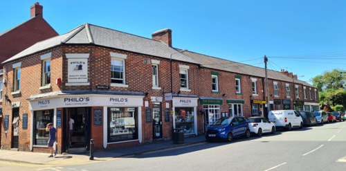
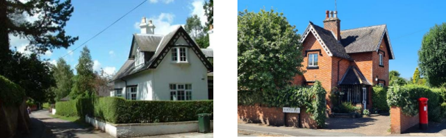
Properties in the centre often front directly onto the pavements (see Figure 8), or have small front gardens enclosed by low to medium height brick walls often with a triangular brick coping (see Figure 9). As properties move away from the centre of the village the frontages become more rural in character and the gardens become more spacious.
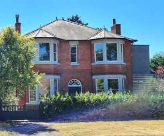
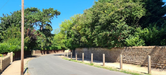
The larger Victorian and Edwardian properties are often fronted by stone walls. Whilst Kirk Lane maintains a rural character due to the vast majority of properties having hedges or fences as front boundaries (see Figure 10).
The stone walls, crushed limestone pavements and the stone kerbing detail contribute to Manor Park’s distinct character (see Figure 11).
5 Buildings of the Conservation Area and Key Characteristics
5.1 Building Types and Activity
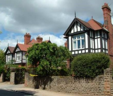
The historic core of Ruddington conveys a charming and quaint ambiance, with well-preserved period buildings that bring attention to Ruddington’s past. The older buildings in Ruddington mainly consist of a mixture of farmhouses, cottages, terraces, framework knitting sheds, Victorian and Georgian houses, along with a number of Methodist churches and former schools.
5.1.1 Building types and Activity SWOT Analysis
Strengths - what activities/places can you go that make the village/town great?
- Framework Knitters Museum
- Heritage Centre
- Village Museum
- Post Office
- Restaurants/ Pubs/ Bars
- Sports/ playing fields
- Library
- Monthly Ruddington Village Market
- Methodist, Baptist and Church of England Churches
- The Ruddington Pantry
- Many community groups
- Allotments
Weaknesses - what activities/places exist that detract from making the village/town great?
- Lack of car parking
- Volume of vehicles using the village as a ‘cut through’
- No public toilets
- Manor Park Retirement village aesthetics are not in keeping with the Manor Park street scene
- New developments and infill not aligning to the Ruddington Design Guide
Opportunities - what activities/places could exist that would village/town even better?
- The new community centre
- Increased leisure facilities for all age groups
- Cosmetic improvements to shop frontages
Threats - what activities/places would make village/town worse?
- The village infrastructure is beyond capacity
- Further developments with no plan for increasing facilities
- Loss of diversity of retail offering
5.2 Key Characteristics and Building Materials
Please refer to the Ruddington Neighbourhood Design Guide, Part 1 Introduction and Character Assessment for an up-to-date position on the character zones.

5.3 Listed buildings
Buildings on the Government’s List of Buildings of Special Architectural or Historic Interest are called “Listed” buildings and are protected by law. Consent is required from Rushcliffe Borough Council before any works of alteration, extension, or demolition can be carried out on any listed building.
Further information can be found in Rushcliffe Borough Council’s publication Listed Buildings in Rushcliffe.
The complete and up-to-date list of the Secretary of State’s Statutory List of Buildings of Special Architectural Interest or Historic Interest can be found on the Historic England website.
Names and photos of the Listed Buildings and structures in Ruddington Conservation Area (correct as of September 2023) are detailed in Appendix 1. All Listed Buildings are shown on the Townscape Appraisal plan, but some smaller structures such as gravestones may not be shown.
A number of the present-day Grade 2 Listed Buildings, were former framework knitters’ workshops, now converted, or have workshops to the rear and provide a definite theme within the village.
The most significant complex of former framework knitters’ cottages, workshops, Chapel and outbuildings (see Figure 17), now form a museum on Chapel Street and date from circa 1829 and circa 1840. They provide powerful architectural and social history links with the thriving community of modern Ruddington.
5.4 Key Unlisted Buildings
Contribution to the established character of the place can also come from buildings which are not recognised via listing or are not old. A plan with all the positive contributions to the area can be found in Appendix 2.
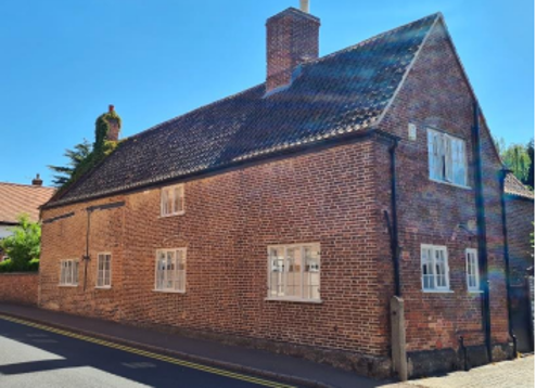
A large number of unlisted terraces, cottages, farmhouses and outbuildings have been identified on the Townscape Appraisal map as having a positive impact on the character of the Conservation Area, the majority of these are 18th and 19th Century. It is the individuality of these buildings, whilst at the same time using a similar palette of materials and construction details which gives the village a coherent character.
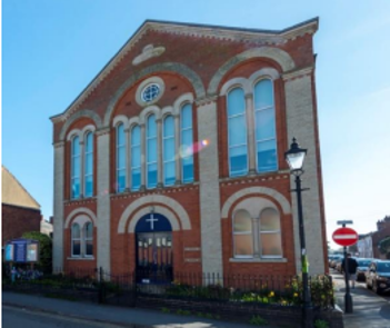
The village has 3 churches these complement some of the other formal buildings in the village centre such as the former school buildings, which are listed.
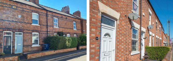
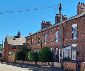
Small rows of terraces are the key characteristic of the village centre. Whilst the terraces are generally similar in scale and materials, they all have their own character due to decorative brickwork and detailing.
In 2023, the boundary of the Conservation Area was extended to include Savages Row, a row of terraced cottages with Flemish bond brickwork, a lighter finish on the header bricks, and segmented arches to windows and doorways, all of which contribute to its special character.
These lodges now seem separated from the former Manor House (now South Manor), but once marked its North and South entrances.
5.5 Local Details
The previous sections (sections 5.3 and 5.4) highlighted the significance of the larger structures; however, the collective details of the many smaller farmhouses, cottages, and agricultural buildings also contribute to the village’s special character.
These lodges now seem separated from the former Manor House (now South Manor), but once marked its North and South entrances.
6 Building Materials and Local Details
Building materials were largely locally sourced, bricks did not often travel far from where they were made, leading to interesting village specific sizes, colours and styles. Roofs would have been made from local materials such as thatch until clay pantiles and slate tiles became popular.
The traditional building materials within the Conservation Area are as follows:
Walls: Dominated by red brick. Chequered brickwork using Flemish Bond or other decorative detailing on terraces.
Roofs: Dominated by slate with some examples of clay pantiles.
Windows: Timber. Arched brick or stone lintels.
7 Generic Management Plan for Conservation Areas in Rushcliffe
7.1 Introduction
In carrying out its planning functions, the Borough Council is required in law to give special attention to the desirability of preserving or enhancing the character or appearance of Conservation Areas. The Management Plan for a Conservation Area is a tool to ensure the special character of the area is preserved and enhanced. The management plans aim to:
- Outline a strategic management proposal for the preservation and enhancement of the Ruddington Conservation Area.
- Act as a guide for professionals and residents alike regarding:
- features of value, worthy of preservation;
- characteristics worthy of preservation;
- opportunities for enhancement;
- development proposals which preserve and enhance the special character of the area.
- Inspire community commitment to conservation principles and reporting.
7.2 National and Local Policies and Guidance
There is a duty to formulate and publish management plans setting out policies and proposals for the preservation and enhancement of Conservation Areas. Many of these policies and proposals are common to all Conservation Areas, and these are set out in this document. The Central Government Guidance and Local policies applicable to Conservation Areas include:
- Rushcliffe Local Plan Part 1: Core Strategy, with a specific focus on:
- Design and Enhancing Local Identity [in part]
- Historic Environment
- Rushcliffe Local Plan Part 2: Development Policies, with a specific focus on:
- Conserving and Enhancing Heritage Assets
- Development Affecting Archaeological Sites
- The National Planning Policy Framework (NPPF), particularly, but not exclusively the chapter on Conserving and Enhancing the Historic Environment.
- The National Planning Practice Guidance (NPPG) (updated 2021 and subject to continual review)
- By Design: Urban Design in the Planning System – Towards Better Practice (2000)
- The Planning (Listed Buildings and Conservation Areas) Act 1990
- Historic England “Historic England Advice Note 1: Conservation Area Designation, Appraisal and Management”
The council will utilise the full range of strategic policy and guidance documents to ensure that development in Ruddington Conservation Area is of a standard that enhances the amenity of the local area. The council will always look to use the most up-to-date versions of the document. Supplementary documents may be issued for individual Conservation Areas where specific policies or proposals are needed.
7.3 Article 4 Directions
There are extra consents required in Conservation Areas. For example, in addition to the general control of development, you will need to get permission for:
- Any additions or alterations to the roof (for example, dormer windows)
- The installation of satellite dishes on chimneys, roofs or walls fronting a highway
- Any extension which extends beyond the side of the original dwelling house
- Any extension of more than one storey that extends beyond the rear wall of the original dwelling house
- Cladding the exterior of the dwelling
- Any demolishing of a building or part of a building that has a volume over 115 square metres
Article 4 of the Town and Country Planning (General Permitted Development) Order 2015, allows planning authorities to restrict some permitted development rights within particular areas. This does not necessarily prevent development or change taking place but enables the Local Authority to manage the design and detailing of the works, and potentially grant permission subject to appropriate conditions. The use of Article 4 Directions will be proposed where it is considered appropriate following the completion of each Area Appraisal across the borough.
7.4 Building Design
Mimicking the local vernacular is not the only way to ‘fit in’ with the character of a conservation area. National policy makes clear that contemporary designed, provided it is sympathetically designed, cannot be dismissed as an option. Therefore, good contemporary design will be encouraged where it respects the context’s character, scale and massing. This must be demonstrated in the Design and Access Statement submitted with any planning application.
Extensions to buildings in Conservation Areas should respect:
- The key characteristics of the original building, including scale, mass, materials and proportions
- The contextual setting and character of the Conservation Area
Copying like for like can devalue and destroy the ability to “read” historic change, and dilutes our historic heritage. Pastiche designs, incorporating poor imitations of other styles, will be resisted, particularly where they incorporate details which are not locally appropriate. Careful high-quality replication may be required in a few very sensitive locations.
In particularly sensitive locations, such as uniform terraces, exact replication may be necessary to maintain compositional unity. In that case, attention to details, choice of materials and high-quality workmanship are the keynotes. However, in some cases, a direct relationship is not impossible. For example, Flemish Bond brickwork cannot be replicated in cavity walls, and narrow lime mortar joints cannot be replicated in modern metric brickwork.
Where a new building is appropriate, on infill sites or where an existing building detracts from the character of the area, the opportunity should be taken to re-establish the streetscape, reinforce enclosure, open up distant vistas or views of landmarks or hide unsightly views.
“New and old buildings can coexist happily without disguising one as the other, if the design of the new is a response to urban design objectives” (DETR – “By Design”, p19).
As with extensions, good contemporary design which respects local character, and the context of the site will be encouraged.
All new buildings should respond appropriately to the existing frontage and normally follow the established building line. Development or redevelopment will normally be resisted if:
“it blocks important views identified in the individual appraisals, uses important open spaces identified in the appraisals, adversely affects the setting of any Listed or key buildings, fails to maintain or re-establish the streetscape where appropriate dominates its Conservation Area background fails to recognise the context of the site destroys important features identified in the individual appraisals such as boundary walls, fences, hedgerows or trees”
Where the quantity of contemporary schemes in a small area becomes significant and outnumbers older buildings within the area, further contemporary schemes could fundamentally shift the architectural character of the area and thus be harmful, even if well designed as an individual project.
New development that stands out from the background of buildings may be appropriate in exceptional circumstances if it contributes positively as a landmark to enhance the street scene, to highlight a corner or to signal a visual change of direction such as along a curving vista.
Any external lighting should be carefully designed and sited to minimise light pollution.
Energy producing or saving devices are generally welcomed by the Council, but careful consideration is required when these are to be located in a Conservation Area and some may require planning permission. In particular, they should be positioned to minimise their impact on the building and on the local amenity.
7.5 Publicity and Knowledge Transfer
Ambiguity about additional controls within a Conservation Area raises the likelihood of inappropriate developments occurring which
may damage the integrity of the conservation area designations.
Efforts have been made to engage local community groups in the development and review of the character appraisals. Empowering
communities to define the special architectural and historic interest of the Conservation Area aims to raise awareness.
Whether the appraisal took a community-led or a council-led approach, upon reviewing all Conservation Areas, the public were invited to ask questions and comment during a public consultation. A consultation event also aimed to diminish any ambiguity about
restrictions within a Conservation Area and increase the likelihood of sensitive and appropriate developments, maintaining the character
of the area.
The council recognise the potential issues of turnover in residency and ownership of properties in the conservation area. Therefore,
Rushcliffe Borough Council will periodically use their media outlets to highlight conservation area designations and the significant,
related planning controls.
The date of the Consultation Event 04/11/2023
If there are any queries about conservation areas, please email conservationareas@rushcliffe.gov.uk
7.6 Public Realm
General maintenance and upkeep to the public realm may include fixing damage to roads and pavements, and fixing issues with street lighting. Issues such as these can impact the quality of the Conservation Area.
The council aims to encourage works to the public realm that are in keeping with, or actively enhance the conservation area. Rushcliffe Borough Council can only advise on work within the public realm that does not require planning permission (for example work completed by statutory undertakers, such as the Highways Authority). In these instances, Rushcliffe borough council cannot prevent such work.
Nottinghamshire County Council are responsible for repairs to roads, pavements and street lighting. Report issues of repairs to roads, pavements and street lighting to Nottinghamshire County Council online.
Rushcliffe Borough Council will continue to undertake their duties in maintaining the public realm. Vandalism, fly tipping and street cleaning are all the responsibility of Rushcliffe Borough Council. Report issues to Rushcliffe Borough Council online.
Works to Trees
You must contact the Local Planning Authority (LPA), Rushcliffe Borough Council, before any works (cutting OR pruning) are carried out to trees within the Thoroton Conservation Area.
Six weeks’ notice is required before any works to trees within the Conservation Area is carried out, even if they are not protected by Tree Preservation Order (TPO).
You can use a Standard notification forms (a section 211 notice) to inform us of the works you would like to undertake.
A flow chart of the decision-making process regarding works to trees.
7.7 Boundary Treatments
Where there is a proposal for a new boundary treatment to be installed, the council would encourage the use of boundary treatments within the area.
Within conservation areas, planning permission is required to alter, maintain, improve, take down or build any new gate, fence, wall or other enclosure with:
- A height of one metre or more if next to a highway (including a public footpath or bridleway), waterway or open space; or
- A height of two metres or more elsewhere.
Where planning permission is required to remove a wall, Rushcliffe Borough Council will aim to protect those boundary walls and fences that have been identified as positively contributing to the area.
Hedgerows are significant habitats for wildlife in lowland Britain. Regulations are intended to protect important hedges in the countryside. The policy applies to hedges that are more than 20m long, (or less if connected to another hedge) on or adjacent to:
- Land used for agriculture or forestry, including the keeping of horses or donkeys
- Registered common land and village greens
- Local Nature Reserves and Sites of Special Scientific Interest.
The policy does not apply if the hedge is within or on the boundary of the curtilage of a house.
7.8 Buildings at risk
A few of the important buildings across the various Conservation Areas are currently vacant or not in regular use, which may lead to some being “at risk” of neglect or decay.
The Council will encourage and advise on renovation and repair work that is sensitive to the original or traditional historic character of the building and retains original features. The council will monitor the opportunity and potential for grant aid schemes to encourage the basic maintenance work necessary to ensure that key buildings within the conservation area are structurally sound and weather tight. However, given the current financial climate and outlook, such schemes are unlikely in the short to medium term.
There is a presumption against the demolition of buildings which contribute to the character of the area unless there are exceptional circumstances. It would benefit both the physical form and the function of the Conservation Area if these buildings were repaired, maintained and brought back into use.
Where the poor condition of a building or structure is as a result of neglect and lack of maintenance by its owner there is no requirement for the Borough Council to take its deteriorated condition into account when deciding whether demolition is appropriate. This is to avoid rewarding the deliberate neglect of buildings by representing such action as a way to obtain planning permission for demolition and redevelopment.
7.9 Enforcement
Rushcliffe Borough Council will, from time to time, assess and monitor changes in the appearance and condition of Ruddington Conservation Area. This will ensure that where necessary enforcement action can be taken promptly to deal with problems as they arise.
Where co-operation cannot be gained by any other means, Rushcliffe Borough Council has the ability to use additional enforcement powers to tackle particular issues within conservation areas. The Council may take formal action if the condition of any building (listed or unlisted) which makes a positive contribution to the character of the Conservation Area is considered to be at risk.
The council will work in accordance with their enforcement policy, which aims to provide an efficient enforcement service in support of the Council’s statutory planning service. Rushcliffe Borough Council’s enforcement actions will remain transparent, consistent, and proportionate, as it is recognised that effective controls over unauthorised development assists in conserving the natural and built environment whilst helping to protect the quality of people’s lives and maintaining the Council’s integrity.
7 Appendix 1 – Listed Buildings (as of March 2023)
Wall, Railings and Gateway to Ruddington Free School
Grade: 2
Listing entry number: 1039603
National grid reference: SK 57233 32857
Location: Wall, Railings and Gateway to Ruddington Free School, Asher Lane
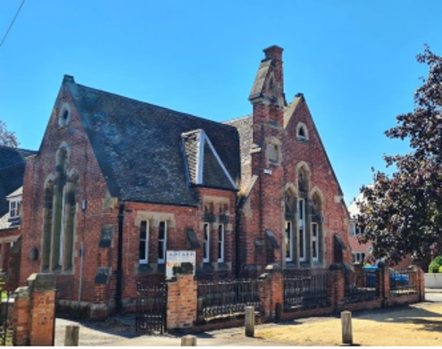
Ruddington Free School, now occupied by the Old School Kitchens and Hibbs Typewriters
Grade: 2
Listing entry number: 1249768
National grid reference: SK 57239 32845
Location: Ruddington Free School, now occupied by the Old School Kitchens and Hibbs Typewriters, The Green
Former Framework Knitters' Workshop Behind Fern Villas
Grade: 2
Listing entry number: 1039604
National grid reference: SK 57300 32960
Location: Former Framework Knitters' Workshop Behind Fern Villas, The Green
Former Framework Knitters' Workshop, now occupied by Alfred Cook (Machinists) Limited
Grade: 2
Listing entry number: 1263504
National grid reference: SK 57276 32966
Location: Former Framework Knitters' Workshop, now occupied by Alfred Cook (Machinists) Limited, Parkyns Street
Former Framework Knitters' Workshop, now part of Museum Complex, East Block
Grade: 2
Listing entry number: 1249738
National grid reference: SK 57174 32946
Location: Former Framework Knitters' Workshop, now part of Museum Complex, East Block, Chapel Street
Grade: 2
Listing entry number: 1039592
National grid reference: SK 57165 32947
Location: Former Framework Knitters' Workshop and Attached Outbuildings, now part of Museum Complex, West Block, Chapel Street
Framework Knitters' Cottages, now part of Museum Complex
Grade: 2
Listing entry number: 1373930
National grid reference: SK 57170 32963
Location: Framework Knitters' Cottages, now part of Museum Complex, Chapel Street
Grade: 2
Listing entry number: 1263508
National grid reference: SK 57207 33156
Location: Church Side, Vicarage Lane
Grade: 2
Listing entry number: 1263576
National grid reference: SK 57238 33158
Location: Church of St Peter, Church Street
Grade: 2
Listing entry number: 1249767
National grid reference: SK 57237 33074
Location: St Peter's Rooms, Church Street
Grade: 2
Listing entry number: 1039594
National grid reference: SK 57270 33082
Location: Manor Farmhouse, 17 and 19 Church Street
Grade: 2
Listing entry number: 1373895
National grid reference: SK 57279 33185
Location: The Hermitage, Wilford Road
Grade: 2
Listing entry number: 1263425
National grid reference: SK 57285 33118
Location: K6 Telephone Kiosk, Church Street
Former Framework Knitters' Workshop behind number 11
Grade: 2
Listing entry number: 1249797
National grid reference: SK 57353 33093
Location: Former Framework Knitters' Workshop behind number 11, High Street
Grade: 2
Listing entry number: 1263538
National grid reference: SK 57458 33097
Location: Ruddington House, Kirk Lane
Grade: 2
Listing entry number: 1039595
National grid reference: SK 57565 33214
Location: 42 Easthorpe Street
The titles of these listings may not make it clear that all listed buildings always include all attached structures and extensions, regardless of age, and all detached outbuildings built before 1st June 1948 which are, or were at the time of listing, ancillary to the function of the primary listed building and were in the same ownership at the time of listing.
For example, when a house is listed, the listing will apply to extensions, porches, detached historic stables, barns, wash houses, privies etc. Such outbuildings and extensions are only exempt from the provisions of listing where the listing specifically excludes them.
8 Appendix 2 – Conservation Area Boundary and Townscape Appraisal

The Ruddington Townscape Map above shows:
- Locations of listed buildings
- Locations of key unlisted buildings
- Open space
- Locations of trees, hedges, and significant hedges and fences
- Viewpoints
Conservation Areas
- Bingham Conservation Area
- East Bridgford Conservation Area
- East Leake Conservation Area
- Hawksworth Conservation Area
- Hickling Conservation Area
- Ruddington Conservation Area
- Thoroton Conservation Area
- Wiverton Conservation Area
- Langar Conservation Area
- West Leake Conservation Area
- Whatton in the Vale Conservation Area
- Costock Conservation Area
- Sutton Bonington Conservation Area
- Upper Saxondale Conservation Area
- Wysall Conservation Area
- Bradmore Conservation Area
- Car Colston Conservation Area
- Scarrington Conservation Area
- Orston Conservation Area
- Flintham Conservation Area
- Edwalton Conservation Area
- Aslockton Conservation Area
- Bunny Conservation Area
- Granby Conservation Area
- Keyworth Conservation Area
- Thrumpton Conservation Area
- Normanton on the Wolds Conservation Area
- Upper Broughton Conservation Area
- Screveton Conservation Area
- Kneeton Conservation Area
- Colston Bassett Conservation Area
- Cropwell Bishop Conservation Area