East Bridgford Conservation Area
East Bridgford Conservation Area Appraisal and Management Plan January 2023
Contents
1.1 Conservation Areas
1.2 The Purpose of a Conservation Area Character Appraisal
1.3 The Planning Policy Context
2 East Bridgford Location and Landscape Setting
3.1 Historical Overview
3.2 Location and Historic Activities
3.3 Historical Mapping
3.4 Relationship of the conservation area to its surroundings
4.1 Plan, Form and Layout
4.2 Landmarks, Focal Points and Views
4.3 Open Spaces, Trees and Landscape
4.3.1 Open Spaces, Trees and Landscape SWOT Analysis
4.4 Public Realm
5 Buildings of the Conservation Area and Key Characteristics
5.1 Building Types and Activity
5.1.1 Building types and Activity SWOT Analysis
5.2 Key Characteristics and Building Materials
5.2.1 Key Characteristics: (Character Zone 1)
5.2.2 Key Characteristics: Main Village Street (Character Zone 2)
5.2.3 Key Characteristics: (Character Zone 3)
5.2.4 Key Characteristics: Former Site of East Bridgford Hall (Character Zone 4)
5.2.5 Key Characteristic Zone Map
5.3 Listed buildings
5.4 Key Unlisted Buildings
5.5 Local Details
5.5.1 Wall Surfaces and Roofing
5.5.2 Windows, doors and railings
6.1 Introduction
6.2 National and Local Policies and Guidance
6.3 Article 4 Directions
6.4 Building Design
6.5 Publicity and Knowledge Transfer
6.6 Public Realm
6.7 Boundary Treatments
6.7.1 Walls and Fences
6.7.2 Hedges
6.8 Buildings at risk
6.9 Enforcement
7 Appendix 1 – Listed Buildings (as of January 2023)
8 Appendix 2 – Townscape Appraisal
1 Introduction
1.1 Conservation Areas
Rushcliffe Borough Council has an obligation under Section 69 of the Planning (Listed Buildings and Conservation Areas) Act 1990 to review, from time to time, its Conservation Area designations.
A Conservation Area, as defined under Section 69, is ‘an area of special architectural or historic interest the character or appearance of which it is desirable to preserve or enhance’.
East Bridgford Conservation Area was designated in December 1973. Prior to the current (2023) appraisal document, the most recent
appraisal of the East Bridgford Conservation Area was carried out in March 2006.
Section 71 of the Planning (Listed Buildings and Conservation Areas) Act 1990 highlights the local planning authority’s duty to formulate and publish proposals for the preservation and enhancement of the conservation areas. This document, therefore, aims to identify and
reaffirm (or redefine) the special architectural or historic interest of the area which warrants its designation. Conservation Area Appraisals are not, and never have been, tools for fossilising a place against change, instead, the processes of change which allow places to grow and evolve are recognised as being unavoidable, and it is also recognised that change can be a positive and desirable force. The designation instead allows greater scrutiny and control to manage change to positive effect and to ensure that any changes which require planning permission do not harm, and ideally serve to actively enhance, the existing character of the place.
East Bridgford Conservation Area: Summary of Special Interest
East Bridgford retains its hilltop settlement character, with old windmills.
Former agricultural buildings and cottages from the early 19th century.
The network of footpaths and narrow winding roads that create a strong sense of enclosure and drama as views of buildings,
streets and open spaces are progressively revealed.
The ability to access the many footpaths and bridle paths into the open countryside.
The far-reaching vistas from the village, particularly on the east-west axis.
The area associated with the (now demolished) East Bridgford Hall characterised by the Beech, Cedar, Elm, Oak and Sycamore trees, originally planted in commemoration of King George IV.
Easy access to fabulous cycling in the Vale of Belvoir and the Trent Valley.
1.2 The Purpose of a Conservation Area Character Appraisal
The purpose of a Conservation Area Character Appraisal is to:
- Identify and record the special interest of the Conservation Area to ensure there is public awareness and understanding of what is
worthy of preservation. - To define and reassess current boundaries to accurately reflect what is now perceived to be of special interest.
- To identify opportunities to safeguard and enhance the special interest of the Conservation Area.
It should be noted that the content in this document is not a comprehensive account of every significant building, structure, tree, wall, feature, or space. Therefore, any omission should not be assumed to imply that they are of no interest.
Generally, the character and appearance of a Conservation Area will be preserved or enhanced by:
- Providing controls and regulating development through the planning system.
- Applying the extra controls that designation provides over demolition, minor development, and the protection of trees.
- Environmental enhancement schemes and possibly providing financial assistance for the repair and restoration of specific buildings.
- Encouraging public bodies such as the local highways authority or utility companies to take opportunities to improve the street scene through the appropriate design and sensitive sighting of street furniture (and retention of historic features of interest), or the removal of eyesores and street features that have a negative impact such as overhead wires.
1.3 The Planning Policy Context
This appraisal provides a firm basis on which applications for development within the East Bridgford Conservation Area would be
assessed. It should be read alongside the wider development plan policy framework produced by Rushcliffe Borough Council and other
National Planning Policy Guidance documents. The relevant documents include:
- Rushcliffe Local Plan Part 1: Core Strategy, with a specific focus on:
- Policy 10 (Design and Enhancing Local Identity) [in part]
- Policy 11 (Historic Environment)
- Rushcliffe Local Plan Part 2: Development Policies, with a specific focus on:
- Policy 28 (Conserving and Enhancing Heritage Assets)
- Policy 29 (Development Affecting Archaeological Sites)
- The National Planning Policy Framework (NPPF) (Revised -2024)
- The National Planning Practice Guidance (2015 - Subject to Continual Review)
- By Design: Urban Design in the Planning System – Towards Better Practice (2000)
- The Planning (Listed Buildings and Conservation Areas) Act 1990
East Bridgford Conservation Area: Summary of Key Issues
Some poor housing design with little screening- especially on Main Street.
The original farms and orchards which characterised the rural nature of the village have largely been developed.
The lack of a substantial tree barrier between the new dual A46 carriageway results in visual and noise pollution of the environment to the east of the village, which also adversely affects the rural nature of the village.
Street parking.
2 East Bridgford Location and Landscape Setting
Rushcliffe Borough forms the southern tip of Nottinghamshire, which borders Leicestershire. It is predominantly a rural Borough that contains a mixture of city suburbs, market towns and villages. Rushcliffe is located about half a mile South of Nottingham city centre, with the River Trent forming the majority of its northern boundary and the River Soar defining its western boundary.
The A46, a distinctive Roman Road, runs through the centre of the Borough and leads to Newark in the North and Leicester in the South. In the northern half of the Borough, the A52 forms Nottingham’s primary transport link to Grantham and the East of England. Junction 24 of the M1 and East Midlands Airport are located about 1 mile from the western border.
East Bridgford is located north of the Borough and adjoins the south bank of the River Trent. East Bridgford is 8 miles South East of Nottingham city centre and is accessible via the A46.
East Bridgford sits on flat land looking over the River Trent to the North-west, with cliffs running along the river’s boundary. The land is predominantly formed from red mudstones with thin beds of soft white gypsum (satin spar) and hard, grey, skerry sandstone. The village is surrounded by agricultural land, arable with some small holdings and stabling. The surrounding fields isolate the village from the nearby trunk roads.
East Bridgford’s archaeological interest is associated with Margidunum, a Roman settlement, originally a fort, however, the community flourished in the second and third centuries.

- Conservation Area Boundary covers: 53.3 hectares (approximately)
- Number of Grade 1 listed buildings: 1
- Number of Grade 2* listed buildings: 0
- Number of Grade 2 listed buildings: 19
A full list of East Bridgford Conservation Area’s Listed buildings can be found in Appendix 1. Details accurate as of January 2023.
3 Historical Contexts
3.1 Historical Overview
East Bridgford stands on a ridge formed by outcropping rocks of the Triassic Mercia Mudstone Group, which are 213-245 million years old.
East Bridgford is known locally for its proximity to Margidunum, initially a Roman fort and army settlement that grew into a roadside town, straddling the Fosse Way adjacent to East Bridgford as we see it today. The settlement of East Bridgford took its name from the nearby river crossing and flourished during the second and third centuries. There have been many archaeological finds from the Prehistoric and Roman periods, with the Roman settlement of Margidunum located to the south, now the site of the A6097 roundabout. The archaeological remains found across the site are now housed at the University of Nottingham.
The Middle Ages in Europe witnessed the use of a ploughing technique within an open-field system that gave rise to the archaeological pattern of ridge and furrow. Ridge and furrow are still evident on some fields surrounding East Bridgford.
East Bridgford’s St Peters Church, which dates back to between 950 and 1100, was implied by mentioning a priest within the Domesday Survey of 1086—the survey documents settlement as Brugeford, with 38 households being recorded. East Bridgford’s landholder at the time of the Domesday book’s writing was Roger de Busli, who was identified as the ninth largest landholder in Nottinghamshire.
Residents of East Bridgford were involved in the civil war. Colonel Francis Hacker of East Bridgford (died 19 October 1660) was an English soldier who fought for Parliament during the English Civil War. Colonel Hacker was one of the 59 signatories of Charles I’s death warrant and one of the Regicides of King Charles I of England.
3.2 Location and Historic Activities
The oldest building within East Bridgford is St Peters Church. Excavations below the chancel walls during its restoration early in the 20th century unearthed the foundations of a cruciform Saxon church that was only eight feet wide. After finding fragments of a Saxon cross and a 13th century headstone (buried in an upright position), it is believed that the Danes burned down the church. The Saxon church was rebuilt between 800 CE and 1050 CE after the fire. The rebuilt church survived the Norman times and has had new additions almost every century since the 13th century. The main feature remaining from the Norman church is its chancel.
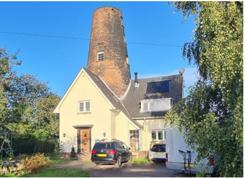
The north-west boundary of the village that adjoins the River Trent has a steep drop-off down to the river. The flat ridge of land East Bridgford sits on is over 30m (over 100ft) above the River Trent, a height which made it an ideal location for windmills, of which the village had three (Stokes’ Mill, Kneeton Hills Mill and Newton Mill). The sails of Stokes Mill were struck by lightning in 1928. The cap, machinery and second-floor gallery were removed from the 17.6 metre (58ft) high tower in 1940 before being converted into a residence in the 1960s.
The village expanded after World War II.
3.3 Historical Mapping
3.4 Relationship of the conservation area to its surroundings
The East Bridgford conservation area incorporates most of the settlement. The village has strong connections with the open countryside, being surrounded by paddocks and fields. These open spaces run alongside the roads in the village’s northern and southern extremities. The many footpaths leading into and out of the village in many directions also enhance East Bridgford’s relationship with the open countryside and the River Trent to the northwest.
4 Spatial Analysis
The relationship between open spaces and the built form within a conservation area can be central to its character. This section describes the village’s layout, highlighting the significant views, landmarks and historical focal points. The contribution of open green spaces, trees and other natural elements to the conservation area’s character is also described within this section.
4.1 Plan, Form and Layout
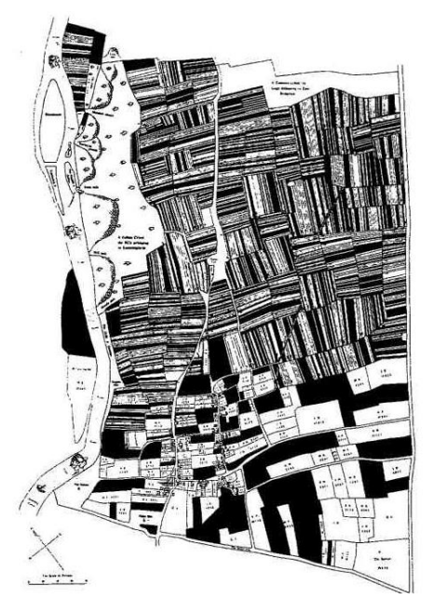
The distribution of manors and freeholders and the patterns of land ownership have greatly influenced how the community appears today, which arose from the village’s agricultural and political heritage. In 1086, four manors were recorded. By the 14th century, inheritance had already separated the biggest manorial authority. The administration of the village’s agricultural estates has played a significant role in its growth. Large, tenanted farms along College Street, also known as Farmers Street, and many of the smaller “end-on” houses along Kneeton Road were used to work the land from the village (also known as Cottagers Street). Many nearby fields that have not been converted into sizable agricultural fields maintain the ridge and furrow markings.
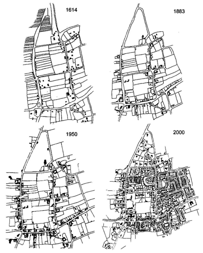
The parish’s current location at the north-eastern tip of the Nottingham Green Belt, which encircles the city on both sides of the Trent River, has ensured that the village has grown primarily within its historical boundaries and has maintained a distinct field separation from other nearby communities. The historical maps in the previous section show how the village’s grid-like arrangement and basic form have not changed over the past 400 years.
The village’s population remained constant from 1086 and 1674 at 250. It had quadrupled by 1801 and again by 1861 to reach about 1078 before declining somewhat the following century. There were 208 dwellings in 1931; currently, there are 790, and the population has increased by 50% since 1960. The hamlet has maintained its unique identity despite its fast expansion, with its environment, habitation pattern, and structures bearing traces of more than a millennium of history.
The village’s rural nature has altered significantly over the past 30 years as housing has displaced agricultural land in the village’s centre. These modifications have had a wide range of positive economic and social effects.
There has been little change to the outline of the village from that seen on the 1614 Maudlin College map-commissioned in 1614 to record the College’s holdings in East Bridgford.
Once a village of orchards, modern houses have largely infilled the internal open spaces. The village’s historic core would have been the church, although this is not at the centre. Radiating outwards- Main Street, College Street, Kneeton Road, Kirk Hill- retains much of its original character of brick-built houses with pantile or slate roofs often built end-on to the road. The brick walls and wealth of large mature trees also characterise the village.
The village has grown greatly since the war by in-filling its many open spaces, but block expansion has taken place on the south side of the village, and that trend is continuing with the current planned 140+ houses alongside and opposite the medical centre.
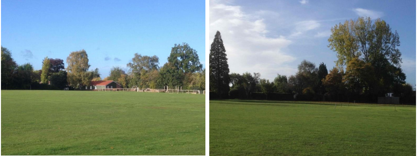
A feature of the village is the open playing area - Butts Close, so called because of its historic use as an archery practice area, now accommodates cricket, football, tennis, bowls and a children’s play area.
The village’s settlement pattern based on an irregular grid with housing densities varying by locality is a feature. Some new areas of development have little regard for green borders – examples include Haycroft Way, and Holloway Close.
Below is a map that describes the current plan, form and layout of the village/town.
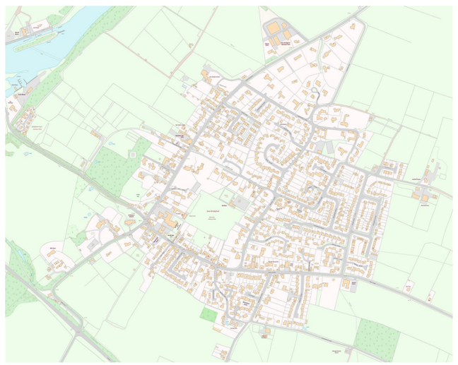
By comparing the historical maps, the current layout, shows the newer housing development, which extends the settlement eastward along with more recent infill. Kirk Hill, Kneeton Road in East Bridgford, has a strong sylvan environment with mature trees, giving it a particularly strong character. Equally significant are the trees and hedgerows that encircle the fields and paddocks on the village’s outskirts. The area to the north of the settlement has lost its identity due to the large-scale agricultural farms.
4.2 Landmarks, Focal Points and Views
After the Church, the second most obvious landmark is the windmill at the southwestern corner of the village which is visible from certain points within the village.
4.3 Open Spaces, Trees and Landscape
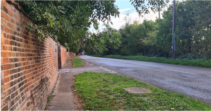
The position above sea level, with the river escarpment, provides open panoramic views to the north over the Trent floodplain. On the approach to the village from both Kirk Hill and Kneeton Road, the main impression is one of trees and hedgerows; the houses are largely hidden, set back from the highway and behind trees and hedges. In addition, Kirk Hill has a prominent wall which adds to the character of the approach to the village and is shown in Figure 7.
The Bowling Green in the centre of the village provides a pleasant and tranquil contrast to the built environment, with views of surrounding trees and glimpses of houses from the Bowling Green (north side of Butts Close).
4.3.1 Open Spaces, Trees and Landscape SWOT Analysis
Strengths - what are the positives of the open spaces, trees, and landscape
- East Bridgford retains its hilltop settlement character, with old windmills (Stokes’ Mill, Kneeton Mill and Newton Mill) and excellent
views across the Trent Valley. - Extensive footpaths and grid structure make walking a pleasure.
- The views from the eastern edge of the village over the Vale of Belvoir are particularly important in linking the village to the wider
countryside. - The open spaces and mature trees create a green passage for wildlife habitat that extends from the River Trent, through the village and into the adjacent countryside.
- The far-reaching vistas from the village, particularly on the east-west axis, ensure that the village is clearly embedded in the heart of rural Nottinghamshire.
Weaknesses - what are the negatives of the open spaces, trees, and landscape
- The original farms and orchards which characterised the rural nature of the village have largely been developed.
- Local Plan 2, taking out green belt land to the east along Butt Lane, is a further example.
- Footpath closures due to land-slip on the cliff edge.
- The lack of a substantial tree barrier between the new dual A46 carriageway results in visual and noise pollution of the environment to the east of the village, which also adversely affects the rural nature of the village.
- The recent closure of the footpath along the cliff top from Trent Lane.
Opportunities – what could make the open spaces, trees, and landscape better?
- Improve footpaths/access and increase community areas like woodland.
- Re-opening of the cliff top footpath from the bottom of Trent Lane along the River Trent cliff top in the direction of Kneeton.
- More trees and shrub screening in some gardens.
- Continue the free tree scheme.
Threats - what would make open spaces, trees and landscapes worse?
- Limiting views with inappropriate development/expansion of the village and infill in the large grounds of houses around Cherry
Holt Lane, Lammas Lane, and Kneeton Road. - Further developments into the green belt would significantly change the character of the setting.
- The loss of a mature hedge and tree barrier between the village and the A6097, potentially increasing visual and noise pollution from the southern aspect of the village.
Works to Trees
You must contact the Local Planning Authority (LPA), Rushcliffe Borough Council before any works (cutting OR pruning) are carried out to trees within the East Bridgford Conservation Area.
Six weeks’ notice is required before any works to trees within the Conservation Area is carried out, even if they are not protected by Tree Preservation Order (TPO).
Standard notification forms (a section 211 notice), further information and contact details.
A flow chart of the decision-making process regarding works to trees.
4.4 Public Realm
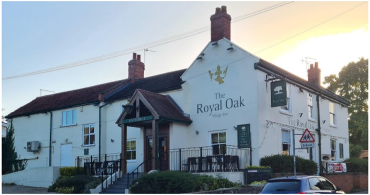
Many of the public amenities outlined in the following section are along Main Street. The Royal Oak Village, the village inn (see Figure 10) is one of the spaces contributing to the community spirit within the village and has been outlined as a strength within the SWOT analysis as a strength.
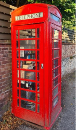
There is a ‘K6’ Red Phone Box, or ‘Jubilee Kiosk’, which originally commemorated the Silver Jubilee of the coronation of King George V, now used as a book exchange (see Figure 11). The reuse of the kiosk as a book exchange contributes to a feeling of community.
5 Buildings of the Conservation Area and Key Characteristics
5.1 Building Types and Activity
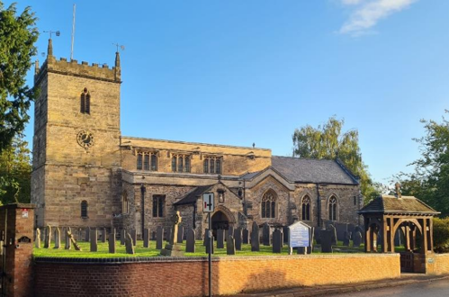
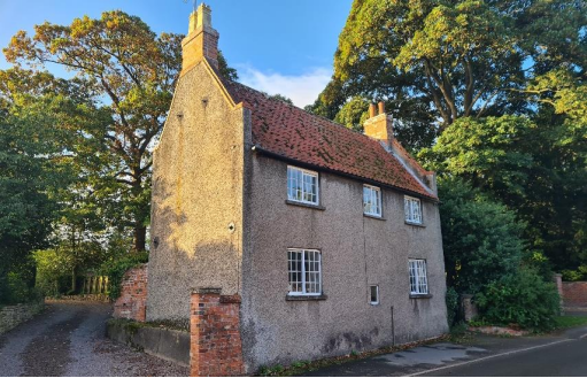
The architectural styles and building types within East Bridgford span many centuries and includes large manor houses/halls, farmhouses, cottages and farm buildings. Although there are four manor houses/halls, these grand buildings are relatively secluded, and it is the medieval Church of St Peter ((11th century) see Figure 5 - Church of St Peter (Zone 1) Figure 5)) and Stokes Mill ((1828) see Figure 6) that form two of the most prominent landmark buildings.
Other buildings within the village include:
- A fine, listed church with Saxon foundations (See Figure 5).
- Two small shops selling groceries and newspapers. One of which is a Post Office.
- A doctors’ surgery and a hairdressers.
- Village Hall with unsympathetic front extension facing the road (completed around 1970 to a small budget).
- A good primary school.
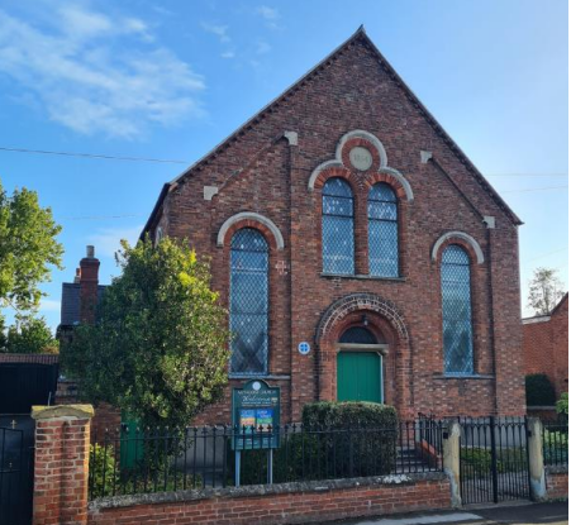
- Two Methodist Chapels, one now a dwelling.
- The W.I. Hut - now sold and awaiting development.
- Of the residential buildings, there are:
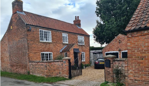
- A number of large, detached houses of historical interest (one, the Old Hall, very large and imposing - dating to the 1600s).
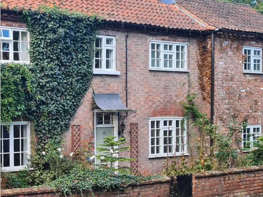
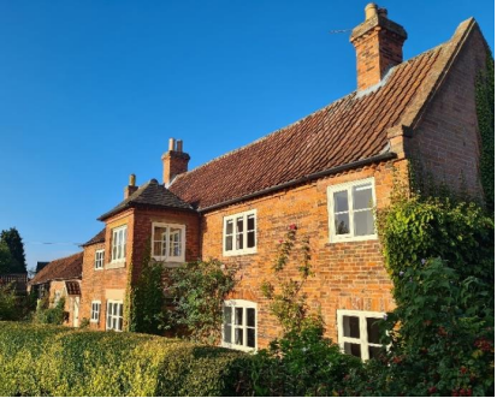
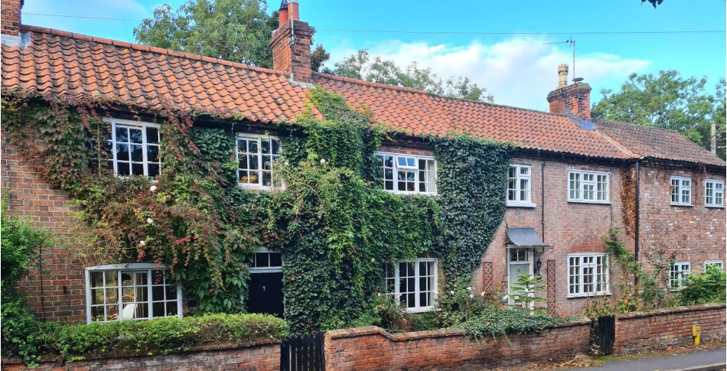
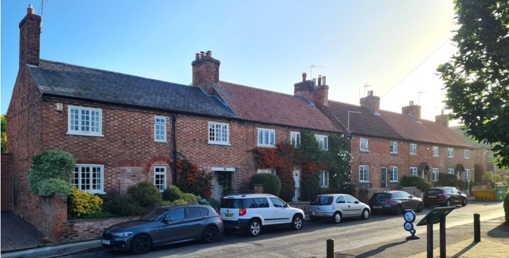
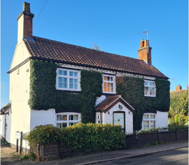
- A number of smaller cottagers’ cottages often built end onto the road. All are built of local brick with pantile or slate roofs. Some have been painted or rendered to preserve the bricks. The older properties are mostly on Main Street, Kirk Hill, Kneeton Road and College Street.
- Some bungalows, dating from about the 1970’s.
- A windmill, now without sails and converted into a house (see Figure 6).
5.1.1 Building types and Activity SWOT Analysis
The results of the SWOT Analysis were received from East Bridgford Parish Council on December 14th, 2022.
Strengths - what activities/places can you go that make the village/town great?
- The annual village Horticultural Show has been run by the local community since 1864.
- The wide range of sporting activities held on and around Butt Field.
- The ability to access the many footpaths and bridle paths into the open countryside.
- The vibrant church communities and numerous local societies and groups.
- An exceptional scout, guides and brownies group with extremely dedicated leaders.
- A first-class doctor’s surgery. Exceptional school. Welcoming Post Office, Newsagents, Hairdressers’ and Pub.
- A good play area for young children.
- Allotment facilities.
- Easy access to fabulous cycling in the Vale of Belvoir and the Trent Valley.
Weaknesses - what activities/places exist that detract from making the village/town great?
- Recent decisions by central planners have eroded the principles of the design statement etc, in favour of modern buildings such as the two built on the grounds of a large, old house on Cherry Holt Lane.
- Inconsiderate parking by visiting sports teams and individuals.
- Inconsiderate dog walkers that do not control their dogs or clear up after them.
- Littering of roads from through traffic.
- Some poor housing design with little screening-especially on Main Street. Street parking, cut-through traffic.
Opportunities - what activities/places could exist that would village/town even better?
- Opportunity to use CIL infrastructure money to improve community provision to enhance the village.
- Improved play area for young children and a Youth Club.
- Increased local employment/businesses.
Threats - what activities/places would make village/town worse?
- Threat of Butt Lane South and North being over-developed with intensive, urban designs & minimal green areas.
- Increased industrial activity and associated increase in road traffic, especially large vehicles if the local industrial park expands
significantly.
5.2 Key Characteristics and Building Materials
5.2.1 Key Characteristics: (Character Zone 1)
Materials:
Walls: Most of the walls of residential buildings are brick in various bonds. One listed building is a mud wall construction with a roughcast render (see Figure 14). The Church of St Peter, which is made of stone, is also located within this character zone.
Along Kneeton Road, there is a prominent stone wall. In addition to this, some of the 20th century houses have a dolomitic limestone garden wall.
Roofs: Clay pantile and Welsh Slate are common throughout East Bridgford.
Windows: Within this character area it is common for the timber framed windows to have horizontal glazing bars creating either two or three panes per window.
Key Characteristics / Architectural Features:
Along Kneeton Road of this character area, the gable ends of many properties front the main road, with their front façade accessed by a small path perpendicular to the main road.
Where the main façade of the buildings faces the main road, the older buildings have small (or no) front gardens; however, it is the building which contributes to the character of the street. Whereas the newer buildings are mostly set back further, and it is their front gardens, hedges or walls which contribute to the character of the street.
Grass verges to the north and south of this character area, and various stretches of brick and stone garden walls throughout
5.2.2 Key Characteristics: Main Village Street (Character Zone 2)
Materials
Walls: Similar to the other characters in East Bridgford, most of the residential buildings are brick in various bonds, however, within this character zone, there are a number of properties with brick painted white or with a white/neutral render or stucco finish.
Roofs: Clay pantile and Welsh Slate are common throughout East Bridgford.
Windows: There are many timber framed windows, many of which are sliding sash windows or top hung opening transom. It is very common for the windows to have glazing bars with eight, six or four panes in each window. Marginal lights are more common to the east of this character area.
Key Characteristics / Architectural Features:
The community services and facilities are mostly located along this street, attracting activity area and life to the buildings, walls and gardens within it.
The row of cottages opposite the village shop defines the special architectural character of the area.
5.2.3 Key Characteristics: (Character Zone 3)
Materials:
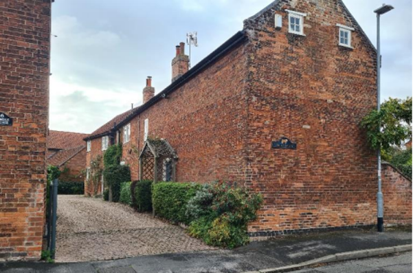
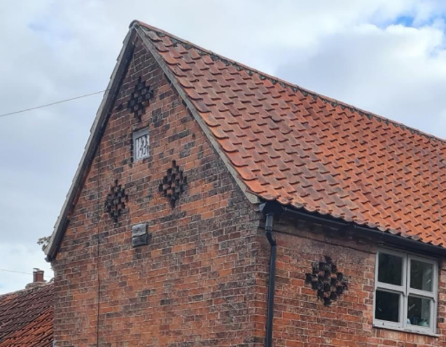
Walls: Mainly red brick in various bonds. Ventilation holes in C18th brick walls, particularly along College Street, now present as diaper details. Dentillated brickwork to eaves is also common within the area on many of the 18th and early 19th century buildings.
Roofs: As with the other character areas, the clay pantile can be seen throughout this character area. The steep pitch of many roofs makes this visible.
Key Characteristics / Architectural Features:
This area is characterised by a network of footpaths and narrow winding roads that create a strong sense of enclosure and drama as views of buildings, streets and open spaces are progressively revealed.
The modern infill is largely screened by attractive planting and landscape, which also contributes to the character of the area.
5.2.4 Key Characteristics: Former Site of East Bridgford Hall (Character Zone 4)
Key Characteristics / Architectural Features:
The area associated with the (now demolished) East Bridgford Hall. This area is characterised by the Beech, Cedar, Elm, Oak and Sycamore trees, which were originally planted in commemoration of King George IV. Many of these mature trees are still evident around the perimeter of the area today.
In conjunction with the mature trees, the detached late 20th century houses within a patchwork of large plots and views out to the countryside now characterise this area.
5.2.5 Key Characteristic Zone Map
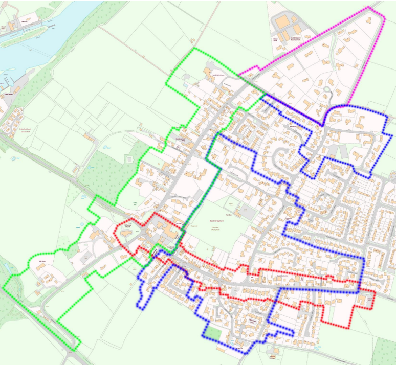
Key to Zone Map
- Green dots: Kirk Hill and Kneeton Road (Zone 1)
- Red dots: Village Main Street (Zone 2)
- Blue dots: (Zone 3)
- Pink dots: The former site of East Bridgford Hall (Zone 4)
This map is reproduced from Ordnance Survey material with the permission of Ordnance Survey on behalf of the Controller of His Majesty’s Stationary Office © Crown Copyright. Unauthorised reproduction infringes Crown Copyright and may lead to prosecution or civil proceedings. Rushcliffe Borough Council - 100019419
5.3 Listed buildings
Buildings on the Government’s List of Buildings of Special Architectural or Historic Interest are called “Listed” buildings and are protected by law. Consent is required from Rushcliffe Borough Council before any works of alteration, extension, or demolition can be carried out on any listed building.
Further information can be found in Rushcliffe Borough Council’s publication Listed Buildings in Rushcliffe.
The complete and up-to-date list of the Secretary of State’s Statutory List of Buildings of Special Architectural Interest or Historic Interest can be found on the Historic England website.
Names and photos of the Listed Buildings and structures in East Bridgford Conservation Area (correct as of January 2023) are detailed in Appendix 1. All Listed Buildings are shown on the Townscape Appraisal plan, but some smaller structures, such as gravestones, may not be shown.
There is a Scheduled Ancient Monument, a site that’s legally protected because of its historical importance at the edge of the village. It is described as the site of a ‘motte and bailey’ (an early form of Norman castle). There is also a possibility that the raised area was a prospect mount belonging to the 18th Century house of East Bridgford Hill; this would have provided a viewing point to overlook the garden. The Nottinghamshire County Council Archaeology Section has researched this further (see references section). The townscape
appraisal map clearly shows this Scheduled Ancient Monument on the west side of the village.
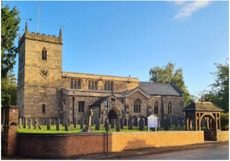
Church of St Peter is Grade 1 Listed. Built in the 11th century, restored in 1671, with the tower rebuilt in 1778. Walls constructed of ashlar, dressed stone, brick and coursed rubble. Slate and plain tile roofs.
Early 18th century dovecote and converted into a dwelling in the 19th century. Grade 2 listed. Constructed of mud with roughcast and brick dressings. Steep-pitched pantile roof with brick coped gables and brick kneelers. Windows are Yorkshire sashes with glazing bars.
Early and mid-18th and mid-19th century grade 2 listed farmhouse and adjoining stables. Brick and timber framing with pantile roofs. Single and two storeys, 6 plus 5 bays.
5.4 Key Unlisted Buildings
Contribution to the established character of the place can also come from buildings which are not recognised via listing or are not old. A plan with all the positive contributions to the area can be found in Appendix 2.
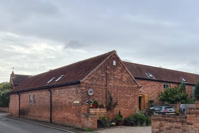
18th century farm buildings converted into residential dwellings. At some point in time, the building appears to have its roof raised and the inclusion of an additional storey. Built in traditional red brick, the local vernacular. Steep gable on end to street.
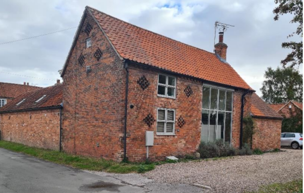
Former barn converted into a residential dwelling. 18th with 19th century single-story addition. Steep pitch pantile roof with gable end onto the public highway, typical of East Bridgford street patterns.
Mid 18th century row of cottages. Built in traditional red brick with Flemish bond, which is common to East Bridgford. Horizontal “Yorkshire sash” windows to No. 14 (left). Clay pantile roof and ridge stacks.
Built in phases from the 19th century. Flemish bond brickwork with a mix of roof treatments (Welsh slate and clay pantile). Two properties have gabled canopies.
Three bay, residential dwelling with extension to the rear. Gable end to street with two gable stacks. Horizontal sliding (Yorkshire Sash) windows.
Former agricultural building converted into residential dwelling. The Croft is a collection of T-shaped buildings centred on a courtyard
reflecting the agricultural past.
Painted brickwork. Symmetrical façade, with central gabled porch and two gable stacks. Dentillated brickwork to the eaves.
Mid-19th century brick-built church with stone detailing to window arches. Centred above the round arched doorway are double round arched windows topped with circle date above stone. Brick detailing on the façade emphasises the pitch of the gable. Dentilated brickwork to eaves.
Modern architecture can enhance the character of a conservation area and the key unlisted buildings do not have to necessarily be old. While the majority of modern buildings and building extensions in the village add little to the special architectural character of the village, they are mostly screened by attractive gardens and boundary walls that possess their own distinct character.
5.5 Local Details
The previous sections (sections 5.3 and 5.4) highlighted the significance of the larger structures; however, the collective details of the many smaller farmhouses, cottages, and agricultural buildings also contribute to the village’s special character.
5.5.1 Wall Surfaces and Roofing
Surfaces such as walls and roofs red clay pantiles from the 18th century, and Welsh slate, which predates the mid-19th century when railways carried materials widely throughout the nation, are typically found on the roofs of old structures in the village.
5.5.2 Windows, doors and railings
Many 18th century cottages have small, low Yorkshire (horizontal) sliding sashes or similarly proportioned casement windows, both with small panes. Larger houses of the same date often have vertical sliding sash windows. Later 19th century sashes have larger panes, often with distinctive side panels. Few original house doors remain in 18th century houses, although four and six-panelled doors are seen in 19th century houses. A few early iron railings remain in the village today, and examples can be seen on Walnut Tree Lane and
Cherryholt Lane.
6 Generic Management Plan for Conservation Areas in Rushcliffe
6.1 Introduction
In carrying out its planning functions, the Borough Council is required in law to give special attention to the desirability of preserving or enhancing the character or appearance of Conservation Areas. The Management Plan for a Conservation Area is a tool to ensure the special character of the area is preserved and enhanced. The management plans aim to:
- Outline a strategic management proposal for the preservation and enhancement of the East Bridgford Conservation Area.
- Act as a guide for professionals and residents alike regarding:
- features of value, worthy of preservation;
- characteristics worthy of preservation;
- opportunities for enhancement;
- development proposals which preserve and enhance the special character of the area.
- Inspire community commitment to conservation principles and reporting.
6.2 National and Local Policies and Guidance
There is a duty to formulate and publish management plans setting out policies and proposals for the preservation and enhancement of Conservation Areas. Many of these policies and proposals are common to all Conservation Areas, and these are set out in this document. The Central Government Guidance and Local policies applicable to Conservation Areas include:
- Rushcliffe Local Plan Part 1: Core Strategy, with a specific focus on:
- Design and Enhancing Local Identity [in part]
- Historic Environment
- Rushcliffe Local Plan Part 2: Development Policies, with a specific focus on:
- Conserving and Enhancing Heritage Assets
- Development Affecting Archaeological Sites
- The National Planning Policy Framework (NPPF), particularly, but not exclusively the chapter on Conserving and Enhancing the Historic Environment.
- The National Planning Practice Guidance (NPPG) (updated 2021 and subject to continual review)
- By Design: Urban Design in the Planning System – Towards Better Practice (2000)
- The Planning (Listed Buildings and Conservation Areas) Act 1990
- Historic England “Historic England Advice Note 1: Conservation Area Designation, Appraisal and Management”
The council will utilise the full range of strategic policy and guidance documents to ensure that development in East Bridgford Conservation Area is of a standard that enhances the amenity of the local area. The council will always look to use the most up-to-date versions of the document. Supplementary documents may be issued for individual Conservation Areas where specific policies or
proposals are needed.
6.3 Article 4 Directions
There are extra consents required in Conservation Areas. For example, in addition to the general control of development, you will
need to get permission for
- Any additions or alterations to the roof (for example, dormer windows)
- The installation of satellite dishes on chimneys, roofs or walls fronting a highway Any extension which extends beyond the side of the original dwelling house any extension of more than one storey that extends beyond the rear wall of the original dwelling house
cladding the exterior of the dwelling any demolishing of a building or part of a building that has a volume over 115 cubic metres. - Article 4 of the Town and Country Planning (General Permitted Development) Order 1995, allows planning authorities to restrict
some permitted development rights within particular areas. This does not necessarily prevent development or change taking place
but enables the Local Authority to manage the design and detailing of the works, and potentially grant permission subject to appropriate conditions. The use of Article 4 Directions will be proposed where it is considered appropriate following the completion of each Area Appraisal across the Borough.
Details of Article 4 Directions for East Bridgford Conservation Area There are currently no Article 4 Directions for East Bridgford
Conservation Area.
6.4 Building Design
Mimicking the local vernacular is not the only way to ‘fit in’ with the character of a conservation area. National policy makes clear that contemporary designed, provided it is sympathetically designed, cannot be dismissed as an option. Therefore, good contemporary design will be encouraged where it respects the context’s character, scale and massing. This must be demonstrated in the Design and Access Statement submitted with any planning application.
Extensions to buildings in Conservation Areas should respect:
- The key characteristics of the original building, including scale, mass, materials and proportions
- The contextual setting and character of the Conservation Area
Copying like for like can devalue and destroy the ability to “read” historic change, and dilutes our historic heritage. Pastiche designs, incorporating poor imitations of other styles, will be resisted, particularly where they incorporate details which are not locally appropriate. Careful high-quality replication may be required in a few very sensitive locations.
In particularly sensitive locations, such as uniform terraces, exact replication may be necessary to maintain compositional unity. In that case, attention to details, choice of materials and high-quality workmanship are the keynotes. However, in some cases, a direct relationship is not impossible. For example, Flemish Bond brickwork cannot be replicated in cavity walls, and narrow lime mortar joints cannot be replicated in modern metric brickwork.
Where a new building is appropriate, on infill sites or where an existing building detracts from the character of the area, the opportunity should be taken to re-establish the streetscape, reinforce enclosure, open up distant vistas or views of landmarks or hide unsightly views.
“New and old buildings can coexist happily without disguising one as the other, if the design of the new is a response to urban design objectives” (DETR – “By Design”, p19).
As with extensions, good contemporary design which respects local character, and the context of the site will be encouraged.
All new buildings should respond appropriately to the existing frontage and normally follow the established building line. Development or redevelopment will normally be resisted if:
“it blocks important views identified in the individual appraisals, uses important open spaces identified in the appraisals, adversely affects the setting of any Listed or key buildings, fails to maintain or re-establish the streetscape where appropriate dominates its Conservation Area background fails to recognise the context of
the site destroys important features identified in the individual appraisals such as boundary walls, fences,
hedgerows or trees”
Where the quantity of contemporary schemes in a small area becomes significant and outnumbers older buildings within the area, further contemporary schemes could fundamentally shift the architectural character of the area and thus be harmful, even if well designed as an individual project.
New development that stands out from the background of buildings may be appropriate in exceptional circumstances if it contributes positively as a landmark to enhance the street scene, to highlight a corner or to signal a visual change of direction such as along a curving vista.
Any external lighting should be carefully designed and sited to minimise light pollution. Energy producing or saving devices are generally welcomed by the Council, but careful consideration is required when these are to be located in a Conservation Area and some may require planning permission. In particular, they should be positioned to minimise their impact on the building and on the local amenity.
6.5 Publicity and Knowledge Transfer
Ambiguity about additional controls within a Conservation Area raises the likelihood of inappropriate developments occurring which
may damage the integrity of the conservation area designations.
Efforts have been made to engage local community groups in the development and review of the character appraisals. Empowering
communities to define the special architectural and historic interest of the Conservation Area aims to raise awareness.
Whether the appraisal took a community-led or a council-led approach, upon reviewing all Conservation Areas, the public were invited to ask questions and comment during a public consultation. A consultation event also aimed to diminish any ambiguity about
restrictions within a Conservation Area and increase the likelihood of sensitive and appropriate developments, maintaining the character
of the area.
The council recognise the potential issues of turnover in residency and ownership of properties in the conservation area. Therefore,
Rushcliffe Borough Council will periodically use their media outlets to highlight conservation area designations and the significant,
related planning controls.
The date of the Consultation Event 22/05/2023
If there are any queries about conservation areas, please email conservationareas@rushcliffe.gov.uk
6.6 Public Realm
General maintenance and upkeep to the public realm may include fixing damage to roads and pavements, and fixing issues with street lighting. Issues such as these can impact the quality of the Conservation Area.
The council aims to encourage works to the public realm that are in keeping with, or actively enhance the conservation area. Rushcliffe Borough Council can only advise on work within the public realm that does not require planning permission (for example work completed by statutory undertakers, such as the Highways Authority). In these instances, Rushcliffe borough council cannot prevent such work.
Nottinghamshire County Council are responsible for repairs to roads, pavements and street lighting. Report issues of repairs to roads, pavements and street lighting to Nottinghamshire County Council online.
Rushcliffe Borough Council will continue to undertake their duties in maintaining the public realm. Vandalism, fly tipping and street cleaning are all the responsibility of Rushcliffe Borough Council. Report issues to Rushcliffe Borough Council online.
Standard notification forms (a section 211 notice) - further information and contact details.
A flow chart of the decision-making process regarding works to trees.
6.7 Boundary Treatments
Where there is a proposal for a new boundary treatment to be installed, the council would encourage the use of boundary treatments within the area.
Within conservation areas, planning permission is required to alter, maintain, improve, take down or build any new gate, fence, wall or other enclosure with:
- A height of one metre or more if next to a highway (including a public footpath or bridleway), waterway or open space; or
- A height of two metres or more elsewhere.
Where planning permission is required to remove a wall, Rushcliffe Borough Council will aim to protect those boundary walls and fences that have been identified as positively contributing to the area.
Hedgerows are significant habitats for wildlife in lowland Britain. Regulations are intended to protect important hedges in the countryside. The policy applies to hedges that are more than 20 metres long, (or less if connected to another hedge) on or adjacent to:
- Land used for agriculture or forestry, including the keeping of horses or donkeys
- Registered common land and village greens
- Local Nature Reserves and Sites of Special Scientific Interest.
The policy does not apply if the hedge is within or on the boundary of the curtilage of a house.
6.8 Buildings at risk
A few of the important buildings across the various Conservation Areas are currently vacant or not in regular use, which may lead to some being “at risk” of neglect or decay.
The Council will encourage and advise on renovation and repair work that is sensitive to the original or traditional historic character of the building and retains original features. The council will monitor the opportunity and potential for grant aid schemes to encourage the basic maintenance work necessary to ensure that key buildings within the conservation area are structurally sound and weather tight. However, given the current financial climate and outlook, such schemes are unlikely in the short to medium term.
There is a presumption against the demolition of buildings which contribute to the character of the area unless there are exceptional circumstances. It would benefit both the physical form and the function of the Conservation Area if these buildings were repaired, maintained and brought back into use.
Where the poor condition of a building or structure is as a result of neglect and lack of maintenance by its owner there is no requirement for the Borough Council to take its deteriorated condition into account when deciding whether demolition is appropriate. This is to avoid rewarding the deliberate neglect of buildings by representing such action as a way to obtain planning permission for demolition and redevelopment.
6.9 Enforcement
Rushcliffe Borough Council will, from time to time, assess and monitor changes in the appearance and condition of East Bridgford Conservation Area. This will ensure that where necessary enforcement action can be taken promptly to deal with problems as they arise.
Where co-operation cannot be gained by any other means, Rushcliffe Borough Council has the ability to use additional enforcement powers to tackle particular issues within conservation areas. The Council may take formal action if the condition of any building (listed or unlisted) which makes a positive contribution to the character of the Conservation Area is considered to be at risk.
The council will work in accordance with their enforcement policy, which aims to provide an efficient enforcement service in support of the Council’s statutory planning service. Rushcliffe Borough Council’s enforcement actions will remain transparent, consistent, and proportionate, as it is recognised that effective controls over unauthorised development assists in conserving the natural and built environment whilst helping to protect the quality of people’s lives and maintaining the Council’s integrity.
7 Appendix 1 – Listed Buildings (as of January 2023)
East Bridgford War Memorial Cross
Grade: 2
Listing entry number: 1456217
National grid reference: SK 69128 43137
Location: Approx. 26m east of St Peter’s Church, The churchyard, East Bridgford, Rushcliffe, Nottinghamshire, NG13 8PE
Garden House, Stable And Garden Wall At The Hill, Kirk Hill
Grade: 2
Listing entry number: 1272770
National grid reference: SK 68939 43074
Location: Garden House, Stable And Garden Wall At The Hill, Kirk Hill
Grade: 2
Listing entry number: 1045675
National grid reference: SK 68986 43120
Location: The Hill, Kirk Hill
Grade: 2
Listing entry number: 1243712
National grid reference: SK 69041 43103
Location: The Old Rectory, Kirk Hill
Grade: 2
Listing entry number: 1243770
National grid reference: SK 69086 43087
Location: 3, Kirk Hill
Grade: 2
Listing entry number: 1272697
National grid reference: SK 69086 43130
Location: Church of St Peter, Kirk Hill
Group of 3 Headstones, 7 metres south of Chancel at Church of St Peter
Grade: 2
Listing entry number: 1272676
Location: Group of 3 Headstones, 7 metres south of Chancel at Church of St Peter, Kirk Hill
The Old Hall and attached outbuilding and boundary wall
Grade: 2
Listing entry number: 1243772
National grid reference: SK 69280 43309
Location: The Old Hall and attached outbuilding and boundary wall, 10 Kneeton Road
Stables and outbuildings at the Old Hall
Grade: 2
Listing entry number: 1272662
National grid reference: SK 69310 43296
Location: Stables and outbuildings at the Old Hall, Kneeton Road
Number 63 and adjoining farm buildings
Grade: 2
Listing entry number: 1272723
National grid reference: SK 69283 43392
Location: Number 63 and adjoining farm buildings, Kneeton Road
Grade: 2
Listing entry number: 1243539
National grid reference: SK 69799 43425
Location: Mulberry Close Farmhouse, Cherryholt Lane
Farm buildings at Mulberry Close
Grade: 2
Listing entry number: 1045672
National grid reference: SK 69844 43419
Location: Farm buildings at Mulberry Close, Cherryholt Lane
Walnut Lodge and adjoining stables
Grade: 2
Listing entry number: 1243773
National grid reference: SK 69399 42808
Location: Walnut Lodge and adjoining stables, 18 Walnut Tree Lane
Manor Lodge and adjoining boundary wall and gateway
Grade: 2
Listing entry number: 1272678
National grid reference: SK 69467 43616
Location: Manor Lodge and adjoining boundary wall and gateway, Kneeton Road
Manor House and attached walls
Grade: 2
Listing entry number: 1272724
National grid reference: SK 69336 43631
Location: Manor House and attached walls, Kneeton Road
Grade: 2
Listing entry number: 1243676
National grid reference: SK 69481 43118
Location: 11 College Street
Number 24 and attached barn and stable and boundary wall
Grade: 2
Listing entry number: 1045674
National grid reference: SK 69582 43189
Location: Number 24 and attached barn and stable and boundary wall, College Street
Grade: 2
Listing entry number: 1243673
National grid reference: SK 69448 43014
Location: Old Manor House, 1 College Street
Pump and trough at old Manor House
Grade: 2
Listing entry number: 1045673
National grid reference: SK 69441 43032
Location: Pump and trough at old Manor House, 1 College Street
Motte and bailey castle adjacent to River Trent
Scheduled Monument
Listing entry number: 1008568
National grid reference: SK 68671 43391
The titles of these listings may not make it clear that all listed buildings always include all attached structures and extensions, regardless of age, and all detached outbuildings built before 1st June 1948 which are, or were at the time of listing, ancillary to the function of the primary listed building and were in the same ownership at the time of listing.
For example, when a house is listed, the listing will apply to extensions, porches, detached historic stables, barns, wash houses, privies etc. Such outbuildings and extensions are only exempt from the provisions of listing where the listing specifically excludes them.
8 Appendix 2 – Townscape Appraisal
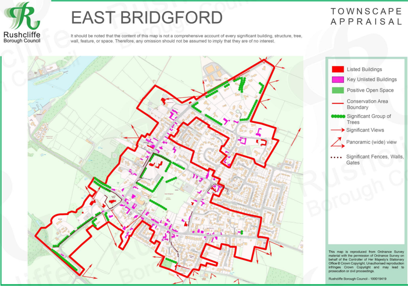
The East Bridgford Townscape Map above shows:
- Locations of listed buildings
- Locations of key unlisted buildings
- Open space
- Locations of trees, hedges, and significant hedges and fences
- Viewpoints
Conservation Areas
- Bingham Conservation Area
- East Bridgford Conservation Area
- East Leake Conservation Area
- Hawksworth Conservation Area
- Hickling Conservation Area
- Ruddington Conservation Area
- Thoroton Conservation Area
- Wiverton Conservation Area
- Langar Conservation Area
- West Leake Conservation Area
- Whatton in the Vale Conservation Area
- Costock Conservation Area
- Sutton Bonington Conservation Area
- Upper Saxondale Conservation Area
- Wysall Conservation Area
- Bradmore Conservation Area
- Car Colston Conservation Area
- Scarrington Conservation Area
- Orston Conservation Area
- Flintham Conservation Area
- Edwalton Conservation Area
- Aslockton Conservation Area
- Bunny Conservation Area
- Granby Conservation Area
- Keyworth Conservation Area
- Thrumpton Conservation Area
- Normanton on the Wolds Conservation Area
- Upper Broughton Conservation Area
- Screveton Conservation Area
- Kneeton Conservation Area
- Colston Bassett Conservation Area
- Cropwell Bishop Conservation Area