Thoroton Conservation Area
Thoroton Conservation Area Appraisal and Management Plan December 2022
Contents
1.1 Conservation Areas
1.2 The Purpose of a Conservation Area Character Appraisal
1.3 The Planning Policy Context
2 Thoroton Location and Landscape Setting
3.1 Location and Historic Activities
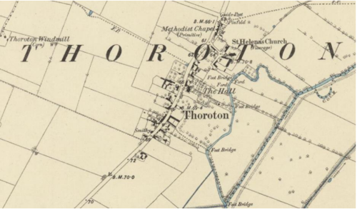
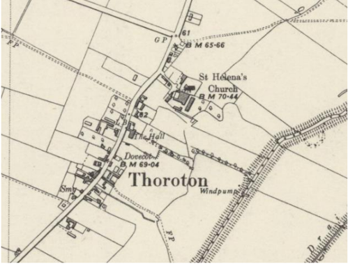
3.2 Historical Mapping
4.1 Plan, Form and Layout
4.2 Landmarks, Focal Points and Views
4.3 Open Spaces, Trees and Landscape
4.3.1 Open Spaces, Trees and Landscape SWOT Analysis
4.4 Public Realm
5 Buildings of the Conservation Area and Key Characteristics
5.1 Building Types and Activity
5.1.1 Building types and Activity SWOT Analysis
5.2 Key Characteristics and Building Materials
5.2.1 Key Characteristics: St Helena's and Surroundings - Zone 1
5.2.2 Key Characteristics: Main Street - Zone 2
5.2.3 Key Characteristics: Mature Landscape - Zone 3
5.2.4 Key Characteristics: Contemporary early 21st Century Housing (Character Zone 4)
5.3 Key Characteristic Zone Map
5.4 Listed buildings
5.5 Key Unlisted Buildings
5.5.1 Contemporary Examples of Designs in Keeping With the Character
6.1 Introduction
6.2 National and Local Policies and Guidance
6.3 Article 4 Directions
6.4 Building Design
6.5 Publicity and Knowledge Transfer
6.6 Public Realm
6.7 Boundary Treatments
6.7.1 Walls and Fences
6.7.2 Hedges
6.8 Buildings at risk
6.9 Enforcement
7 Appendix 1 – Listed Buildings (as of December 2022)
8 Appendix 2 – Conservation Area Boundary and Townscape Appraisal Map
1 Introduction
1.1 Conservation Areas
Rushcliffe Borough Council has an obligation under Section 69 of the Planning (Listed Buildings and Conservation Areas) Act 1990 to review, from time to time, its Conservation Area designations.
A Conservation Area, as defined under Section 69, is ‘an area of special architectural or historic interest the character or appearance of which it is desirable to preserve or enhance’.
Thoroton Conservation Area was first designated Conservation Area status in 1974. Prior to this Appraisal, the most recent appraisal of the Thoroton Conservation Area was carried out in September 2009.
Section 71 of the Planning (Listed Buildings and Conservation Areas) Act 1990 highlights the local planning authority’s duty to formulate and publish proposals for the preservation and enhancement of the conservation areas. This document, therefore, aims to identify and
reaffirm (or redefine) the special architectural or historic interest of the area which warrants its designation.
Conservation Area Appraisals are not, and never have been, tools for fossilising a place against change, instead, the processes of change which allow places to grow and evolve are recognised as being unavoidable, and it is also recognised that change can be a positive and desirable force. The designation instead allows greater scrutiny and control to manage change to positive effect and to ensure that any changes which require planning permission do not harm, and ideally serve to actively enhance, the existing character of the place.
Thoroton Conservation Area: Summary of Special Interest
The village lies in the South Nottinghamshire Farmlands Character Area and within the Vale of Belvoir.
18th and 19th century red brick buildings throughout the village.
The 14th century Pigeoncote restored in the 19th century.
Mud walls near St Helena's Church, Smite Farm, and the Pigeoncote
The grass verges, mature trees and fields all contribute to the rural character.
Good network of footpaths, bridle tracks and country lanes offering beautiful views of the village and countryside.
1.2 The Purpose of a Conservation Area Character Appraisal
The purpose of a Conservation Area Character Appraisal is to:
- Identify and record the special interest of the Conservation Area to ensure there is public awareness and understanding of what is
worthy of preservation. - To define and reassess current boundaries to accurately reflect what is now perceived to be of special interest.
- To identify opportunities to safeguard and enhance the special interest of the Conservation Area.
It should be noted that the content in this document is not a comprehensive account of every significant building, structure, tree, wall, feature, or space. Therefore, any omission should not be assumed to imply that they are of no interest.
Generally, the character and appearance of a Conservation Area will be preserved or enhanced by:
- Providing controls and regulating development through the planning system.
- Applying the extra controls that designation provides over demolition, minor development, and the protection of trees.
- Environmental enhancement schemes and possibly providing financial assistance for the repair and restoration of specific buildings.
- Encouraging public bodies such as the local highways authority or utility companies to take opportunities to improve the street scene through the appropriate design and sensitive sighting of street furniture (and retention of historic features of interest), or the removal of eyesores and street features that have a negative impact such as overhead wires.
Thoroton Conservation Area: Summary of Key Issues
No village hall /community space
Vehicle parking that causes damage to the verges.
1.3 The Planning Policy Context
This appraisal provides a firm basis on which applications for development within the Thoroton Conservation Area would be
assessed. It should be read alongside the wider development plan policy framework produced by Rushcliffe Borough Council and other
National Planning Policy Guidance documents. The relevant documents include:
- Rushcliffe Local Plan Part 1: Core Strategy, with a specific focus on:
- Policy 10 (Design and Enhancing Local Identity) [in part]
- Policy 11 (Historic Environment)
- Rushcliffe Local Plan Part 2: Development Policies, with a specific focus on:
- Policy 28 (Conserving and Enhancing Heritage Assets)
- Policy 29 (Development Affecting Archaeological Sites)
- The National Planning Policy Framework (NPPF) (Revised -2021)
- The National Planning Practice Guidance (2016 - Subject to Continual Review)
- By Design: Urban Design in the Planning System – Towards Better Practice(2000)
- The Planning (Listed Buildings and Conservation Areas) Act 1990
2 Thoroton Location and Landscape Setting
Rushcliffe Borough forms the southern tip of Nottinghamshire which borders Leicestershire. It is predominantly a rural Borough that contains a mixture of city suburbs, market towns and villages. Rushcliffe is located about half a mile South of Nottingham city centre, with the River Trent forming the majority of its northern boundary and the River Soar defining its western boundary.
The Borough consists of mostly rural areas, but also a combination of market towns and villages. The A46, a notable Roman Road (the Fosse Way), runs through the centre of the Borough and leads to Newark in the North and Leicester in the South. In the northern half of the Borough, the A52 forms Nottingham’s primary transport link to Grantham and the East of England. Junction 24 of the M1 and East Midlands Airport are both located about 1 mile from the western border.
Thoroton is one of a group of small villages, including Hawksworth, Screveton, Car Colston, Orston and Scarrington, which are within close proximity to each other and are share similar characteristics and historic rural context with open countryside between which is accessible by a network of public footpaths.
Thoroton lies in the South Nottinghamshire Farmlands Character Area and the flat landscape has been divided up into large arable fields. Within the South Nottinghamshire Farmlands character area, the village is located along the western banks of the River Smite, about 15 miles (24 km) east of Nottingham, 4 miles (6.4 km) north-east of Bingham and adjacent to Scarrington, Hawksworth, Sibthorpe, Orston and Aslockton. It is bounded the Fosse Way – A46 – 3 miles (4.8 km) to the west, the A1 3 miles (4.8 km) to the east, and the A52 2 miles (3.2 km) further south.
The village lies on the edge of the Vale of Belvoir, a name which derives from the Norman-French for ‘beautiful view’ and dates back from the Norman times (a period between 1066 -1154 CE). Part of the special character of Thoroton is its setting – on the approach, there are no built structures surrounding the village and only road signs indicating a slower speed suggest that a village is nearby

Thoroton is one of a group of small villages, including Hawksworth, Car Colston, Orston and Scarrington, all of which share characteristics of the historic and rural context and have conservation areas of their own. The proximity of these villages to each other permits a network of public footpaths, each with views across the open countryside setting. On the approach to, and within the immediate setting of Thoroton, there are no built structures surrounding the village and only road signs indicating a slower speed suggest that a village is nearby.
- Conservation Area Boundary covers: 26.93 hectares (approximately)
- Number of Grade 1 listed buildings: 1
- Number of Grade 2I* listed buildings: 0
- Number of Grade 2 listed buildings: 4
A full list of Thoroton Conservation Area’s Listed buildings can be found in Appendix 1. Details accurate as of December 2022.
3 Historical Contexts
3.1 Location and Activities
Thoroton sits on a finger of gypsum, which extends out from the Belvoir escarpment and is bounded by alluvial soils consisting of loose clay, silt, gravel, and organic matter deposited throughout the River Trent basin. Floodplain alluvium soil is highly fertile and supports agricultural activities within the area to the present day.
The village is host to several farms and their historical buildings (Manor Farm, Manor House Farm, Thoroton Farm, Hall Farm, Holy Farm and Smite Farm) of which one is listed (Manor Farmhouse) and two remain as substantial farming enterprises active today (Smite and Holly). A key characteristic of Thoroton is its working farms some with complexes of modern agricultural buildings.
Within Roman Britain, the Fosse Way provided access to the area around Thoroton, which would have grown food produce to support the local garrisons at the Roman settlement of Margidunum (near present-day Bingham). The Smite fields have many Roman coin finds.
Thoroton is mentioned within the Domesday Survey of 1086, where there was an estimated population of 22 households. The earliest known connection with the Thoroton family, which included the famous Nottinghamshire historian Dr Robert Thoroton, is to be found during the reign of Henry III (1216-1272). At this time a freeholder by the name of Roger Thurverton was the major landowner in the village and apparently took his surname from the place.
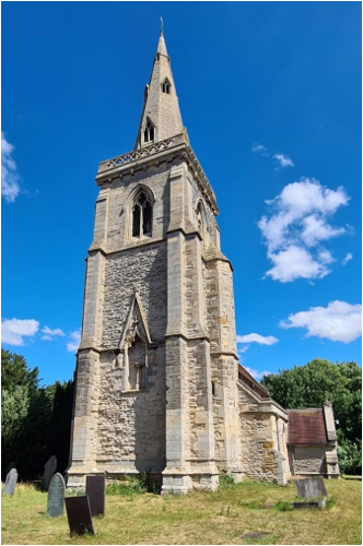
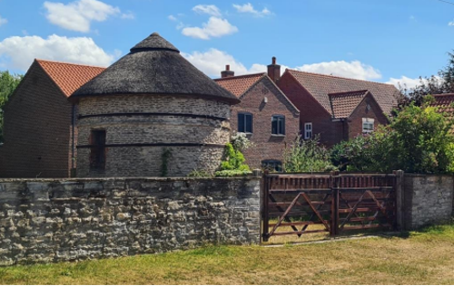
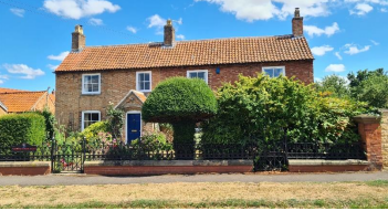
According to Dr Thoroton the settlement “was ever a Hamlet” under the jurisdiction of nearby Orston. To this day the simple linear form of the village is testament to the slow growth of the settlement, with the only public building being the church of St Helena. The church (see Figure 6 – Church of St Helena), which is mainly of 14th century construction but incorporates masonry from earlier centuries, is one of two surviving medieval structures in the village. The other is a 14th century dovecote (see Figure 7 -Thoroton Pigeoncote) of which the ground floor and half of the first floor survive. The circular stone building now has a conical thatched roof and is similar in design to the dovecote at nearby Sibthorpe.
Ethel Bedford Fenwick (1857-1947), the first registered nurse (and leader of the campaign for the Nurse’s Registry Act 1919) is a notable figure of Thoroton. Ethel spent her formative years at Thoroton Hall in Nottinghamshire and is buried at St Helena's Church. A special service celebrating the life of Ethel was held in May 2022 at the Church.
3.2 Historical Mapping
4 Spatial Analysis
The relationship between open spaces and the built form within a conservation area can be central to its character. This section describes the village’s layout, highlighting the significant views, landmarks and historical focal points. The contribution of open green spaces, trees and other natural elements to the conservation area’s character is also described within this section.
4.1 Plan, Form and Layout
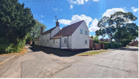
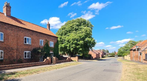
The village’s building line is variable, consisting of dwellings that immediately abut pavements and verges while others are set back behind walls and hedgerows. There is also a variation in the angle of older buildings in relation to the street which also adds interest and character.
Dwellings are either single or double storey, with many of the detached properties in large plots accessible directly from the Main Street. The space between properties varies and does not follow a regular pattern all of which contributes to the rural in its character with mature trees and hedgerows and not dominated by hardstanding driveways or garages.
Below is a map that describes the current plan, form and layout of the village.
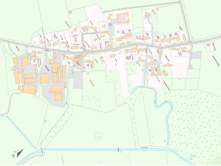
This map is reproduced from Ordnance Survey material with the permission of Ordnance Survey on behalf of the Controller of His Majesty’s Stationary Office © Crown Copyright. Unauthorised reproduction infringes Crown Copyright and may lead to prosecution or civil proceedings.
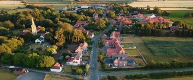
Figure 5 shows an aerial view of the village from the north looking southwards.
4.2 Landmarks, Focal Points and Views
The Church (see Figure 6 – Church of St Helena) is a landmark and focal point, with the spire visible both from within the village and in its wider context such as from footpaths and roads leading to the village.
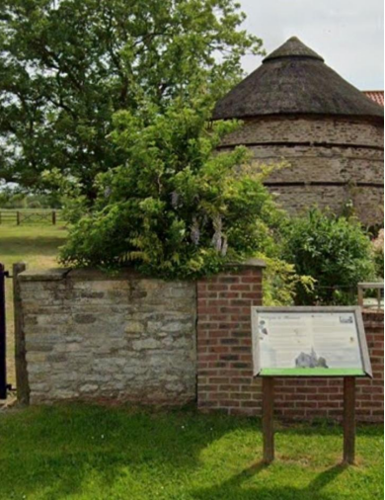
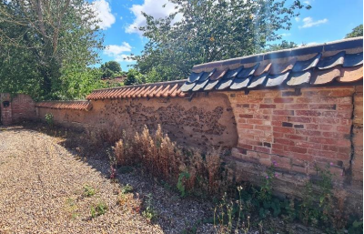
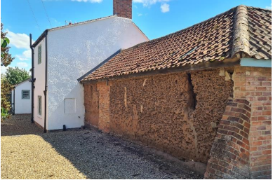
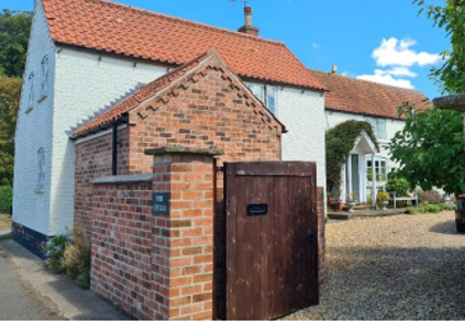
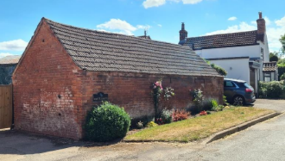
The mud structures within Nottinghamshire are all located within the Borough of Rushcliffe. Three of these mud structures can be found in Thoroton and are shown in Figure 7 to Figure 9.
4.3 Open Spaces, Trees and Landscape
On the approach to the village, hedgerows combined with wide grass verges and trees contribute to its rural character. In addition, few footpaths within and across the village contribute to its character.
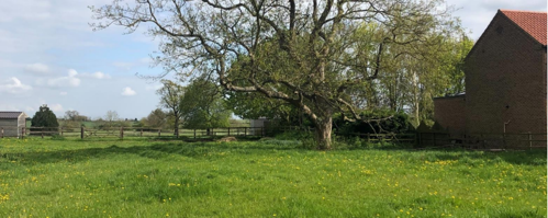
The largest area of open space within the Conservation Area boundary can be glimpsed towards the east between buildings from the village street (see Figure 12). In the north of the village, the churchyard at St Helena’s is one of the few accessible open spaces and provides a good vantage point for views over open countryside. The views across the countryside is characterised by open lawns, pasture and bands of mature trees and is bordered on the eastern side by the channel of the River Smite.
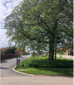
A handful of large mature trees act as prominent features along the village street, particularly during the summer months when they are in leaf. Grass verges can be found in sections along the village street and on the approaches to the village in conjunction with hedgerows. Significant trees are identified on the townscape appraisal.
4.3.1 Open Spaces, Trees and Landscape SWOT Analysis
Within smaller villages and larger towns there are publicly accessible open spaces which are not identifiable as formal parks but remain significant to public life. The SWOT Analysis below aims to identify such places, while also highlighting opportunities for improvement.
The results within the SWOT Analysis were received from Thoroton Parish Meeting on 20th October 2022.
Strengths - what are the positives of the open spaces, trees, and landscape
- Grass verges and the absence of kerbstones
- Open space and surrounding open countryside
- Rural character
- Mature trees, fields and hedgerows
- Limited street lighting and low level lighting
- External views of the village reinforce its rural character, clearly defining the boundary of and a clear break with any other settlement.
Weaknesses - what are the negatives of the open spaces, trees, and landscape
- Vehicle parking that causes damage to the verges
- Mature trees are approaching end of their life and there is currently no plan to replace them.
Opportunities – what could make the open spaces, trees, and landscape better?
- More tree planting
Threats - what would make open spaces, trees and landscapes worse?
- Loss of glimpses of the open countryside
- Any external development that impinges on the village setting in its landscape.
Works to Trees
You must contact the Local Planning Authority (LPA), Rushcliffe Borough Council before any works (cutting OR pruning) are carried out to trees within the Thoroton Conservation Area.
Six weeks’ notice is required before any works to trees within the Conservation Area is carried out, even if they are not protected by a Tree Preservation Order (TPO).
Standard notification forms (a section 211 notice), further information and contact details.
A flow chart of the decision-making process regarding works to trees.
4.4 Public Realm
The street scene is rural in its character with mature trees and hedgerows with very few hardstanding driveways or garages. The grass verges and vegetation are a significant part of the character of the village heavily influenced by the surrounding open countryside.
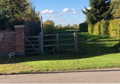
Brick and stone boundary walls, mature hedgerows, iron railings and simple timber fences are used around front gardens but in several instances the walls of the buildings themselves denote the property boundary fronting onto the village street, all of which contribute to the character of the rural street scene.
The village street, like the roads on the approaches to Thoroton are paved with asphalt but many of the private drives and farm tracks in the village are of gravel or unpaved, something which greatly contributes to its informal rural character.
5 Buildings of the Conservation Area and Key Characteristics
5.1 Building Types and Activity
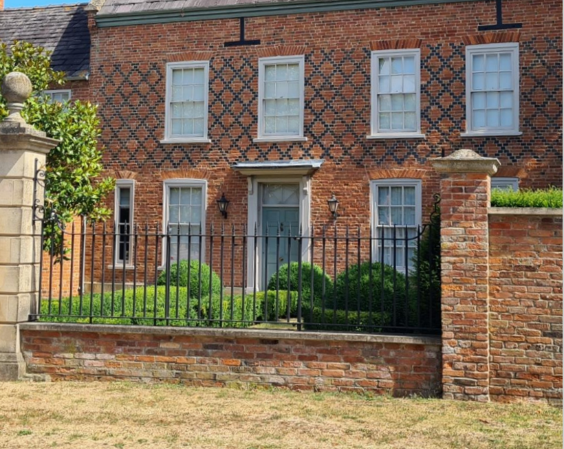
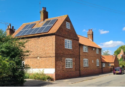
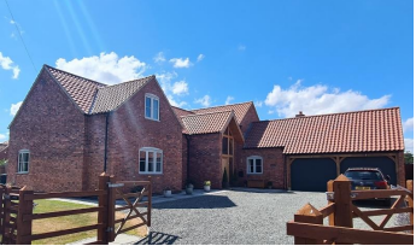
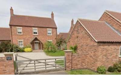
The older buildings in Thoroton mainly consist of a mixture 18th and 19th century farmhouses, cottages, barns and outbuildings. Notable exceptions include the 18th century Thoroton Hall, a 17th century Manor House and a church and dovecote of the 14th century. There are a handful of 20th century dwellings that are less sympathetic to the character of the village, however there are a number of early 21st century buildings which are more in keeping.
The village hosts events such as a summer fete, Christmas coffee morning and held a celebration for the Queens Jubilee in 2022. Residents felt that events such as these contributed to the characteristic of a small rural village.
5.1.1 Building types and Activity SWOT Analysis
The results of the SWOT Analysis were received from Thoroton Parish Meeting on 20th December, 2022.
Strengths - what activities/places can you go that make the village/town great?
- Residents can step out on to a network of footpaths and bridleways within a few yards of their properties.
Weaknesses - what activities/places exist that detract from making the village/town great?
- No village hall/community space
Opportunities - what activities/places could exist that would village/town even better?
- Village Hall
- The housing stock in the village has grown by 40% in the past 5 years. We now need to address the need for a community space in the village.
Threats - what activities/places would make village/town worse?
- Enclosure of footpaths and bridleways
5.2 Key Characteristics and Building Materials
5.2.1 Key Characteristics: St Helena’s and Surroundings - Zone 1
Materials
Walls: Coursed stone and random rubble to the church. Residential dwellings in the area are red brick or brick painted white.
Roofs: Pantile roof to dwellings and slate roof to the church.
Windows: Within this character area it is common for the timber framed windows to have horizontal glazing bars creating either two or three panes per window.
Key Characteristics / Architectural Features:
14th century church and 17th century manor house set back from the village street and accessed via a tree lined lane.
Some residential properties arranged in courtyards.
Mud wall with historic interest.
5.2.2 Key Characteristics: Main Street - Zone 2
Materials
Walls: Primarily comprises of traditional red brick, and painted render or painted brickwork in neutral tones.
Roofs: Gabled and hip gabled pantile roofs.
Key Characteristics / Architectural Features:
Detached and semi-detached residential properties and converted farm buildings of varying character.
Traditional red brick buildings often situated close to highway edge. 20th century infill development along both sides is invariably set back behind front gardens.
Some mature trees and a few glimpses of open countryside between buildings.
There are two mud walls within this zone, one of which is the Pigeoncote, and the other is adjacent to Smite Farm.
5.2.3 Key Characteristics: Mature Landscape - Zone 3
Key Characteristics / Architectural Features:
Mature landscape that has historically been associated with the older properties within the village, including lawns, pasture, woodland areas of mature trees and plantations of young trees.
The original channel along with the current course of the River Smite.
5.2.4 Key Characteristics: Contemporary early 21st Century Housing Zone 4
Materials
Walls: Predominantly brick with the odd building with a white render.
Roofs: Predominantly pantile (with the odd slate) roof. Mainly gable roof with some hipped gables on the Thoroton Farm development. Plain clay tiles have been used on some of the single stories within the Thoroton Farm development.
Key Characteristics / Architectural Features:
Contemporary, early 21st century detached and semidetached residential dwellings, many with a bespoke building outline and layout.
Some dwellings on Main Street have detached outbuildings hard to the footpath, contributing to the rural character of the village.
Timber gable porches.
While the scale of the buildings on the Thoroton Farm development are not out of scale with other barn conversion examples, they are considerably larger than other building within the village.
5.3 Key Characteristic Zone Map
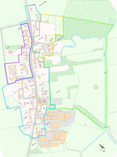
Key to Zone Map
- Yellow dots: St Helena's Church and Surroundings (Zone 1)
- Blue dots: Main Street (Zone 2)
- Green dots: Mature Landscape (Zone 3)
- Purple dots: Contemporary early 21st century Housing (Zone 4)
This map is reproduced from Ordnance Survey material with the permission of Ordnance Survey on behalf of the Controller of His Majesty’s Stationary Office © Crown Copyright. Unauthorised reproduction infringes Crown Copyright and may lead to prosecution or civil proceedings.
5.3.1 Key Characteristics SWOT Analysis
The results of the SWOT Analysis were received from Thoroton Parish Meeting on 20th December, 2022.
Strengths - what is it about most existing buildings that looks good?
- Rural character
- Individuality of dwellings
- Traditional red brick and brick detailing
- Variation of driveway materials
Weaknesses - what is it about most existing buildings that does not look good?
- Generic housing
- Unconsidered pastiche buildings which do not respond to the character of the village or individual sites within
Opportunities - what could make existing buildings (or new builds) look good and contribute to the character of the area?
- None listed
Threats - what could make existing buildings (or new builds) look worse and detract from the character of the area?
- Developments not in-keeping with the character of the area leading to a dilution of the character
5.4 Listed buildings
Buildings on the Government’s List of Buildings of Special Architectural or Historic Interest are called “Listed” buildings and are protected by law. Consent is required from Rushcliffe Borough Council before any works of alteration, extension, or demolition can be carried out on any listed building.
Further information can be found in Rushcliffe Borough Council’s publication Listed Buildings in Rushcliffe.
The complete and up-to-date list of the Secretary of State’s Statutory List of Buildings of Special Architectural Interest or Historic Interest.
Names and photos of the Listed Buildings and structures in Thoroton Conservation Area (correct as of December 2022) are detailed in Appendix 1. All Listed Buildings are shown on the Townscape Appraisal plan, but some smaller structures such as gravestones may not be shown.
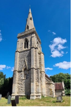
Fragments of the church date back to the 11th century. Restored and chancel rebuilt between 1868-1869. Coursed and random rubble. Set-back buttresses to tower and a pierced quatrefoil parapet.
14th century round tower Pigeoncote restored in 19th century. Coursed and squared rubble with brick reveal to openings. Conical thatched roof.
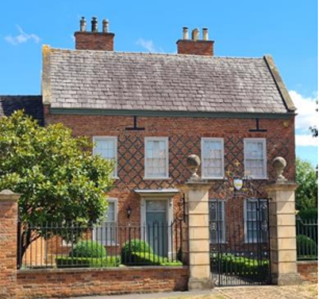
Early 18th century Manor House with early 19th century alterations and additions. Red brick with blue brick diaper work. Graduated slate roofs, with ashlar coped gables and kneelers. Two storey, four bays with timber framed sash windows.
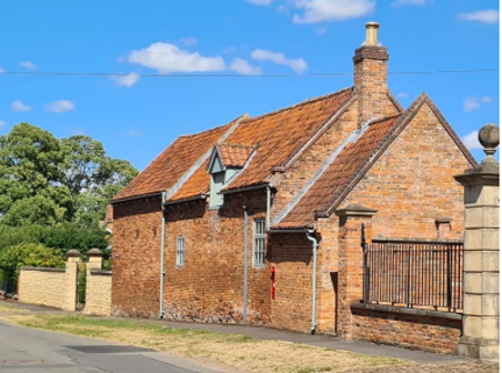
18th century red brick stable, coach house and blacksmith’s forge with 19th century adjoining wall. Laid out in a long rectangular plan aligned to the road. Irregular elevations. The stable and coach house is laid in Flemish stretcher bond and the blacksmith’s forge in English garden wall bond.
5.5 Key Unlisted Buildings
Contribution to the established character of the place can also come from buildings which are not recognised via listing, or are not old. A plan with all of the positive contributions to the area can be found in Appendix 2 - Conservation Area Boundary and Townscape Appraisal Map.
The mud walls (as shown in Figure 8 and Figure 9), while the walls are not considered buildings, they are key unlisted structures.
Two storey, four bay, brick cottage. Flemish bond brickwork to street elevation. Pantile roof with two ridge stack chimneys. Segmented arch brick lintel with alternate colour bricks. Low (below 1 metre) brick garden wall.
Two storey dwelling house, with newer additions to rear. Flemish bond to street elevation. Four bays. Brick porch. Dog tooth brickwork to eaves. Low (below 1 metre) brick garden wall with coping with metal railings above.
Single storey agricultural outbuilding hard street edge.
5.5.1 Contemporary Examples of Designs in Keeping With the Character
While Swift House and the Paddock House are not the only newer developments within the area, the scale and form of these are more appropriate and in keeping than the Thoroton Farm development to the north of the village.
6 Generic Management Plan for Conservation Areas in Rushcliffe
6.1 Introduction
In carrying out its planning functions, the Borough Council is required in law to give special attention to the desirability of preserving or enhancing the character or appearance of Conservation Areas. The Management Plan for a Conservation Area is a tool to ensure the special character of the area is preserved and enhanced. The management plans aim to:
- Outline a strategic management proposal for the preservation and enhancement of the Thoroton Conservation Area.
- Act as a guide for professionals and residents alike regarding:
- features of value, worthy of preservation;
- characteristics worthy of preservation;
- opportunities for enhancement;
- development proposals which preserve and enhance the special character of the area.
- Inspire community commitment to conservation principles and reporting.
6.2 National and Local Policies and Guidance
There is a duty to formulate and publish management plans setting out policies and proposals for the preservation and enhancement of Conservation Areas. Many of these policies and proposals are common to all Conservation Areas, and these are set out in this document. The Central Government Guidance and Local policies applicable to Conservation Areas include:
- Rushcliffe Local Plan Part 1: Core Strategy, with a specific focus on:
- Design and Enhancing Local Identity [in part]
- Historic Environment
- Rushcliffe Local Plan Part 2: Development Policies, with a specific focus on:
- Conserving and Enhancing Heritage Assets
- Development Affecting Archaeological Sites
- The National Planning Policy Framework (NPPF), particularly, but not exclusively the chapter on Conserving and Enhancing the Historic Environment.
- The National Planning Practice Guidance (NPPG) (updated 2021 and subject to continual review)
- By Design: Urban Design in the Planning System – Towards Better Practice (2000)
- The Planning (Listed Buildings and Conservation Areas) Act 1990
- Historic England “Historic England Advice Note 1: Conservation Area Designation, Appraisal and Management”
The council will utilise the full range of strategic policy and guidance documents to ensure that development in Thoroton Conservation Area is of a standard that enhances the amenity of the local area. The council will always look to use the most up-to-date versions of the document.
Supplementary documents may be issued for individual Conservation Areas where specific policies or proposals are needed.
6.3 Article 4 Directions
There are extra consents required in Conservation Areas. For example, in addition to the general control of development, you will
need to get permission for:
- Any additions or alterations to the roof (for example, dormer windows)
- The installation of satellite dishes on chimneys, roofs or walls fronting a highway
- Any extension which extends beyond the side of the original dwelling house
- Any extension of more than one storey that extends beyond the rear wall of the original dwelling house
- Cladding the exterior of the dwelling
- Any demolishing of a building or part of a building that has a volume over 115 cubic metres
Article 4 of the Town and Country Planning (General Permitted Development) Order 1995, allows planning authorities to restrict
some permitted development rights within particular areas. This does not necessarily prevent development or change taking place
but enables the Local Authority to manage the design and detailing of the works, and potentially grant permission subject to appropriate conditions. The use of Article 4 Directions will be proposed where it is considered appropriate following the completion of each Area Appraisal across the Borough.
Details of Article 4 Directions for Thoroton Conservation Area There are currently no Article 4 Directions for Thoroton Conservation Area.
6.4 Building Design
Mimicking the local vernacular is not the only way to ‘fit in’ with the character of a conservation area. National policy makes clear that contemporary designed, provided it is sympathetically designed, cannot be dismissed as an option. Therefore, good contemporary design will be encouraged where it respects the context’s character, scale and massing. This must be demonstrated in the Design and Access Statement submitted with any planning application.
Extensions to buildings in Conservation Areas should respect:
- The key characteristics of the original building, including scale, mass, materials and proportions
- The contextual setting and character of the Conservation Area
Copying like for like can devalue and destroy the ability to “read” historic change, and dilutes our historic heritage. Pastiche designs, incorporating poor imitations of other styles, will be resisted, particularly where they incorporate details which are not locally appropriate. Careful high-quality replication may be required in a few very sensitive locations.
In particularly sensitive locations, such as uniform terraces, exact replication may be necessary to maintain compositional unity. In that case, attention to details, choice of materials and high-quality workmanship are the keynotes. However, in some cases, a direct relationship is not impossible. For example, Flemish Bond brickwork cannot be replicated in cavity walls, and narrow lime mortar joints cannot be replicated in modern metric brickwork.
Where a new building is appropriate, on infill sites or where an existing building detracts from the character of the area, the opportunity should be taken to re-establish the streetscape, reinforce enclosure, open up distant vistas or views of landmarks or hide unsightly views.
“New and old buildings can coexist happily without disguising one as the other, if the design of the new is a response to urban design objectives” (DETR – “By Design”, p19).
As with extensions, good contemporary design which respects local character, and the context of the site will be encouraged.
All new buildings should respond appropriately to the existing frontage and normally follow the established building line. Development or redevelopment will normally be resisted if:
“it blocks important views identified in the individual appraisals, uses important open spaces identified in the appraisals, adversely affects the setting of any Listed or key buildings, fails to maintain or re-establish the streetscape where appropriate dominates its Conservation Area background fails to recognise the context of
the site destroys important features identified in the individual appraisals such as boundary walls, fences,
hedgerows or trees”
Where the quantity of contemporary schemes in a small area becomes significant and outnumbers older buildings within the area, further contemporary schemes could fundamentally shift the architectural character of the area and thus be harmful, even if well designed as an individual project.
New development that stands out from the background of buildings may be appropriate in exceptional circumstances if it contributes positively as a landmark to enhance the street scene, to highlight a corner or to signal a visual change of direction such as along a curving vista.
Any external lighting should be carefully designed and sited to minimise light pollution.
Energy producing or saving devices are generally welcomed by the Council, but careful consideration is required when these are to be located in a Conservation Area and some may require planning permission. In particular, they should be positioned to minimise their impact on the building and on the local amenity.
6.5 Publicity and Knowledge Transfer
Ambiguity about additional controls within a Conservation Area raises the likelihood of inappropriate developments occurring which
may damage the integrity of the conservation area designations.
Efforts have been made to engage local community groups in the development and review of the character appraisals. Empowering
communities to define the special architectural and historic interest of the Conservation Area aims to raise awareness.
Whether the appraisal took a community-led or a council-led approach, upon reviewing all Conservation Areas, the public were invited to ask questions and comment during a public consultation. A consultation event also aimed to diminish any ambiguity about
restrictions within a Conservation Area and increase the likelihood of sensitive and appropriate developments, maintaining the character
of the area.
The council recognise the potential issues of turnover in residency and ownership of properties in the conservation area. Therefore,
Rushcliffe Borough Council will periodically use their media outlets to highlight conservation area designations and the significant,
related planning controls.
The date of the Consultation Event 13/03/2023
If there are any queries about conservation areas, please email conservationareas@rushcliffe.gov.uk
6.6 Public Realm
General maintenance and upkeep to the public realm may include fixing damage to roads and pavements, and fixing issues with street lighting. Issues such as these can impact the quality of the Conservation Area.
The council aims to encourage works to the public realm that are in keeping with, or actively enhance the conservation area. Rushcliffe Borough Council can only advise on work within the public realm that does not require planning permission (for example work completed by statutory undertakers, such as the Highways Authority). In these instances, Rushcliffe borough council cannot prevent such work.
Nottinghamshire County Council are responsible for repairs to roads, pavements and street lighting. Report issues of repairs to roads, pavements and street lighting to Nottinghamshire County Council online.
Rushcliffe Borough Council will continue to undertake their duties in maintaining the public realm. Vandalism, fly tipping and street cleaning are all the responsibility of Rushcliffe Borough Council. Report issues to Rushcliffe Borough Council online.
Standard notification forms (a section 211 notice) - further information and contact details.
A flow chart of the decision-making process regarding works to trees.
6.7 Boundary Treatments
Where there is a proposal for a new boundary treatment to be installed, the council would encourage the use of boundary treatments within the area.
Within conservation areas, planning permission is required to alter, maintain, improve, take down or build any new gate, fence, wall or other enclosure with:
- A height of one metre or more if next to a highway (including a public footpath or bridleway), waterway or open space; or
- A height of two metres or more elsewhere.
Where planning permission is required to remove a wall, Rushcliffe Borough Council will aim to protect those boundary walls and fences that have been identified as positively contributing to the area.
Hedgerows are significant habitats for wildlife in lowland Britain. Regulations are intended to protect important hedges in the countryside. The policy applies to hedges that are more than 20m long, (or less if connected to another hedge) on or adjacent to:
- Land used for agriculture or forestry, including the keeping of horses or donkeys
- Registered common land and village greens
- Local Nature Reserves and Sites of Special Scientific Interest.
The policy does not apply if the hedge is within or on the boundary of the curtilage of a house.
6.8 Buildings at risk
A few of the important buildings across the various Conservation Areas are currently vacant or not in regular use, which may lead to some being “at risk” of neglect or decay.
The Council will encourage and advise on renovation and repair work that is sensitive to the original or traditional historic character of the building and retains original features. The council will monitor the opportunity and potential for grant aid schemes to encourage the basic maintenance work necessary to ensure that key buildings within the conservation area are structurally sound and weather tight. However, given the current financial climate and outlook, such schemes are unlikely in the short to medium term.
There is a presumption against the demolition of buildings which contribute to the character of the area unless there are exceptional circumstances. It would benefit both the physical form and the function of the Conservation Area if these buildings were repaired, maintained and brought back into use.
Where the poor condition of a building or structure is as a result of neglect and lack of maintenance by its owner there is no requirement for the Borough Council to take its deteriorated condition into account when deciding whether demolition is appropriate. This is to avoid rewarding the deliberate neglect of buildings by representing such action as a way to obtain planning permission for demolition and redevelopment.
6.9 Enforcement
Rushcliffe Borough Council will, from time to time, assess and monitor changes in the appearance and condition of Thoroton Conservation Area. This will ensure that where necessary enforcement action can be taken promptly to deal with problems as they arise.
Where co-operation cannot be gained by any other means, Rushcliffe Borough Council has the ability to use additional enforcement powers to tackle particular issues within conservation areas. The Council may take formal action if the condition of any building (listed or unlisted) which makes a positive contribution to the character of the Conservation Area is considered to be at risk.
The council will work in accordance with their enforcement policy, which aims to provide an efficient enforcement service in support of the Council’s statutory planning service. Rushcliffe Borough Council’s enforcement actions will remain transparent, consistent, and proportionate, as it is recognised that effective controls over unauthorised development assists in conserving the natural and built environment whilst helping to protect the quality of people’s lives and maintaining the Council’s integrity.
7 Appendix 1 – Listed Buildings (as of December 2022)
Grade: 2
Listing entry number: 1272720
National grid reference: SK 76482 42531
Location: Church of St Helena, Church Lane
Grade: 2
Listing entry number: 1244673
National grid reference: SK 76461 42551
Location: Manor Farmhouse, Church, Lane
Grade: 2
Listing entry number: 1243821
National grid reference: SK 76325 42403
Location: Thoroton Hall, Main Street
Stable, Coach House, Blacksmith's Forge and Adjoining Wall
Grade: 2
Listing entry number: 1244674
National grid reference: SK 76317 42429
Location: West of Thoroton Hall, Main Street, Thoroton, Nottinghamshire
Grade: 2
Listing entry number: 1243822
National grid reference: SK 76296 42342
Location: Thoroton Pigeoncote, Main Street, Thoroton, NG13 9DS
The titles of these listings may not make it clear that all listed buildings always include all attached structures and extensions, regardless of age, and all detached outbuildings built before 1st June 1948 which are, or were at the time of listing, ancillary to the function of the primary listed building and were in the same ownership at the time of listing.
For example, when a house is listed, the listing will apply to extensions, porches, detached historic stables, barns, wash houses, privies etc. Such outbuildings and extensions are only exempt from the provisions of listing where the listing specifically excludes them.
8 Appendix 2 – Townscape Appraisal

The Thoroton Townscape Map above shows:
- Locations of listed buildings
- Locations of key unlisted buildings
- Open space
- Locations of trees, hedges, and significant hedges and fences
- Viewpoints
Conservation Areas
- Bingham Conservation Area
- East Bridgford Conservation Area
- East Leake Conservation Area
- Hawksworth Conservation Area
- Hickling Conservation Area
- Ruddington Conservation Area
- Thoroton Conservation Area
- Wiverton Conservation Area
- Langar Conservation Area
- West Leake Conservation Area
- Whatton in the Vale Conservation Area
- Costock Conservation Area
- Sutton Bonington Conservation Area
- Upper Saxondale Conservation Area
- Wysall Conservation Area
- Bradmore Conservation Area
- Car Colston Conservation Area
- Scarrington Conservation Area
- Orston Conservation Area
- Flintham Conservation Area
- Edwalton Conservation Area
- Aslockton Conservation Area
- Bunny Conservation Area
- Granby Conservation Area
- Keyworth Conservation Area
- Thrumpton Conservation Area
- Normanton on the Wolds Conservation Area
- Upper Broughton Conservation Area
- Screveton Conservation Area
- Kneeton Conservation Area
- Colston Bassett Conservation Area
- Cropwell Bishop Conservation Area