Colston Bassett Conservation Area
Colston Bassett Conservation Area Appraisal and Management Plan March 2023
Contents
1.1 Conservation Areas
1.2 The Purpose of a Conservation Area Character Appraisal
1.3 The Planning Policy Context
2 Colston Bassett Location and Landscape Setting
2.1 The Colston Bassett Conservation Area
3.1 Location and Historic Activities
3.2 Archaeology
3.3 Historical Mapping
4.1 Plan, Form and Layout
4.2 Landmarks, Focal Points and Views
4.3 Open Spaces, Trees and Landscape
4.3.1 Open Spaces, Trees and Landscape SWOT Analysis
4.4 Public Realm
5 Buildings of the Conservation Area and Key Characteristics
5.1 Building Types and Activity
5.2 Key Characteristics and Building Materials
5.2.1 Key Characteristics: Village Centre - Zone 1
5.2.2 Key Characteristics: Working Farms - Zone 2
5.2.3 Key Characteristics: Hall Grounds Dive - Zone 3
5.2.4 Key Characteristics: Colston Hall Grounds - Zone 4
5.2.5 Key Characteristics: Surrounding Farmland - Zone 5
5.2.6 Key Characteristics SWOT Analysis
5.3 Listed Buildings
5.4 Key Unlisted Buildings
6.1 Introduction
6.2 National and Local Policies and Guidance
6.3 Article 4 Directions
6.4 Building Design
6.5 Publicity and Knowledge Transfer
6.6 Public Realm
6.7 Boundary Treatments
6.7.1 Walls and Fences
6.7.2 Hedges
6.8 Buildings at risk
6.9 Enforcement
7 Appendix 1 – Listed Buildings (as of January 2023)
8 Names of Key Unlisted Buildings
9 Appendix 2 – Conservation Area Boundary and Townscape Appraisal Map
1 Introduction
1.1 Conservation Areas
Rushcliffe Borough Council has an obligation under Section 69 of the Planning (Listed Buildings and Conservation Areas) Act 1990 to review, from time to time, its Conservation Area designations.
A Conservation Area, as defined under Section 69, is ‘an area of special architectural or historic interest the character or appearance of which it is desirable to preserve or enhance’.
Colston Bassett Conservation Area was designated in 1973. Prior to this reappraisal of 2023, the Colston Bassett Conservation Area was reviewed in 2009.
Section 71 of the Planning (Listed Buildings and Conservation Areas) Act 1990 highlights the local planning authority’s duty to formulate and publish proposals for the preservation and enhancement of the conservation areas. This document, therefore, aims to identify and reaffirm (or redefine) the special architectural or historic interest of the area which warrants its designation.
Conservation Area Appraisals are not, and never have been, tools for to fossilise a place against change, instead, the processes of change which allow places to grow and evolve are recognised as being unavoidable, and it is also recognised that change can be a positive and desirable force. The designation instead allows greater scrutiny and control to manage change to positive effect and to ensure that any changes which require planning permission do not harm, and ideally serve to actively enhance, the existing character of the place.
Colston Bassett Conservation Area: Summary of Special Interest
A strong rural character both in terms of architecture and landscape.
A range of architectural styles reflects various estate ownerships.
The Market Cross which provides the village with a strong focal point at its centre.
Modern infill development hasn't reduced the quality of the conservation area and traditional building styles are still in the majority.
A sylvan backdrop with a large number of important mature trees and hedgerows has largely been maintained.
Strong rural approaches into village lined with hedgerows, grass verges and mature trees and former parkland around Colston Hall.
Colston Bassett Conservation Area: Summary of Key Issues
Development pressure for new housing in a popular village is a constant demand and there is a threat of losing the open spaces that have previously been maintained between most buildings.
The loss of mature trees through disease, instability and development has threatened the sylvan backdrop, a noted feature of the Conservation Area.
1.2 The Purpose of a Conservation Area Character Appraisal
The purpose of a Conservation Area Character Appraisal is to:
- Identify and record the special interest of the Conservation Area to ensure there is public awareness and understanding of what is worthy of preservation.
- To define and reassess current boundaries to accurately reflect what is now perceived to be of special interest.
- To identify opportunities to safeguard and enhance the special interest of the Conservation Area.
It should be noted that the content in this document is not a comprehensive account of every significant building, structure, tree, wall, feature, or space. Therefore, any omission should not be assumed to imply that they are of no interest.
Generally, the character and appearance of a Conservation Area will be preserved or enhanced by:
- Providing controls and regulating development through the planning system.
- Applying the extra controls that designation provides over demolition, minor development, and the protection of trees.
- Environmental enhancement schemes and possibly providing financial assistance for the repair and restoration of specific buildings.
- Encouraging public bodies such as the local highways authority or utility companies to take opportunities to improve the street scene through the appropriate design and sensitive sighting of street furniture (and retention of historic features of interest), or the removal of eyesores and street features that have a negative impact such as overhead wires.
1.3 The Planning Policy Context
This appraisal provides a firm basis on which applications for development within the Colston Bassett Conservation Area would be assessed. It should be read alongside the wider development plan policy framework produced by Rushcliffe Borough Council and other National Planning Policy Guidance documents. The relevant documents include:
- Rushcliffe Local Plan Part 1: Core Strategy, with a specific focus on:
- Policy 10 (Design and Enhancing Local Identity) [in part]
- Policy 11 (Historic Environment)
- Rushcliffe Local Plan Part 2: Development Policies, with a specific focus on:
- Policy 28 (Conserving and Enhancing Heritage Assets)
- Policy 29 (Development Affecting Archaeological Sites)
- The Colston Basset Neighbourhood Plan 2018 - 2028
- The National Planning Policy Framework (NPPF) (Revised -2021)
- The National Planning Practice Guidance (2015 - Subject to Continual Review)
- By Design: Urban Design in the Planning System – Towards Better Practice (2000)
- The Planning (Listed Buildings and Conservation Areas) Act 1990
2 Colston Bassett Location and Landscape Setting
Rushcliffe Borough forms the southern tip of Nottinghamshire which borders Leicestershire. It is predominantly a rural Borough that contains a mixture of city suburbs, market towns and villages. Rushcliffe is located about half a mile South of Nottingham city centre, with the River Trent forming the majority of its northern boundary and the River Soar defining its western boundary.
The A46, a distinctive Roman Road, runs through the centre of the Borough and leads to Newark in the North and Leicester in the South. In the northern half of the Borough, the A52 forms Nottingham’s primary transport link to Grantham and the East of England. Junction 24 of the M1 and East Midlands Airport are located about 1 mile from the western border.
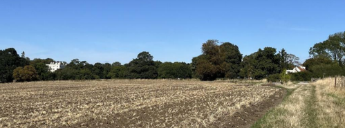
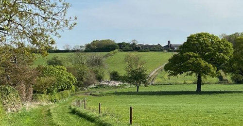
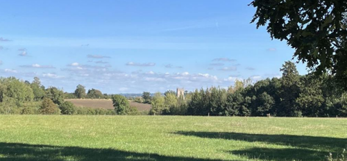
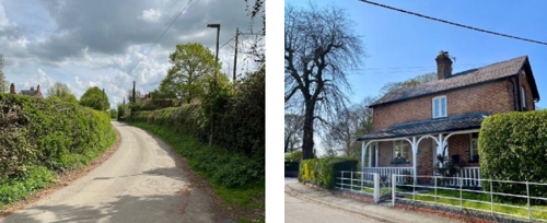
Colston Bassett lies in the Vale of Belvoir Character Area approximately 3km to the east of the A46 and 2km to the south of the village of Cropwell Bishop. The village is surrounded by paddocks, arable fields and hedgerows and is linked to neighbouring villages and the A46 by a number of small country lanes and a network of footpaths. The river Smite flows just to the west of the village centre. Individual mature trees and wooded areas are a dominant feature in the Conservation Area which provide a notable backdrop to the village's important buildings and spaces.

2.1 The Colston Bassett Conservation Area
Colston Bassett is a sylvan village, more so than other villages in the local area. It is renowned for its mature planting which goes a long way to forming the character and spaces that make up the village and its intrinsic rural character. Over 20 listed buildings/structures, plus additional non-designated assets can be found within the conservation area. These include examples of brick and pantile barns and cottages, Georgian and Victorian houses of greater stature. Open spaces and their enclosure are a key part of the layout of the village.
The Colston Bassett Conservation Area has a strong rural character both in terms of architecture and landscape. Once operated as a single-family estate, it still retains the feel of an estate village with the surrounding farms and many buildings within the village still in the ownership of the family or their trusts. This can be seen in several key characteristics which were adopted by the estate over time.
The historic village is arranged to either side of the River Smite, which creates two distinctive sides of the village each with a noticeably different character, connected by two listed road bridges and a single footbridge.
It is of note that the conservation area contains numerous paths and bridleways, as well as largely maintaining the pattern of enclosures as identified in the Colston Bassett Neighbourhood Plan.
- Conservation Area Boundary covers: 120 hectares (approximate)
- Number of Grade I listed buildings: 1
- Number of Grade II* listed buildings: 0
- Number of Grade II listed buildings: 21
- Scheduled Monuments: 2
A full list of Colston Bassett Conservation Area’s Listed buildings can be found in Appendix 1. Details accurate as of January 2023.
3 Historical Contexts
3.1 Location and Historic Activities
The village of Colston is first recorded in the Domesday Book of 1086. At that time there were two parishes of Colston and Kinoulton, Colston having a similar parish boundary to the present-day parish of Colston Bassett. Before the Norman Conquest both villages were part of the Saxon manor of Newbold. After the Conquest the village was gifted to Thurstine de Basset, the chief falconer to William I, and later the name of Newbold ceased to exist. It is considered that the origins of the name Colston relates to “Ton (meaning enclosure or place) of Col”, with Col being a Saxon, old English or possibly Scandinavian personal name. The name “Colsey” is also associated with the village meaning Col’s island likely to have reflected its situation over a low lying or mired area.
The family name Bassett was added to the parish of Colston in 1120 after Ralph Basset, head of an important Norman noble family and Lord Chief Justice of England, had gained the estate from King Henry I. Work started on St Mary’s Church by 1115. The first Market Cross was erected when King Henry III granted the fourth Ralph Bassett of Drayton the right to hold a weekly market in1257. The cross originally included a sundial (or cube dial), but the shaft was rebuilt in 1831 for the coronation of William IV, In 1922 the cross was gifted to the National Trust becoming one of the oldest, and certainly smallest monuments, in their care. Colston Bassett invariably had absentee landlords until 1571 when Edward Golding acquired the estate, and it remained in the Golding family for five generations. The second Edward Golding undertook much of the process of enclosure, with the parish divided into around 170 named fields.
In 1604 Colston Bassett was subject to a disastrous outbreak of the plague. The burials of 83 victims of the plague are recorded between July 1604 and March 1605.
The Civil War of 1651 impacted on the village, with families including the Goldings set against each other on opposite sides of the conflict. Sir Edward Golding set about rebuilding the Hall and carried out extensive tree planting between 1704 and 1710.
The estate passed into the hands of the Martin family around 1800. Henry Martin was the MP for Kinsale and the person from whom the Martin Arms takes its name. He was responsible for the construction of several of the larger properties that exist today such as the Rectory and Colston Bassett House, formerly the Yews, as well as establishing Hills Farm on the edge of the village, enlarging and improving many farmhouses and cottages and establishing the first school in what late became the village shop and is now The Old Telegraph private residence.
The estate was sold in 1864 to Mr George Thomas Davy, ‘an eminent London merchant’. It was George Thomas Davy who was responsible for planting and landscaping the village as it can still largely be seen today, including lowering of the gradient of Hall Lane, the construction of New Road and the new, stone-built school on School Lane which is still in use today.
In 1876 the estate was purchased by Mr Robert Millington Knowles. He further developed the tree planting in the village and constructed various agricultural buildings and cottages. Mr Knowles was also responsible for building the new church (St John the Divine) in the centre of the village. The roof of the old church of St Mary's was removed on completion of the new church in 1892, although it remains consecrated ground remaining in use for village burials.
Around 1913 the Colston Bassett and District Dairy was opened as a cooperative and has specialised in making Stilton cheese. There was little post war building and development in the village until new houses were erected in the wooded area of Hall Grounds during the 1960’s. Whilst modern in design (1960’s) this part of the village has retained its sylvan nature and rural setting. The development was reminiscent of cottages hidden in the woodland. The properties were screened from New Road, Hall Lane and St. Mary’s by mature trees. A proportion has since been redeveloped as locally notable contemporary homes.
3.2 Archaeology
The low-lying hump or island later occupied by the Manor and surrounding parkland may have been occupied in prehistory as a defensible area surrounded by low lying wetland and surrounding watercourses adjoining the Smite.
Earthwork surveys of the landscape around Colston Bassett have revealed a complex patchwork of ridge and furrow fields, boundary banks, ditches and terraced ground. These features are typical of a rural medieval community based around working the land.
Other archaeological features include two quarries and a sandpit, all of which were situated just outside the grounds of Colston Hall. Although it is not known when these were in active use they would have certainly provided contemporary villagers with building materials together with those from brickworks and nearby lime kilns.
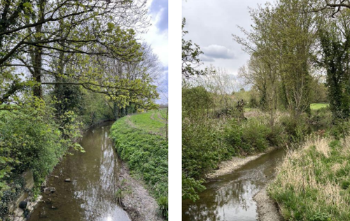
The River Smite was straightened in the mid-20th Century, previously flowing a far more meandering course and arranged with several fish weirs and pools. Works to improve the flow along the river left some ox bow ponds surrounded by the trees remaining also as a habitat for wildlife.
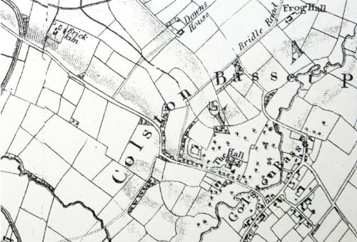
3.3 Historical Mapping
4 Spatial Analysis
The relationship between open spaces and the built form within a conservation area can be central to its character. This section describes the village’s layout, highlighting the significant views, landmarks and historical focal points. The contribution of open green spaces, trees and other natural elements to the conservation area’s character is also described within this section.
4.1 Plan, Form and Layout
Colston Bassett is characterised as a dispersed village, comprising clusters of outlying farmsteads, hunt kennels, and workers’ cottages—all historically associated with the Colston Bassett Estate. The former Rectory, in its time, was located beyond the core of the village.
Estate development was strategically positioned to complement the setting of the Manor. Landscaped vistas were created across the open countryside, with workers’ cottages and ancillary buildings carefully screened by intentional tree planting. Estate buildings were deliberately designed to avoid direct views towards the Hall or Manor House, with windows positioned on alternative elevations.
The western part of the conservation area corresponds to the historic parkland surrounding Colston Hall. This area was extensively planted with trees and originally contained only a few later farm buildings and the Old Vicarage. The former parkland was bounded to the north by the hedge-lined Wash Pit Lane.
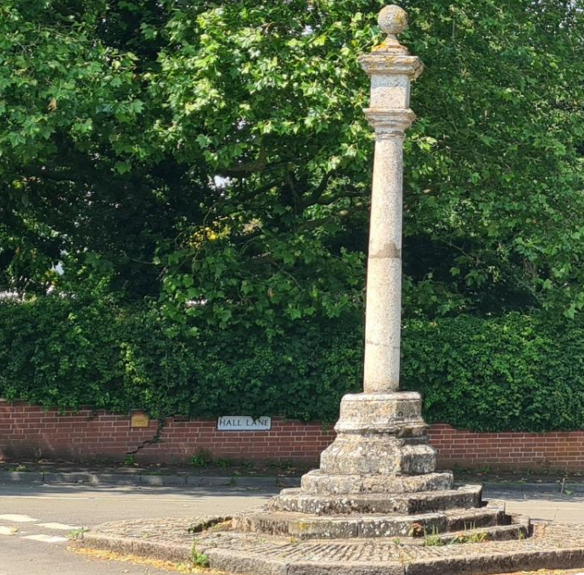
To the east lies the medieval core of the village, developed along the relatively straight alignment of School Lane and Church Gate. These lanes run diagonally from south-west to north-east, converging at the Market Cross (see Figure 14). This junction also connects to the wooded Hall Lane, which ascends westward to the ridge where Colston Hall is situated. St John’s Church occupies a prominent position along Church Gate and enjoys extensive views over the former parkland towards the River Smite, whose mature trees continue to define the heart of the village
Behind Church Gate remains an expansive open area once occupied by working farms and paddocks, interspersed with a few cottages along Bunnison Lane. This area connects to Bakers Lane, which serves as a back lane linking through to Harby Lane near Colston Bassett Dairy.
Many of the former agricultural buildings have since been converted to residential use, with associated domestic curtilages established.
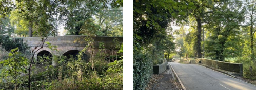
At the far end of Church Gate, Wash Pit Lane curves westward, forming the northern boundary of the conservation area. The River Smite flows west of the village centre and is crossed by two Grade II listed bridges: Smite Bridge on Hall Lane and China Bridge on Wash Pit Lane. A smaller stream joins the Smite at the northern edge of the conservation area, and historically another stream would have flowed through Sandpit Hollow, passing behind the Rectory to merge with the Smite further south.
These three watercourses and their associated valleys define the topography of the area, placing Colston Hall on a low-lying island at the centre. The elevated site of the old church, overlooking a cricket pitch, significantly enhances the village’s visual appeal. The surrounding former parkland fields are included within the boundaries of the Conservation Area.
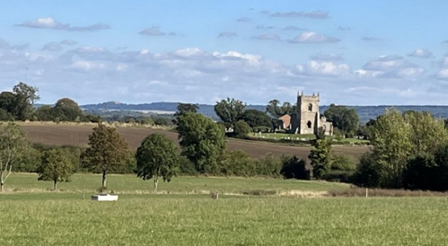
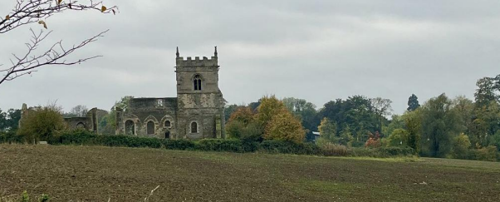
The three most visually prominent structures in the village are Colston Hall, the ruin of St Mary’s Church, and the later St John’s Church located at the centre. However, the defining characteristic of Colston Bassett is its sylvan setting. Trees dominate the landscape, with buildings appearing secondary within the environment. All approaches into the village are framed by mature trees, clearly delineating the settlement from the surrounding farmland.

This map is reproduced from Ordnance Survey material with the permission of Ordnance Survey on behalf of the Controller of His Majesty’s Stationary Office © Crown Copyright. Unauthorised reproduction infringes Crown Copyright and may lead to prosecution or civil proceedings.
Rushcliffe Borough Council - 100019419
4.2 Landmarks, Focal Points and Views
The principal landmarks of Colston Bassett include Colston Hall and the ruins of St Mary’s Church, located to the west of the village centre. The Market Cross, situated at the junction of the village’s three main roads, serves as the central focal point of the settlement. This prominent location is flanked by key community buildings including The Martins Arms public house, the Village Shelter, and the Village Hall.
Along Church Gate and School Lane, there are frequent and often framed views towards the surrounding fields, reinforcing the village’s rural setting. Within the central area, a number of small paddocks provide valuable open space. These areas contribute significantly to the village’s character by offering visual relief between built forms and enhancing the sense of openness. Just as important as the surrounding buildings, these green spaces allow for outward views to the countryside and maintain the spacious, rural atmosphere that defines Colston Bassett.
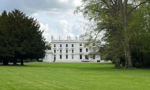
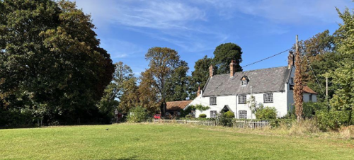
Colston Bassett Hall, a classically styled building with Italianate influences, was constructed circa 1704 and remodelled around 1860. It was formally listed as a building of special architectural or historic interest in September 1965.
The Hall has undergone various alterations by successive owners. Notably, the main entrance—originally located on the south elevation—has been relocated to the west. From the southern windows, there are views across a fine grove of trees, planted in 1710, which now partly envelop the remnants of the historic Lord’s Walk. The principal elevation of the Hall faces east towards the village, although this view is now obscured by mature tree planting, contributing to the secluded character of the Hall and its grounds.
St Mary’s Church remains a prominent feature within the landscape and can still be viewed from numerous vantage points throughout the village, reflecting its historically dominant siting. A particularly notable view is afforded from the end of Church Gate, looking west along Wash Pit Lane, where the ruins of St Mary’s are seen in their elevated position, commanding the surrounding area and reinforcing the church’s former visual significance within the settlement
From a standpoint opposite the Church of St John the Divine, glimpses of Colston Hall can be caught through the tree line across the paddock and farmland.
Other important views include the end of School Lane near School House overlooking open countryside to the west and down to the Smite, as well the view back towards Colston Hall. Also the open views from Hall Lane around the Old Rectory, from the Market Cross and along Hall Lane (including the Peter and Paul Cottages) and the listed Martins Arms.
The Colston Bassett Village Cross, located on Church Gate (see figure 9, or cover image), is reputed to be one of the oldest National Trust properties in Nottinghamshire—and notably one of the smallest. The octagonal, four-stepped base of the Cross, constructed in sandstone, is believed to date from the 15th century, placing it within the late medieval period and reflecting elements of the Early Renaissance and early modern eras. The limestone shaft was a later addition, erected in 1831 to commemorate the coronation of King William IV.

Adjacent to the Village Cross stands the Village Meeting Shelter, a structure gifted to the residents of Colston Bassett by the current estate owners, the Le Marchant family. Architecturally, the shelter is notably uncharacteristic of the local vernacular, being constructed in the style of a weather-boarded, timber-framed building with a roof of clay peg tiles more typically associated with the traditional architecture of southern England. Despite its contrasting style, the shelter is well-used by walkers and cyclists, enhancing the communal and recreational value of this focal point within the village.
Colston Bassett is advantageously located within gently undulating countryside on the edge of the Belvoir escarpment, affording expansive long-distance views across the Vale towards the escarpment, as well as a variety of inward and internal views into and within the village itself.
The Townscape Appraisal map illustrates these key views and other views which link the village to the adjacent countryside.
4.3 Open Spaces, Trees and Landscape
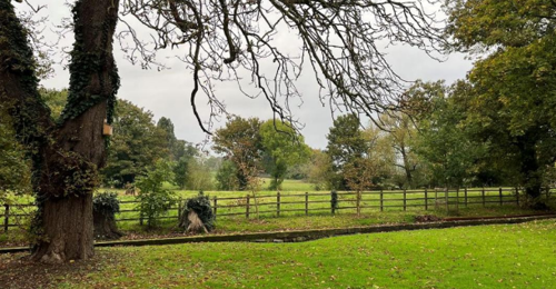
Mature trees are a defining feature of Colston Bassett’s character and contribute significantly to its rural and sylvan setting. They are particularly prominent along the ridge on which Colston Hall is situated, enhancing its elevated presence in the landscape. Elsewhere, individual specimens and smaller groups of trees are dispersed throughout the village core and along the hedgerows bordering surrounding lanes.
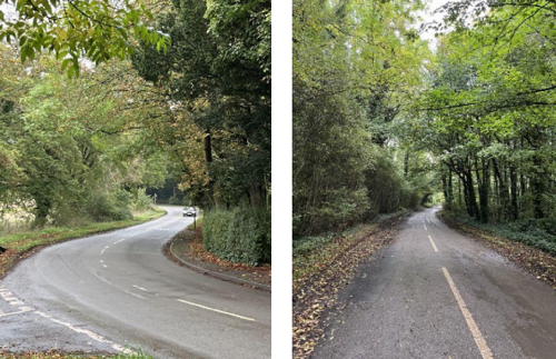
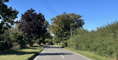
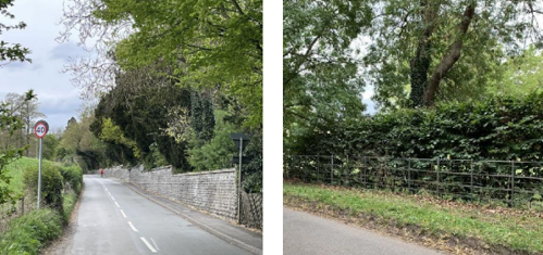
All highway approaches to the village are lined with mature trees, which collectively create a distinct sense of enclosure and establish Colston Bassett as a verdant enclave within the wider agricultural landscape.
Stands and avenues of mature oak trees remain a key feature of the traditional parkland associated with Colston Hall. Across the wider conservation area, Ash, Sycamore, and Horse Chestnut are the most commonly occurring species, with occasional surviving Elms and areas of protected verge, particularly along the boundary adjoining Langar Lane.
The churchyard, together with the gardens and grass verges found throughout the village, makes a positive contribution to the character and quality of public open space. Additionally, the surrounding fields and paddocks, many of which are visible from the public realm, reinforce the village’s rural setting.
Recent tree planting has focused on Oak and Lime—species well suited to the local climate and soil conditions. Notable examples include new planting along the Millennium Walk leading from New Road to the old church, as well as along the paddock adjoining Post Office Farmhouse.
Although some mature tree loss has occurred, particularly around areas of modern development, the conservation area retains its strongly sylvan character, which remains a defining and valued feature of Colston Bassett.
The Colston Bassett Neighbourhood Plan (CBNP) designates several areas as Local Green Spaces, including the Village Hall Paddock, the Smiteside Cricket Ground, and St Mary’s Churchyard. This designation affords these spaces a high level of protection from future development, helping to preserve the village’s rural setting and community assets.
The village’s organic pattern of development has resulted in the retention of small paddocks within the village core. These spaces provide a sense of openness and visual relief between built forms, contributing significantly to the rural and informal character that is distinctive to Colston Bassett.
The Smite wildlife corridor is recognised as an important ecological and landscape feature that contributes significantly to the character of Colston Bassett. The potential impact of various forms of pollution on this and other local wildlife habitats warrants further investigation as part of ongoing environmental and conservation efforts.
The accompanying photographs were taken during a period of limited rainfall. However, the River Smite is prone to flooding following periods of heavy rain, primarily affecting farmland to the north, but occasionally impacting sections of the road network at lower-lying points within the village.
4.3.1 Open Spaces, Trees and Landscape SWOT Analysis
Strengths - what are the positives of the open spaces, tress and landscape
Positive open spaces and trees:
- The paddock to the right of the Village Hall.
- Cricket pitch and surrounding area.
- St. Mary’s Church and the surrounding areas including the trees.
- The tree lined roads, lanes, including trees in gardens and other hedges which contribute to the street scene and act as biodiversity corridors.
- Views along the River Smite as you pass over the bridge, getting glimpses of the stretch of the water course through woodland and the River Smite Biodiversity Focus Area.
- The network of public footpaths and bridleways.
Weaknesses - what are the negatives of the open spaces, tress and landscape
- Loss of mature trees (due to end of life, disease or otherwise).
- No fixed strategy to plant new trees for the future.
- It relies more on traditional form, layout and space to create its outstanding sylvan atmosphere.
Opportunities - what could make the open spaces, tress and landscape better?
- Continue to plant replacement trees.
- Retention of significant views and maintain their character.
- Encourage walkers and cyclists to visit and use the public footpaths and bridleways.
Threats - what could make the open spaces, tress and landscape worse?
- Loss of mature trees slowly eroding the sylvan character.
- Loss of woodland and significant views.
Works to Trees
You must contact the Local Planning Authority (LPA), Rushcliffe Borough Council before any works (cutting OR pruning) are carried out to trees within the Colston Bassett Conservation Area.
Six weeks’ notice is required before any works to trees within the Conservation Area is carried out, even if they are not protected by a Tree Preservation Order (TPO).
If there is a tree which undergoes annual maintenance, include this information with the notice. It may be possible, upon agreement with the tree officer, that only one notice is required to cover the future annual maintenance.
Standard notification forms (a section 211 notice), further information and contact details.
A flow chart of the decision-making process regarding works to trees.
4.4 Public Realm
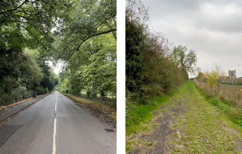
The public footpaths and bridleways across England represent an extensive network of historic rights of way, established over centuries as routes to fields, neighbouring settlements, and market towns. Colston Bassett benefits from a relatively well-developed network of such public footpaths, which are actively used by local residents. These routes are highly valued not only for recreational use—supporting physical and mental wellbeing—but also for their socio-historical significance as part of the parish’s rural heritage.
The village acts as a popular destination and meeting point for walkers and cyclists from outside the parish, supporting local amenities such as The Martins Arms public house (see Figure 31). This highlights the wider social and economic value of the footpath network, which enriches both the community’s quality of life and its historical character.
The rural character of Colston Bassett is further reinforced by lanes such as Harby Lane, Bunnison Lane, Wash Pit Lane, and New Lane, all of which feature mature hedgerows, trees, and grass verges. Additionally, Bunnison Lane, Church Gate, and Hall Lane are defined by a variety of traditional boundary treatments, including brick and stone walls, and estate-style metal railings—some of which are topped with hedging. While village roads are surfaced in asphalt, many private driveways are finished in gravel, contributing to a more informal and distinctly rural character throughout the village.
5 Buildings of the Conservation Area and Key Characteristics
5.1 Building Types and Activity
Colston Bassett has historically been an agriculturally focused settlement, with its landscape and community life shaped by farming and associated rural activities. This strong agricultural heritage, combined with longstanding estate ownership, has played a significant role in guiding the village’s development and has contributed to its distinctive rural character and identity.

There is a clear hierarchy of cottages within the village, reflecting their historical association with agricultural activity and estate management. A significant amount of building took place in the mid-nineteenth century, a period of relative prosperity for farming, resulting in the construction of many of the workers’ cottages that contribute to the village’s historic character today.
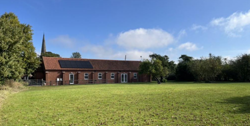
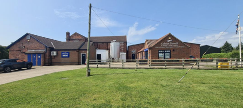
Colston Bassett Dairy has been producing traditional Stilton and Shropshire Blue cheeses for over a century. Established as a farming co-operative in 1913, the dairy remains operational today, continuing to make cheese using traditional methods. Originally, milk was sourced from surrounding local farms, all located within approximately 1.5 miles of the dairy, situated in the Vale of Belvoir.
Colston Bassett Stilton has been recognised as one of the top three British cheese brands in the Guild of Fine Food’s prestigious ‘Best Brands’ survey on six occasions between 2013 and 2020.
The Colston Bassett Dairy itself stands as a tangible symbol of the cheese-making process. While the production activities remain important, the dairy buildings also play a vital role in telling the story of this traditional craft, contributing to the cultural and historic narrative of the village.
Within the village, a range of amenities and community activities are located both within and adjacent to the Conservation Area. The Martins Arms public house offers food, drink, and accommodation, serving as an important social hub for residents and visitors alike. St John’s Church and St Mary’s Church provide additional cultural and visitor attractions, popular with walkers and cyclists.
Under new ownership, The Martins Arms has plans to introduce local food shopping facilities, further enhancing its role within the village community.
Community activity spaces include the Village Hall and its adjoining paddock, which host a variety of events such as concerts, talks, exercise classes, parties, and regular Sunday breakfasts. The Smiteside Cricket & Croquet Club fields provide further recreational opportunities.
The absence of a village shop or Post Office limits the village’s self-sufficiency and places greater importance on maintaining transport links. The local bus service remains a vital connection for many, particularly older residents, although it is under-utilised due to its infrequent, bookable nature and lack of weekend service.
The two historic bridges within the village are significant features. Both date from the late 18th century and are Grade II listed. The China Bridge, located on Wash Pit Lane to the north of the Conservation Area, is an exemplary example of coursed squared stone construction with a brick vault. Its design includes swept sides and a distinctive hump-backed profile, supported by a single-span depressed arch. The bridge is further distinguished by three-course brick voussoirs, which demonstrate the high level of craftsmanship and architectural significance of the structure.

5.2 Key Characteristics and Building Materials
5.2.1 Key Characteristics: Village Centre - Zone 1
Materials:
The traditional building materials within the Conservation Area are as follows:
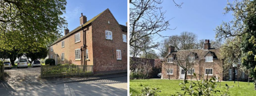
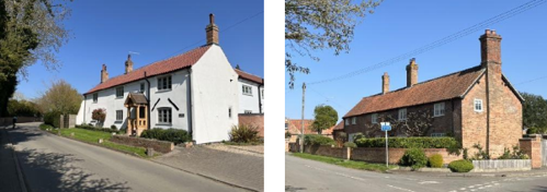
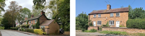
Walls: The village centre features a variety of locally sourced multi-red brick buildings, alongside a number of structures with rendered or painted white brick façades. Recent developments generally continue to use brick to maintain visual cohesion. The church is constructed in traditional stone, distinguishing it from surrounding buildings.
Roofs: Traditional roofing materials include clay pantiles on many vernacular buildings. More prominent and important buildings often feature slate roofs, with some roofs clad in plain tiles.
Windows: Although many original timber windows have been replaced with uPVC alternatives, some traditional York sliding sash windows remain evident, contributing to the historic character.
Doors: Doors are generally timber and traditionally styled, with some incorporating glazed panels. Original doors are rare.
Key Characteristics / Architectural Features
The area forms the historic core of the village, characterised by a strong rural atmosphere and a distinctly traditional village aesthetic.
All former agricultural buildings within this zone have been sensitively converted to residential use, maintaining the village’s agrarian heritage while adapting to contemporary needs.
Public buildings—including the Parish Hall, The Martins Arms public house, and the former school—are clustered around the Market Cross, which acts as a focal point.
Other notable features include Smite Bridge, various residential properties, and the churchyard.
The predominant building materials are red brick and stone, with some examples of painted brick and render.
Boundaries are defined by a mixture of walls, hedgerows, and estate railings, complementing the village’s rural character.
Groups of mature trees are scattered throughout the area, reinforcing the sylvan setting and contributing to the overall sense of enclosure and greenery.
5.2.2 Key Characteristics: Working Farms - Zone 2
Materials:
Walls: Traditional farmhouses and agricultural buildings are predominantly constructed in locally sourced multi-red brick. Modern agricultural sheds are generally clad with profiled metal sheeting on both roofs and walls. The cheese dairy is a notable exception; its modern brick walls have been designed to reflect the vernacular character of the area.
Roofs: Traditional farm buildings and houses typically feature clay pantile roofs, while the grander Manor House is distinguished by a slated roof. The cheese dairy uses concrete pantiles, blending modern functionality with local materials.
Windows: Houses in this area retain traditional timber casement windows, often with horizontal glazing bars, consistent with the rural character.
Doors: Doors are generally timber and traditionally styled, some partially glazed, although original doors are scarce.
Key Characteristics / Architectural Features
The area encompasses two working farms, each retaining fine historic buildings that are partially concealed by more recent agricultural sheds.
The three-storey Manor House, one of the oldest and most prominent buildings in the village, dominates the landscape in this zone.
The farmhouses, agricultural buildings, Colston Bassett Dairy, and surrounding paddocks collectively reinforce the area’s strong rural character.
Hedgerows and grass verges provide natural boundaries, with some sections of brick walling, particularly along Bunnison Lane, contributing to the sense of enclosure and historic continuity.
5.2.3 Key Characteristics: Hall Grounds Dive - Zone 3
Materials:
Walls: Traditional buildings in this area are limited, typically constructed from local multi-red brick. The majority of buildings date from the past 60 years and exhibit a variety of materials including stone, render, and brick.
Roofs: Roofing materials are diverse, ranging from zinc standing seam and flat roofs to slate and concrete tiles, reflecting modern architectural trends.
Windows: Generally, windows are larger with fewer glazing bars, made possible by advances in glazing technology.
Doors: A wide variety of door styles are present, reflecting the diverse architectural character of the area.
Key Characteristics / Architectural Features
The Hall Grounds consist predominantly of large, detached properties exhibiting a range of modern architectural styles.
These properties are set within a mature, verdant landscape, which contributes a strong sylvan character to the area.
Access is provided via narrow drives leading to the various residences.
A notable feature is the stone-walled tradesmen’s entrance to the Hall, which retains historic interest within the predominantly modern setting.
Overall, the area is defined by a combination of modern architectural diversity and a pronounced green, wooded environment.
5.2.4 Key Characteristics: Colston Hall Grounds - Zone 4
Materials:
The traditional building materials within the Conservation Area are as follows:
Walls: Traditional buildings in this area are limited, typically constructed from local multi-red brick. The majority of buildings date from the past 60 years and exhibit a variety of materials including stone, render, and brick.
Roofs: Roofing materials are diverse, ranging from zinc standing seam and flat roofs to slate and concrete tiles, reflecting modern architectural trends.
Windows: Generally, windows are larger with fewer glazing bars, made possible by advances in glazing technology.
Doors: A wide variety of door styles are present, reflecting the diverse architectural character of the area.
Key Characteristics / Architectural Features
The Hall Grounds consist predominantly of large, detached properties exhibiting a range of modern architectural styles.These properties are set within a mature, verdant landscape, which contributes a strong sylvan character to the area.
Access is provided via narrow drives leading to the various residences.
A notable feature is the stone-walled tradesmen’s entrance to the Hall, which retains historic interest within the predominantly modern setting.
Overall, the area is defined by a combination of modern architectural diversity and a pronounced green, wooded environment.
5.2.5 Key Characteristics: Surrounding Farmland - Zone 5
Materials:
Walls: St Mary’s Church is constructed from traditional stone. Other historic buildings in the area—including the former hunt kennels/riding centre and the Old Vicarage—are built in local brick, reflecting their association with the Estate.
Roofs: These buildings predominantly feature slate roofs, consistent with their Estate connections.
Windows: All windows are timber; the higher-status Old Vicarage notably retains traditional sash windows.
Doors: Doors are timber, generally of traditional design, complementing the historic character of the buildings.
Key Characteristics / Architectural Features
The ruin of St Mary’s Church, situated near the summit of a small hill, forms a prominent focal point within this landscape.
This area includes the Old Rectory, a listed building accompanied by some more contemporary outbuildings.
Other buildings are traditional in style and dispersed across the countryside surrounding the village.
The landscape is characterised by arable and pasture land, intersected by the River Smite and one of its tributaries.
Country lanes bordered by verges, hedgerows, and mature trees contribute to the rural and picturesque quality of the area.
Notable features include the picturesque ruin of St Mary’s Church, various historic farm buildings, and the Old Vicarage (dated 1834).

5.2.6 Key Characteristics SWOT Analysis
Strengths – what is it about most existing buildings that looks good?
- The Martins Arms pub serves as a key visual and social landmark, widely recognised across the borough as emblematic of the village’s identity.
- Many buildings reflect older cottage, Victorian, and Georgian architectural styles, contributing to a cohesive historic character.
- Traditional roof pitches are predominantly around 40 degrees, typically finished with pantiles or slate, with some steeper roofs on older properties that were historically thatched (e.g., The Martins Arms).
- Building forms are simple and functional, shaped by traditional construction techniques and the availability of local materials.
- Colston Bassett Hall, The Mews, and The Lodge exhibit classical architectural styles consistent with the Hall Grounds, reinforcing a strong sense of place.
- Generous spaces between buildings maintain a sense of openness throughout the village.
- Many older properties have been sympathetically preserved externally while being modernised internally, retaining their historic appearance.
Weaknesses – what is it about most existing buildings that does not look good?
- Subjective interpretations of what constitutes “harm” and the principles of “preserve and enhance” can lead to differing opinions between the council, residents, and developers, complicating consensus on developments.
- Modernisation and refurbishment have, in some cases, resulted in the gradual erosion of essential historic character and architectural detail.
Opportunities – what could make existing buildings (or new builds) look good and contribute to the character of the area?
- The village’s ongoing evolution offers opportunities to integrate sustainable design and modern building technology, ensuring that future development contributes positively to the area’s character.
- Redevelopment of unlisted or undesignated heritage assets presents a chance to create the next generation of valued heritage buildings.
- New development within the rural centre and lanes such as Harby Lane, Church Gate, and Bunnison Lane should be carefully designed to retain the rural look and feel.
Threats – what could make existing buildings (or new builds) look worse and detract from the character of the area?
- The strong desirability of the village ensures a consistent demand for residential development, which could risk over-development or inappropriate alterations if not carefully managed.
- Rapid advances in building technology may lead to designs or materials that are unsympathetic to the conservation area’s historic character if not properly controlled.
5.3 Listed Buildings
Buildings on the Government’s List of Buildings of Special Architectural or Historic Interest are called “Listed” buildings and are protected by law. Consent is required from Rushcliffe Borough Council before any works of alteration, extension, or demolition can be carried out on any listed building.
Further information can be found in Rushcliffe Borough Council’s publication Listed Buildings in Rushcliffe.
The complete list of the Secretary of State’s Statutory List of Buildings of Special Architectural Interest or Historic Interest can be accessed online.
Names and photos of the Listed Buildings and structures in Cropwell Butler Conservation Area (correct as of January 2024) are detailed in Appendix 1. All Listed Buildings are shown on the Townscape Appraisal plan, but some smaller structures such as gravestones may not be shown.
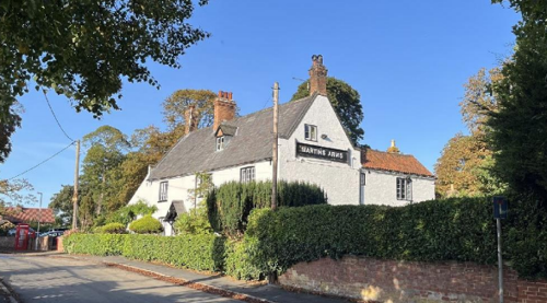
The Martins Arms Inn, originally a farm and alehouse known for brewing its own beer, was renamed in honour of the local Squire during a period of significant expansion. This early 18th-century building features later rear wings and an addition dating from the 19th or 20th century to the left. Constructed of painted brick, it is characterised by a steeply pitched slate roof with brick-coped gables set on square brick kneelers. The building includes an end stack and an off-centre ridge stack, with pantile roofing on the rear wings. Comprising two storeys and an attic, the three-bay façade displays tripartite casement windows with glazing bars, all set beneath segmental heads and raised sills. Historically part of the Estate until its sale in 1990, the Martins Arms remains a prominent community hub under its current ownership.
5.4 Key Unlisted Buildings
Contribution to the established character of the place can also come from buildings which are not recognised via listing, or are not old. A plan with all of the positive contributions to the area can be found in Appendix 2 - Conservation Area Boundary and Townscape Appraisal Map.
6 Generic Management Plan for Conservation Areas in Rushcliffe
6.1 Introduction
In carrying out its planning functions, the Borough Council is required in law to give special attention to the desirability of preserving or enhancing the character or appearance of Conservation Areas. The Management Plan for a Conservation Area is a tool to ensure the special character of the area is preserved and enhanced. The management plans aim to:
- Outline a strategic management proposal for the preservation and enhancement of the Colston Bassett Conservation Area.
- Act as a guide for professionals and residents alike regarding:
- features of value, worthy of preservation;
- characteristics worthy of preservation;
- opportunities for enhancement;
- development proposals which preserve and enhance the special character of the area.
- Inspire community commitment to conservation principles and reporting.
6.2 National and Local Policies and Guidance
There is a duty to formulate and publish management plans setting out policies and proposals for the preservation and enhancement of Conservation Areas. Many of these policies and proposals are common to all Conservation Areas, and these are set out in this document. The Central Government Guidance and Local policies applicable to Conservation Areas include:
- Rushcliffe Local Plan Part 1: Core Strategy, with a specific focus on:
- Design and Enhancing Local Identity [in part]
- Historic Environment
- Rushcliffe Local Plan Part 2: Development Policies, with a specific focus on:
- Conserving and Enhancing Heritage Assets
- Development Affecting Archaeological Sites
- Colston Basset Neighbourhood Plan
- The National Planning Policy Framework (NPPF), particularly, but not exclusively the chapter on Conserving and Enhancing the Historic Environment.
- The National Planning Practice Guidance (NPPG) (updated 2021 and subject to continual review)
- By Design: Urban Design in the Planning System – Towards Better Practice (2000)
- The Planning (Listed Buildings and Conservation Areas) Act 1990
- Historic England “Historic England Advice Note 1: Conservation Area Designation, Appraisal and Management”
The council will utilise the full range of strategic policy and guidance documents to ensure that development in Colston Bassett Conservation Area is of a standard that enhances the amenity of the local area. The council will always look to use the most up-to-date versions of the document.
Supplementary documents may be issued for individual Conservation Areas where specific policies or proposals are needed.
6.3 Article 4 Directions
There are extra consents required in Conservation Areas. For example, in addition to the general control of development, you will need to get permission for
- Any additions or alterations to the roof (for example, dormer windows)
- The installation of satellite dishes on chimneys, roofs or walls fronting a highway
- Any extension which extends beyond the side of the original dwelling house
- Any extension of more than one storey that extends beyond the rear wall of the original dwelling house
- Cladding the exterior of the dwelling
- Any demolishing of a building or part of a building that has a volume over 115 cubic metres
Article 4 of the Town and Country Planning (General Permitted Development) Order 1995, allows planning authorities to restrict some permitted development rights within particular areas. This does not necessarily prevent development or change taking place but enables the Local Authority to manage the design and detailing of the works, and potentially grant permission subject to appropriate conditions. The use of Article 4 Directions will be proposed where it is considered appropriate following the completion of each Area Appraisal across the Borough.
Details of Article 4 Directions for Colston Bassett Conservation Area
There are currently no Article 4 Directions for Colston Bassett Conservation Area.
6.4 Building Design
Mimicking the local vernacular is not the only way to ‘fit in’ with the character of a conservation area. National policy makes clear that contemporary designed, provided it is sympathetically designed, cannot be dismissed as an option. Therefore, good contemporary design will be encouraged where it respects the context’s character, scale and massing. This must be demonstrated in the Design and Access Statement submitted with any planning application.
Extensions to buildings in Conservation Areas should respect:
- The key characteristics of the original building, including scale, mass, materials and proportions
- The contextual setting and character of the Conservation Area
Copying like for like can devalue and destroy the ability to “read” historic change, and dilutes our historic heritage. Pastiche designs, incorporating poor imitations of other styles, will be resisted, particularly where they incorporate details which are not locally appropriate. Careful high-quality replication may be required in a few very sensitive locations.
In particularly sensitive locations, such as uniform terraces, exact replication may be necessary to maintain compositional unity. In that case, attention to details, choice of materials and high-quality workmanship are the keynotes. However, in some cases, a direct relationship is not impossible. For example, Flemish Bond brickwork cannot be replicated in cavity walls, and narrow lime mortar joints cannot be replicated in modern metric brickwork.
Where a new building is appropriate, on infill sites or where an existing building detracts from the character of the area, the opportunity should be taken to re-establish the streetscape, reinforce enclosure, open up distant vistas or views of landmarks or hide unsightly views.
“New and old buildings can coexist happily without disguising one as the other, if the design of the new is a response to urban design objectives” (DETR – “By Design”, p19).
As with extensions, good contemporary design which respects local character, and the context of the site will be encouraged.
All new buildings should respond appropriately to the existing frontage and normally follow the established building line. Development or redevelopment will normally be resisted if:
“it blocks important views identified in the individual appraisals, uses important open spaces identified in the appraisals, adversely affects the setting of any Listed or key buildings, fails to maintain or re-establish the streetscape where appropriate dominates its Conservation Area background fails to recognise the context of the site destroys important features identified in the individual appraisals such as boundary walls, fences, hedgerows or trees”
Where the quantity of contemporary schemes in a small area becomes significant and outnumbers older buildings within the area, further contemporary schemes could fundamentally shift the architectural character of the area and thus be harmful, even if well designed as an individual project.
New development that stands out from the background of buildings may be appropriate in exceptional circumstances if it contributes positively as a landmark to enhance the street scene, to highlight a corner or to signal a visual change of direction such as along a curving vista.
Any external lighting should be carefully designed and sited to minimise light pollution.
Energy producing or saving devices are generally welcomed by the Council, but careful consideration is required when these are to be located in a Conservation Area and some may require planning permission. In particular, they should be positioned to minimise their impact on the building and on the local amenity.
6.5 Publicity and Knowledge Transfer
Ambiguity about additional controls within a Conservation Area raises the likelihood of inappropriate developments occurring which may damage the integrity of the conservation area designations.
Efforts have been made to engage local community groups in the development and review of the character appraisals. Empowering communities to define the special architectural and historic interest of the Conservation Area aims to raise awareness.
Whether the appraisal took a community-led or a council-led approach, upon reviewing all Conservation Areas, the public were invited to ask questions and comment during a public consultation.
A consultation event also aimed to diminish any ambiguity about restrictions within a Conservation Area and increase the likelihood of sensitive and appropriate developments, maintaining the character of the area.
The council recognise the potential issues of turnover in residency and ownership of properties in the conservation area. Therefore, Rushcliffe Borough Council will periodically use their media outlets to highlight conservation area designations and the significant, related planning controls.
The approach taken within Colston Bassett Conservation Area was Parish Council led.
The consultation period took place between the following dates - 04/06/2025 – 29/06/2025.
The date of the Consultation Event - 11/06/2025.
If there are any queries about conservation areas, please email conservationareas@rushcliffe.gov.uk
6.6 Public Realm
General maintenance and upkeep to the public realm may include fixing damage to roads and pavements, and fixing issues with street lighting. Issues such as these can impact the quality of the Conservation Area.
The council aims to encourage works to the public realm that are in keeping with, or actively enhance the conservation area. Rushcliffe Borough Council can only advise on work within the public realm that does not require planning permission (for example work completed by statutory undertakers, such as the Highways Authority). In these instances, Rushcliffe borough council cannot prevent such work.
Nottinghamshire County Council are responsible for repairs to roads, pavements and street lighting. Report issues of repairs to roads, pavements and street lighting to Nottinghamshire County Council online.
Rushcliffe Borough Council will continue to undertake their duties in maintaining the public realm. Vandalism, fly tipping and street cleaning are all the responsibility of Rushcliffe Borough Council. Report issues to Rushcliffe Borough Council online.
Works to Trees
You must contact the Local Planning Authority (LPA), Rushcliffe Borough Council, before any works (cutting OR pruning) are carried out to trees within the Colston Bassett Conservation Area.
Six weeks’ notice is required before any works to trees within the Conservation Area is carried out, even if they are not protected by Tree Preservation Order (TPO).
Standard notification forms (a section 211 notice) - further information and contact details.
A flow chart of the decision-making process regarding works to trees.
6.7 Boundary Treatments
Where there is a proposal for a new boundary treatment to be installed, the council would encourage the use of boundary treatments within the area.
Within conservation areas, planning permission is required to alter, maintain, improve, take down or build any new gate, fence, wall or other enclosure with:
- A height of one metre or more if next to a highway (including a public footpath or bridleway), waterway or open space; or
- A height of two metres or more elsewhere.
Where planning permission is required to remove a wall, Rushcliffe Borough Council will aim to protect those boundary walls and fences that have been identified as positively contributing to the area.
Hedgerows are significant habitats for wildlife in lowland Britain. Regulations are intended to protect important hedges in the countryside. The policy applies to hedges that are more than 20m long, (or less if connected to another hedge) on or adjacent to:
- Land used for agriculture or forestry, including the keeping of horses or donkeys
- Registered common land and village greens
- Local Nature Reserves and Sites of Special Scientific Interest.
The policy does not apply if the hedge is within or on the boundary of the curtilage of a house.
6.8 Buildings at Risk
A few of the important buildings across the various Conservation Areas are currently vacant or not in regular use, which may lead to some being “at risk” of neglect or decay.
The Council will encourage and advise on renovation and repair work that is sensitive to the original or traditional historic character of the building and retains original features. The council will monitor the opportunity and potential for grant aid schemes to encourage the basic maintenance work necessary to ensure that key buildings within the conservation area are structurally sound and weather tight. However, given the current financial climate and outlook, such schemes are unlikely in the short to medium term.
There is a presumption against the demolition of buildings which contribute to the character of the area unless there are exceptional circumstances. It would benefit both the physical form and the function of the Conservation Area if these buildings were repaired, maintained and brought back into use.
Where the poor condition of a building or structure is as a result of neglect and lack of maintenance by its owner there is no requirement for the Borough Council to take its deteriorated condition into account when deciding whether demolition is appropriate. This is to avoid rewarding the deliberate neglect of buildings by representing such action as a way to obtain planning permission for demolition and redevelopment.
6.9 Enforcement
Rushcliffe Borough Council will, from time to time, assess and monitor changes in the appearance and condition of Colston Bassett Conservation Area. This will ensure that where necessary enforcement action can be taken promptly to deal with problems as they arise.
Where co-operation cannot be gained by any other means, Rushcliffe Borough Council may take formal action if the condition of any building (listed or unlisted) which makes a positive contribution to the character of the Conservation Area is considered to be at risk.
The council will work in accordance with their enforcement policy, which aims to provide an efficient enforcement service in support of the Council’s statutory planning service. Rushcliffe Borough Council’s enforcement actions will remain transparent, consistent, and proportionate, as it is recognised that effective controls over unauthorised development assists in conserving the natural and built environment whilst helping to protect the quality of people’s lives and maintaining the Council’s integrity
7 Appendix 1 – Listed Buildings (as of January 2023)
Dovecote Approximately 50 Metres North East Of Manor Farmhouse
Grade: II
Listing entry number: 1370141
National grid reference: SK 70142 33202
Location: Dovecote Approximately 50 Metres North East of Manor Farmhouse, Bakers Lane
Grade: II
Listing entry number: 1210496
National grid reference: SK 69981 33265
Location: Church of St John The Divine, Church Gate
Grade: II
Listing entry number: 1436251
National grid reference: SK 69968 33282
Location: Churchyard of the Church of St John the Divine, Church Gate, Colston Bassett, Notts, NG12 3FP
Grade: II
Listing entry number: 1210538
National grid reference: SK 69785 33271
Location: Smite Bridge Over River Smite, Hall Lane
Grade: II
Listing entry number: 1045649
National grid reference: SK 69906 33727
Location: China Bridge Over River Smite, Washpit Lane
Grade: II
Listing entry number: 1370142
National grid reference: SK 69623 33411
Location: Colston Hall, Hall Lane
Grade: II
Listing entry number: 1210547
National grid reference: SK 69357 33334
Location: The Old Rectory, Hall Lane
Grade: II
Listing entry number: 1210664
National grid reference: SK 69505 33816
Location: Group of Headstones South of South Transept Approximately 10 Metres North of South Churchyard Wall of Church of St Mary, New Road
Grade: Scheduled Monument
Listing entry number: 1006381
National grid reference: SK 69488 33845
Group of Headstones Approximately 12 Metres South of South Transept of Old Church of St Mary
Grade: II
Listing entry number: 1045646
National grid reference: SK 69502 33822
Location: Group of Headstones Approximately 12 Metres South of South Transept of Old Church of St Mary, New Road
Spencer Headstone Approximately 8 Metres South of South Transept of Old Church of St Mary
Grade: II
Listing entry number: 1290385
National grid reference: SK 69501 33828
Location: Spencer Headstone Approximately 8 Metres South of South Transept of Old Church of St Mary, New Road
Grade: II
Listing entry number: 1045647
National grid reference: SK 69488 33832
Location: Thompson Headstone Approximately 10 Metres South of South Door of South Aisle of Old Church of St Mary, New Road
Medieval Market Cross and 19th Century Commemorative Cross
Grade: Scheduled Monument
Listing entry number: 1012872
National grid reference: SK 69865 33192
Group of Headstones Approximately 12 Metres South of South Transept of Old Church of St Mary
Grade: II
Listing entry number: 1045646
National grid reference: SK 69502 33822
Location: Group of Headstones Approximately 12 Metres South of South Transept of Old Church of St Mary, New Road
Grade: II
Listing entry number: 1370145
National grid reference: SK 69829 33170
Location: Martins Arms Public House, School Lane
K6 Telephone Kiosk Adjacent To Martins Arms Public House
Grade: II
Listing entry number: 1264495
National grid reference: SK 69818 33146
Location: K6 Telephone Kiosk Adjacent To Martins Arms Public House, School Lane
Cam Headstone Approximately 20 Metres South of West Side of Tower of Old Church of St Mary
Grade: II
Listing entry number: 1210704
National grid reference: SK 69480 33815
Location: Cam Headstone Approximately 20 Metres South of West Side of Tower of Old Church of St Mary, New Road
Grade: II
Listing entry number: 1210688
National grid reference: SK 69486 33823
Location: Speight Headstone Approximately 15 Metres South of South Door of South Aisle of Old Church of St Mary, New Road
Group of Headstones in Angle Between Chancel and South Transept of Old Church of St Mary
Grade: II
Listing entry number: 1370143
National grid reference: SK 69503 33840
Location: Group of Headstones in Angle Between Chancel and South Transept of Old Church of St Mary, New Road
Grade: II
Listing entry number: 1370144
National grid reference: SK 69488 33811
Location: Group of Headstones Approximately 25 Metres South of Tower And 5 Metres North of South Churchyard Wall of Old Church of St Mary, New Road
Grade: I
Listing entry number: 1210576
National grid reference: SK 69492 33842
Location: Remains of Church of St Mary, New Road
Grade: II
Listing entry number: 1045643
National grid reference: SK 70093 33196
Location: Manor Farmhouse, Bakers Lane
Grade: II
Listing entry number: 1045644
National grid reference: SK 69865 33192
Location: Village Cross, Church Gate
Grade: II
Listing entry number: 1045648
National grid reference: SK 69467 33827
Location: Draper Headstone Approximately 10 Metres South West of South Aisle, West End, of Old Church of St Mary, New Road
*The titles of these listings may not make it clear that all listed buildings always include all attached structures and extensions, regardless of age, and all detached outbuildings built before 1 June 1948 which are, or were at the time of listing, ancillary to the function of the primary listed building and were in the same ownership at the time of listing.
For example, when a house is listed, the listing will apply to extensions, porches, detached historic stables, barns, wash houses, privies etc. Such outbuildings and extensions are only exempt from the provisions of listing where the listing specifically excludes them.
8 Names of Key Unlisted Buildings
Hall Lane
- The Lodge & Curved Entrance Walls
- Peter and Paul Cottages
- Garden Cottage
- The Mews
- The Wall of the Walled Garden
Church Gate
- The Old Telegraph Office
- Post Office Farmhouse
- Byre Cottage
- Chestnut Cottage
- Chestnut Cottage Barn
- Sunset Cottage
- Honeysuckle Cottage
- Paynes Cottage
- The Old Stables
- Yew Cottage
- Colston Bassett House
- Church Gate Cottage (was Chippy Hacky)
- Pear Tree Cottage
- The Old Smithy
- Home Farm
- Cob Castle (name?)
- Chancery Cottage
- War Memorial St Johns
School Lane
- The Farmhouse
- Linden Lea
- School House &The Cottage
- Ascot House
- The Barn
- The School
Bunnison Lane
- Bunnystone Cottage
- Newton’s Cottage
- 5 Bunnison Lane
- 5A Bunnison Lane
- The Old Farmhouse
- Outbuilding to Above
- St Anthony’s Cottage
Bakers Lane
- Church Farmhouse & Traditional Farm Buildings
- Harby Lane
- Manor Farm Cottage
- Well Cottage
Spring Hill
- The Elms
New Road
- Belle Vue Cottage & adjacent Cottage
9 Appendix 2 – Conservation Area Boundary and Townscape Appraisal Map
Map showing the location of:
- Conservation Area boundary - red line
- Listed buildings - red
- Unlisted buildings - purple
- Positive open space - green
- Wooded Areas - dark green
- Significant views - red arrows
- Significant gate, wall or fence - dotted line
- Significant hedges - light green line
Conservation Areas
- Bingham Conservation Area
- East Bridgford Conservation Area
- East Leake Conservation Area
- Hawksworth Conservation Area
- Hickling Conservation Area
- Ruddington Conservation Area
- Thoroton Conservation Area
- Wiverton Conservation Area
- Langar Conservation Area
- West Leake Conservation Area
- Whatton in the Vale Conservation Area
- Costock Conservation Area
- Sutton Bonington Conservation Area
- Upper Saxondale Conservation Area
- Wysall Conservation Area
- Bradmore Conservation Area
- Car Colston Conservation Area
- Scarrington Conservation Area
- Orston Conservation Area
- Flintham Conservation Area
- Edwalton Conservation Area
- Aslockton Conservation Area
- Bunny Conservation Area
- Granby Conservation Area
- Keyworth Conservation Area
- Thrumpton Conservation Area
- Normanton on the Wolds Conservation Area
- Upper Broughton Conservation Area
- Kneeton Conservation Area
- Colston Bassett Conservation Area
- Cropwell Bishop Conservation Area