Orston Conservation Area
Orston Conservation Area Appraisal and Management Plan March 2023

Contents
1.1 Conservation Areas
1.2 The Purpose of a Conservation Area Character Appraisal
1.3 The Planning Policy Context
2 Orston Location and Landscape Setting
3.1 Location and Historic Activities
3.2 Historical Mapping
4.1 Plan, Form and Layout
4.2 Landmarks, Focal Points and Views
4.3 Open Spaces, Trees and Landscape
4.3.1 Open Spaces, Trees and Landscape SWOT Analysis
4.4 Public Realm
5 Buildings of the Conservation Area and Key Characteristics
5.1 Building Types and Activity
5.1.1 Building types and Activity SWOT Analysis
5.2 Key Characteristics and Building Materials
5.2.1 Key Characteristics: Orston Hall and Surrounding Countryside - Zone 1
5.2.2 Key Characteristics: High Street - Zone 2
5.2.3 Key Characteristics: Church Street, Launder Street and The Green - Zone 3
5.2.4 Key Characteristics: Loughbon - Zone 4
5.2.5 Key Characteristics: Chapel Street - Zone 5
5.2.6 Key Characteristics: Mill Lane and Village Green Crossroads - Zone 6
5.2.7 Key Characteristics: Lombard Street and Surrounding Countryside - Zone 7
5.2.8 Key Characteristics: Hill Road and Station Road - Zone 8
5.2.9 Key Characteristics SWOT Analysis
5.3 Listed buildings
5.4 Key Unlisted Buildings
6.1 Introduction
6.2 National and Local Policies and Guidance
6.3 Article 4 Directions
6.4 Building Design
6.5 Publicity and Knowledge Transfer
6.6 Public Realm
6.7 Boundary Treatments
6.7.1 Walls and Fences
6.7.2 Hedges
6.8 Buildings at risk
6.9 Enforcement
7 Appendix 1 – Listed Buildings (as of January 2023)
8 Appendix 2 – Conservation Area Boundary and Townscape Appraisal Map
1 Introduction
1.1 Conservation Areas
Rushcliffe Borough Council has an obligation under Section 69 of the Planning (Listed Buildings and Conservation Areas) Act 1990 to review, from time to time, its Conservation Area designations.
A Conservation Area, as defined under Section 69, is ‘an area of special architectural or historic interest the character or appearance of which it is desirable to preserve or enhance’.
Orston Conservation Area was designated in 1990. Prior to this appraisal of 2023, the most recent appraisal of the Orston Conservation
Area was carried out in 2010.
Section 71 of the Planning (Listed Buildings and Conservation Areas) Act 1990 highlights the local planning authority’s duty to formulate and publish proposals for the preservation and enhancement of the conservation areas. This document, therefore, aims to identify and
reaffirm (or redefine) the special architectural or historic interest of the area which warrants its designation.
Conservation Area Appraisals are not, and never have been, tools for to fossilise a place against change, instead, the processes of change which allow places to grow and evolve are recognised as being unavoidable, and it is also recognised that change can be a positive and desirable force. The designation instead allows greater scrutiny and control to manage change to positive effect and to ensure that any changes which require planning permission do not harm, and ideally serve to actively enhance, the existing character of the place.
Orston Conservation Area: Summary of Special Interest
The low-lying western side of the village is connected by a central thoroughfare to the higher ground of the Belvoir Ridge in the east.
Strong sylvan character around Orston Hall and the Churchyard of St Mary’s provides tree lined western approach to the village.
Hedgerows and grass verges dominate approaches to the village from the east.
Strong equestrian influence has resulted in the retention of a large number of paddocks on the outskirts of the village.
Large variety of residential property types includes a substantial proportion of traditional cottages and houses.
1.2 The Purpose of a Conservation Area Character Appraisal
The purpose of a Conservation Area Character Appraisal is to:
- Identify and record the special interest of the Conservation Area to ensure there is public awareness and understanding of what is
worthy of preservation. - To define and reassess current boundaries to accurately reflect what is now perceived to be of special interest.
- To identify opportunities to safeguard and enhance the special interest of the Conservation Area.
It should be noted that the content in this document is not a comprehensive account of every significant building, structure, tree, wall, feature, or space. Therefore, any omission should not be assumed to imply that they are of no interest.
Generally, the character and appearance of a Conservation Area will be preserved or enhanced by:
- Providing controls and regulating development through the planning system.
- Applying the extra controls that designation provides over demolition, minor development, and the protection of trees.
- Environmental enhancement schemes and possibly providing financial assistance for the repair and restoration of specific buildings.
- Encouraging public bodies such as the local highways authority or utility companies to take opportunities to improve the street scene through the appropriate design and sensitive sighting of street furniture (and retention of historic features of interest), or the removal of eyesores and street features that have a negative impact such as overhead wires.
Orston Conservation Area: Summary of Key Issues
Amenities – Lack of conveniently located recreational areas such as sports fields. Growing trend in closure of rural pubs, local shops and places of worship could potentially threaten existing facilities in Orston.
Development – Threat to the overall character of the village from the number and scale of individual new builds, along with the significant reconfiguration of older buildings.
Highways and Transportation – Increasing trend of on street parking. Poor condition of road surfaces. Speeding through traffic and HGV traffic along Station Road.
Public Realm – Increasing amount of street signage and unsympathetic street lighting.
1.3 The Planning Policy Context
This appraisal provides a firm basis on which applications for development within the Orston Conservation Area would be
assessed. It should be read alongside the wider development plan policy framework produced by Rushcliffe Borough Council and other
National Planning Policy Guidance documents. The relevant documents include:
- Rushcliffe Local Plan Part 1: Core Strategy, with a specific focus on:
- Policy 10 (Design and Enhancing Local Identity) [in part]
- Policy 11 (Historic Environment)
- Rushcliffe Local Plan Part 2: Development Policies, with a specific focus on:
- Policy 28 (Conserving and Enhancing Heritage Assets)
- Policy 29 (Development Affecting Archaeological Sites)
- The National Planning Policy Framework (NPPF) (Revised -2021)
- The National Planning Practice Guidance (2015 - Subject to Continual Review)
- By Design: Urban Design in the Planning System – Towards Better Practice (2000)
- The Planning (Listed Buildings and Conservation Areas) Act 1990
2 Orston Location and Landscape Setting
Rushcliffe Borough forms the southern tip of Nottinghamshire, which borders Leicestershire. It is predominantly a rural Borough that contains a mixture of city suburbs, market towns and villages. Rushcliffe is located about half a mile South of Nottingham city centre, with the River Trent forming the majority of its northern boundary and the River Soar defining its western boundary.
The A46, a distinctive Roman Road, runs through the centre of the Borough and leads to Newark in the North and Leicester in the South. In the northern half of the Borough, the A52 forms Nottingham’s primary transport link to Grantham and the East of England. Junction 24 of the M1 and East Midlands Airport are located about 1 mile from the western border.
The village of Orston lies in the northeast of the Borough on the edge of the Vale of Belvoir Character Area. About a mile to the south is the hamlet of Elton, through which the A52 runs east-west. The Nottingham and Ambergate branch line offers alternative transport to Nottingham and Grantham from the small railway station of Elton and Orston, about half a mile to the south of the village.
Two miles southwest of Orston are the twin villages of Whatton-in-the-Vale and Aslockton, where there is also a railway station that provides frequent services. There is also a good local bus service in Orston which terminates at Bingham.
The rural landscape around Orston is heavily influenced by the course of the River Smite which flows northwards past the western fringe of the village.

2.1 Orston Conservation Area
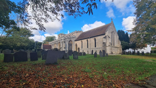
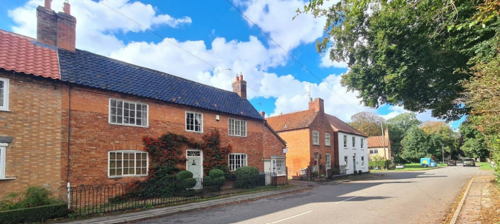
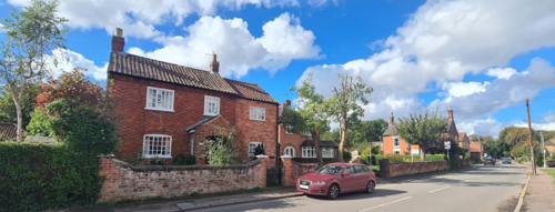
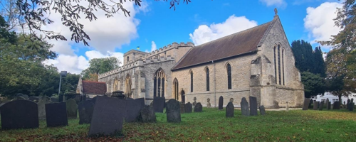
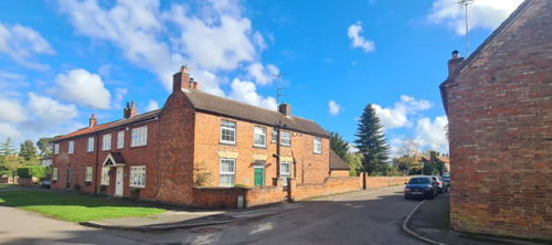
The Orston Conservation Area has an intricate street pattern, with High Street and Church Street suggesting a medieval layout. Between these streets lies St Mary’s Church, a building of significant historical interest. While the church is primarily 13th, 14th, and 15th century in origin, its tower dates from 1766, with restoration work carried out in 1889 and 1914. Inside, notable features include a delicately carved font dated 1662 and a drum from the Battle of Waterloo.
The village is exceptionally well-preserved, with many fine cottages and farmhouses, and it boasts nine Listed Buildings. Trees are a defining characteristic of Orston’s landscape. An avenue of trees creates an attractive western approach to the village, while Horse Chestnut trees enhance several street scenes, adding to its charm.
Among Orston’s notable buildings is The Gables, a remarkable 17th-century brick house distinguished by its large and unusual Dutch gable. In contrast, the village hall represents a far newer addition, built to replace the earlier hall that was destroyed during a bombing in 1941.
- Conservation Area Boundary covers: 33.46 hectares (approximate)
- Number of Grade 1 listed buildings: 1
- Number of Grade 2* listed buildings: 0
- Number of Grade 2 listed buildings: 8
A full list of Scarrington Conservation Area’s Listed buildings can be found in Appendix 1. Details accurate as of March 2023.
3 Historical Contexts
3.1 Location and Historic Activities
Evidence suggests that Orston has been settled since at least 1000 BC. However, the village’s current form, characterised by its central church, village green, and cluster of cottages, likely developed soon after the Roman withdrawal.
The name Orston derives from the Old English Ordicestune or “farmstead of Ordric” after the name of the village’s leader. Other incarnations of the village’s name include Oschintone (1086 Domeseday Survey), Oskintone (1242), Horston (1428) and Horson (circa 1500).
During the early medieval period Orston was a place of some importance being at the head of one of the five great manors of Nottinghamshire and having jurisdiction over an area which included the villages of Scarrington, Staunton, Thoroton, Screveton and Aslockton. This administrative structure dated back to the Danelaw of 877 and continued under the Normans after the Domesday Survey of 1086. The Survey mentions 33 people living in the village by name and along with their families the total population probably amounted to around 150 to 175. Although no visible evidence remains today, the Manor at Orston was originally located at the north end of High Street. It remained under Royal ownership until the reign of Richard I (1189–1199), when it was ceded to William de Albini.
The Manor’s presence would have made High Street the focal point of the village. However, following the Manor’s demolition around 1840, the street has been somewhat sidelined. Subsequent development, including the new buildings of Manor Farm, shifted eastward onto the higher ground of the Belvoir Escarpment.
The church has also played a pivotal role in the life of the village. The earliest parts of the current St Mary’s Church date back to the late 11th century, when King William II granted it to the Dean and Chapter of Lincoln. This arrangement entitled Lincoln Cathedral to 10 percent of the village’s income, collected as produce in the tithe barn, which still stands within the grounds of Orston Hall.
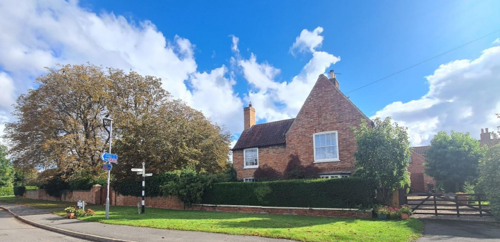
The area surrounding what is now known as The Hall, located on the west side of the village, holds significant historical importance. Originally, Orston Hall served as the Rectory, though it is unlikely that the Rector ever resided there. Instead, the house was typically leased to a tenant. The Rector employed a vicar, who lived opposite the Hall in what is now known as the Vicarage, and the vicar often employed a curate, who resided in a simpler dwelling elsewhere in the village.
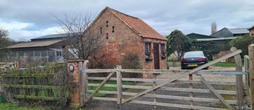
Between the Hall and the Vicarage, along High Street, stands a large barn that was used to store tithes — agricultural produce paid to the Rector.
To the west of the Hall, between it and the River Smite, lies a wooded area containing the original course of the river and two fishponds associated with the Hall.
Beyond the wood lies a field known as The Park. This area closely resembles medieval parks found across the country, which were typically reserved for the use of the King and his officers.
Adjacent to The Park, at the southern end of Chapel Street and opposite the former Methodist chapel, is a particularly intriguing earthwork feature; a levelled area surrounded by visible banks and pathways. This feature may have functioned as a water meadow—a piece of land flooded early in the year to produce an early hay crop. If so, the River Smite would likely have been dammed upstream, near Aslockton, to divert water down the Bon Moor Drain and into the meadow.
Prior to World War Two the village was primarily a farming community with the related trades of miller, wheelwright, blacksmith, saddler and joiner all present. A shop, school, post office, village hall and pub would have further contributed to the village’s self-sufficiency. Orston’s villagers farmed the land using an open field system until enclosure in 1793. Most of the villages in the Vale of Belvoir used a three-field system but Orston was the exception to the rule and used a four field system for its arable crops. The rich pastureland alongside the River Smite also provided good grazing and there is archaeological evidence to suggest that some of this land may have been used as water meadows, a practice which was rare in the East Midlands.
The Manor House no longer stands, having been demolished around 1840. The old maps show the site of the original manor house and its many outbuildings to be at the north end of High Street on the footpath to Thoroton. The Lord of the Manor did not live there; just visiting it when presiding over the manorial court. In 1952 a stock of 1,413 coins were discovered in the field, thought to be those of a local roundhead sympathizer.
Orston’s prosperity was not solely based on agriculture however and since medieval times part of the village’s workforce was employed in digging gypsum, evidence for which can be seen in the form of pits in the fields north of Loughbon and along Moor Lane. Indeed the quality of Orston’s gypsum was so renowned (it was called “the finest in the Kingdom” by the Victoria History of the Counties of England) that in the 1860s a quarry and works known as The Royal Plaster Works were established in the in the area to the south of Loughbon.
This was soon followed by a larger mine and factory next to the railway to the south which operated until their closure in 1914. The production of plaster resulted in the extraction of large quantities of clay which was used to produce bricks, tiles and pipes. A high gypsum content gave these bricks a light orange colour which still visibly contrasts with the darker red colour of older bricks dug from a pit opposite the Hall.
Following the closure of the plaster works corn milling soon became profitable and the windmill on Mill Lane was eventually superseded in 1920 by a larger mechanised mill on Station Road. This mill came to be the single largest employer in the village for most of the twentieth century.
The layout of properties in Orston today gives little indication of the village’s nineteenth century appearance which was characterised by terraces for agricultural and gypsum workers known as Rows. Most of these dwellings were one-up one-down affairs and today Little Gables on The Row (once split into 4 separate houses) is the only building which gives an impression of what they were like. Yeomen’s houses by contrast were more substantially built and a few pre-1800 houses still survive.
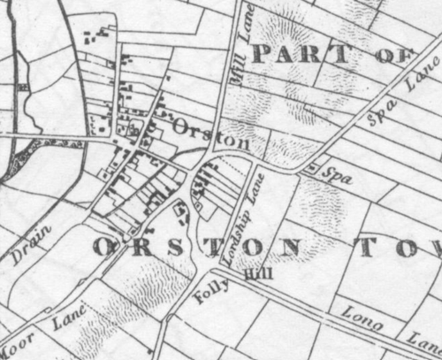
3.2 Historical Mapping
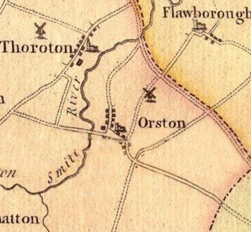
This map shows Orston’s road layout with High Street clearly the principal thoroughfare. The positions of Orston Hall, St Mary’s Church and the Windmill on Mill lane are all clearly shown but interestingly, the Manor House is not obvious.
This map was the first to show the post enclosure field system. Also note the buildings of the Manor House at the north end of High Street which is now a dead end.
4 Spatial Analysis
The relationship between open spaces and the built form within a conservation area can be central to its character. This section describes the village’s layout, highlighting the significant views, landmarks and historical focal points. The contribution of open green spaces, trees and other natural elements to the conservation area’s character is also described within this section.
4.1 Plan, Form and Layout
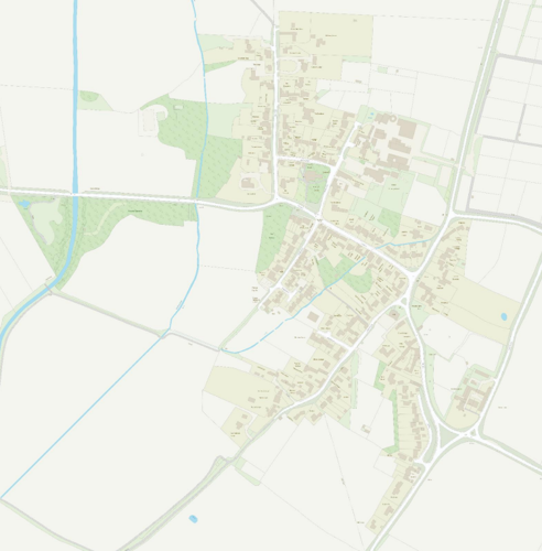
Orston’s layout is centred around a principal thoroughfare comprising Smite Lane, The Green, Loughbon and Hill Road, which runs roughly from northwest to southeast. Branching out from this main axis are five secondary roads: High Street, Church Street, Chapel Street, Lombard Street and Mill Lane, all of which are orientated (approximately) north - south. Notably, Mill Lane extends northward, connecting Orston to Flawborough.
Launder Street provides a key link between High Street and Church Street, skirting the northern edge of the churchyard. In the southeast of the village, Hill Road intersects with three other routes at a crossroads: Lordship Lane heading north, Bottesford Lane leading east, and Station Road extending southward.
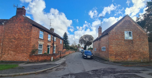
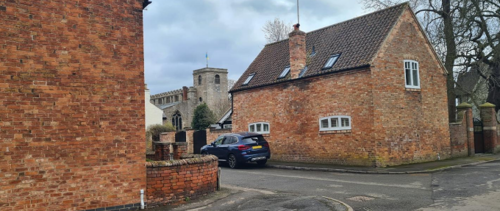
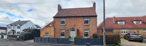
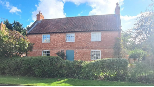
Residential properties in Orston are typically found with their principal elevations facing the highway, as on High Street and Chapel Street. However, in some places, such as on Loughbon, homes are also positioned gable-end to the road. Larger, more prominent properties like Orston Hall, The Woodlands, and Manor Farm are distinctively set back within private grounds, contributing to the village’s diverse architectural character.
pavement - Loughbon
A comparison of the current village layout with the 1900 map reveals significant eastward expansion. This development has extended Orston onto higher ground along Hill Road, Station Road, and Lordship Lane, reflecting both historical growth and adaptation to the local topography.
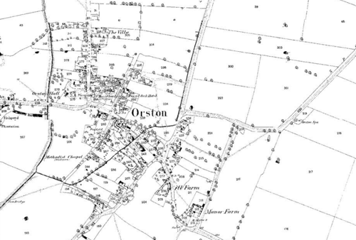
Below is a map that describes the current plan, form and layout of the village/town.
This map is reproduced from Ordnance Survey material with the permission of Ordnance Survey on behalf of the Controller of His Majesty’s Stationary Office © Crown Copyright. Unauthorised reproduction infringes Crown Copyright and may lead to prosecution or civil proceedings.
Rushcliffe Borough Council - 100019419
4.2 Landmarks, Focal Points and Views
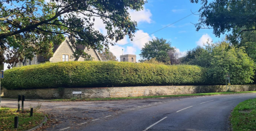
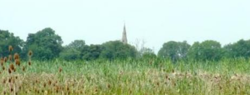
Orston is enriched by a number of noteworthy landmarks that significantly shape its visual character and serve as focal points within the village. Among these, the most prominent are St Mary’s Church and its churchyard, located at the cultural centre of the village. The church and churchyard sit above street level, enclosed by a stone retaining wall and framed by mature trees, creating a striking visual presence.
Arthur Mee (1938) in his entry for Orston in the book Nottinghamshire, explains,
“If we come from the Hilltop [the foot of an escarpment to a ridge along Elton Road,] we look down on
its red roofs nestling in the trees. The low road, shaded by trees brings up to two bridges, spanning
the River Smite and a brook. The prettiest corner is by the stone church.”
Street (behind the Church) facing Churchyard
Another prominent landmark is Manor Farm, situated at the southeast crossroads. Its prominence and position at the junction of Hill Road, Lordship Lane, Bottesford Lane, and Station Road make it a key feature of the village.
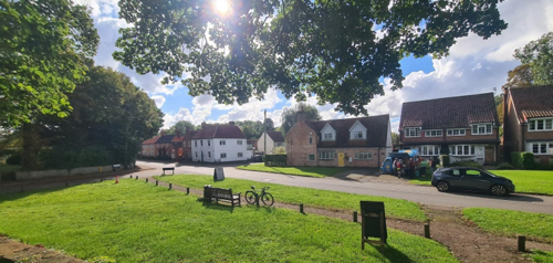
Additionally, the crossroads of Hill Road, Lombard Street, Mill Lane, and Loughbon, with its charming green and wide grass verges, acts as a third focal point, contributing to the village’s picturesque character.
The higher ground along Hill Road and Station Road, along with the open aspect on the western fringes of the village, provides excellent vantage points for outward views of the surrounding countryside, highlighting Orston’s connection to its rural setting.
approach to the village
4.3 Open Spaces, Trees and Landscape
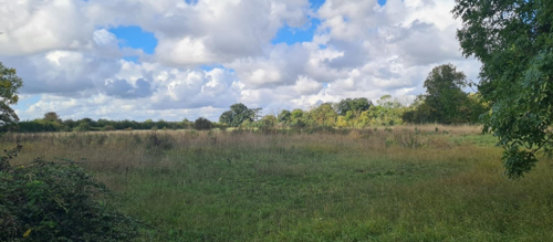
Orston’s network of roads is closely lined by properties, with the areas between streets often occupied by large gardens, small fields, and paddocks. The village outskirts are flanked by attractive open countryside, easily accessible via a well-maintained network of public footpaths. For example, the pastureland between Lombard Street and Station Road (see Figure 12 below).
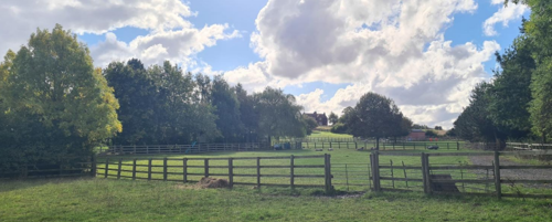
View from Lombard Street
Orston’s strong equestrian tradition has created a continuing demand for good grazing land, further reinforcing the village’s rural character. Individual mature trees and wooded areas also define certain parts of the village, adding to its scenic charm.
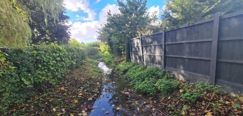
This sylvan backdrop is particularly pronounced in the northwest of the village, around Orston Hall and the churchyard, where trees and greenery dominate the landscape. A green corridor extends along the Hill Road approach from the south, enhancing the sense of arrival into the village. Another green corridor runs alongside the Bon Moor Drain (see Figure 14 below) visible from public pathways.
walkways
Wide grass verges and hedgerows further contribute to Orston’s rural character. They soften the built environment when used as boundary treatments within the village and enhance its scenic appeal along the approaches to the settlement. Within the historical core of the village, wide grass verges and mature trees in the background, enhance its special interest (see Figure 15).
grass verges and mature trees in the foreground and background
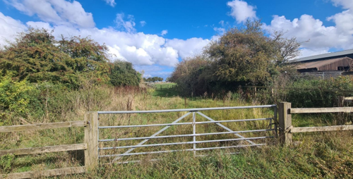
The open space at the southern tip of Chapel Street, opposite the site of the former Methodist chapel with the earthworks on it, is positive not only for its historical interest, but also for the views out it offers (see Figure 16).
Chapel Street
The most significant trees, hedges, open spaces, grass verges and gardens are marked on the Townscape Appraisal map.
4.3.1 Open Spaces, Trees and Landscape SWOT Analysis
Strengths - what are the positives of the open spaces, trees, and landscape
- The green areas within the Conservation Area are of particularly high quality. Notable examples are: stands of chestnut trees, “ridge & furrow” fields and ancient hedgerows.
- Attractive rural setting. On the western edge is the Millennium Green and the River Smite – the biggest watercourse in the Vale of Belvoir. To the East is the ridge that extends from Newark to Granby. This ridge is 17 meters higher than the Green, opposite the church: enough to provide splendid views over the village and the Trent Valley, an excellent sledging run.
- There are several wildlife havens for example the church yard and the banks of the Smite. There are many wildlife corridors, for example the dyke through the centre of the village.
- Green areas within public parts of village, for example gardens and paddocks, woodland, millennium green.
- Three ‘village green’ areas - on Loughbon in front of church, outside village hall at north end of Lombard street, at top of Hill Road at junction with Station Road.
- Woods and trees are very evident in the village. Churchyard, Fishpond Plantation and The Rookery, around Orston Hall (including area to north of Old Vicarage) and around The Chestnuts at junction of Loughbon and Mill Lane/Hill Road.
- Mature trees along roads into village and surrounding hedgerows (some ancient hedgerows), along with trees in private gardens.
- Ridge and furrow, along with other archaeological remains e.g. earthworks of previous activities and industries (gypsum mining, brick making).
Weaknesses - what are the negatives of the open spaces, trees, and landscape
There are various problems regarding trees:
- Many Chestnut trees are affected by disease;
- Overhanging Ash trees at the end of Chapel street are damaged by Ivy growth;
- There are diseased and decaying trees either side of Smite lane;
- There is Ash die-back disease affecting many trees in the conservation area;
- There is a large, decayed Sycamore in the churchyard at the corner of Church Street and The Green.
Bon Moor drain is usually dry and overgrown with vegetation, which blocks it. During heavy rainfall, it can quickly overflow, increasing the flood risk to Orston.
Opportunities – what could make the open spaces, trees, and landscape better?
- Restore the footpath along Station Road to the railway station.
- Create a new footpath between the Manor Farm development and the bottom of Hill Road.
- Ensure the preservation of views, especially on approaches to the village, by the careful management of hedgerows and trees.
- Opportunity for residents to help riparian owners to keep the drain clear.
Threats - what would make open spaces, trees and landscapes worse?
- The intensive industrialisation of the surrounding fields, pasture and countryside for the use of solar farming.
Works to Trees
You must contact the Local Planning Authority (LPA), Rushcliffe Borough Council before any works (cutting OR pruning) are carried out to trees within the Orston Conservation Area.
Six weeks’ notice is required before any works to trees within the Conservation Area is carried out, even if they are not protected by a Tree Preservation Order (TPO).
If there is a tree which undergoes annual maintenance, include this information with the notice. It may be possible, upon agreement with the tree officer, that only one notice is required to cover the future annual maintenance.
Standard notification forms (a section 211 notice), further information and contact details.
A flow chart of the decision-making process regarding works to trees.
4.4 Public Realm
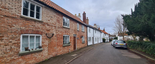
Public roads in Orston are mostly paved with asphalt and flanked by wide grass verges (see Figure 17) but some stretches of highway such as Loughbon are relatively narrow and have pavements, creating a more urban feel. Some of the village’s smaller tracks and private drives are of gravel, giving them a more informal appearance (see Figure 18).
There is a considerable amount of variety in boundary treatments within the village owing to the diverse size, orientation, and age of Orston’s buildings.
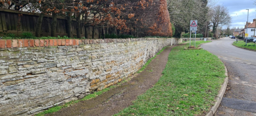
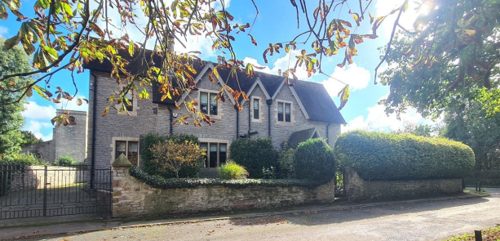
Generally, it is large buildings in their own grounds such as Orston Hall and St Mary’s church have either grey lias stone or brick boundary walls (see Figure 20).
High Street
Old Vicarage
Detached residential properties with front gardens generally define their boundaries using hedgerows (see Figure 21), timber fencing, metal railings (see Figure 24), or low brick walls (see Figure 25), often incorporating timber five bar gates for access to driveways (see Figure 21).
House, High Street
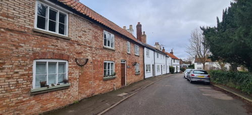
Some individual buildings and terraces of smaller cottages such as those along Launder Street and Chapel Street define their property boundaries by presenting their principal or side elevations directly onto the highway (for example, see Figure 23).
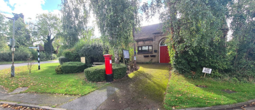
Street furniture tends to be around The Green, with a timber bench for seating and a K6 Telephone box, which has been used to hang planters from it (see Figure 27). Outside the Village Hall, at the junction of Lombard Street and Hill Road, there is a cast iron finger post topped with a county roundel, a bench and a post box (see Figure 26 and Figure 28).
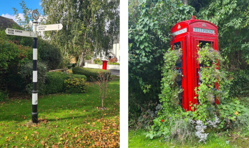
Junction of Lombard Street and Hill Road
5 Buildings of the Conservation Area and Key Characteristics
5.1 Building Types and Activity
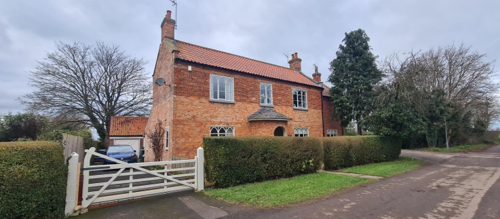
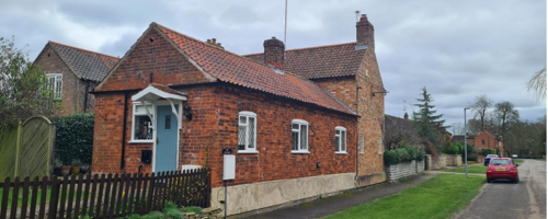
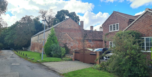
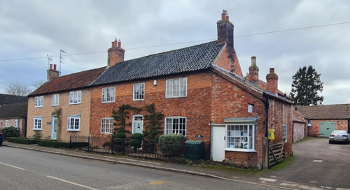
Orston’s steady growth over time is reflected in its building stock which exhibits a wide variety of architectural styles, layouts and proportions. The traditional buildings in Orston are to be found spread throughout the village’s streets and consist of a mixture of country houses, farmhouses, cottages, barns and outbuildings, many of which can be seen on the historical maps (as shown in Figure 3). With the exception of the thirteenth century Church of St Mary’s, the oldest of these date to the seventeenth century but the great majority were built during the eighteenth and nineteenth centuries. Twentieth and twenty-first century detached, and semi-detached dwellings have subsequently occupied the spaces in-between often leading to a varied street scene.
Other building types include the Durham Ox Public House, and the former Methodist Chapel on Chapel Street (now converted).
Within Orston, the evolution of many buildings is evident in the brickwork, bond patterns, and structural alterations. Numerous former agricultural buildings have undergone modifications, including lateral extensions (see Figure 29), and roof-raising (see Carlin House, High Street (Figure 21), Mulhouse (see Figure 39), Loughbon (Figure 24) and (Figure 30), to accommodate the changing uses over time.
Similarly, smaller adjacent cottages have been converted into single dwellings, and the infilling of former openings with replaced brickwork that contrasts subtly with the original materials.
The terraced cottages on Launder Street and on The Row off Lombard Street were built at the end of the 18th century and have not been rebuilt or extended. They show the character of typical housing for agricultural workers at that time.
Little Gables on The Row built in 1800 for agricultural workers on common land, was originally part of a row of about 16 one-up and one-down houses. In 1880 there were 45 people living there.
5.1.1 Building types and Activity SWOT Analysis
Strengths - what activities/places can you go that make the village/town great?
- Rich history. Orston has evolved from being a significant Parish with a powerful “Lord” into a centre of gypsum mining in the late 19th Century. In the 20th century agriculture regained its dominance. Now, the current main sources of employment are those related to equestrianism, a small industrial estate and a gun club. A growing sector is home working, typically Internet based.
Around 50 households in Orston contain one or more home-workers. Historical evolution is reflected in the built fabric. - The village retains a thriving school, pub, church, and village hall – contributing to a sustainable village.
- Little essential through traffic passes along the main Street (Loughbon). About half the properties in the village are situated on cul-de-sacs. There is easy access to the A52 trunk road.
- Immediately surrounding farmland under cultivation or grazing. Strong equestrian influence helps to maintain mix of pasture and arable.
Weaknesses - what activities/places exist that detract from making the village/town great?
- Despite the fact that all of the Conservation Area is within a 30mph area, speeding is a major problem on all through roads in the village.
- HGVs cause particular concern both along Station Road and through the village.
- There is an absence of recreational areas apart from those on the periphery. The Sports field, in particular, is over a mile from the village.
- There is a significant increase in traffic and parking in the area around the school at drop-off and pickup times. While short-lived (and during term time only), it results in a considerable amount of congestion parking issues. Some efforts by locals to protect the verges against parking has the potential to affect the character of the area (see weaknesses in section 5.2.9).
- School grounds including play area no longer open to the public, resulting in lack of safe play facilities for children.
- Millennium green is available for family recreational activities but is outside the built-up part of the village and there is no play equipment there.
Opportunities - what activities/places could exist that would village/town even better?
- Ensure adequate mix of housing sizes.
- Consider the introduction of a 20mph speed limit within the village
- Consider introduction of 3.5 tonne weight restrictions within the village and 7.5 tonne limit on Station Road.
- Ensure all future Planning Permissions make effective provision for off street parking.
Threats - what activities/places would make village/town worse?
- None identified.
5.2 Key Characteristics and Building Materials
Traditional building materials in the village were largely sourced locally. For instance, bricks were typically produced near where they were used, with many villages having their own brick pits and yards. This practice resulted in distinctive village-specific brick sizes, colours, and styles. The village prominently features local brick and stone, which are evident throughout the area.
Roofs were traditionally made from local materials such as thatch, until clay pantiles gained popularity.
Today, traditional building materials still evident across the conservation area include:
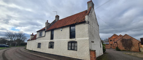
Walls: Predominantly constructed from orange or red brick laid in various bonds. There are also notable examples of buildings with sections reportedly made from blue lias stone and a single cob (Ramswin House).
Roofs: Characterised by steep pitches, most are covered with orange or red clay pantiles or Bottesford blue clay pantiles. Less common but present are roofs with plain tiles or slate. Gable ends are usually plain close verge, where the tiles run to the edge of the brick gables, though parapet gables are also found. Brick chimney stacks are almost always built into gable walls.
Windows: Primarily timber casements and sashes with glazing bars, in a variety of styles, sizes, and configurations. Examples of stone mullioned casements can be seen at The Old Vicarage, stained glass at the Wesleyan Chapel, and gothic tracery at St. Mary’s Church are typically arched brick.
This combination of materials and features contributes to the unique architectural character of the area.
5.2.1 Key Characteristics: Orston Hall and Surrounding Countryside - Zone 1
Orston Hall Materials:
Walls: Brick and coursed rubble, with ashlar quoins.
Roofs: Hipped and gabled slate and plain tile roofs.
Windows: Mainly glazing bar sashes. Windows at the front of the property have eared and shouldered moulded architraves.
Doors: The front door is off-centre with a round headed moulded doorcase with flanked by pilasters and full height sashes.
Key Characteristics / Architectural Features:
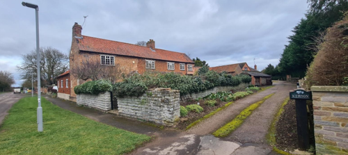
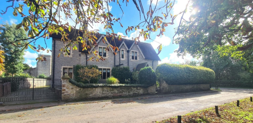
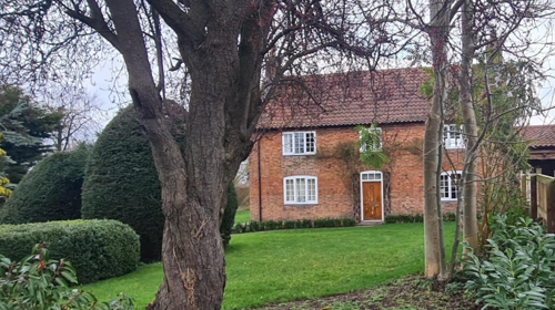
This zone is defined by its historic charm and strong connection to the surrounding countryside. The late 17th-century country house, Orston Hall, which was re-fronted and altered during the 18th and 19th centuries, reflecting the evolving architectural styles of those periods is at the heart of this character zone.
A distinctive stone boundary wall with its ornate gate piers (Grade 2 listed) contributes to a sense of formality. The mature trees within the boundary add to a sense of grandeur. Complementing this is the Old Vicarage opposite, which adds to its historic charm.
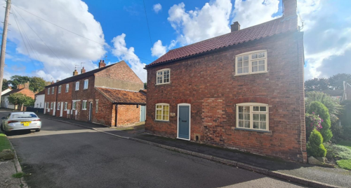
5.2.2 Key Characteristics: High Street - Zone 2
Materials: (in addition to general materials at the beginning of the section):
Walls: Typically brick with a few examples of Flemish bond brickwork. Within this character zone there are a number of properties which have had their roofs raised, and this is evident in the subtle differences in brick colour and bonds.
Roofs: Pantile roof and tend not to have a steep pitch.
Windows: Traditional windows have the timber frames with glazing bars. There are a few arch top lintels.
Key Characteristics / Architectural Features:
This area within Orston features a blend of traditional cottages and modern detached properties, while maintaining the village's historical roots. Many of the newer buildings have front gardens, adding a sense of openness and greenery to the streetscape. The principal elevations of most buildings are oriented toward the highway, creating a cohesive and orderly appearance.
Wide grass verges along the roads contribute to the rural atmosphere, providing a soft, natural edge to the streets. These are further enhanced by occasional mature trees and hedgerow front boundaries, which add texture and visual interest while reinforcing the area's distinctive rural charm.
5.2.3 Key Characteristics: Church Street, Launder Street and The Green - Zone 3
Materials:
Walls: Brick with a number of properties rendered in neutral light tones or painted white.
Roofs: Pantile roofs are common, especially closer to Church Street.
Windows: A number of timber framed windows remain.
Key Characteristics / Architectural Features:
This character area is the historic village centre of Orston. Cottages are arranged facing the Churchyard of St. Mary’s. Notable buildings in this area include the Rectory, The Durham Ox Public House, and The Woodlands, each contributing to the architectural and cultural richness of the setting.
The Churchyard itself is surrounded by mature trees and greenery that enhance the tranquil atmosphere. This verdant setting not only frames the church but also defines the identity of the village centre.
Modern infill developments within this area have been designed with sensitivity to the existing environment, carefully preserving the rural character that makes this part of the village distinctive.
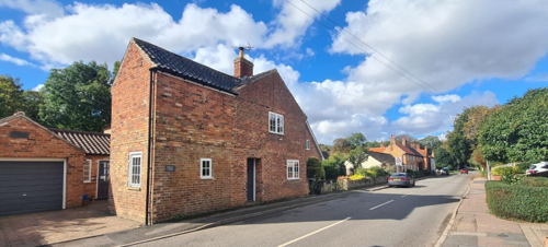
5.2.4 Key Characteristics: Loughbon - Zone 4
Materials:
Walls: Predominantly brick. There are a number of examples of Flemish bond within this character area. There is also a number of properties with brick detailing at the eaves.
Roofs: While there are a number of pantile roofs, concrete tiles and plain tiles are evident.
Windows: A number of examples of timber framed windows, including sash and sliding sash windows exist.
Key Characteristics / Architectural Features:
This part of Orston is characterised by a distinctive streetscape defined by the orientation and arrangement of its buildings and natural features. Traditional cottages on the south side of the street are mostly oriented with their gable ends facing the highway. These cottages typically sit directly on the pavement, creating a sense of enclosure and intimacy along the street.
In contrast, the homes on the north side of the street are of 20th-century construction. While more modern in design, these properties contribute to the overall character of the area through the presence of trees, boundary hedges, and walls, which soften the streetscape and mirror the natural elements found throughout the village. Together, these features create balance between built and natural forms.
5.2.5 Key Characteristics: Chapel Street - Zone 5
Materials (in addition to general materials at the beginning of the section):
Walls: Predominantly brick with a large number painted white. Some of the late 20th century properties have a rendered finish to the walls of the first floor. This tends to make them stand out as modern, detracting from the historic character of the area.
Roofs: From Loughbon, looking down chapel street, many of the roofs appear to be clay pantile. Along Chapel Street from Loughbon, most of the clay pantiles are present on the left-hand side, however, more noticeable are the concrete tiles on the right-hand side as the properties are set back.
Windows: Many of the traditional windows have been replaced, eroding the historic character of the street.
Key Characteristics / Architectural Features:
This area of Orston reflects the village's evolving architectural and social history, with a mix of 19th and 20th-century developments. The 19th-century terraced workers' cottages are a notable feature, offering a glimpse into the village's industrial past. These cottages, typically modest in design, contribute to the historical character and charm of the area.
The 20th-century council houses, which are often set back from the road with grassed front gardens. The associated greenery, including communal spaces, gardens, and planted areas, adds a sense of openness and community to the neighbourhood.
A key landmark within this zone is the Wesleyan Chapel, built in 1848, which has now been converted into a home.
5.2.6 Key Characteristics: Mill Lane and Village Green Crossroads - Zone 6
Materials: As outlined in the general materials at the beginning of the section.
Key Characteristics / Architectural Features:
This area of Orston is defined by its spacious and distinctly rural village character, created by wide grass verges, a central village green, and low building density. The open layout gives the neighbourhood a sense of tranquillity and connection to the countryside.
The properties in this area are a mix of 20th-century developments and older houses and cottages, reflecting the village's gradual growth over time. Many homes sit within substantial garden plots, enhancing the feeling of space.
Small clusters of mature trees and boundary hedges contribute significantly to the visual appeal, softening the built environment and reinforcing the rural aesthetic.
5.2.7 Key Characteristics: Lombard Street and Surrounding Countryside - Zone 7
Materials: As outlined in the general materials at the beginning of the section.
Key Characteristics / Architectural Features:
This character area of has mix of informally arranged cottages and farmhouses, nestled within a pastoral setting of paddocks and pastureland. The surrounding fields and open spaces enhance the sense of connection to the countryside.
Rural features are abundant, including traditional hedgerows and post-and-rail fencing that clearly delineate field boundaries. Grass verges along the highway, coupled with occasional clusters of trees, further contribute to the natural character of the area. These elements work together to maintain the rural ambiance.
Modern infill development and sensitively converted barns have been integrated into the area without detracting from its historical and agricultural roots. Additionally, Moor Lane, a notable track in this part of the village, leads southward to the site of the former gypsum works, adding an industrial heritage element to the area’s history.
5.2.8 Key Characteristics: Hill Road and Station Road - Zone 8
Materials (in addition to general materials at the beginning of the section): As outlined in the general materials at the beginning
of the section.
Key Characteristics / Architectural Features:
The higher ground in the eastern part of Orston is defined by its elevated rural charm, characterised by wide grass verges, hedgerows, and belts of mature trees that contribute to its scenic beauty. This area offers a sense of openness and greenery, typical of the village’s rural landscape.
A notable building within this character areas is Manor Farm, a prominent property set back from the road within its own grounds. Enclosed by a stone boundary wall, Manor Farm serves as a focal point at the crossroads, commanding attention and enhancing the area's character.
Other notable traditional buildings include the Hill Farm complex and The Old Mill, both of which reflect the agricultural heritage of the village. In contrast, Hill Top, a cul-de-sac in this area, features a collection of modest 20th-century detached houses, offers a more modern residential element.
The views from Hill Top are particularly significant.
5.2.9 Key Characteristics SWOT Analysis
Strengths – what is good about most existing buildings /streetscape that contributes to the character of the Conservation Area?:
- Orston retains its rural character and there is evidence of developing history of the village.
- Many surviving older buildings in good state of
preservation. - There has been little infill that has destroyed the character of streetscapes.
- Good network of footpaths within the Conservation Area that link with footpaths to most neighbouring villages.
- Orston features in several walking guides, the most popular route being from Whatton down Lombard Street and on to Aslockton via the Millennium Green.
- Topography (elevated land to the east and Northeast dropping down to lower level around course of R Smite) provides good views over the village and beyond. Views include surrounding villages especially church steeples (e.g. Thoroton, Bottesford, Whatton) which help to give wider context to Orston within landscape of primarily nuclear settlement.
- Several good views within the village.
Weaknesses – what is not so good about most existing buildings / the streetscape that detracts from the character of the Conservation Area?
- Size of new buildings are out of scale others in the area, and there is over-development to some of the older buildings. This not only affects the character of the area but also hints at ‘gentrification’.
- Most roads within the Conservation Area are in a very poor state of repair. E.g. south end of High Street, Smite Lane and Lombard Street.
- In the recent past, parts of the conservation area, notably in areas along Loughbon and around The Green, have been affected by the introduction of new temporary and fixed unofficial signage, and of other street furniture, the design of which has not always served to complement or enhance the surrounding street scape, and has collectively tended to create a somewhat ‘cluttered’
appearance. While some of these additions (e.g. the war memorial on Loughbon) are relatively recent, others (e.g. the unofficial local signposting and the contents of the information lecterns on The Green outside the church) have been in place for some years and are no longer in good condition. - Where grass verges are tended by local residents, attempts have been made in some instances to protect them from parking damage by the strategic placement of large stones or posts which remain in situ at all times. An over-proliferation of these
obstacles can be detrimental to the character of the conservation area.
Opportunities – what could make existing buildings (or new builds) look good and contribute to the character of the area?
- As existing unofficial items of signage and street furniture become damaged, decayed, or fall into disrepair, the opportunity should be taken to objectively consider whether their removal would be more appropriate than their replacement. It should be ensured that any new additions or replacements make a positive contribution to the streetscape and are of high quality, both in design
and in choice of materials.
Threats – what could make existing buildings (or new builds) look worse and detract from the character of the area?
- None identified.
5.3 Listed buildings
Buildings on the Government’s List of Buildings of Special Architectural or Historic Interest are called “Listed” buildings and are protected by law. Consent is required from Rushcliffe Borough Council before any works of alteration, extension, or demolition can be carried out on any listed building.
Further information can be found in Rushcliffe Borough Council’s publication Listed Buildings in Rushcliffe.
There is also the complete and up-to-date list of the Secretary of State’s Statutory List of Buildings of Special Architectural Interest or Historic Interest.
Names of the Listed Buildings and structures in Orston Conservation Area (correct as of January 2025) are detailed in Appendix 1. All Listed Buildings are shown on the Townscape Appraisal plan, but some smaller structures such as gravestones may not be shown.
late 17th and late 19th century
Railing, Shop, Cottage and Stable – 1785 and early 19th and mid 19th century
5.4 Key Unlisted Buildings
Contribution to the established character of the place can also come from buildings which are not recognised via listing or are not old. A plan with all of the positive contributions to the area can be found in Appendix 2 - Conservation Area Boundary and Townscape Appraisal Map.
There are other non-listed houses of historical interest: Manor Farm (mentioned elsewhere) which was built by the Lord of the Manor when the Manor House (mentioned elsewhere) was demolished.
6 Generic Management Plan for Conservation Areas in Rushcliffe
6.1 Introduction
In carrying out its planning functions, the Borough Council is required in law to give special attention to the desirability of preserving or enhancing the character or appearance of Conservation Areas. The Management Plan for a Conservation Area is a tool to ensure the special character of the area is preserved and enhanced. The management plans aim to:
- Outline a strategic management proposal for the preservation and enhancement of the Orston Conservation Area.
- Act as a guide for professionals and residents alike regarding:
- features of value, worthy of preservation;
- characteristics worthy of preservation;
- opportunities for enhancement;
- development proposals which preserve and enhance the special character of the area.
- Inspire community commitment to conservation principles and reporting.
6.2 National and Local Policies and Guidance
There is a duty to formulate and publish management plans setting out policies and proposals for the preservation and enhancement of Conservation Areas. Many of these policies and proposals are common to all Conservation Areas, and these are set out in this document. The Central Government Guidance and Local policies applicable to Conservation Areas include:
- Rushcliffe Local Plan Part 1: Core Strategy, with a specific focus on:
- Design and Enhancing Local Identity [in part]
- Historic Environment
- Rushcliffe Local Plan Part 2: Development Policies, with a specific focus on:
- Conserving and Enhancing Heritage Assets
- Development Affecting Archaeological Sites
- The National Planning Policy Framework (NPPF), particularly, but not exclusively the chapter on Conserving and Enhancing the Historic Environment.
- The National Planning Practice Guidance (NPPG) (updated 2021 and subject to continual review)
- By Design: Urban Design in the Planning System – Towards Better Practice (2000)
- The Planning (Listed Buildings and Conservation Areas) Act 1990
- Historic England “Historic England Advice Note 1: Conservation Area Designation, Appraisal and Management”
The council will utilise the full range of strategic policy and guidance documents to ensure that development in Orston Conservation Area is of a standard that enhances the amenity of the local area. The council will always look to use the most up-to-date versions of the document.
Supplementary documents may be issued for individual Conservation Areas where specific policies or proposals are needed.
6.3 Article 4 Directions
There are extra consents required in Conservations Areas. For example, in addition to the general control of development, you will
need to get permission for
- Any additions or alterations to the roof (for example, dormer windows)
- The installation of satellite dishes on chimneys, roofs or walls fronting a highway
- Any extension which extends beyond the side of the original dwelling house
- Any extension of more than one storey that extends beyond the rear wall of the original dwelling house
- Cladding the exterior of the dwelling
- Any demolishing of a building or part of a building that has a volume over 115 cubic metres
Article 4 of the Town and Country Planning (General Permitted Development) Order 1995, allows planning authorities to restrict
some permitted development rights within particular areas. This does not necessarily prevent development or change taking place
but enables the Local Authority to manage the design and detailing of the works, and potentially grant permission subject to appropriate conditions. The use of Article 4 Directions will be proposed where it is considered appropriate following the completion of each Area Appraisal across the Borough.
Details of Article 4 Directions for Orston Conservation Area
There are currently no Article 4 Directions for Orston Conservation Area.
6.4 Building Design
Mimicking the local vernacular is not the only way to ‘fit in’ with the character of a conservation area. National policy makes clear that contemporary designed, provided it is sympathetically designed, cannot be dismissed as an option. Therefore, good contemporary design will be encouraged where it respects the context’s character, scale and massing. This must be demonstrated in the Design and Access Statement submitted with any planning application.
Extensions to buildings in Conservation Areas should respect:
- The key characteristics of the original building, including scale, mass, materials and proportions
- The contextual setting and character of the Conservation Area
Copying like for like can devalue and destroy the ability to “read” historic change, and dilutes our historic heritage. Pastiche designs, incorporating poor imitations of other styles, will be resisted, particularly where they incorporate details which are not locally appropriate. Careful high-quality replication may be required in a few very sensitive locations.
In particularly sensitive locations, such as uniform terraces, exact replication may be necessary to maintain compositional unity. In that case, attention to details, choice of materials and high-quality workmanship are the keynotes. However, in some cases, a direct relationship is not impossible. For example, Flemish Bond brickwork cannot be replicated in cavity walls, and narrow lime mortar joints cannot be replicated in modern metric brickwork.
Where a new building is appropriate, on infill sites or where an existing building detracts from the character of the area, the opportunity should be taken to re-establish the streetscape, reinforce enclosure, open up distant vistas or views of landmarks or hide unsightly views.
“New and old buildings can coexist happily without disguising one as the other, if the design of the new is a response to urban design objectives” (DETR – “By Design”, p19).
As with extensions, good contemporary design which respects local character, and the context of the site will be encouraged.
All new buildings should respond appropriately to the existing frontage and normally follow the established building line. Development or redevelopment will normally be resisted if:
“it blocks important views identified in the individual appraisals, uses important open spaces identified in the appraisals, adversely affects the setting of any Listed or key buildings, fails to maintain or re-establish the streetscape where appropriate dominates its Conservation Area background fails to recognise the context of
the site destroys important features identified in the individual appraisals such as boundary walls, fences,
hedgerows or trees”
Where the quantity of contemporary schemes in a small area becomes significant and outnumbers older buildings within the area, further contemporary schemes could fundamentally shift the architectural character of the area and thus be harmful, even if well designed as an individual project.
New development that stands out from the background of buildings may be appropriate in exceptional circumstances if it contributes positively as a landmark to enhance the street scene, to highlight a corner or to signal a visual change of direction such as along a curving vista.
Any external lighting should be carefully designed and sited to minimise light pollution. Energy producing or saving devices are generally welcomed by the Council, but careful consideration is required when these are to be located in a Conservation Area and some may require planning permission. In particular, they should be positioned to minimise their impact on the building and on the local amenity.
6.5 Publicity and Knowledge Transfer
Ambiguity about additional controls within a Conservation Area raises the likelihood of inappropriate developments occurring which
may damage the integrity of the conservation area designations.
Efforts have been made to engage local community groups in the development and review of the character appraisals. Empowering
communities to define the special architectural and historic interest of the Conservation Area aims to raise awareness.
Whether the appraisal took a community-led or a council-led approach, upon reviewing all Conservation Areas, the public were invited to ask questions and comment during a public consultation. A consultation event also aimed to diminish any ambiguity about
restrictions within a Conservation Area and increase the likelihood of sensitive and appropriate developments, maintaining the character
of the area.
The council recognise the potential issues of turnover in residency and ownership of properties in the conservation area. Therefore,
Rushcliffe Borough Council will periodically use their media outlets to highlight conservation area designations and the significant,
related planning controls.
The approach taken within Orston Conservation Area was Community Led.
The consultation period took place between the following dates 26/02/2025 and 23/03/2025
The date of the Consultation Event - 03/03/2025
If there are any queries about conservation areas, please email conservationareas@rushcliffe.gov.uk
6.6 Public Realm
General maintenance and upkeep to the public realm may include fixing damage to roads and pavements, and fixing issues with street lighting. Issues such as these can impact the quality of the Conservation Area.
The council aims to encourage works to the public realm that are in keeping with, or actively enhance the conservation area. Rushcliffe Borough Council can only advise on work within the public realm that does not require planning permission (for example work completed by statutory undertakers, such as the Highways Authority). In these instances, Rushcliffe borough council cannot prevent such work.
Nottinghamshire County Council are responsible for repairs to roads, pavements and street lighting. Report issues of repairs to roads, pavements and street lighting to Nottinghamshire County Council online.
Rushcliffe Borough Council will continue to undertake their duties in maintaining the public realm. Vandalism, fly tipping and street cleaning are all the responsibility of Rushcliffe Borough Council. Report issues to Rushcliffe Borough Council online.
You must contact the Local Planning Authority (LPA), Rushcliffe Borough Council, before any works (cutting OR pruning) are carried out to trees within the Orston Conservation Area
Six weeks’ notice is required before any works to trees within the Conservation Area is carried out, even if they are not protected by Tree Preservation Order (TPO).
Standard notification forms (a section 211 notice) - further information and contact details.
A flow chart of the decision-making process regarding works to trees.
6.7 Boundary Treatments
Where there is a proposal for a new boundary treatment to be installed, the council would encourage the use of boundary treatments within the area.
Within conservation areas, planning permission is required to alter, maintain, improve, take down or build any new gate, fence, wall or other enclosure with:
- A height of one metre or more if next to a highway (including a public footpath or bridleway), waterway or open space; or
- A height of two metres or more elsewhere.
Where planning permission is required to remove a wall, Rushcliffe Borough Council will aim to protect those boundary walls and fences that have been identified as positively contributing to the area.
Hedgerows are significant habitats for wildlife in lowland Britain. Regulations are intended to protect important hedges in the countryside. The policy applies to hedges that are more than 20m long, (or less if connected to another hedge) on or adjacent to:
- Land used for agriculture or forestry, including the keeping of horses or donkeys
- Registered common land and village greens
- Local Nature Reserves and Sites of Special Scientific Interest.
The policy does not apply if the hedge is within or on the boundary of the curtilage of a house.
6.8 Buildings at risk
A few of the important buildings across the various Conservation Areas are currently vacant or not in regular use, which may lead to some being “at risk” of neglect or decay.
The Council will encourage and advise on renovation and repair work that is sensitive to the original or traditional historic character of the building and retains original features. The council will monitor the opportunity and potential for grant aid schemes to encourage the basic maintenance work necessary to ensure that key buildings within the conservation area are structurally sound and weather tight. However, given the current financial climate and outlook, such schemes are unlikely in the short to medium term.
There is a presumption against the demolition of buildings which contribute to the character of the area unless there are exceptional circumstances. It would benefit both the physical form and the function of the Conservation Area if these buildings were repaired, maintained and brought back into use.
Where the poor condition of a building or structure is as a result of neglect and lack of maintenance by its owner there is no requirement for the Borough Council to take its deteriorated condition into account when deciding whether demolition is appropriate. This is to avoid rewarding the deliberate neglect of buildings by representing such action as a way to obtain planning permission for demolition and redevelopment.
6.9 Enforcement
Rushcliffe Borough Council will, from time to time, assess and monitor changes in the appearance and condition of Orston Conservation Area. This will ensure that where necessary enforcement action can be taken promptly to deal with problems as they arise.
Where co-operation cannot be gained by any other means, Rushcliffe Borough Council has the ability to use additional enforcement powers to tackle particular issues within conservation areas. The Council may take formal action if the condition of any building (listed or unlisted) which makes a positive contribution to the character of the Conservation Area is considered to be at risk.
The council will work in accordance with their enforcement policy, which aims to provide an efficient enforcement service in support of the Council’s statutory planning service. Rushcliffe Borough Council’s enforcement actions will remain transparent, consistent, and proportionate, as it is recognised that effective controls over unauthorised development assists in conserving the natural and built environment whilst helping to protect the quality of people’s lives and maintaining the Council’s integrity.
7 Appendix 1 – Listed Buildings (as of January 2023)
Grade: 2
Listing entry number: 1243806
National grid reference: SK 76861 41152
Location: Gatepiers at Orston Hall, High Street
Grade: 2
Listing entry number: 1244339
National grid reference: SK 76812 41169
Location: Orston Hall, Smite Lane
Grade: 1
Listing entry number: 1272710
National grid reference: SK 76812 41169
Location: Church of St Mary, Church Street
Grade: 2
Listing entry number: 1272421
National grid reference: SK 76970 41079
Location: The Woodlands, Church Street
The Ferns with Adjoining Railing, Shop, Cottage and Stable
Grade: 2
Listing entry number: 1243806
National grid reference: SK 76861 41152
Location: The Ferns with Adjoining Railing, Shop, Cottage and Stable, Loughbon
Grade: 2
Listing entry number: 1272712
National grid reference: SK 77197 41045
Location: Laburnum Cottage, Mill Lane
Grade: 2
Listing entry number: 1244316
National grid reference: SK 77147 40978
Location: The Chestnuts, Hill Road
Grade: 2
Listing entry number: 1243807
National grid reference: SK 77123 40865
Location: The Gables, Hill Road, Smite Lane
Grade: 2
Listing entry number: 1272711
National grid reference: SK 76979 40780
Location: Hamilton's Farmhouse, Lombard Street
*The titles of these listings may not make it clear that all listed buildings always include all attached structures and extensions, regardless of age, and all detached outbuildings built before 1 June 1948 which are, or were at the time of listing, ancillary to the function of the primary listed building and were in the same ownership at the time of listing.
For example, when a house is listed, the listing will apply to extensions, porches, detached historic stables, barns, wash houses, privies etc. Such outbuildings and extensions are only exempt from the provisions of listing where the listing specifically excludes them.
8 Appendix 2 – Conservation Area Boundary and Townscape Appraisal Map

The Orston Townscape Map above shows:
- Conservation area boundary - red line
- Locations of listed buildings (red)
- Locations of key unlisted buildings (purple)
- Open space
- Locations of trees, hedges, and significant hedges and fences
- Viewpoints
Conservation Areas
- Bingham Conservation Area
- East Bridgford Conservation Area
- East Leake Conservation Area
- Hawksworth Conservation Area
- Hickling Conservation Area
- Ruddington Conservation Area
- Thoroton Conservation Area
- Wiverton Conservation Area
- Langar Conservation Area
- West Leake Conservation Area
- Whatton in the Vale Conservation Area
- Costock Conservation Area
- Sutton Bonington Conservation Area
- Upper Saxondale Conservation Area
- Wysall Conservation Area
- Bradmore Conservation Area
- Car Colston Conservation Area
- Scarrington Conservation Area
- Orston Conservation Area
- Flintham Conservation Area
- Edwalton Conservation Area
- Aslockton Conservation Area
- Bunny Conservation Area
- Granby Conservation Area
- Keyworth Conservation Area
- Thrumpton Conservation Area
- Normanton on the Wolds Conservation Area
- Upper Broughton Conservation Area
- Kneeton Conservation Area
- Colston Bassett Conservation Area
- Cropwell Bishop Conservation Area