Keyworth Conservation Area
Keyworth Conservation Area Appraisal and Management Plan May 2025
Contents
1.1 Conservation Areas
1.2 The Purpose of a Conservation Area Character Appraisal
1.3 The Planning Policy Context
2 Keyworth Location and Landscape Setting
2.1 The Keyworth Conservation Area
3.1 Location and Historic Activities
3.2 Historical Mapping
4.1 Plan, Form and Layout
4.2 Focal Points and Views
4.3 Open Spaces, Trees and Landscape
4.3.1 Open Spaces, Trees and Landscape SWOT Analysis
4.4 Public Realm
5 Buildings of the Conservation Area and Key Characteristics
5.1 Building Types and Activity
5.1.1 Building Types SWOT Analysis
5.2 Key Characteristics and Building Materials
5.2.1 Key Characteristics - The Square, Selby Lane and Nottingham Road (Zone 1)
5.2.2 Key Characteristics - Blind Lane (Zone 2)
5.2.3 Key Characteristics - Main Street (Zone 3)
5.2.4 Key Characteristics - Lings Lane (Zone 4)
5.2.5 Key Characteristics - SWOT Analytics
5.3 Listed Buildings
5.4 Key Unlisted Buildings
5.5 Building Materials and Local Details
6.1 Introduction
6.2 National and Local Policies and Guidance
6.3 Article 4 Directions
6.4 Building Design
6.5 Publicity and Knowledge Transfer
6.6 Public Realm
6.7 Boundary Treatments
6.7.1 Walls and Fences
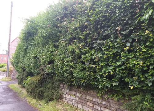
6.7.2 Hedges
6.8 Buildings at risk
6.9 Enforcement
7 Appendix 1 – Listed Buildings (as of September 2023)
8 Appendix 2 – Conservation Area Boundary and Townscape Appraisal Map
1 Introduction
1.1 Conservation Areas
Rushcliffe Borough Council has an obligation under Section 69 of the Planning (Listed Buildings and Conservation Areas) Act 1990 to review, from time to time, its Conservation Area designations.
A Conservation Area, as defined under Section 69, is ‘an area of special architectural or historic interest the character or appearance of which it is desirable to preserve or enhance’.
Keyworth Conservation Area was designated in 1999. Prior to this reappraisal of 2023, the Keyworth Conservation Area was reviewed in 2010.
Section 71 of the Planning (Listed Buildings and Conservation Areas) Act 1990 highlights the local planning authority’s duty to formulate and publish proposals for the preservation and enhancement of the conservation areas. This document, therefore, aims to identify and
reaffirm (or redefine) the special architectural or historic interest of the area which warrants its designation.
Conservation Area Appraisals are not, and never have been, tools for to fossilise a place against change, instead, the processes of change which allow places to grow and evolve are recognised as being unavoidable, and it is also recognised that change can be a positive and desirable force. The designation instead allows greater scrutiny and control to manage change to positive effect and to ensure that any changes which require planning permission do not harm, and ideally serve to actively enhance, the existing character of the place.
1.2 The Purpose of a Conservation Area Character Appraisal
The purpose of a Conservation Area Character Appraisal is to:
- Identify and record the special interest of the Conservation Area to ensure there is public awareness and understanding of what is
worthy of preservation. - To define and reassess current boundaries to accurately reflect what is now perceived to be of special interest.
- To identify opportunities to safeguard and enhance the special interest of the Conservation Area.
It should be noted that the content in this document is not a comprehensive account of every significant building, structure, tree, wall, feature, or space. Therefore, any omission should not be assumed to imply that they are of no interest.
Generally, the character and appearance of a Conservation Area will be preserved or enhanced by:
- Providing controls and regulating development through the planning system.
- Applying the extra controls that designation provides over demolition, minor development, and the protection of trees.
- Environmental enhancement schemes and possibly providing financial assistance for the repair and restoration of specific buildings.
- Encouraging public bodies such as the local highways authority or utility companies to take opportunities to improve the street scene through the appropriate design and sensitive sighting of street furniture (and retention of historic features of interest), or the removal of eyesores and street features that have a negative impact such as overhead wires.
1.3 The Planning Policy Context
This appraisal provides a firm basis on which applications for development within the Keyworth Conservation Area would be
assessed. It should be read alongside the wider development plan policy framework produced by Rushcliffe Borough Council and other
National Planning Policy Guidance documents. The relevant documents include:
- Rushcliffe Local Plan Part 1: Core Strategy, with a specific focus on:
- Policy 10 (Design and Enhancing Local Identity) [in part]
- Policy 11 (Historic Environment)
- Rushcliffe Local Plan Part 2: Development Policies, with a specific focus on:
- Policy 28 (Conserving and Enhancing Heritage Assets)
- Policy 29 (Development Affecting Archaeological Sites)
- The National Planning Policy Framework (NPPF) (Revised -2021)
- The National Planning Practice Guidance (2015 - Subject to Continual Review)
- By Design: Urban Design in the Planning System – Towards Better Practice (2000)
- The Planning (Listed Buildings and Conservation Areas) Act 1990
2 Keyworth Location and Landscape Setting
Rushcliffe Borough forms the southern tip of Nottinghamshire, which borders Leicestershire. It is predominantly a rural Borough that contains a mixture of city suburbs, market towns and villages. Rushcliffe is located about half a mile South of Nottingham city centre, with the River Trent forming the majority of its northern boundary and the River Soar defining its western boundary.
The A46 (Fosse Way), a distinctive Roman Road, runs through the centre of the Borough and leads to Newark in the North and Leicester in the South. In the northern half of the Borough, the A52 forms Nottingham’s primary transport link to Grantham and the East of England. Junction 24 of the M1 and East Midlands Airport are located about 1 mile from the western border.
Keyworth is situated approximately 6 miles to the south of West Bridgford on a small hill set among the undulating landscape of the South Nottinghamshire Wolds. The strategic position made the village an ideal location for windmills and for centuries Keyworth’s economy was based around the milling of grain. The last of Keyworth’s windmills stood on Selby Lane until its demolition in the 1950s, but the village logo (a blue and white windmill) still commemorates this important aspect of its heritage.
The village, although not directly on a major road, has easy access links to the A606 Melton Road, the Fosse Way which passes close by to the east and the A60 Loughborough Road to the west. Neighbouring communities are Plumtree, Normanton-on-the-Wolds, Stanton-on-the-Wolds, Widmerpool, Wysall, Bunny and Bradmore, some of which look to Keyworth for services.
Keyworth is built on top of a small hill, which has added significance because of the undulating landscape and the extensive surrounding farmlands which form the edge of the South Nottinghamshire Wolds.

2.1 The Keyworth Conservation Area
The village's transformation from an agriculturally based economy, through the 19th century framework knitting industry to its current role as an important local retail centre can be traced within the remaining spaces and buildings.
The small, 10.8-hectare Conservation Area was designated in October 1999 and lies at the heart of the village. It comprises mostly of the retail and commercial core and is focused on the church and the remains of 5 Grade 2 Listed houses and barns along Main Street. The most notable is the timber-framed George Martyn’s barn on 31 Main Street - the lintel over the doorway is inscribed "1651GM".
This review, which began in 2023 and concluded in mid-2025, resulted in the extension of the Conservation Area to include part of Lings Lane, an area whose character strongly reflects Keyworth’s agricultural heritage.
- Conservation Area Boundary covers: 10.8 hectares (approximate)
- Number of Grade 1 listed buildings: 1
- Number of Grade 2* listed buildings: 0
- Number of Grade 2 listed buildings: 6
A full list of Keyworth Conservation Area’s Listed buildings can be found in Appendix 1.
3 Historical Contexts
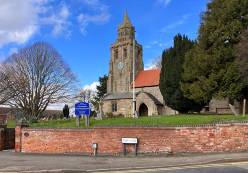
The Keyworth Conservation Area was designated in October 1999 and lies in the heart of the village. It comprises mainly of the retail and commercial core and is focused on the parish church and historic properties found along Main Street. The townscape is dominated by the unusual 15th century lantern tower of the Grade 1, 14th century church of St Mary Magdalene. The village's transformation from an agriculturally based economy, through the 19th century framework knitting industry to its current role as an important local retail
centre for 7400 people can be traced within the remaining spaces and buildings.
3.1 Location and Historic Activities
The earliest documentary evidence for Keyworth is contained in the Domesday Book of 1086 when the village had a population of 80 people. However, archaeological evidence in the form of pre-Roman and Roman coins point to human occupation of the area going back at least a thousand years earlier. Although not in the Conservation Area, trial archaeological trenching in 2019 for the new housing development north-west of Platt Lane revealed features including 5 iron Age field boundary ditches, 2 pits, a ring ditch, pottery and
animal bone. Other features included small pits and post holes, flint, a copper alloy (possibly part of a brooch), charcoal and heat affected stones. Ceramic evidence indicates late Iron Age occupation (around 100 BC to 43 AD) which pre-dates the Roman occupation of Britain.
Until the Enclosure Act of 1794 the land around Keyworth was farmed under the open field system with a pattern of three large fields and an area of common pasture. Remains of ‘Ridge and Furrow’ can be seen all around the village, particularly to the south and west and importantly on the Rectory Field. Keyworth village itself was a small rural hamlet focused around the 14th century Church of St Mary Magdalene and the adjacent open area now known as The Square which contained the village cross, water pump and pinfold. Running southwards from the churchyard for around a quarter of a mile was a small street, then called Town Street (now called Main Street). The farmsteads and cottages built alongside the street in a strip plot system are clearly shown on Sanderson’s map of 1835. There were as many as 12 farms at one time.
From being primarily a farming community, the built form of Keyworth began to change rapidly as the 19th century progressed. By the 1860s a growing framework knitting industry had become Keyworth’s main source of employment and boosted the village population to 900 by 1881. According to the occupations recorded in the 1861 census Keyworth specialised in the manufacture of gloves rather than the more traditional cotton hose. The demand for well-lit workshops and workers housing intensified the urban form as yards of ‘frame-shops’ and workers dwellings sprang up between and behind the existing buildings on Town Street. This development also began to expand the limits of the village to the north and east along Nottingham Road and Selby Lane. However, from the 1870s the large-scale mechanisation of manufacturing led to a steady decline in this cottage industry. The last manufacturer in the village, Pike and Gunn, closed in 1959 and today only two traditional workshop buildings with their typically large windows survive.
The religious life of the village has also been an influential factor in its development. The Nonconformist presence in Keyworth began with the establishment of the Independent Chapel on Nottingham Road in 1768 and continued when the first Methodist Chapel was built on Elm Avenue in 1828. The latter was replaced by a larger Methodist Church on Selby Lane in 1881. During the latter half of the 19th century the rapidly increasing support for Primitive Methodism gave rise to tension between Anglicans and Non-conformists in
the village. In 1872 Selby Lane became the battleground in a bitter dispute when the establishment of a nondenominational Board school was met with strong opposition by the Anglicans who had built the first purpose built National school in the village in 1862 just a stone’s throw away. The dispute came to be known as ‘The Battle of the Board’. Today the National School survives as the Parochial Church Hall but the Board school was demolished in 1985, after modern primary schools were built in the 1960s and 1970s to accommodate the increasing number of children in the village.
Additionally, significant change in the rural lifestyle of the locality occurred with the coming of the railway to the neighbouring village of Plumtree in 1880. The railway placed Keyworth within commuting distance of Nottingham but the inconvenience of travelling to work and the depression in agriculture and framework knitting led to a decline in the village population. The compact village structure therefore remained much the same well into the 20th century. Dwellings were approved to the north of the historic core of the village from the 1950’s onwards in response to the development pressure emanating from Nottingham and the opening of Cotgrave Colliery in 1962. The construction of large-scale housing estates dramatically changed the village from one based in a rural economy, to an economy tied to the neighbouring cities.
3.2 Historical Mapping
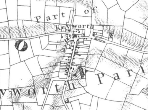

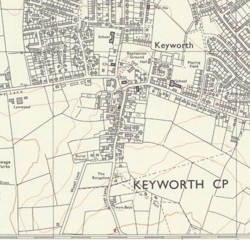
Note the developments in the north and east
4 Spatial Analysis
The relationship between open spaces and the built form within a conservation area can be central to its character. This section describes the village’s layout, highlighting the significant views, landmarks and historical focal points. The contribution of open green spaces, trees and other natural elements to the conservation area’s character is also described within this section.
4.1 Plan, Form and Layout
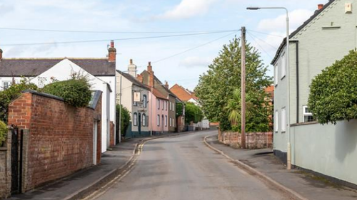
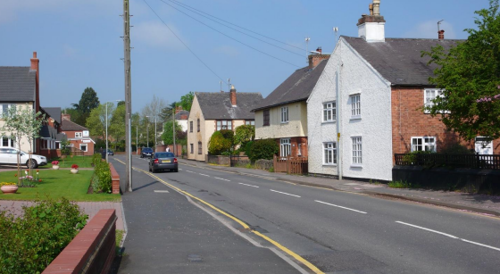
Keyworth’s historic street pattern consists of a linear central thoroughfare with a north-south orientation (Main Street) and an open junction at its northern end (The Square). Running east and west from The Square are Selby Lane and Bunny Lane respectively. Keyworth’s larger community buildings such as the churches and school are situated in the north of the Conservation Area while
an informal mixture of traditional cottages farmhouses, barns and workshops closely line the edge of Main Street to the south.
Below is a map that describes the current plan, form and layout of the village.

This map is reproduced from Ordnance Survey material with the permission of Ordnance Survey on behalf of the Controller of His Majesty’s Stationary Office © Crown Copyright. Unauthorised reproduction infringes Crown Copyright and may lead to prosecution or civil proceedings.
Rushcliffe Borough Council - 100019419
4.2 Focal Points and Views
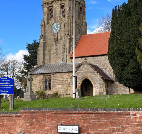
Keyworth’s most important landmark is the church of St Mary Magdalene which forms a visual stop at the northern end of Main Street and can be glimpsed in views throughout the Conservation Area and beyond its boundary. Views along Main Street are tightly framed by its buildings while views of the South Nottinghamshire Wolds can be seen from the south of the Conservation Area where the edge of the village remains open to the surrounding countryside, which is part of the designated green belt. When approaching Keyworth along Wysall Lane, the southern edge of the built form of the Conservation Area can be seen among the landscape of pasture land and hedgerows to the south. Approaching from the west along Bunny Lane, the elevated position of Main Street allows a number of the Conservation Area’s key buildings (most noticeably the church and 19 Main Street) to stand prominently on the horizon. Also noteworthy is the Selby Lane approach that provides views of the eastern edge of the Conservation Area with the church tower visible
in the background.
of the Conservation Area. Key unlisted buildings gable end on to the street
4.3 Open Spaces, Trees and Landscape
In the north of the Conservation Area the Rectory Field, The Square and the churchyard create a feeling of spaciousness which is in sharp contrast to Main Street where the buildings closely line the edge of the highway and create a sense of enclosure. Trees are a prominent feature of the north of the Conservation Area where they frame views of the church and line Nottingham Road and the northern side of Selby Lane. Grass verges and hedgerows are limited to the southern tip of the Conservation Area where the urban
character of Main Street gives way to the open countryside beyond.
Church on Selby Lane
4.3.1 Open Spaces, Trees and Landscape SWOT Analysis
Strengths - what are the positives of the open spaces, trees, and landscape
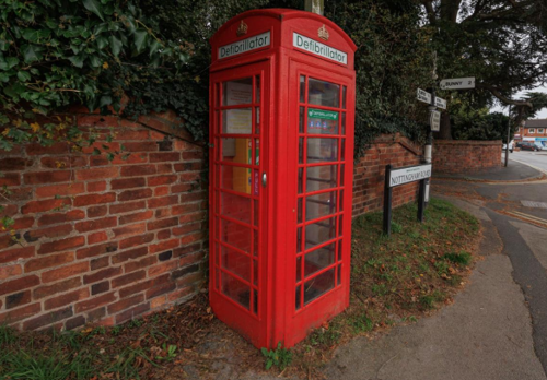
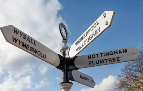
- Retention in good repair of original direction finger posts and K6 telephone box in the Square.
- Grade 1 Church and its churchyard setting with mature trees and trees in the Square provide a focal point.
- Rectory Field with ridge and furrow is a rare survivor in such a location and accessible to all.
- Peace Garden - quiet place for reflection.
- Activity Park provision.
- A variety of traditional boundary treatments enhance the public realm.
Weaknesses - what are the negatives of the open spaces, trees, and landscape
- Narrow path across Rectory Field, which is the only public amenity open space in the village centre.
- Poor hard and soft landscaping in the Square, dangerous paving in central island.
- Poor landscaping in front of Neo-Georgian properties on Main Street.
- Unattractive appearance of electricity sub-station site on Main Street.
Opportunities – what could make the open spaces, trees, and landscape better?
- Enhancement with additional trees and shrubs.
- Pedestrian priority in the Square.
- Wild flowers and more trees on Wysall Lane gateway to the village.
- Widening of current pedestrian path along edge of Rectory Field between Nottingham Road and Keyworth Parish Council car park.
Threats - what would make an open spaces, trees and landscape worse?
- Potential development on field on Wysall Lane on approach to CA (ridge and furrow evident) would cause detrimental impact on the setting of the village and conservation area for views in and out.
- Creeping development on Rectory Field.
Works to Trees
You must contact the Local Planning Authority (LPA), Rushcliffe Borough Council before any works (cutting OR pruning) are carried out to trees within the Keyworth Conservation Area.
Six weeks’ notice is required before any works to trees within the Conservation Area is carried out, even if they are not protected by a Tree Preservation Order (TPO).
If there is a tree which undergoes annual maintenance, include this information with the notice. It may be possible, upon agreement with the tree officer, that only one notice is required to cover the future annual maintenance.
Standard notification forms (a section 211 notice), further information and contact details.
A flow chart of the decision-making process regarding works to trees.
the transition into open countryside at the southern edge of the
Conservation Area
Nottingham Road create a leafy suburban character
space in the heart of the Conservation Area
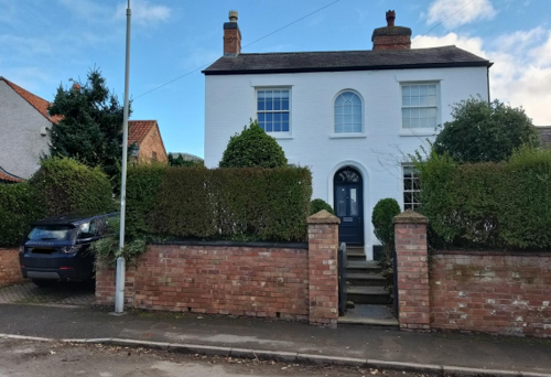
4.4 Public Realm
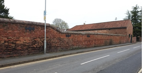
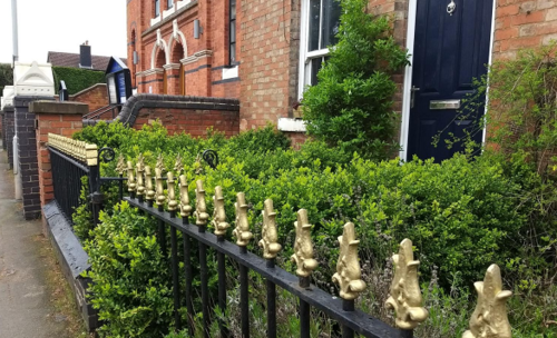
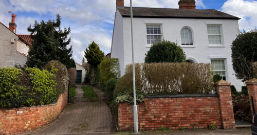
The boundary treatments in Keyworth include combinations of orange/red brick walls of varied heights, locally produced iron railings and hedges. There are also a few examples of stone walls. In many cases, particularly along Main Street, the buildings themselves form the property boundaries by having their walls positioned directly against the pavement. Roads and pavements in the village are paved with asphalt but a number of private drives retain an informal character by being surfaced with gravel. Other notable public realm features
include the two remaining finger post signs (at The Square and the Nottingham Road/Bunny Lane junction) and a K6 red telephone box on Nottingham Road.
In the Square, any development of the shops that are within the Conservation Area should enhance the character of the Conservation Area. While some shops in the Square do not lie in the Conservation Area, they are adjacent to the boundary. As the quality of these shop premises has an impact on the Conservation Area, it would be desirable that any development of them is in keeping with the vernacular of the Conservation Area. There is a statutory duty to ensure that new development affecting the Conservation Area preserves or enhances the character and appearance of the Area.
Examples of boundary treatments in Keyworth
5 Buildings of the Conservation Area and Key Characteristics
5.1 Building Types and Activity
The majority of the Conservation Area’s historic buildings are a varied mixture of eighteenth and nineteenth century cottages, farmhouses, former agricultural buildings, Georgian houses and framework knitter’s workshops. These are generally one or two storeys in height with occasional three storey elements. There are also examples of public buildings in the shape of non-conformist chapels, Victorian school building and a fourteenth century Church.
Recent activities involving the community are:
- the Hedgehog Highways Project, which operates across the village as part of ‘Wild Things Keyworth’, a local action group raising awareness of climate change and aiding the Green Recovery.
- Keyworth Abundance Project which operates from a building in the Conservation Area and provides a multi-purpose Community Eco Hub with a broad environmental focus.
5.1.1 Building Types and Activity SWOT Analysis
Strengths - what activities/places can you go that makes the village/town great?
- Rectory Field amenity space for all.
- Keyworth Show held annually on Rectory Field.
- Barns well preserved from earlier farming use.
- Martyn’s Barn open days - HODs, NGS, exhibitions.
- Abundance Project (community hub), Village Hall complex, 3 churches with halls in the CA for many community activities.
- Scouts, Guiding, varied activities and groups for all ages.
- Children’s play areas, Activity Park.
- Keyworth Hedgehog Highways Project.
- Access to the surrounding countryside by public
footpaths and bridleways
Weaknesses - what activities/places that exist that detract from making the village/town great?
- Poor 1960s architecture of shops in the Square.
- Recent building development has led to an erosion of the conservation area character and the setting of the Grade 1 listed Parish Church.
Opportunities - what activities/places could exist that would village/town even better?
- Increase in local employment and business.
- A wider variety of retail opportunities.
- Potential increase in listed buildings.
Threats - what activities/places would village/town worse?
- Unsympathetic shop front signage.
- Coloured render and paintwork that is out of keeping.
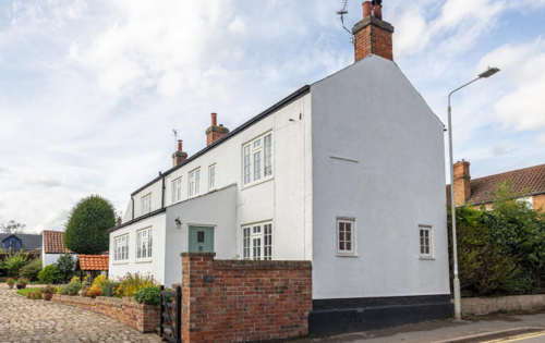
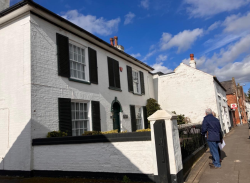
5.2 Key Characteristics and Building Materials
5.2.1 Key Characteristics - The Square, Selby Lane and Nottingham Road (Zone 1)
This part of the Conservation Area contains the commercial centre of the village and its public buildings. It is also one of the greenest parts of the village and includes the most significant open spaces and groups of trees.
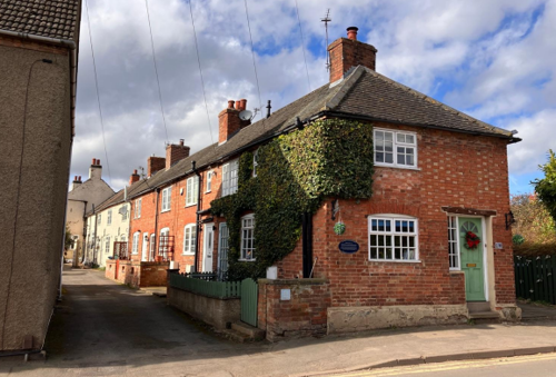
Elm Avenue – mainly small terraced cottages
Materials:
Walls: Residential properties are mainly red brick in various bonds, with others rendered or painted in white.
Roofs: Clay pantile and slate are common. Brick chimneys.
Windows: These are mainly small casement windows with evidence in some properties of bricks in the top of the gable end where small horizontal windows provided light for Framework Knitters to work in their properties
Doors: Much altered, with some original doorways bricked up. Some house doors are evidence of historic passageways between houses in the terraced row.
Key Characteristics / Architectural Features:
The frontages of the properties have very small front gardens. It is the properties that contribute to the character of the street.
They have an aspect from their frontages across the open green area of the Parochial Church lawn or across the car park to the Rectory Field.
Former Methodist Chapel, now incorporated in residential building on corner of Elm Avenue / Elm Close.
Rectory Field – largest public realm space in the village centre. Trees on west and south boundaries, with predominance of hedges on north boundary. Several benches providing public seating. Railings, incorporating the Memorial Gates, along length of western boundary. ‘Peace Garden’ area with benches for contemplation.
The greenest open area for public enjoyment in the village. Picnic tables on edge of field by Village Hall and Activity Park fronting Nottingham Road.
Nottingham Road and The Square
Materials:
Walls: Properties are mainly red brick in various bonds, with others rendered or painted in white/ neutral colours or stone. Included in this area are United Reformed Church, red brick (1903), The Hall rendered (1768), Old Rectory brick (1859) and 14th century Parish Church of St Mary Magdalene stone including some lias (Grade 1 listed). 1-3 Main Street are rendered white.
Roofs: Mainly clay pantiles and slate.
Windows: Original styles with stone detail on the churches and Old Rectory.
Doors: Wooden doors on Churches in keeping with character area. Otherwise, some much changed, including UPVC frames.
Key Characteristics / Architectural Features:
The elevated position of the Parish Church and its grounds dominates the Square. The low wall with trees along the east side of Nottingham Road and planting, including trees opposite the Parish Churchyard in the Square, contribute to the green character of the centre of the village. They soften the hard appearance of brick paving in front of the shops and have a role in screening the 1960’s
architecture. A brick retaining wall continues around the Church and its grounds into Selby Lane.
K6 phone box and 2 finger posts remain.
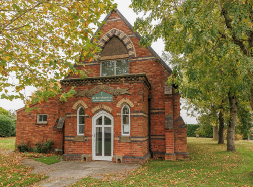
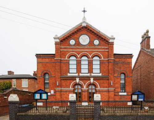
Selby Lane – A mixture of residential and public buildings (Parochial Church Hall and Methodist Chapel 1881).
Walls: Mainly red brick in various bonds, including Flemish brickwork giving a chequered appearance with others rendered/painted in white.
Roofs: Clay pantiles and slate are common. Brick chimney stack and pots on pair of Victorian cottages.
Windows: Vertical sash windows on Victorian cottages. Public building windows in keeping with character zone. Some UPVC replacements.
Doors: Original doors on cottages, otherwise much changed.
Key Characteristics / Architectural Features:
Boundary red brick walls and fencing emphasise the narrowness of the character along this road. Some low walls are embellished with railings.
Cottage front gardens are small and most are bounded by low brick walls with hedging. The area opens up at the Parochial Church Hall with its expanse of lawn around the building.
Two sets of semi-detached cottages are perpendicular to the street, with gable ends fronting the public highway, a common feature in the village.
5.2.2 Key Characteristics - Blind Lane (Zone 2)
This narrow lane running parallel to Main Street contains a cluster of small workers cottages and has an enclosed feel. A blue lias dry stone wall runs along the eastern side of the lane. There is some 20th century infill.
Materials
Walls: Mainly red brick and light-coloured render
Roofs: Clay pantiles and slate.
Windows: Traditional casement style and vertical sash on cottages, modern UPVC on modern infill.
Doors: Much changed.
Key Characteristics / Architectural Features
Retaining boundary wall on east side of lane is lias stone, with hedgerow along the top of the wall creating a leafy character.
A quiet backwater close to the village centre. One cottage has its gable end facing directly onto the lane.
Other older traditional properties are set back a very small distance from the lane edge, while newer 20th century infill houses have longer front gardens.
5.2.3 Key Characteristics - Main Street (Zone 3)
Historically the village’s principal thoroughfare, this road is characterised by its informally arranged collection of cottages, farmhouses, houses, worker’s terraces and courtyards of traditional farm buildings. The proximity of the crowded building line to the highway creates a distinctly urban feel.
Materials
Walls: Red brick, brick painted white, render, barns with timber frame and brick infill panels. Herringbone brick pattern on Martyn’s Barn. Lias plinths, (esp. Home Farm Barn). Flemish bond brickwork on many buildings. English Garden Wall Bond on Post Office (No.18)
and on the boundary wall of 2 Wysall Lane.
Roofs: Slate, some red pantiles, plain tiles (replacement for thatch), geometric tile detail on Home Farm. Modern concrete tiles on no.9 and WD Gill premises. Steep pitches to some properties. Parapet gables, brick chimney stacks with 19th century chimney pots.
Windows: Original vertical sliding sashes (especially on Listed Buildings). UPVC Replacements, modern sashes. Stone sills and headers on 22-28 Main Street.
Doors: Original doors are solid. Many modern replacements. Double timber doors on Martyn’s Barn frontage.
Key Characteristics / Architectural Features
Most buildings on rear of pavement forming enclosure to street. Some gable ends onto the street frontage. Diamond shaped air vents on Home Farm Barn. Boot scrapers on many properties. Stone headers and sills on some properties.
Former Framework Knitter’s Cottage (No.62) with window high in gable end to provide good light for working.
Framework Knitter’s Workshop (Grade 2 listed) in rear garden of 4 Wysall Lane.
Front boundary treatments to properties contribute
to the special character of the area, with walls, railings (The Post House no.20), yew hedges, hedges above walls and original farmyard walls to Holly Farm Cottages.
5.2.4 Key Characteristics: Lings Lane (Zone 4)
Walls: Mainly red brick and light-coloured render.
Roofs: Mostly slate and clay pantiles.
Windows: Casement in various styles and much altered.
Doors: Mainly similar traditional designs.
Key Characteristics / Architectural Features
Boundaries to properties and fields are formed by native hedges and trees enhancing the rural character.
The townscape changes abruptly from the urban feel along Main Street to the sudden open vistas of countryside from Wysall Lane. By contrast, the approach from the countryside along Wysall Lane offers a soft edge leading into the enclosed feel of the built-up conservation area core area.
A mixture of properties provides a loose knit, ribbon development on the east side of Lings Lane. Beyond is Motley Close field to the east of Lings Lane / north of Wolds Lane with archaeological evidence supporting the idea that it was a moot (a meeting place for debate).
There is ridge and furrow identifiable in the field west of Lings Lane, opposite 2-14 Wysall Lane. It was known as Bunny Gate Field, as part of the historic open field system.
Lings Lane was previously known as Pasture Lane, as it led to Keyworth’s common pasture further along. It was a route to local stone pits for collecting the lias rock for plinths, walls and road building in the local area and also a historic route to othervillages (public footpaths still exist to Widmerpool and Wysall from points on Lings Lane.

5.2.5 Key Characteristics SWOT Analysis
Strengths – what is good about most existing buildings that looks good?
- Original brickwork.
- Original timber framed barns in good repair.
- Herringbone brickwork on Martyn’s Barn.
- Narrow gables, steep roofs (previously thatched).
- Boot scrapers (a necessity in earlier times).
- The Parish Church – a dominant position and focal point.
Weaknesses – what is good about most existing buildings that looks good does not look good?
- Recent building development not in keeping.
- Newer builds out of proportion.
- Concrete tiles used for roofing replacement.
- Poor quality door and window replacements.
- Hard landscaped frontages not in keeping.
Opportunities – what could make existing buildings (or new builds) look good and contribute to the character of the area?
- Replacement of plastic windows with more traditional material.
- Less advertising boards, rationalisation of signage on commercial buildings.
- New builds designed in keeping.
- Electricity sub-station area to be more regularly maintained by the electricity provider responsible.
- More flower baskets and troughs.
Threats – what could make existing buildings (or new builds) look worse and detract from the character of the area?
- Unsympathetic commercial development.
- Empty properties detracting from the vitality of the area.
- Too many wires criss-crossing above Main Street and new communication technology impacting negatively on the streetscape.
- Cluttered street furniture.
5.4 Listed Buildings
Buildings on the Government’s List of Buildings of Special Architectural or Historic Interest are called “Listed” buildings and are protected by law. Consent is required from Rushcliffe Borough Council before any works of alteration, extension, or demolition can be carried out on any listed building.
Further information can be found in Rushcliffe Borough Council’s publication Listed Buildings in Rushcliffe, which is also available online on the listed buildings webpage.
The complete list of the Secretary of State’s Statutory List of Buildings of Special Architectural Interest or Historic Interest can also be found on the Historic England website.
Names and photos of the Listed Buildings and structures in Keyworth Conservation Area (correct as of September 2023) are detailed in Appendix 1. All Listed Buildings are shown on the Townscape Appraisal plan, but some smaller structures such as gravestones may not be shown.
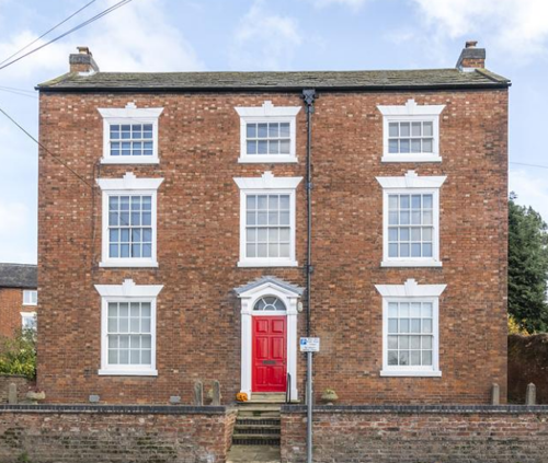
Keyworth contains seven Listed Buildings, all of which are Grade 2 Listed apart from the Grade 1 Listed Church of St Mary Magdalene).
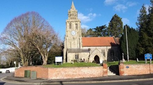
Keyworth’s only Grade 1 Listed Building. It was extensively restored in
1874 and 1884 and has an unusual 15th Century octagonal lantern tower.
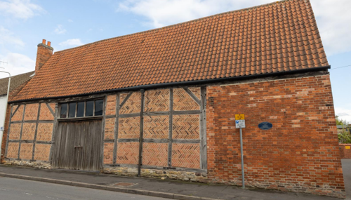
farmer George Martyn of Bunny), a 17th Century timber framed barn with
18th century herringbone brick infill panels. The frame is built on a Blue
Lias rubble plinth and the steep pitch of the pantile roof indicates that it
was once thatched.

19th Century Cottage at 15 Main Street (both individually
Grade 2 Listed).
The barn has a series of diamond shaped ventilation holes and retains traces of an original timber framed construction built on a Blue Lias rubble plinth. The roof of the barn uses a combination of plain tiles (at the eaves) and clay pantiles whilst the cottage is roofed in a distinctive pattern of machine tiles.

of 4 and 6 Wysall Lane. The upper floor was accessed by an internal
stair but has now been reverted back to the original external staircase
by the current owner. The building is lit by a range of windows across
both sides of the building

early 19th Century Yeomans House with
a distinctive machine tiled roof, red brick
gable stack and symmetrical frontage.
style with well set red brick walls, slate roof and a regular pattern of sash
windows placed symmetrically around a central doorway with fanlight
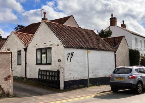
5.4 Key Unlisted Buildings
Contribution to the established character of the place can also come from buildings which are not recognised via listing, or are not old. A plan with all of the positive contributions to the area can be found in Appendix 2 - Conservation Area Boundary and Townscape Appraisal Map. Below are some key examples, but not an exhaustive list, of positive contributions.

5.5 Building Materials and Local Details
Traditional building materials were largely locally sourced. Bricks for example, were not transported far from where they were made, with most villages having their own brick pit and yard. This led to interesting village-specific sizes, colours and styles of brickwork. Roofs would have been made from local materials such as thatch until clay pantiles became popular.
The traditional building materials within the Conservation Area are as follows:
Building walls are predominantly of orange/red brick but blue lias limestone is also found, sourced from local stone pits close by in the surrounding countryside and often used as a plinth. Some buildings are rendered and whitewashed, typical of the treatment of old, decaying brickwork. Flemish bond, sometimes using yellow brick headers to create a chequerboard pattern, and stretcher bond brickwork are the most commonly found but there are also rare examples of English Bond and herringbone bond. Apart from a few exceptions such as the village’s church buildings, detailing is restricted to occasional eaves dentil courses, string courses and decorative brick air vents on former barns but the vast majority of traditional buildings are relatively restrained in their use of such features.


brick infill panels on George Martyns
Barn, Main Street

– possibly indicating former thatch.
The traditional roofing materials are pantiles (particularly in the case of former farm outbuildings) plain tiles and natural slate (mostly on 19th century buildings). There are also a small number of decorative machine tile roofs. Brick chimneys are generally of a simple character and positioned on the roof ridge or built into the gable walls. Nineteenth century chimney pots with fluted tops, designed to allow good coal burning cross drafts survive on many Victorian buildings. Simpler eighteenth-century hand-made pots can also be found in smaller numbers.

Windows are a mixture of timber vertical sliding sashes (including margin light, sixteen pane and six pane varieties) and painted timber casements. In recent decades there has been a growing trend towards replacing timber windows with uPVC. Ashlar lintels and sills are common on nineteenth century buildings and arched brick lintels are also widespread.

wedge lintels and key blocks


brick with pantile roof – 37 Main Street
Doors are extremely varied in age and character but include six panelled and part glazed examples which are combined with details such as fanlights, door cases, brick porches and decorative stone lintels. More rustic plank barn doors with ironwork hinges can also be found on surviving agricultural buildings. Alongside several doorways boot scrapers are incorporated within a shaped stone surround or as positioned as free structures connected to the building with square headed nails.

Neo-classical door case and fanlight


a shaped stone surround
6 Generic Management Plan for Conservation Areas in Rushcliffe
6.1 Introduction
In carrying out its planning functions, the Borough Council is required in law to give special attention to the desirability of preserving or enhancing the character or appearance of Conservation Areas. The Management Plan for a Conservation Area is a tool to ensure the special character of the area is preserved and enhanced. The management plans aim to:
- Outline a strategic management proposal for the preservation and enhancement of the Keyworth Conservation Area.
- Act as a guide for professionals and residents alike regarding:
- features of value, worthy of preservation;
- characteristics worthy of preservation;
- opportunities for enhancement;
- development proposals which preserve and enhance the special character of the area.
- Inspire community commitment to conservation principles and reporting.
6.2 National and Local Policies and Guidance
There is a duty to formulate and publish management plans setting out policies and proposals for the preservation and enhancement of Conservation Areas. Many of these policies and proposals are common to all Conservation Areas, and these are set out in this document. The Central Government Guidance and Local policies applicable to Conservation Areas include:
- Rushcliffe Local Plan Part 1: Core Strategy, with a specific focus on:
- Design and Enhancing Local Identity [in part]
- Historic Environment
- Rushcliffe Local Plan Part 2: Development Policies, with a specific focus on:
- Conserving and Enhancing Heritage Assets
- Development Affecting Archaeological Sites
- The National Planning Policy Framework (NPPF), particularly, but not exclusively the chapter on Conserving and Enhancing the Historic Environment.
- The National Planning Practice Guidance (NPPG) (updated 2021 and subject to continual review)
- By Design: Urban Design in the Planning System – Towards Better Practice (2000)
- The Planning (Listed Buildings and Conservation Areas) Act 1990
- Historic England “Historic England Advice Note 1: Conservation Area Designation, Appraisal and Management”
The council will utilise the full range of strategic policy and guidance documents to ensure that development in Keyworth Conservation Area is of a standard that enhances the amenity of the local area. The council will always look to use the most up-to-date versions of the document.
Supplementary documents may be issued for individual Conservation Areas where specific policies or proposals are needed.
6.3 Article 4 Directions
There are extra consents required in Conservation Areas. For example, in addition to the general control of development, you will
need to get permission for
- Any additions or alterations to the roof (for example, dormer windows)
- The installation of satellite dishes on chimneys, roofs or walls fronting a highway
- Any extension which extends beyond the side of the original dwelling house
- Any extension of more than one storey that extends beyond the rear wall of the original dwelling house
- Cladding the exterior of the dwelling
- Any demolishing of a building or part of a building that has a volume over 115 cubic metres
Article 4 of the Town and Country Planning (General Permitted Development) Order 1995, allows planning authorities to restrict
some permitted development rights within particular areas. This does not necessarily prevent development or change taking place
but enables the Local Authority to manage the design and detailing of the works, and potentially grant permission subject to appropriate conditions. The use of Article 4 Directions will be proposed where it is considered appropriate following the completion of each Area Appraisal across the Borough.
Details of Article 4 Directions for Keyworth Conservation Area
There are currently no Article 4 Directions for Keyworth Conservation Area.
6.4 Building Design
Mimicking the local vernacular is not the only way to ‘fit in’ with the character of a conservation area. National policy makes clear that contemporary designed, provided it is sympathetically designed, cannot be dismissed as an option. Therefore, good contemporary design will be encouraged where it respects the context’s character, scale and massing. This must be demonstrated in the Design and Access Statement submitted with any planning application.
Extensions to buildings in Conservation Areas should respect:
- The key characteristics of the original building, including scale, mass, materials and proportions
- The contextual setting and character of the Conservation Area
Copying like for like can devalue and destroy the ability to “read” historic change, and dilutes our historic heritage. Pastiche designs, incorporating poor imitations of other styles, will be resisted, particularly where they incorporate details which are not locally appropriate. Careful high-quality replication may be required in a few very sensitive locations.
In particularly sensitive locations, such as uniform terraces, exact replication may be necessary to maintain compositional unity. In that case, attention to details, choice of materials and high-quality workmanship are the keynotes. However, in some cases, a direct relationship is not impossible. For example, Flemish Bond brickwork cannot be replicated in cavity walls, and narrow lime mortar joints cannot be replicated in modern metric brickwork.
Where a new building is appropriate, on infill sites or where an existing building detracts from the character of the area, the opportunity should be taken to re-establish the streetscape, reinforce enclosure, open up distant vistas or views of landmarks or hide unsightly views.
“New and old buildings can coexist happily without disguising one as the other, if the design of the new is a response to urban design objectives” (DETR – “By Design”, p19).
As with extensions, good contemporary design which respects local character, and the context of the site will be encouraged.
All new buildings should respond appropriately to the existing frontage and normally follow the established building line. Development or redevelopment will normally be resisted if:
“it blocks important views identified in the individual appraisals, uses important open spaces identified in the appraisals, adversely affects the setting of any Listed or key buildings, fails to maintain or re-establish the streetscape where appropriate dominates its Conservation Area background fails to recognise the context of
the site destroys important features identified in the individual appraisals such as boundary walls, fences,
hedgerows or trees”
Where the quantity of contemporary schemes in a small area becomes significant and outnumbers older buildings within the area, further contemporary schemes could fundamentally shift the architectural character of the area and thus be harmful, even if well designed as an individual project.
New development that stands out from the background of buildings may be appropriate in exceptional circumstances if it contributes positively as a landmark to enhance the street scene, to highlight a corner or to signal a visual change of direction such as along a curving vista.
Any external lighting should be carefully designed and sited to minimise light pollution.
Energy producing or saving devices are generally welcomed by the Council, but careful consideration is required when these are to be located in a Conservation Area and some may require planning permission. In particular, they should be positioned to minimise their impact on the building and on the local amenity.
6.5 Publicity and Knowledge Transfer
Ambiguity about additional controls within a Conservation Area raises the likelihood of inappropriate developments occurring which
may damage the integrity of the conservation area designations.
Efforts have been made to engage local community groups in the development and review of the character appraisals. Empowering
communities to define the special architectural and historic interest of the Conservation Area aims to raise awareness.
Whether the appraisal took a community-led or a council-led approach, upon reviewing all Conservation Areas, the public were invited to ask questions and comment during a public consultation.
A consultation event also aimed to diminish any ambiguity about restrictions within a Conservation Area and increase the likelihood of sensitive and appropriate developments, maintaining the character of the area.
The council recognise the potential issues of turnover in residency and ownership of properties in the conservation area. Therefore,
Rushcliffe Borough Council will periodically use their media outlets to highlight conservation area designations and the significant, related planning controls.
The approach taken within Keyworth Conservation Area was Community Led.
The consultation period took place between the following dates
29/05/25 – 21/06/2025
The date of the Consultation Event
04/06/2025
If there are any queries about conservation areas, please email conservationareas@rushcliffe.gov.uk
6.6 Public Realm
General maintenance and upkeep to the public realm may include fixing damage to roads and pavements, and fixing issues with street lighting. Issues such as these can impact the quality of the Conservation Area.
The council aims to encourage works to the public realm that are in keeping with, or actively enhance the conservation area. Rushcliffe Borough Council can only advise on work within the public realm that does not require planning permission (for example work completed by statutory undertakers, such as the Highways Authority). In these instances, Rushcliffe borough council cannot prevent such work.
Nottinghamshire County Council are responsible for repairs to roads, pavements and street lighting. Report issues of repairs to roads, pavements and street lighting to Nottinghamshire County Council online.
Rushcliffe Borough Council will continue to undertake their duties in maintaining the public realm. Vandalism, fly tipping and street cleaning are all the responsibility of Rushcliffe Borough Council. Report issues to Rushcliffe Borough Council online.
You must contact the Local Planning Authority (LPA), Rushcliffe Borough Council, before any works (cutting OR pruning) are carried out to trees within the xxxxxx Conservation Area
Six weeks’ notice is required before any works to trees within the Conservation Area is carried out, even if they are not protected by Tree Preservation Order (TPO).
Standard notification forms (a section 211 notice) - further information and contact details.
A flow chart of the decision-making process regarding works to trees.
6.7 Boundary Treatments
Where there is a proposal for a new boundary treatment to be installed, the council would encourage the use of boundary treatments within the area.
Within conservation areas, planning permission is required to alter, maintain, improve, take down or build any new gate, fence, wall or other enclosure with:
- A height of one metre or more if next to a highway (including a public footpath or bridleway), waterway or open space; or
- A height of two metres or more elsewhere.
Where planning permission is required to remove a wall, Rushcliffe Borough Council will aim to protect those boundary walls and fences that have been identified as positively contributing to the area.
Hedgerows are significant habitats for wildlife in lowland Britain. Regulations are intended to protect important hedges in the countryside. The policy applies to hedges that are more than 20m long, (or less if connected to another hedge) on or adjacent to:
- Land used for agriculture or forestry, including the keeping of horses or donkeys
- Registered common land and village greens
- Local Nature Reserves and Sites of Special Scientific Interest.
The policy does not apply if the hedge is within or on the boundary of the curtilage of a house.
6.8 Buildings at Risk
A few of the important buildings across the various Conservation Areas are currently vacant or not in regular use, which may lead to some being “at risk” of neglect or decay.
The Council will encourage and advise on renovation and repair work that is sensitive to the original or traditional historic character of the building and retains original features. The council will monitor the opportunity and potential for grant aid schemes to encourage the basic maintenance work necessary to ensure that key buildings within the conservation area are structurally sound and weather tight. However, given the current financial climate and outlook, such schemes are unlikely in the short to medium term.
There is a presumption against the demolition of buildings which contribute to the character of the area unless there are exceptional circumstances. It would benefit both the physical form and the function of the Conservation Area if these buildings were repaired, maintained and brought back into use.
Where the poor condition of a building or structure is as a result of neglect and lack of maintenance by its owner there is no requirement for the Borough Council to take its deteriorated condition into account when deciding whether demolition is appropriate. This is to avoid rewarding the deliberate neglect of buildings by representing such action as a way to obtain planning permission for demolition and redevelopment.
6.9 Enforcement
Rushcliffe Borough Council will, from time to time, assess and monitor changes in the appearance and condition of Keyworth Conservation Area. This will ensure that where necessary enforcement action can be taken promptly to deal with problems as they arise.
Where co-operation cannot be gained by any other means, Rushcliffe Borough Council has the ability to use additional enforcement powers to tackle particular issues within conservation areas. The Council may take formal action if the condition of any building (listed or unlisted) which makes a positive contribution to the character of the Conservation Area is considered to be at risk.
The council will work in accordance with their enforcement policy, which aims to provide an efficient enforcement service in support of the Council’s statutory planning service. Rushcliffe Borough Council’s enforcement actions will remain transparent, consistent, and proportionate, as it is recognised that effective controls over unauthorised development assists in conserving the natural and built environment whilst helping to protect the quality of people’s lives and maintaining the Council’s integrity.
7 Appendix 1 – Listed Buildings (as of September 2023)
Grade: 1
Listing entry number: 1039626
National grid reference: SK 61389 30836
Location: Church Of St Mary Magdalene, The Square
Barn Adjoining Number 15 and Attached Range of Outbuildings
Grade: 2
Listing entry number: 1039620
National grid reference: SK 61394 30726
Location: Barn Adjoining Number 15 and Attached Range of Outbuildings, Main Street
Grade: 2
Listing entry number: 1039623
National grid reference: SK 61424 30715
Location: 17, Main Street
Grade: 2
Listing entry number: 1373902
National grid reference: SK 61394 30719
Location: 15, Main Street
Grade: 2
Listing entry number: 1373903
National grid reference: SK 61394 30699
Location: 19, Main Street
Grade: 2
Listing entry number: 1373904
National grid reference: SK 61380 30667
Location: Barn at Number 31, Main Street
Former Framework Knitter's Workshop Behind Numbers 4 And 6, Wysall Lane
Grade: 2
Listing entry number: 1373905
National grid reference: SK 61311 30436
Location: Former Framework Knitter's Workshop Behind Numbers 4 And 6, Wysall Lane
*The titles of these listings may not make it clear that all listed buildings always include all attached structures and extensions, regardless of age, and all detached outbuildings built before 1 June 1948 which are, or were at the time of listing, ancillary to the function of the primary listed building and were in the same ownership at the time of listing.
For example, when a house is listed, the listing will apply to extensions, porches, detached historic stables, barns, wash houses, privies etc. Such outbuildings and extensions are only exempt from the provisions of listing where the listing specifically excludes them. Appendix 2 - Conservation Area Boundary and Townscape Appraisal Map.
8 Appendix 2 – Conservation Area Boundary and Townscape Appraisal Map

Map show the location of:
- Listed buildings - red
- Unlisted buildings - purple
- Positive open space - green
- Significant views - red arrows
Conservation Areas
- Bingham Conservation Area
- East Bridgford Conservation Area
- East Leake Conservation Area
- Hawksworth Conservation Area
- Hickling Conservation Area
- Ruddington Conservation Area
- Thoroton Conservation Area
- Wiverton Conservation Area
- Langar Conservation Area
- West Leake Conservation Area
- Whatton in the Vale Conservation Area
- Costock Conservation Area
- Sutton Bonington Conservation Area
- Upper Saxondale Conservation Area
- Wysall Conservation Area
- Bradmore Conservation Area
- Car Colston Conservation Area
- Scarrington Conservation Area
- Orston Conservation Area
- Flintham Conservation Area
- Edwalton Conservation Area
- Aslockton Conservation Area
- Bunny Conservation Area
- Granby Conservation Area
- Keyworth Conservation Area
- Thrumpton Conservation Area
- Normanton on the Wolds Conservation Area
- Upper Broughton Conservation Area
- Kneeton Conservation Area
- Colston Bassett Conservation Area
- Cropwell Bishop Conservation Area