Flintham Conservation Area
Flintham Conservation Area Appraisal and Management Plan October 2023

Contents
1.1 Conservation Areas
1.2 The Purpose of a Conservation Area Character Appraisal
1.3 The Planning Policy Context
2 Flintham Location and Landscape Setting
2.1 The Flintham Conservation Area
3.1 Location and Historic Activities
3.2 Archaeology and Scheduled Monuments
3.3 Historical Mapping
4.1 Plan, Form and Layout
4.2 Landmarks, Focal Points and Views
4.3 Open Spaces, Trees and Landscape
4.4 Public Realm
5 Buildings of the Conservation Area and Key Characteristics
5.1 Building Types and Activity
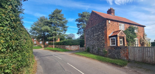
5.2 Key Characteristics and Building Materials
5.2.1 Materials
5.2.2 Overall Character
5.3 Character Areas
5.3.1 Key Characteristics: Hall and Grounds - Zone 1
5.3.2 Key Characteristics: Inholms Road - Zone 2
5.3.3 Key Characteristics: Village Centre - Zone 3
5.3.4 Key Characteristics: Town End Lane - Zone 4
5.3.5 Key Characteristics: Woods Lane - Zone 5
5.3.6 Key Characteristics: Small Paddocks and Fields - Zone 6
5.3.7 Characteristic Zone Maps
5.4 Listed Buildings
5.5 Key Unlisted Buildings
6.1 Introduction
6.2 National and Local Policies and Guidance
6.3 Article 4 Directions
6.4 Building Design
6.5 Publicity and Knowledge Transfer
6.6 Public Realm
6.7 Boundary Treatments
6.7.1 Walls and Fences
6.7.2 Hedges
6.8 Buildings at risk
6.9 Enforcement
7 Appendix 1 – Listed Buildings
8 Appendix 2 – Conservation Area Boundary and Townscape Appraisal Map
1 Introduction
1.1 Conservation Areas
Rushcliffe Borough Council has an obligation under Section 69 of the Planning (Listed Buildings and Conservation Areas) Act 1990 to review, from time to time, its Conservation Area designations.
A Conservation Area, as defined under Section 69, is ‘an area of special architectural or historic interest the character or appearance of which it is desirable to preserve or enhance’.
Flintham Conservation Area was first designated in 1972. Prior to this appraisal of 2023 (adopted September 2025), the most recent appraisal of the Flintham Conservation Area was carried out in 2009.
Section 71 of the Planning (Listed Buildings and Conservation Areas) Act 1990 highlights the local planning authority’s duty to formulate and publish proposals for the preservation and enhancement of the conservation areas. This document, therefore, aims to identify and reaffirm (or redefine) the special architectural or historic interest of the area which warrants its designation.
Conservation Area Appraisals are not, and never have been, tools for to fossilise a place against change, instead, the processes of change which allow places to grow and evolve are recognised as being unavoidable, and it is also recognised that change can be a positive and desirable force. The designation instead allows greater scrutiny and control to manage change to positive effect and to ensure that any changes which require planning permission do not harm, and ideally serve to actively enhance, the existing character of the place.
Flintham Conservation Area: Summary of Special Interest
The approaches to the village vary in character, ranging from narrow lanes lined by hedges to wider roads with verges. Approaching from the South, there are a variety of trees with open views of the village.
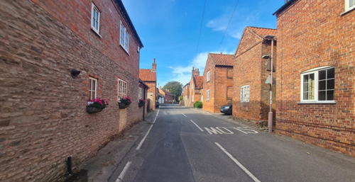
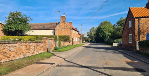
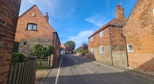
The linear Main Street is distinctive with a consistent level of materials and design. Main Street is defined by buildings or walls built alongside the road which gives the area an enclosed feel.
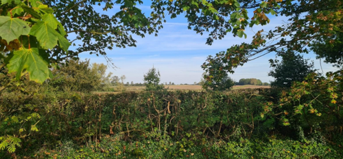
A key feature of the village is Flintham Hall with its surrounding parkland. Although some of this area is used for agriculture it retains its historic character due to mature clumps of trees and individual trees within the fields.
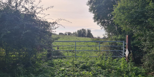
The village is closely bordered by a network of small fields and paddocks.
1.2 The Purpose of a Conservation Area Character Appraisal
The purpose of a Conservation Area Character Appraisal is to:
- Identify and record the special interest of the Conservation Area to ensure there is public awareness and understanding of what is worthy of preservation.
- To define and reassess current boundaries to accurately reflect what is now perceived to be of special interest.
- To identify opportunities to safeguard and enhance the special interest of the Conservation Area.
It should be noted that the content in this document is not a comprehensive account of every significant building, structure, tree, wall, feature, or space. Therefore, any omission should not be assumed to imply that they are of no interest.
Generally, the character and appearance of a Conservation Area will be preserved or enhanced by:
- Providing controls and regulating development through the planning system.
- Applying the extra controls that designation provides over demolition, minor development, and the protection of trees.
- Environmental enhancement schemes and possibly providing financial assistance for the repair and restoration of specific buildings.
- Encouraging public bodies such as the local highways authority or utility companies to take opportunities to improve the street scene through the appropriate design and sensitive sighting of street furniture (and retention of historic features of interest), or the removal of eyesores and street features that have a negative impact such as overhead wires.
1.3 The Planning Policy Context
This appraisal provides a firm basis on which applications for development within the Scarrington Conservation Area would be assessed. It should be read alongside the wider development plan policy framework produced by Rushcliffe Borough Council and other National Planning Policy Guidance documents. The relevant documents include:
- Rushcliffe Local Plan Part 1: Core Strategy, with a specific focus on:
- Policy 10 (Design and Enhancing Local Identity) [in part]
- Policy 11 (Historic Environment)
- Rushcliffe Local Plan Part 2: Development Policies, with a specific focus on:
- Policy 28 (Conserving and Enhancing Heritage Assets)
- Policy 29 (Development Affecting Archaeological Sites)
- The National Planning Policy Framework (NPPF) (Revised -2021)
- The National Planning Practice Guidance (2015 - Subject to Continual Review)
- By Design: Urban Design in the Planning System – Towards Better Practice (2000)
- The Planning (Listed Buildings and Conservation Areas) Act 1990
Flintham Conservation Area: Summary of Key Issues
- None identified
2 Flintham Location and Landscape Setting
Rushcliffe Borough forms the southern tip of Nottinghamshire, which borders Leicestershire. It is predominantly a rural Borough that contains a mixture of city suburbs, market towns and villages. Rushcliffe is located about half a mile South of Nottingham city centre, with the River Trent forming the majority of its northern boundary and the River Soar defining its western boundary.
The A46 (Fosse Way), a distinctive Roman Road, runs through the centre of the Borough and leads to Newark in the North and Leicester in the South. In the northern half of the Borough, the A52 forms Nottingham’s primary transport link to Grantham and the East of England. Junction 24 of the M1 and East Midlands Airport are located about 1 mile from the western border.
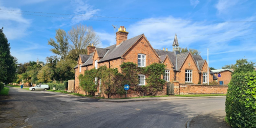
Flintham is located just to the East of the A46 adjacent to the Borough’s northern boundary. The village has a church, pub, school, museum, a community run shop, a sports pavilion with playing field, and a village hall. The A46 forms a barrier between the village and housing located to the West, adjacent to Syerston Airfield. Flintham is located on a slight ridge running East to West.

2.1 The Flintham Conservation Area
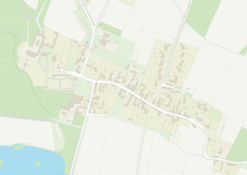
The Flintham Conservation Area is one of Rushcliffe’s largest Conservation Areas and contains the most listed buildings or structures – 39 in total. The Conservation Area has two distinct parts, the core of the village with adjacent small fields and paddocks and Flintham Hall with its parkland and woodland. Areas not included within the conservation area are the housing on Inholms Gardens and areas of large-scale arable farming located to the north of the village.
- Conservation Area Boundary covers: 139.50 hectares (approximate)
- Number of Grade I listed buildings: 2
- Number of Grade II* listed buildings: 0
- Number of Grade II listed buildings: 37
A full list of Flintham Conservation Area’s Listed buildings can be found in Appendix 1. Details accurate as of January 2023.
3 Historical Contexts
3.1 Location and Historic Activities
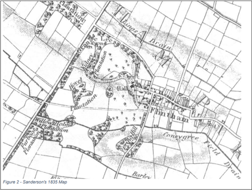
A Roman road, dating from the first century AD, cuts through the parish as can be seen in Figures 2 and 3. The road, which became known as The Fosse Way, follows the line of a pre-Roman trackway and forms the boundary between most communities along its route. Flintham is an exception, indicating that there may have been a settlement here before the Romans upgraded the trackway to a road. The village appears in the Domesday Book of 1086 as Flinteham.
Flintham’s history is intimately linked with the evolution of its principal estate and the families who shaped its character over the centuries. The Thoroton family, established as small landowners in medieval Nottinghamshire, became a prominent local influence. Originally taking their name from the village of Thoroton, the family’s fortunes were notably advanced by Dr. Robert Thoroton (1623–1678), whose celebrated work, Antiquities of Nottinghamshire (1677), highlighted the county’s rich heritage.
A pivotal development occurred when Thomas Thoroton (1636–1695) acquired Kirketon Hall (later known as Screveton Hall) and the manor of Screveton in 1685, establishing it as the family’s principal residence. In the early 18th century, further prosperity was secured when Robert Thoroton (1692–1751) inherited land in Derbyshire, bolstering the family’s wealth through involvement in local mining ventures.
The family's connection with Flintham was cemented in 1789 when Thomas Thoroton (1723–1794) sold the Derbyshire estate, likely to finance the purchase of Flintham House in Nottinghamshire. This transition marked Flintham House’s emergence as the family’s primary seat, a status that has continued through successive generations despite subsequent estate sales in the late 19th and early 20th centuries. The Hildyard family, through marital alliances and inheritances, further enriched the legacy of Flintham, with significant improvements made to the house, its parkland, and the parish church.
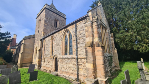
Flintham’s historical narrative is also reflected in its landscape. The hall is set against a backdrop of mature woodland that stretches towards the River Trent, visible from key local routes such as the Fosse Way. The parish church, with origins in the 13th century, retains many historic elements—including a distinctive tower with a pyramidal roof, a 14th-century font, and a variety of later period fixtures—that attest to the enduring legacy of the area’s ecclesiastical and social history.
The appearance of the countryside around Flintham is primarily a result of the enclosure movement from the 16th to the 18th centuries, modified by the requirements of modern farming. The maps below show that while many field boundaries remain unchanged, pressure for more economical farming techniques resulted in larger fields being created. Many of the fields and paddocks immediately adjacent to the village have remained relatively unchanged.
In A Topographical Dictionary of England, Samuel Lewis, (1848), the village is described as containing ‘611 inhabitants… and comprises by admeasurement 2101 acres, whereof 1471 are arable, 420 pasture, and 210 woodland; the soil is a red marl in the lower part of the parish, and in the upper part sandy.’ From the 1860's onwards the number of inhabitants decreased as villagers moved to Nottingham and north Nottinghamshire in search of regular work.
3.2 Archaeology and Scheduled Monuments
There is one scheduled ancient monument in Flintham, the remains of a mud walled dovecote, located South of Main Street at the rear of Cottage Farm and The Broadmarsh. Grid ref: SK7420 4590. Before the use of brick, mud would have been a common building material.
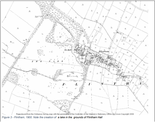
3.3 Historical Mapping
4 Spatial Analysis
The relationship between open spaces and the built form within a conservation area can be central to its character. This section describes the village’s layout, highlighting the significant views, landmarks and historical focal points. The contribution of open green spaces, trees and other natural elements to the conservation area’s character is also described within this section.
4.1 Plan, Form and Layout
The historic maps above show the road layout has remained much the same. There was a footpath running across the Hall grounds at one time being a route into the village, another from Kneeton which led to what is now the Hall’s main drive.
The only notable infill has been along the road that links the village with the A46. As this is slightly set apart from the historic core of the village it has had little impact on the character of the Conservation Area. The village has always had a linear nature with properties being close to the adjacent roads (see Figure 4).
This map is reproduced from Ordnance Survey material with the permission of Ordnance Survey on behalf of the Controller of His Majesty’s Stationary Office © Crown Copyright. Unauthorised reproduction infringes Crown Copyright and may lead to prosecution or civil proceedings. Rushcliffe Borough Council - 100019419
4.2 Landmarks, Focal Points and Views
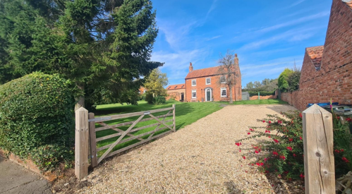
The view from the lane which runs from the corner of Main Street and Inholms Road gives a tantalising glimpse of Flintham Hall, which isn’t readily visible from other parts of the village.
The Townscape Appraisal map illustrates these key views and other views which link the village to the adjacent countryside.
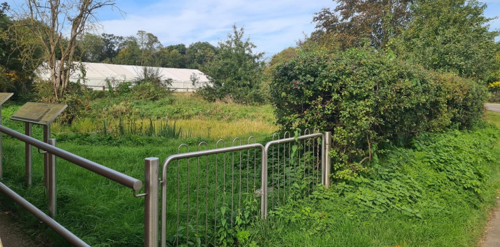
4.3 Open Spaces, Trees and Landscape
The Hall’s grounds are a Registered Park and Garden, giving the feel of a natural English landscape with rolling grassland dotted with trees, lakes and woodlands. However the grounds are predominantly man-made including the lake which was created when the Hall was redeveloped in the mid-19th century.
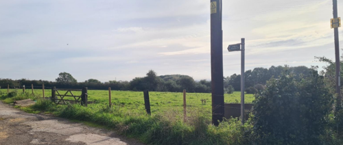
The main approach to the village from the A46 is enhanced by mature woodland to the South and additional tree planting located along the wide verge and the edge of the adjacent public open space to the North. This entrance to the village is a stark contrast to the character of Main Street, which due to the density of housing and its close proximity to the road leaves very little space for many prominent trees.
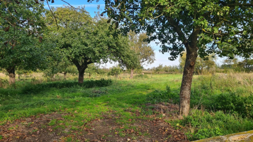
The orchard located on the corner of Main Street and Spring Lane has distinctive timber fencing which enhances the rural character. Woods Lane also has a strong rural character where the property frontages are dominated by hedgerows.
The most prominent and traditional hedging plant is Hawthorn which complements the surrounding countryside. There is some loss of character when non-native plants such as Laurel have been used for hedging in this rural context.
The most significant trees, hedges, open spaces, grass verges and gardens are marked on the Townscape Appraisal map.
Works to Trees
You must contact the Local Planning Authority (LPA), Rushcliffe Borough Council before any works (cutting OR pruning) are carried out to trees within the Scarrington Conservation Area.
Six weeks’ notice is required before any works to trees within the Conservation Area is carried out, even if they are not protected by a Tree Preservation Order (TPO).
If there is a tree which undergoes annual maintenance, include this information with the notice. It may be possible, upon agreement with the tree officer, that only one notice is required to cover the future annual maintenance.
Standard notification forms (a section 211 notice), further information and contact details.
A flow chart of the decision-making process regarding works to trees.
4.4 Public Realm
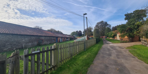
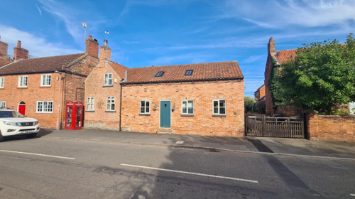
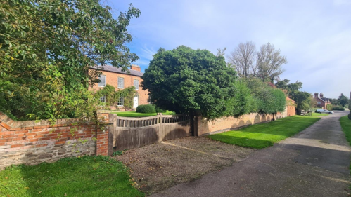
Boundary treatments are particularly important in Flintham. Woods Lane mentioned above is dominated by hedgerows, while Main Street is dominated by red brick and stone walls. These, along with the unusual design of timber fencing around Flintham Hall, all help to define Flintham’s special character.
There are many examples of walls and timber fencing in the village. Many of the walls have either flat brick coping or a triangular brick coping.
Significant walls and hedges are marked on the Townscape Appraisal map.
Surfacing also makes an important contribution to the character of the Conservation Area and a number of properties still show examples of stone cobble paving. Any loss of this paving would drastically reduce the character of each property.
5 Buildings of the Conservation Area and Key Characteristics
5.1 Building Types and Activity
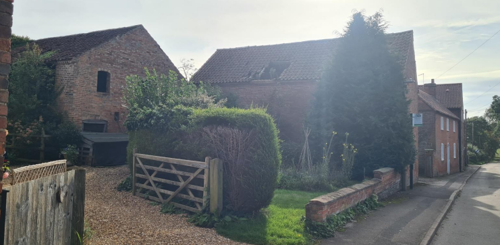
The older buildings in Flintham are a mix of farmhouses, cottages, Georgian houses and outbuildings, many of these can be seen on the historical maps shown in 4.1.
5.2 Key Characteristics and Building Materials
Historically, most building materials in Flintham were sourced locally, as transportation was limited before the arrival of the railways. As a result, bricks were typically produced and used close to their place of manufacture. Roofing materials also reflected local resources, with thatch being common until the widespread adoption of clay pantiles.
The key traditional building materials within the Conservation Area are as follows:
Walls: Red brick is the predominant material, often featuring remnants of stone walls at the base.
Roofs: Clay pantiles are the most common roofing material, with some examples of Welsh slate. Gable ends generally fall into two categories:
- Small parapet gables.
- Plain close verge gables, where the tiles extend to the edge of the brick gable.
- Most chimneys are built into the gable wall.
Windows: Timber sliding sash windows are characteristic, often creating a symmetrical façade. Many retain traditional glazing bars, with arched brick lintels being a distinctive feature.
Doors: Timber doors are typical, with six-panel designs frequently seen on larger properties. Many buildings are positioned close to the road, with doorways often located at the side or rear of the property.
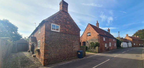
The consistency of materials and overall design, along with variations in individual property layout and scale, complement each other and create an interesting and varied street scene.
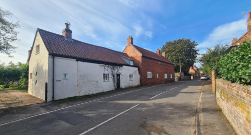
Note the lack of doors facing the road and the differences in gables with parapet gables on the left and a plain close verge on the right of the foreground buildings. The Main Street is dominated by walls.
5.3 Character Areas
5.3.1 Key Characteristics: Hall and Grounds - Zone 1
Key Characteristics / Architectural Features:
This character zone features a picturesque landscape with a lake, open grassland dotted with mature trees, and surrounding woodland with smaller tree clumps. Agricultural fields retain their historic character, enhanced by mature trees and hedgerows that preserve traditional boundaries. The mix of water, greenery, and open vistas creates a sense of seclusion and continuity, reinforcing the area's rural charm within the Conservation Area.
5.3.2 Key Characteristics: Inholms Road - Zone 2
Key Characteristics / Architectural Features:
A tree-lined entrance welcomes visitors to the village, featuring wide grassy verges framed by mature woodland or community open space. This green corridor enhances the rural character and sense of arrival. In contrast, the properties to the north do not contribute to the historic character of the Conservation Area.
5.3.3 Key Characteristics: Village Centre - Zone 3
Key Characteristics / Architectural Features:
The character zone exhibits a high degree of enclosure. This is primarily due to the continuous building frontage and boundary walls directly abutting Main Street and Spring Lane. This layout also creates a strong sense of spatial definition along these thoroughfares.
5.3.4 Key Characteristics: Town End Lane - Zone 4
Key Characteristics / Architectural Features:
The character zone exhibits a high degree of enclosure. This is primarily due to the continuous building frontage and boundary walls directly abutting Main Street and Spring Lane. This layout creates a strong sense of spatial definition along these thoroughfares.
5.3.5 Key Characteristics: Woods Lane - Zone 5
Key Characteristics / Architectural Features:
Woods lane area is characterised by residential development of 1970's origin, providing access to a bridleway connecting Flintham and Syerston. Notable features contributing to the lane's distinct character include: substantial grass verges, established hedgerow boundaries, and generously proportioned front gardens.
5.3.6 Key Characteristics: Small Paddocks and Fields - Zone 6
Key Characteristics / Architectural Features:
This area of the village is enclosed by a network of small fields and paddocks. These small areas of land are important to the village's character. Changing the nature of these small fields into larger ones would negatively impact the village's unique feel and appearance. It's important to keep these small fields to maintain this part of the village's current character.
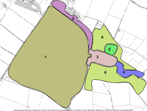
Zone Map showing the area covered by the six zones.
5.4 Listed Buildings
Buildings on the Government’s List of Buildings of Special Architectural or Historic Interest are called ‘Listed’ buildings and are protected by law. Consent is required from Rushcliffe Borough Council before any works of alteration, extension, or demolition can be carried out on any listed building.
Further information can be found in Rushcliffe Borough Council’s publication Listed Buildings in Rushcliffe.
The complete and up-to-date list of the Secretary of State’s Statutory List of Buildings of Special Architectural Interest or Historic Interest.
Names of the Listed Buildings and structures in Flintham Conservation Area (correct as of 2023) are detailed in Appendix 1. All Listed Buildings are shown on the Townscape Appraisal plan, but some smaller structures such as gravestones may not be shown.
There are 39 listed buildings or structures in Flintham all being Grade II apart from the Hall and adjoining terrace wall which is Grade I. All the Listed buildings fall within the Conservation Area.
The Hall was based on an earlier Georgian House which was remodelled in 1851 and encased in Ancaster Stone by the architect T. C. Hine, who was based in Nottingham. The Conservatory is approximately 40 foot high and was modelled on the Crystal Palace. Many of the Hall’s ancillary buildings and structures such as the three lodges, ice house, kennels, the walled gardens and garden urns are also listed.
A complete list of all these buildings and structures is provided in Appendix 3. All listed buildings are shown on the appraisal plan, but some of the smaller structures aren’t shown.

5.5 Key Unlisted Buildings
Contribution to the established character of the place can also come from buildings which are not recognised via listing, or are not old. A plan with all of the positive contributions to the area can be found in Appendix 2 - Conservation Area Boundary and Townscape Appraisal Map.
Almost 50 key unlisted cottages, farmhouses and outbuildings have been identified on the Townscape Appraisal map as having a positive impact on the character of the Conservation Area. The majority of these 18th and 19th Century buildings have a strong relationship with Main Street with many abutting the road or pavements and facing on to the street. This creates a strong sense of place and in a number of instances a sense of enclosure.
6 Generic Management Plan for Conservation Areas in Rushcliffe
6.1 Introduction
In carrying out its planning functions, the Borough Council is required in law to give special attention to the desirability of preserving or enhancing the character or appearance of Conservation Areas. The Management Plan for a Conservation Area is a tool to ensure the special character of the area is preserved and enhanced. The management plans aim to:
- Outline a strategic management proposal for the preservation and enhancement of the Scarrington Conservation Area.
- Act as a guide for professionals and residents alike regarding:
- features of value, worthy of preservation;
- characteristics worthy of preservation;
- opportunities for enhancement;
- development proposals which preserve and enhance the special character of the area.
- Inspire community commitment to conservation principles and reporting.
6.2 National and Local Policies and Guidance
There is a duty to formulate and publish management plans setting out policies and proposals for the preservation and enhancement of Conservation Areas. Many of these policies and proposals are common to all Conservation Areas, and these are set out in this document. The Central Government Guidance and Local policies applicable to Conservation Areas include:
- Rushcliffe Local Plan Part 1: Core Strategy, with a specific focus on:
- Design and Enhancing Local Identity [in part]
- Historic Environment
- Rushcliffe Local Plan Part 2: Development Policies, with a specific focus on:
- Conserving and Enhancing Heritage Assets
- Development Affecting Archaeological Sites
- The National Planning Policy Framework (NPPF), particularly, but not exclusively the chapter on Conserving and Enhancing the Historic Environment.
- The National Planning Practice Guidance (NPPG) (updated 2021 and subject to continual review)
- By Design: Urban Design in the Planning System – Towards Better Practice (2000)
- The Planning (Listed Buildings and Conservation Areas) Act 1990
- Historic England “Historic England Advice Note 1: Conservation Area Designation, Appraisal and Management”
The council will utilise the full range of strategic policy and guidance documents to ensure that development in Flintham Conservation Area is of a standard that enhances the amenity of the local area. The council will always look to use the most up-to-date versions of the document.
Supplementary documents may be issued for individual Conservation Areas where specific policies or proposals are needed.
6.3 Article 4 Directions
There are extra consents required in Conservation Areas. For example, in addition to the general control of development, you will need to get permission for:
- Any additions or alterations to the roof (for example, dormer windows)
- The installation of satellite dishes on chimneys, roofs or walls fronting a highway
- Any extension which extends beyond the side of the original dwelling house
- Any extension of more than one storey that extends beyond the rear wall of the original dwelling house
- Cladding the exterior of the dwelling
- Any demolishing of a building or part of a building that has a volume over 115 cubic metres
Article 4 of the Town and Country Planning (General Permitted Development) Order 1995, allows planning authorities to restrict some permitted development rights within particular areas. This does not necessarily prevent development or change taking place but enables the Local Authority to manage the design and detailing of the works, and potentially grant permission subject to appropriate conditions. The use of Article 4 Directions will be proposed where it is considered appropriate following the completion of each Area Appraisal across the Borough.
Details of Article 4 Directions for Flintham Conservation Area
There are currently no Article 4 Directions for Flintham Conservation Area.
6.4 Building Design
Mimicking the local vernacular is not the only way to ‘fit in’ with the character of a conservation area. National policy makes clear that contemporary designed, provided it is sympathetically designed, cannot be dismissed as an option. Therefore, good contemporary design will be encouraged where it respects the context’s character, scale and massing. This must be demonstrated in the Design and Access Statement submitted with any planning application.
Extensions to buildings in Conservation Areas should respect:
- The key characteristics of the original building, including scale, mass, materials and proportions
- The contextual setting and character of the Conservation Area
Copying like for like can devalue and destroy the ability to “read” historic change, and dilutes our historic heritage. Pastiche designs, incorporating poor imitations of other styles, will be resisted, particularly where they incorporate details which are not locally appropriate. Careful high-quality replication may be required in a few very sensitive locations.
In particularly sensitive locations, such as uniform terraces, exact replication may be necessary to maintain compositional unity. In that case, attention to details, choice of materials and high-quality workmanship are the keynotes. However, in some cases, a direct relationship is not impossible. For example, Flemish Bond brickwork cannot be replicated in cavity walls, and narrow lime mortar joints cannot be replicated in modern metric brickwork.
Where a new building is appropriate, on infill sites or where an existing building detracts from the character of the area, the opportunity should be taken to re-establish the streetscape, reinforce enclosure, open up distant vistas or views of landmarks or hide unsightly views.
“New and old buildings can coexist happily without disguising one as the other, if the design of the new is a response to urban design objectives” (DETR – “By Design”, p19).
As with extensions, good contemporary design which respects local character, and the context of the site will be encouraged.
All new buildings should respond appropriately to the existing frontage and normally follow the established building line. Development or redevelopment will normally be resisted if:
“it blocks important views identified in the individual appraisals, uses important open spaces identified in the appraisals, adversely affects the setting of any Listed or key buildings, fails to maintain or re-establish the streetscape where appropriate dominates its Conservation Area background fails to recognise the context of the site destroys important features identified in the individual appraisals such as boundary walls, fences, hedgerows or trees”
Where the quantity of contemporary schemes in a small area becomes significant and outnumbers older buildings within the area, further contemporary schemes could fundamentally shift the architectural character of the area and thus be harmful, even if well designed as an individual project.
New development that stands out from the background of buildings may be appropriate in exceptional circumstances if it contributes positively as a landmark to enhance the street scene, to highlight a corner or to signal a visual change of direction such as along a curving vista.
Any external lighting should be carefully designed and sited to minimise light pollution.
Energy producing or saving devices are generally welcomed by the Council, but careful consideration is required when these are to be located in a Conservation Area and some may require planning permission. In particular, they should be positioned to minimise their impact on the building and on the local amenity.
6.5 Publicity and Knowledge Transfer
Ambiguity about additional controls within a Conservation Area raises the likelihood of inappropriate developments occurring which may damage the integrity of the conservation area designations.
Efforts have been made to engage local community groups in the development and review of the character appraisals. Empowering communities to define the special architectural and historic interest of the Conservation Area aims to raise awareness.
Whether the appraisal took a community-led or a council-led approach, upon reviewing all Conservation Areas, the public were invited to ask questions and comment during a public consultation. A consultation event also aimed to diminish any ambiguity about restrictions within a Conservation Area and increase the likelihood of sensitive and appropriate developments, maintaining the character of the area.
The council recognise the potential issues of turnover in residency and ownership of properties in the conservation area. Therefore, Rushcliffe Borough Council will periodically use their media outlets to highlight conservation area designations and the significant, related planning controls.
The approach taken within Flintham Conservation Area was Community Led
If there are any queries about conservation areas, please email conservationareas@rushcliffe.gov.uk
6.6 Public Realm
General maintenance and upkeep to the public realm may include fixing damage to roads and pavements, and fixing issues with street lighting. Issues such as these can impact the quality of the Conservation Area.
The council aims to encourage works to the public realm that are in keeping with, or actively enhance the conservation area. Rushcliffe Borough Council can only advise on work within the public realm that does not require planning permission (for example work completed by statutory undertakers, such as the Highways Authority). In these instances, Rushcliffe borough council cannot prevent such work.
Nottinghamshire County Council are responsible for repairs to roads, pavements and street lighting. Report issues of repairs to roads, pavements and street lighting to Nottinghamshire County Council online.
Rushcliffe Borough Council will continue to undertake their duties in maintaining the public realm. Vandalism, fly tipping and street cleaning are all the responsibility of Rushcliffe Borough Council. Report issues to Rushcliffe Borough Council online.
You must contact the Local Planning Authority (LPA), Rushcliffe Borough Council, before any works (cutting OR pruning) are carried out to trees within the Scarrington Conservation Area
Six weeks’ notice is required before any works to trees within the Conservation Area is carried out, even if they are not protected by Tree Preservation Order (TPO).
Standard notification forms (a section 211 notice) - further information and contact details.
A flow chart of the decision-making process regarding works to trees.
6.7 Boundary Treatments
Where there is a proposal for a new boundary treatment to be installed, the council would encourage the use of boundary treatments within the area.
Within conservation areas, planning permission is required to alter, maintain, improve, take down or build any new gate, fence, wall or other enclosure with:
- A height of one metre or more if next to a highway (including a public footpath or bridleway), waterway or open space; or
- A height of two metres or more elsewhere.
Where planning permission is required to remove a wall, Rushcliffe Borough Council will aim to protect those boundary walls and fences that have been identified as positively contributing to the area.
Hedgerows are significant habitats for wildlife in lowland Britain. Regulations are intended to protect important hedges in the countryside. The policy applies to hedges that are more than 20m long, (or less if connected to another hedge) on or adjacent to:
- Land used for agriculture or forestry, including the keeping of horses or donkeys
- Registered common land and village greens
- Local Nature Reserves and Sites of Special Scientific Interest.
The policy does not apply if the hedge is within or on the boundary of the curtilage of a house.
6.8 Buildings at Risk
A few of the important buildings across the various Conservation Areas are currently vacant or not in regular use, which may lead to some being “at risk” of neglect or decay.
The Council will encourage and advise on renovation and repair work that is sensitive to the original or traditional historic character of the building and retains original features. The council will monitor the opportunity and potential for grant aid schemes to encourage the basic maintenance work necessary to ensure that key buildings within the conservation area are structurally sound and weather tight. However, given the current financial climate and outlook, such schemes are unlikely in the short to medium term.
There is a presumption against the demolition of buildings which contribute to the character of the area unless there are exceptional circumstances. It would benefit both the physical form and the function of the Conservation Area if these buildings were repaired, maintained and brought back into use.
Where the poor condition of a building or structure is as a result of neglect and lack of maintenance by its owner there is no requirement for the Borough Council to take its deteriorated condition into account when deciding whether demolition is appropriate. This is to avoid rewarding the deliberate neglect of buildings by representing such action as a way to obtain planning permission for demolition and redevelopment.
6.9 Enforcement
Rushcliffe Borough Council will, from time to time, assess and monitor changes in the appearance and condition of Scarrington Conservation Area. This will ensure that where necessary enforcement action can be taken promptly to deal with problems as they arise.
Where co-operation cannot be gained by any other means, Rushcliffe Borough Council has the ability to use additional enforcement powers to tackle particular issues within conservation areas. The Council may take formal action if the condition of any building (listed or unlisted) which makes a positive contribution to the character of the Conservation Area is considered to be at risk.
The council will work in accordance with their enforcement policy, which aims to provide an efficient enforcement service in support of the Council’s statutory planning service. Rushcliffe Borough Council’s enforcement actions will remain transparent, consistent, and proportionate, as it is recognised that effective controls over unauthorised development assists in conserving the natural and built environment whilst helping to protect the quality of people’s lives and maintaining the Council’s integrity.
7 Appendix 1 – Listed Buildings (as of January 2023)
Grade: 2
Listing entry number: 1243794
National grid reference: SK 74655 45720
Location: Flintham Pinfold, Main Street
Grade: 2
Listing entry number: 1272604
National grid reference: SK 74508 45729
Location: The Mowbray, Main Street
Thatch Cottage and Outbuildings
Grade: 2
Listing entry number: 1243791
National grid reference: SK 74321 45914
Location: Thatch Cottage and Outbuildings, Main Street
Grade: 2
Listing entry number: 1243793
National grid reference: SK 74274 45905
Location: Raspberry Cottage, Main Street
Grade: 2
Listing entry number: 1272705
National grid reference: SK 74263 45912
Location: Netherfield Cottage, Main Street
Bakery Farmhouse and Adjoining Farm Buildings
Grade: 2
Listing entry number: 1243990
National grid reference: SK 74267 45931
Location: Bakery Farmhouse and Adjoining Farm Buildings, Main Street
Manor Farmhouse and Adjoining Farm Buildings
Grade: 2
Listing entry number: 1272602
National grid reference: SK 74176 45961
Location: Manor Farmhouse and Adjoining Farm Buildings, Main Street
Tundyleas Farmhouse and Adjoining Outbuilding
Grade: 2
Listing entry number: 1272602
National grid reference: SK 74190 45992
Location: Tundyleas Farmhouse and Adjoining Outbuilding, Main Street
Farm Buildings and Pigeoncote At College Farm
Grade: 2
Listing entry number: 1272607
National grid reference: SK 74188 46033
Location: Farm Buildings and Pigeoncote At College Farm, Main Street
College Farmhouse with Adjoining Outbuilding, Boundary Wall and Water Pump
Grade: 2
Listing entry number: 1272732
National grid reference: SK 74148 46010
Location: College Farmhouse with Adjoining Outbuilding, Boundary Wall and Water Pump, Main Street
Grade: 2
Listing entry number: 1243827
National grid reference: SK 74124 46008
Location: K6 Telephone Kiosk, Main Street
Grade: 2
Listing entry number: 1244078
National grid reference: SK 74039 45923
Location: Ivy Cottage, Spring Lane
Flintham House and Adjoining Boundary Wall
Grade: 2
Listing entry number: 1243792
National grid reference: SK ref
Location: Flintham House and Adjoining Boundary Wall, Main Street
Water Pump and Trough at The Old Bakehouse
Grade: 2
Listing entry number: 1243982
National grid reference: SK 74109 46022
Location: Water Pump and Trough at The Old Bakehouse, Main Street
Grade: 2
Listing entry number: 1243788
National grid reference: SK 74102 46020
Location: The Old Bakehouse, Main Street
Grade: 2
Listing entry number: 1272606
National grid reference: SK 74080 46022
Location: Forge Cottage, Main Street
Stable Range at Flintham House
Grade: 2
Listing entry number: 1272599
National grid reference: SK 74071 46003
Location: Stable Range at Flintham House, Main Street
Grade: 2
Listing entry number: 1001080
National grid reference: SK 73429 46023
Location: Flintham Hall - Park and Garden
Flintham Hall and Adjoining Terrace Wall
Grade: 1
Listing entry number: 1272727
National grid reference: SK 73839 46104
Location: Flintham Hall And Adjoining Terrace Wall
The Aviaries and Adjoining Garden Walls at Flintham Hall
Grade: 2
Listing entry number: 1272730
National grid reference: SK 73920 45931
Location: The Aviaries and Adjoining Garden Walls at Flintham Hall
Garden House With Adjoining Walls and Potting Sheds at Flintham Hall
Grade: 2
Listing entry number: 1243783
National grid reference: SK 73926 46031
Location: Garden House With Adjoining Walls and Potting Sheds at Flintham Hall
Sundial 120 Metres South East of Flintham Hall
Grade: 2
Listing entry number: 1243782
National grid reference: SK 73868 46038
Location: Sundial 120 Metres South East of Flintham Hall
Fountain 45 Metres Southwest of Flintham Hall
Grade: 2
Listing entry number: 1272729
National grid reference: SK 73810 46068
Location: Fountain 45 Metres Southwest of Flintham Hall
Garden Urn 50 Metres Southwest of Flintham Hall
Grade: 2
Listing entry number: 1243781
National grid reference: SK 73788 46068
Location: Garden Urn 50 Metres Southwest of Flintham Hall
Service Wing, Bakehouse, Cartshed and Stable With Adjoining Water Pump at Flintham Hall
Grade: 2
Listing entry number: 1243779
National grid reference: SK 73864 46137
Location: Service Wing, Bakehouse, Cartshed and Stable With Adjoining Water Pump at Flintham Hall
Grade: 2
Listing entry number: 1243979
National grid reference: SK 74026 46131
Location: Old School House, Inholms Road
Ice House 400 Metres North West of Flintham Hall
Grade: 2
Listing entry number: 1243777
National grid reference: SK 73444 46279
Location: Ice House 400 Metres North West of Flintham Hall
Grade: 2
Listing entry number: 1272652
National grid reference: SK 73433 46599
Location: West Lodge at Flintham Hall
Grade: 2
Listing entry number: 1243785
National grid reference: SK 73928 46380
Location: Tree Lodge, Inholms Road
Stables With Adjoining Forge, Water Pump and Boundary Wall at Flintham Hall
Grade: 2
Listing entry number: 1243778
National grid reference: SK 73852 46173
Location: Stables With Adjoining Forge, Water Pump and Boundary Wall at Flintham Hall
Garden Urn 20 Metres West of Flintham Hall
Grade: 2
Listing entry number: 1272728
National grid reference: SK 73791 46104
Location: Garden Urn 20 Metres West of Flintham Hall
Grade: 1
Listing entry number: 1272726
National grid reference: SK 73882 46104
Location: Church of St Augustine, Church Lane
The Old Vicarage and Adjoining Outbuilding
Grade: 2
Listing entry number: 1243776
National grid reference: SK 73912 46087
Location: The Old Vicarage and Adjoining Outbuilding, Church Lane
Boundary Wall at Church of St Augustine
Grade: 2
Listing entry number: 1243894
National grid reference: SK 73883 46065
Location: Boundary Wall at Church of St Augustine, Church Lane
Garden House with Adjoining Walls and Potting Sheds at Flintham Hall
Grade: 2
Listing entry number: 1243783
National grid reference: SK 73926 46031
Location: Garden House with Adjoining Walls and Potting Sheds at Flintham Hall
Flintham House and Adjoining Boundary Wall
Grade: 2
Listing entry number: 1243792
National grid reference: SK 74090 46001
Location: Flintham House and Adjoining Boundary Wall, Main Street
Grade: 2
Listing entry number: 1272731
National grid reference: SK 73627 45285
Location: The Kennels at Flintham Hall
Grade: 2
Listing entry number: 1243795
National grid reference: SK 73689 45234
Location: Keeper's Lodge, Spring Lane
Home Farmhouse and Adjoining Farm Buildings
Grade: 2
Listing entry number: 1272583
National grid reference: SK 73996 45904
Location: Home Farmhouse and Adjoining Farm Buildings, Spring Lane
*The titles of these listings may not make it clear that all listed buildings always include all attached structures and extensions, regardless of age, and all detached outbuildings built before 1 June 1948 which are, or were at the time of listing, ancillary to the function of the primary listed building and were in the same ownership at the time of listing.
For example, when a house is listed, the listing will apply to extensions, porches, detached historic stables, barns, wash houses, privies etc. Such outbuildings and extensions are only exempt from the provisions of listing where the listing specifically excludes them. Appendix 2 - Conservation Area Boundary and Townscape Appraisal Map.
8 Appendix 2 – Conservation Area Boundary and Townscape Appraisal Map

The Bradmore Townscape Map above shows:
- Conservation area boundary - red line
- Locations of listed buildings (red)
- Locations of key unlisted buildings (purple)
- Open space
- Locations of trees, hedges, and significant hedges and fences
- Viewpoints
Conservation Areas
- Bingham Conservation Area
- East Bridgford Conservation Area
- East Leake Conservation Area
- Hawksworth Conservation Area
- Hickling Conservation Area
- Ruddington Conservation Area
- Thoroton Conservation Area
- Wiverton Conservation Area
- Langar Conservation Area
- West Leake Conservation Area
- Whatton in the Vale Conservation Area
- Costock Conservation Area
- Sutton Bonington Conservation Area
- Upper Saxondale Conservation Area
- Wysall Conservation Area
- Bradmore Conservation Area
- Car Colston Conservation Area
- Scarrington Conservation Area
- Orston Conservation Area
- Flintham Conservation Area
- Edwalton Conservation Area
- Aslockton Conservation Area
- Bunny Conservation Area
- Granby Conservation Area
- Keyworth Conservation Area
- Thrumpton Conservation Area
- Normanton on the Wolds Conservation Area
- Upper Broughton Conservation Area
- Kneeton Conservation Area
- Colston Bassett Conservation Area
- Cropwell Bishop Conservation Area