Car Colston Conservation Area
Car Colston Conservation Area Appraisal and Management Plan April 2023

Contents
1.1 Conservation Areas
1.2 The Purpose of a Conservation Area Character Appraisal
1.3 The Planning Policy Context
2 Car Colston Location and Landscape Setting
2.1 The Car Colston Conservation Area
3.1 Location and Historic Activities
3.2 Archaeology
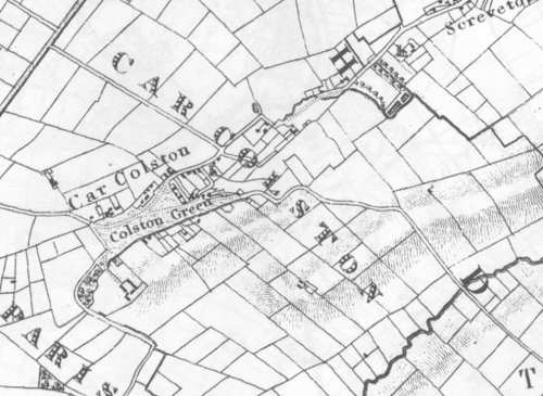
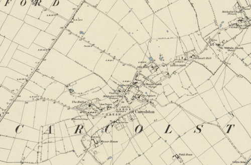
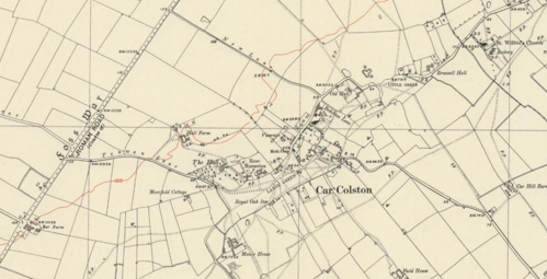
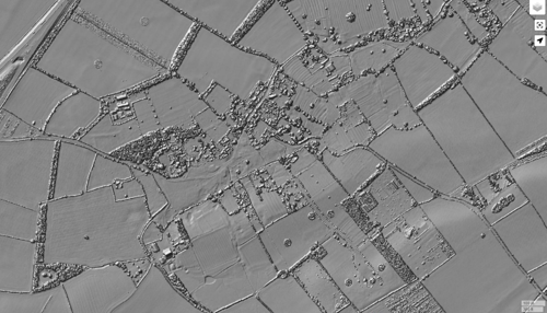
3.3 Historical Mapping
4.1 Plan, Form and Layout
4.2 Landmarks, Focal Points and Views
4.3 Open Spaces, Trees and Landscape
4.3.1 Open Spaces, Trees and Landscape SWOT Analysis
4.4 Public Realm
5 Buildings of the Conservation Area and Key Characteristics
5.1 Building Types and Activity
5.1.1 Building types and Activity SWOT Analysis
5.2 Key Characteristics and Building Materials
5.2.1 Key Characteristics: Large Common
5.2.2 Key Characteristics: Spring Lane around St Mary's Church
5.2.3 Key Characteristics: Little Common
5.2.4 Key Characteristics: Car Colston Hall
5.2.5 Key Characteristics: Surrounding Countryside
5.2.6 Key Characteristics: Mature Landscape
5.3 Key Characteristics Zone Map
5.3.1 Key Characteristics SWOT Analysis
5.4 Listed Buildings
5.5 Key Unlisted Buildings
6.1 Introduction
6.2 National and Local Policies and Guidance
6.3 Article 4 Directions
6.4 Building Design
6.5 Publicity and Knowledge Transfer
6.6 Public Realm
6.7 Boundary Treatments
6.7.1 Walls and Fences
6.7.2 Hedges
6.8 Buildings at risk
6.9 Enforcement
7 Appendix 1 – Listed Buildings (as of April 2023)
8 Appendix 2 – Conservation Area Boundary and Townscape Appraisal Map
1 Introduction
1.1 Conservation Areas
Rushcliffe Borough Council has an obligation under Section 69 of the Planning (Listed Buildings and Conservation Areas) Act 1990 to review, from time to time, its Conservation Area designations.
A Conservation Area, as defined under Section 69, is ‘an area of special architectural or historic interest the character or appearance of which it is desirable to preserve or enhance’.
Prior to this reappraisal of 2023, the most recent appraisal and extension of the Car Colston Conservation Area prior was carried out in
June 2009.
Car Colston Conservation Area: Summary of Special Interest
Common and Pasture Land: Extensive common land to the west and east, with pasture land around the outskirts, providing open green spaces and enhancing the village's rural character.
Cottage Clusters: Informal, small groups of cottages, many with traditional brick walls and pantiled roofs, adding historical charm and architectural cohesion.
Country Houses: Substantial country houses with large private gardens and outbuildings, reflecting historical affluence and maintaining a scenic residential landscape.
St. Mary’s Church: The thirteenth-century St. Mary’s Church, a prominent and historical landmark, adding significant architectural and
cultural value.
Panoramic Views and Vistas: The conservation area offers important interactions with panoramic views and vistas that highlight the rich history and unique character of the village.
Section 71 of the Planning (Listed Buildings and Conservation Areas) Act 1990 highlights the local planning authority’s duty to formulate and publish proposals for the preservation and enhancement of the conservation areas. This document, therefore, aims to identify and
reaffirm (or redefine) the special architectural or historic interest of the area which warrants its designation.
A Conservation Area Appraisals are not, and never have been, tools for to fossilise a place against change, instead, the processes of change which allow places to grow and evolve are recognised as being unavoidable, and it is also recognised that change can be a positive and desirable force. The designation instead allows greater scrutiny and control to manage change to positive effect and to ensure that any changes which require planning permission do not harm, and ideally serve to actively enhance, the existing character of the place.
1.2 The Purpose of a Conservation Area Character Appraisal
The purpose of a Conservation Area Character Appraisal is to:
- Identify and record the special interest of the Conservation Area to ensure there is public awareness and understanding of what is
worthy of preservation. - To define and reassess current boundaries to accurately reflect what is now perceived to be of special interest.
- To identify opportunities to safeguard and enhance the special interest of the Conservation Area.
It should be noted that the content in this document is not a comprehensive account of every significant building, structure, tree, wall, feature, or space. Therefore, any omission should not be assumed to imply that they are of no interest.
Generally, the character and appearance of a Conservation Area will be preserved or enhanced by:
- Providing controls and regulating development through the planning system.
- Applying the extra controls that designation provides over demolition, minor development, and the protection of trees.
- Environmental enhancement schemes and possibly providing financial assistance for the repair and restoration of specific buildings.
- Encouraging public bodies such as the local highways authority or utility companies to take opportunities to improve the street scene through the appropriate design and sensitive sighting of street furniture (and retention of historic features of interest), or the removal of eyesores and street features that have a negative impact such as overhead wires.
Car Colston Conservation Area: Summary of Key Issues
Highways and Transportation – Commuter traffic passing through the village. Difficulty in controlling traffic speeds without
threatening rural village character.
Development that would negatively impact the landscape – Threat of intensive industrialisation of the surrounding fields, pasture and countryside.
1.3 The Planning Policy Context
This appraisal provides a firm basis on which applications for development within the Car Colston Conservation Area would be
assessed. It should be read alongside the wider development plan policy framework produced by Rushcliffe Borough Council and other
National Planning Policy Guidance documents. The relevant documents include:
- Rushcliffe Local Plan Part 1: Core Strategy, with a specific focus on:
- Policy 10 (Design and Enhancing Local Identity) [in part]
- Policy 11 (Historic Environment)
- Rushcliffe Local Plan Part 2: Development Policies, with a specific focus on:
- Policy 28 (Conserving and Enhancing Heritage Assets)
- Policy 29 (Development Affecting Archaeological Sites)
- The National Planning Policy Framework (NPPF) (Revised -2021)
- The National Planning Practice Guidance (2015 - Subject to Continual Review)
- By Design: Urban Design in the Planning System – Towards Better Practice (2000)
- The Planning (Listed Buildings and Conservation Areas) Act 1990
2 Car Colston Location and Landscape Setting
Rushcliffe Borough forms the southern tip of Nottinghamshire, which borders Leicestershire. It is predominantly a rural Borough that contains a mixture of city suburbs, market towns and villages. Rushcliffe is located about half a mile south of Nottingham city centre, with the River Trent forming the majority of its northern boundary and the River Soar defining its western boundary.
The A46, a distinctive Roman Road, runs through the centre of the Borough and leads to Newark in the North and Leicester in the South. In the northern half of the Borough, the A52 forms Nottingham’s primary transport link to Grantham and the East of England. Junction 24 of the M1 and East Midlands Airport are located about 1 mile from the western border.
Car Colston is a village situated ½ mile to the east of the Fosse Way and approximately 2 miles north of Bingham in the South Nottinghamshire Farmlands Character Area.
Car Colston along with Screveton, Flintham, Kneeton and East Bridgford form the Fosse Group of Parishes.

The immediate surroundings of the village are characterised by commons, paddocks, and pasture but beyond this the land is predominantly used for intensive arable farming.
2.1 The Car Colston Conservation Area
The Car Colston Conservation Area covers the entire village, which has a population of 171, according to the 2021 Census. It also includes 13 Listed Buildings or structures and a Scheduled Monument, protected under the Ancient Monuments and Archaeological Areas Act 1979. The scheduled monument comprises of a minor Romano-British villa, a moat, six fishponds, ridge and furrow, a postmill mound, a leat, a boundary bank and ditch, part of the earthwork remains of the shrunken or shifted medieval village, a millpond and a hollow way.
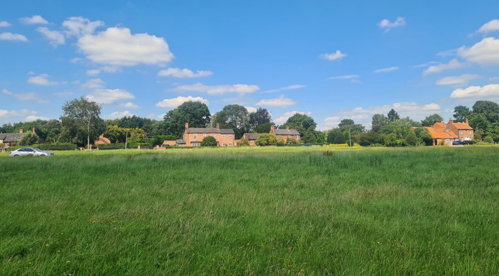
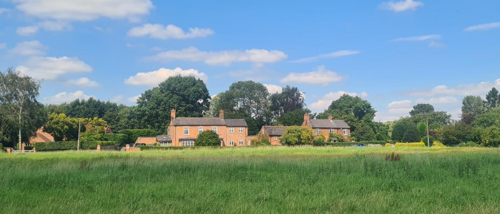
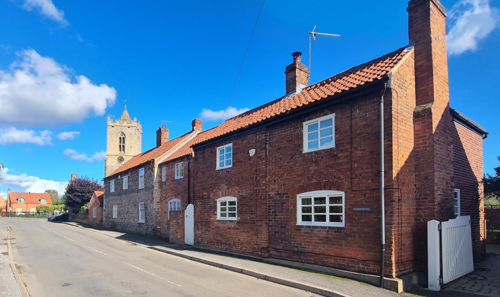
The most obvious features of the village are the two commons, with detached houses standing in their own grounds or informal groupings of small cottages occurring between Large Common and the 13th and 14th century Early English style church of St Mary's. The predominant building material is local clamp-fired red brick with clay pantiled roofs.
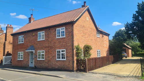
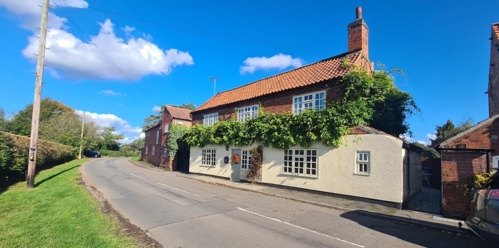
Adjoining Little Common lies Brunsell Hall where remains of the original 1662 Manor House can still be seen. Just off Large Common is Colston House (formerly Beech Close House), which is also Grade 2 Listed, an attractive Country House, built in 1718 and standing in a walled garden.
Another key characteristic of the conservation area is the panoramic views and significant vistas from within the boundary. There is an important interaction within the conservation area and the panoramic views that exist which celebrates the rich history of the village and its unique character.
The boundary was extended in 2025 to preserve and enhance the open and rural character upon entrance to the village along Car Lane in the southeast. The previous appraisal identified this area as Positive Open Space outside of the Conservation Area. This change to the boundary brings it inside of the boundary.
- Conservation Area Boundary covers: 73.1 hectares (approximate)
- Number of Grade 1 listed buildings: 1
- Number of Grade 2* listed buildings: 0
- Number of Grade 2 listed buildings: 12
A full list of Car Colston Conservation Area’s Listed buildings can be found in Appendix 1. Details accurate as of April 2023.
3 Historical Contexts
3.1 Location and Historic Activities
The name Car Colston was derived from a number of sources. Colston was probably from the Old Norse name Kolr and the Saxon word for farm – tun. Thus we get Kolr’s Farm – Kolrstun. The prefix Car was added in the mid thirteenth century, no doubt to distinguish the village from Colston Bassett. The word originated from the old Norse word “Kirkjz” meaning church.
The earliest indications of occupation at Car Colston are of Bronze Age origin. Evidence for the first substantial structures is to be found at Hall Close (to the south and east of what is now Manor Farm), in the south west corner of the village. Here the foundations of a winged Roman villa (a Scheduled Ancient Monument) were discovered. Roman pottery has also been found in the adjacent field.
Other remains of the medieval village are to be seen in a series of earthworks, again in Hall Close. In the south-west corner of this field, is a square moat which once surrounded the Willoughby Manor House. Earthworks in the immediate vicinity of this moat are probably the remains of enclosures around subsidiary manorial buildings. In the northern half of Hall Close are a series of rectangular earthworks defined by depressions which were once lanes and property boundaries around medieval houses and gardens. Here and elsewhere around Car Colston, traces of the ridge and furrow of medieval fields may be distinguished.
The Domesday Survey of 1086 described the village of 'Colestone’ as then consisting of five freeholds of about 40 acres arable with proportionate pasture, and three separate manors, though it made no mention of a church. However, one probably existed some hundred years later. The earliest masonry present in the existing fabric of the church of St Mary’s dates to the 13th century.
Earthwork features in the village are not solely medieval however. In a field north Little Common are two round earth mounds with a pond between them which formed the prospect from which one could appreciate the view of Dr Robert Thoroton’s 17th century residence.
Today the village’s special character lies in its two commons, both registered and managed by the Car Colston Common Land Management Committee on behalf of the owners of the properties adjacent to the common and who own the common rights. The commons permit the views across the surrounding countryside towards the Kneeton Hills over the Fosse Way, also over the vale to Belvoir Castle, eight miles away. Large Common is 16 ½ acres (the largest in the county) and Little Common at the other end of the
village is 5 ½ acres. These originated in the reign of Queen Elizabeth I.
In 1598 the medieval fields were enclosed by the agreement of the larger landowners. The two Commons were set aside in order to provide the cottagers with grazing for their stock. Gates to enclose the Commons were hung at the entrances to the village from May to November.
In the early 17th century, an outbreak of plague reduced the village’s population by a fifth but mercifully the upheavals of the Civil War and the Rebellion of the 1680s left the village relatively unscathed.
It was around this time that Car Colston was the home of Dr Robert Thoroton (1623-78), the celebrated author who wrote first major history of the county, the Antiquities of Nottinghamshire (published in 1677). Dr Thoroton practiced as a physician and lived the life of a country gentleman. Since 1863 his stone coffin, dated 21 November 1678, has been in the church of St Mary at the west end of the north aisle, having been discovered below the surface in 1845. As part of the church’s renovations, the tomb is being made more accessible and a story board of Dr Thoroton’s life displayed together with St Mary’s Thoroton Trail. The Nottinghamshire Heritage Gateway provides more information on his life and contributions.
In the east of the village, Brunsell Hall, or rather, one wing of the three wings that remains, was built in 1662 by Samuel Brunsell, one of Thoroton’s contemporaries. The two thirds of the house was demolished in 1759.
The majority of the buildings which can be seen in the village today date to the 18th and early 19th centuries and include among them grand properties such as Colston House (1719), the Old Hall (1812) and Car Colston Hall (1838). The natural and built form of the village has changed very little through the twentieth century and even today the number of modern buildings is very limited.
3.2 Archaeology
Car Colston is home to a complex, multi-period archaeological site, which includes the remains of a minor Romano-British villa and several other significant features. The site is designated as a Scheduled Monument under the Ancient Monuments and Archaeological Areas Act 1979.
The villa, believed to be of a corridor-type design, is located at SK 71954249, set in permanent pasture. Positioned at the top of a slight rise above the river plain, the villa faces almost due south. The remains of two wing rooms, a corridor, and at least three rear rooms are clearly visible, providing a near-complete outline of the building. The structure's foundations were largely robbed in 1886, with the material used to construct local farm roads. However, a ground plan drawn between 1839-1845 by T.C. Blagg still exists, helping to
confirm the layout.
The villa itself is thought to have been a small, canton-type structure, comprising a series of corner rooms connected by a passageway, with additional rooms extending from the hall. Today, the site is under pasture and situated within an area of medieval ridge and furrow, though no formal excavation has been recorded. The earthworks remain faint but discernible, including depressions along the former wall lines.
Notably, the villa's final stones were removed in the late 19th century, leaving behind depressions in the ground. The height of the ground within the walls suggests that some floor layers may still survive. The corridor or veranda, measuring approximately 3.6 metres wide and 24 metres long, runs east-west, with a range of rooms to the north, ranging from 3.3 metres to 5.7 metres in width. The two larger front rooms, likely measuring 7.1 metres by 7.8 metres each, would have formed a symmetrical façade.
The remaining earthworks are primarily the result of stone robbing that occurred in the late 19th century, leaving trenches along the wall lines that have formed an inverted site. Despite these disturbances, the site's significance remains evident, with the villa's layout and associated features still partially preserved in the landscape.
Nottinghamshire Historic Environment Record - Roman Villa at Car Colston
In the northeast corner of the field south of the Large Green, there are several small depressions that form a series of rectangular shapes. One depression measures 8 metres by 9 metres, and to the south of this is another rectangle, measuring 18 metres by 21 metres, with two raised tongues of land projecting into it. Further south, a larger rectangle, 25 metres by 14 metres, appears to be deeper, as it is cut into the sloping ground. However, the bottom of this depression is roughly at the same level as the other two.
These features are likely the remains of a set of ponds, which would have been fed by a stream flowing along the edge of the Green. However, they are now too shallow to collect water from the stream.
Nottinghamshire Historic Environment Record - Fishponds at Car Colston
Other earthworks exist in Car Colston but are not part of the Scheduled Monument as they are separated from it by modern developments. On the southeast edge of the monument, several ditch-like features run from the modern field boundary. These appear to be relatively recent, as they overlap medieval ridge and furrow, and are included in the scheduling only where they intersect with the designated area
3.3 Historical Mapping
4 Spatial Analysis
The relationship between open spaces and the built form within a conservation area can be central to its character. This section describes the village’s layout, highlighting the significant views, landmarks and historical focal points. The contribution of open green spaces, trees and other natural elements to the conservation area’s character is also described within this section.
4.1 Plan, Form and Layout
Car Colston has a plan form consisting of groups of cottages, large houses and farm buildings which feel to be diffused throughout the village; however, historically, these properties would have focused around the two commons.
The large common becomes a meeting point, supported by the three main roads, Tenman Lane Church Street/Screveton Road and Car Lane, which form a Y shaped junction, converging at the Large Common.
Tenman Lane, which runs from the Fosse Way in the west, passes through the northern edge of Large Common and then forks in two. From this junction Church Street heads north eastwards through the most built-up area of the village and then runs roughly west-east past Little Common (Where it becomes Screveton Road) before continuing on towards Screveton. Car Lane forks eastwards away from the junction and turns southeast out of the village towards Scarrington.
The cottages and houses of Car Colston almost always present their principal elevations to the highway and where they are situated on the edge of a Common, a rough gravel track usually provides vehicular access from the main road.
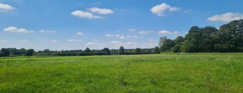
Car Colston is defined by the dispersed nature of the built form. Most of the properties are to the north of Tenman Lane and Car Lane. There are very few properties to the south of these roads, which permits many of the uninterrupted views out into open countryside.
Below is a map that describes the current plan, form and layout of the village/town.

This map is reproduced from Ordnance Survey material with the permission of Ordnance Survey on behalf of the Controller of His Majesty’s Stationary Office © Crown Copyright. Unauthorised reproduction infringes Crown Copyright and may lead to prosecution or civil proceedings.
Rushcliffe Borough Council - 100019419
4.2 Landmarks, Focal Points and Views
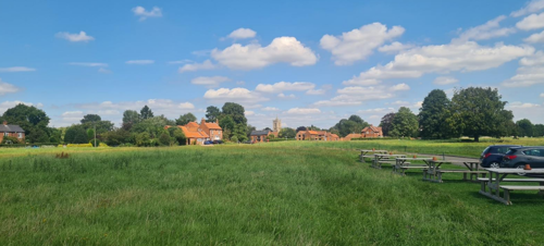
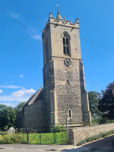
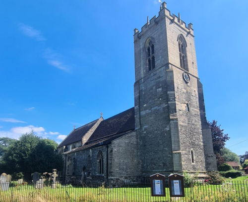
Car Colston’s Commons (The Large Green and Little Green) create a spacious, rural character and allow frequent views of both landmark buildings and the surrounding countryside. From the Large Common the tower of the church of St Mary’s (see Figure 5) and Car Colston Hall are particularly striking focal points.
The tower of St Mary’s Church is a landmark of significant architectural and historic value within the Conservation Area. With elements dating from the 13th century through to the 20th, it encapsulates the church's evolution and serves as a focal point on the village skyline.
The groups of brick cottages situated on the edges of the Commons contribute to the area's visual charm and help frame views across the open green spaces
The buildings dispersed around the commons creates gaps between them which enable views out into open countryside, fields and paddocks, which contribute to the open feel of Car Colston.
Located on the north side of The Green, the early 19th-century whipping post is a rare surviving example of a public punishment device (see Figure 7). Constructed from chamfered oak with iron manacles and a rounded leaded top, it serves as a tangible reminder of past social and judicial practices. Although modest in scale, it holds value as a local landmark and contributes to the historic character of The Green. Listed for its group value, it enhances the area’s historic interest and offers potential for interpretation and public engagement.
4.3 Open Spaces, Trees and Landscape
The Large Common, spanning 16 ½ acres, is the largest area of common land in Nottinghamshire. On the opposite side of the village, the Little Common covers 5 ½ acres of open grassland. These commons date back to the reign of Queen Elizabeth I, when individual strips were cultivated by villagers.
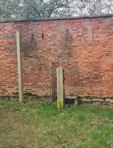
In 1598, the village freeholders agreed to enclose the parish into fields while leaving the greens open for cottagers to graze horses, cows, and geese. These grazing rights remain active today and are managed by the Common Rights Committee, which enforces regulations strictly. At three village exits, posts remain as reminders of where gates once stood.
In addition to Car Colston’s two Commons there are expansive areas of open space around the boundaries of the village which significantly contributes to the rural character of Car Colston, and are intrinsically linked to the village’s historical development as a farming community. Many of these small fields, paddocks and pastures around the village still show evidence of medieval ridge and furrow farming (see Figure 10).
Mature trees play a vital role in shaping the village landscape. They are scattered across the Commons, surrounding fields, and small strips of woodland along field boundaries. Likewise, hedgerows are prominent features, enclosing gardens, outlining fields, and lining highways. Together with grass verges, they contribute to the village's rural charm and scenic approaches.
4.3.1 Open Spaces, Trees and Landscape SWOT Analysis
Strengths - what are the positives of the open spaces, trees, and landscape
- The common land and the unique character of the village that this central feature creates.
- The open feel of the village, which is supported by the dispersed nature of developments within the village.
- The views out into the surrounding landscape.
Weaknesses - what are the negatives of the open spaces, trees, and landscape
- The loss of mature trees through disease, felling or otherwise.
Opportunities – what could make the open spaces, trees, and landscape better?
- None identified
Threats - what would make open spaces, trees and landscapes worse?
- The loss of the open feel the village.
- The intense industrialisation or commercialisation of the surrounding landscape, which would negatively impact the rural feel. The traffic associated with the development would also be problematic village core.
Works to Trees
You must contact the Local Planning Authority (LPA), Rushcliffe Borough Council before any works (cutting OR pruning) are carried out to trees within the Car Colston Conservation Area.
Six weeks’ notice is required before any works to trees within the Conservation Area is carried out, even if they are not protected by a Tree Preservation Order (TPO).
If there is a tree which undergoes annual maintenance, include this information with the notice. It may be possible, upon agreement with the tree officer, that only one notice is required to cover the future annual maintenance.
Standard notification forms (a section 211 notice), further information and contact details.
A flow chart of the decision-making process regarding works to trees.
4.4 Public Realm
While the main roads around Car Colston are surfaced with asphalt, the minor roads and driveways across the commons are gravel tracks, a factor which contributes greatly to the rural quality of the village. There are a number of driveways which also have gravelled surfacing (for example, the Village Hall, see Figure 16).
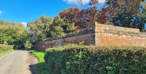
Boundary treatments around the village are varied with examples of hedgerows, brick or stone walls (e.g. the Old Hall (see Figure 13 and Figure 13 and 14) and Colston House), iron railings (e.g. St Mary’s church (see Figure 6) and wooden fencing (e.g. the Old Vicarage) defining property boundaries and enclosing private gardens.
and lavender planting at the edges
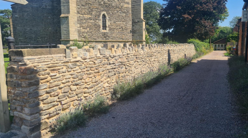
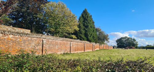
The Garden Wall at the Old Hall (Grade 2 listed), dates to the mid-17th century with additions circa 1812. It is constructed of brick with ashlar detailing. The Garden Wall features a plinth, dentillated cornice, and tapered brick coping, supported by intermediate buttresses in a C-shaped layout. The prominence of the wall upon entrance to the village from the northeast, combined with its historic significance contributes to the character of the area.
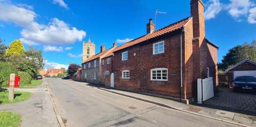
Many properties, particularly the cottages along Church Street, are built directly onto the pavement, eliminating the need for additional boundary features such as walls or fences (see Figure 14. This layout creates a distinctive streetscape which contrasts the openness of the properties which surround the Commons.
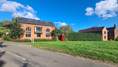
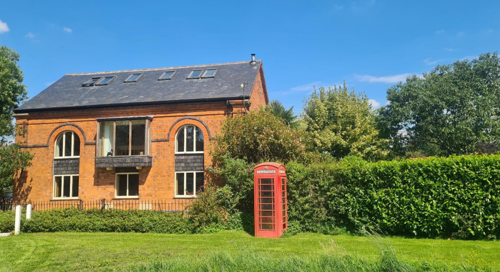
The K6 telephone box, located on the edge of the Large Common, is an example of mid-20th-century British design by Sir Giles Gilbert Scott. Its striking red colour against the green backdrop of the adjacent hedge makes it stand out within the open landscape of the common (see Figure 16).
Similarly, the traditional red post box on Screveton Road (See Figure 15 and Figure 17) contributes to the character of the village. Positioned within the historic streetscape and outside of the Village Hall, it serves as a functional yet symbolic feature.
Situated outside the walled gardens of Beech Close, the 18th-century stocks (Grade 2 Listed), crafted from square oak with a rounded leaded top and two pairs of iron manacles, it is a rare and well-preserved historical feature.
on the pavement, Screveton Road
5 Buildings of the Conservation Area and Key Characteristics
5.1 Building Types and Activity
The buildings of Car Colston are predominantly a mixture of 17th, 18th and 19th century country houses, cottages, barns and outbuildings, all of which reflect its agricultural roots, and showcase the vernacular style and materials typical of rural Nottinghamshire. In addition to these there are occasional examples of earlier structures such as the 13th century (but predominantly 14th century) St Mary’s church.
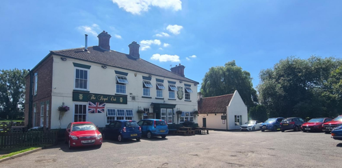
Also of note is The Royal Oak pub, a building that is over 200 years old (see Figure 18). It is believed by some to have origins as a hosiery factory. This is suggested by the distinctive vaulted brick ceiling in the bar, which appears designed to support the weight of textile machinery above.
The 20th century timber Cricket Pavilion (see Figure 19), located within the village's scenic setting, has recently undergone refurbishment. The modernisation has enhanced its facilities, ensuring it meets the needs of the community and supports the development of local cricket, including opportunities for juniors and women, creating social value.

Many of the above structures can be seen on the historical maps. More recent infill buildings have generally remained sympathetic to the village’s traditional character.
5.1.1 Building types and Activity SWOT Analysis
Strengths - what activities/places can you go that make the village/town great?
- The common land areas provide significant amenity value for both recreational and community use.
- A well-maintained network of footpaths and tracks offers recreational opportunities and enhances the rural character.
- The Village Hall is a well-used facility.
- The village benefits from retaining key amenities, including a Church and a Public House.
Weaknesses - what activities/places exist that detract from making the village/town great?
- Commuter traffic passing through the village disrupts its tranquillity, occasionally at speed.
Opportunities - what activities/places could exist that would village/town even better?
- Strengthening collaboration between the common land management committee and other residents to preserve shared spaces.
Threats - what activities/places would make village/town worse?
- Modern in-fill development buildings out of character or diminishing the dispersed feel of the village.
5.2 Key Characteristics and Building Materials
Traditional building materials were largely locally sourced. Bricks for example, were not transported far from where they were made, with most villages having their own brick pit and yard. This led to interesting village-specific sizes, colours, and styles of brickwork. Roofs would have been made from local materials such as thatch until clay pantiles became popular.
5.2.1 Key Characteristics: Entrance and Current Settlement - Large Common (Zone 1)
The Large Common is a significant feature within the Conservation Area, encompassing 16½ acres of rough grassland. It includes a well-maintained cricket field with a traditional pavilion, serving as a focal point for local community events and recreational activities.
Materials:
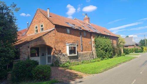
Walls: Dominated by orange/red brick. Brick walls are occasionally rendered. This character area includes Manor Cottages (formerly The Manor House and subsequently extended and converted into two cottages) which is the only example of a timber framed wall in the village.
Roofs: Dominated by orange clay pantiles with occasional examples of plain tile or slate roofs. Gable ends are mostly plain close verge where the tiles run to the edge of the brick gables but there are also a few examples of parapet gables. Chimney stacks are positioned either on gable ends or centrally on roof ridges.
Windows: Traditional windows which are still evident within the village are timber framed with small panes.
Key Characteristics / Architectural Features:
The Large Common is relatively open with few trees, offering unobstructed views across the landscape. This openness enhances the feeling of space and allows for panoramic views both within and beyond the area.
Around the Common are clusters of red brick cottages, characteristic of the area. Many of these cottages are accessed by gravel drives, contributing to the rural aesthetic of the area. The historic Colston House, set within its private grounds, adds the historical narrative of the landscape. This country house, along with the Royal Oak Public House and the Manor Farm buildings, reflects the historical development and socio-economic background of the area.
Properties in and around the Large Common are occasionally defined by well-kept hedgerows or traditional brick and stone walls as their boundary, which add to the rural charm and historical continuity of the landscape.
5.2.2 Key Characteristics: Spring Lane around St Mary's Church (Zone 2)
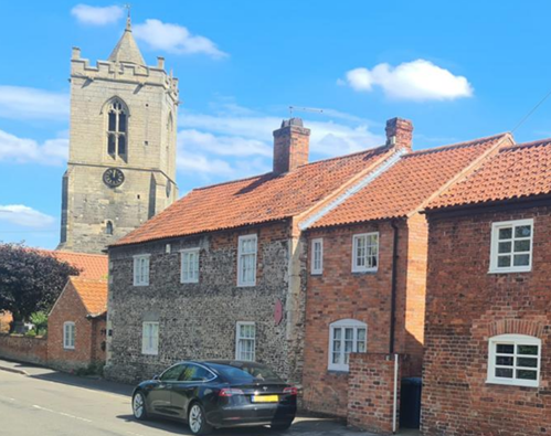
The area surrounding St Mary’s Church on Spring lane is a quintessential example of the village’s historical charm, featuring a mix of traditional and more contemporary buildings. The street is anchored by a row of traditional red brick cottages that front directly onto the pavement, creating a cohesive and picturesque streetscape.
Materials:
Walls: While red/orange brick dominates the street scene, there are occasional examples of stone walled buildings in addition to The Church of St Mary’s. Walls often feature decorative brick cornicing and/or embellishments such as blue brick or dressed stone detailing. Some of the brick walls have been rendered.
Roofs: Gabled ends are mostly close verge, with the material being predominantly clay pantile or clay tile. Hipped roofs are visible within this character area, although not characteristic of the area. Dormer windows are a also evident throughout the village, but noticeable within this character area.
Windows: Traditional windows which are still evident within character area remain as timber framed with small panes. There are a few which have arched top.
Key Characteristics / Architectural Features:
On the east side of Spring Lane the dominant feature is the church and churchyard of St Mary’s, a key landmark that that forms the basis of historical value and contributes to the architectural significance of the area.
The red brick cottages are a testament to the local building traditions and contribute to the street’s historic character.
The west side of Screveton Road presents a more varied architectural landscape. Here, the 20th century Wilmot Close houses and the Village Hall introduce more modern elements to the area. Additionally, a converted stone and brick barn exemplifies adaptive reuse of historical structures, blending old and new. The Old Vicarage, set back from the highway set behind private gardens, further enriches the architectural diversity and visual depth of the street.
5.2.3 Key Characteristics: Little Common (Zone 3)
Little Common is a 5½-acre expanse of rough grassland that serves as a green and open communal space within the conservation area.
Materials:
Walls: Similar to the character area around St Mary Chuch on Screveton Road, red/orange brick are predominant, there are occasional rendered brick walls. Otherwise, walls often feature decorative brick cornicing and/or embellishments with blue brick.
Roofs: Dominated by orange clay pantiles with occasional examples of plain tile or slate roofs. Dormer windows are common within this character area.
Key Characteristics / Architectural Features:
This area continues the tranquil setting of the rural atmosphere, enhanced by its natural landscape and the surrounding properties.
Properties around the Little Common are set within substantial private gardens with small outbuildings. These properties, with their significant garden spaces, contribute to the open and spacious feel of the area, reinforcing its rural character. The presence of well-maintained brick walls, hedgerows, and informal planting defines the boundaries of many of these properties, adding to the aesthetic and historical value of the area. This select variety of boundary treatments adds to the area's visual interest and historical continuity.
This common area allows for frequent and expansive views out to the surrounding countryside, enhancing the sense of openness and connection to the natural landscape.
5.2.4 Key Characteristics: Car Colston Hall (Zone 4)
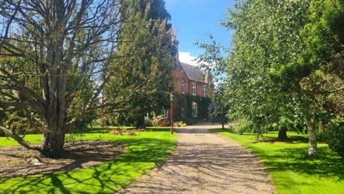
Car Colston Hall is a Tudor Revival style mansion, dating back to circa 1838 and built for Reverend J. Girardot. The Hall, along with its accompanying outbuildings, is set within an expansive parkland that includes extensive wooded areas, creating a picturesque and historically rich environment.
Materials:
Walls: Brick walls, the structure of which are irregular in plan and comprises two storeys plus attics, organized into three bays.
Roofs: The hall boasts three gable and three ridge stacks, some of which are grouped and partly external, adding to the building's historic charm.
Windows: The windows are cross-mullioned casements, typical of the Tudor Revival style.
Doors: Features a projecting central bay with a stepped coped parapet and a four-centred arched doorway on the west side.
Key Characteristics / Architectural Features:
Car Colston Hall exemplifies the Tudor Revival style, characterised by its use of brick with patterned plain tile roofs and ashlar dressings.
In addition to the details outlined to the left, the building features a range of architectural details, including a plinth, ashlar quoins and copings, a first-floor lintel band, a string course, and coped gables with kneelers.
5.2.5 Key Characteristics: Surrounding Countryside (Zone 5)
Key Characteristics / Architectural Features:
Arable Fields and Pasture Land: representative of the traditional and ongoing agricultural practices that define the rural character of the area.
Copses and Mature Trees: Enhancing the natural beauty and biodiversity of the landscape.
Scheduled Ancient Monument (Hall Close): This area is notable for its variety of historic earthworks. These ancient earthworks offer a glimpse into the region's past, highlighting its long-standing agricultural and settlement history.
Hedgerows and Fencing: Traditional boundary treatments that preserve the countryside’s character and ecological integrity. In 2024, the boundary was expanded to include more countryside. This was to preserve and enhance the character of this entrance to the village along Car Lane.
Small Ponds: Contributing to the area's ecological richness and supporting diverse wildlife.
5.2.6 Key Characteristics: Mature Landscape (Zone 6 )
The Mature Landscape within this character area consists of estate land historically associated with the larger properties in the village. This area features paddocks with mature trees and various landscape elements, creating a picturesque and historically rich environment.
Key Characteristics / Architectural Features:
The paddocks contribute to the rural character and provide an open, pastoral landscape.
Mature Trees: Scattered throughout the paddocks are mature trees, which enhance the aesthetic value and ecological diversity of the landscape. These trees are significant for their age and size, providing important habitats for wildlife.
The pond adds to the ecological richness of the landscape, supporting a variety of life and providing water sources for animals.
5.3 Key Characteristics Zone Map

5.3.1 Key Characteristics SWOT Analysis
Strengths – what is good about most existing buildings /streetscape that contributes to the character of the Conservation Area?:
- Distinctive open layout of the village shaped by its common land areas.
- A number of historic buildings that contribute to architectural and cultural interest to the village.
- Good network of well-maintained footpaths and tracks in and around the village with amenity value, all simultaneously contribute to its rural character.
Weaknesses – what is not so good about most existing buildings / the streetscape that detracts from the character of the Conservation Area?
- none identified
Opportunities – what could make existing buildings (or new builds) look good and contribute to the character of the area?
- none identified
Threats – what could make existing buildings (or new builds) look worse and detract from the character of the area?
- The development of solar farms and the associated construction traffic as a consequence.
5.4 Listed Buildings
Buildings on the Government’s List of Buildings of Special Architectural or Historic Interest are called “Listed” buildings and are protected by law. Consent is required from Rushcliffe Borough Council before any works of alteration, extension, or demolition can be carried out on any listed building.
Further information can be found in Rushcliffe Borough Council’s publication Listed Buildings in Rushcliffe.
There is also the complete and up-to-date list of the Secretary of State’s Statutory List of Buildings of Special Architectural Interest or Historic Interest.
Names of the Listed Buildings and structures in Car Colston Conservation Area (correct as of April 2023) are detailed in Appendix 1. All Listed Buildings are shown on the Townscape Appraisal plan, but some smaller structures such as gravestones may not be shown.
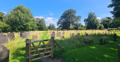
Car Colston boasts several notable listed buildings, including St. Mary’s Church (Grade 1) (see Figure 25). With origins spanning the 13th to 16th centuries, featuring significant restorations in 1911. Highlights include its 14th-century tower with a crenelated parapet and spire, ornate chancel windows with reticulated tracery, and mid-14th-century nave arcades renowned for its tall mid-14th-century chancel and intricate window tracery.
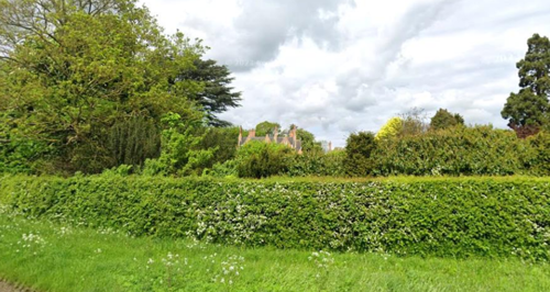
Other highlights include Car Colston Hall (Grade 2), built in 1838 in the Tudor Gothic Revival style. While there is limited visibility of the hall from the village centre, the hall is partially visible over its boundary hedge on approach to the village.
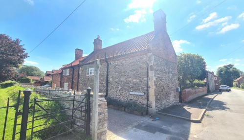
There is also Brunsell Hall (Grade 2), a surviving portion of a 1662 H-plan brick manor house, two-thirds of which was demolished in 1759. The village also features more modest listed structures, such as the stone-walled 18th-century Martin’s Cottage and a 19th-century wooden whipping post complete with iron manacles and a leaded top
5.5 Key Unlisted Buildings
Contribution to the established character of the place can also come from buildings which are not recognised via listing, or are not old. The Car Colston Conservation Area includes a number of unlisted buildings that make a positive contribution to the character and appearance of the Conservation Area. This may be because of their age, architectural style, former function, or general contribution to the variety of the townscape. A plan with all of the positive contributions to the area can be found in Appendix 2 - Conservation Area Boundary and Townscape Appraisal Map.
6 Generic Management Plan for Conservation Areas in Rushcliffe
6.1 Introduction
In carrying out its planning functions, the Borough Council is required in law to give special attention to the desirability of preserving or enhancing the character or appearance of Conservation Areas. The Management Plan for a Conservation Area is a tool to ensure the special character of the area is preserved and enhanced. The management plans aim to:
- Outline a strategic management proposal for the preservation and enhancement of the Car Colston Conservation Area.
- Act as a guide for professionals and residents alike regarding:
- features of value, worthy of preservation;
- characteristics worthy of preservation;
- opportunities for enhancement;
- development proposals which preserve and enhance the special character of the area.
- Inspire community commitment to conservation principles and reporting.
6.2 National and Local Policies and Guidance
There is a duty to formulate and publish management plans setting out policies and proposals for the preservation and enhancement of Conservation Areas. Many of these policies and proposals are common to all Conservation Areas, and these are set out in this document. The Central Government Guidance and Local policies applicable to Conservation Areas include:
- Rushcliffe Local Plan Part 1: Core Strategy, with a specific focus on:
- Design and Enhancing Local Identity [in part]
- Historic Environment
- Rushcliffe Local Plan Part 2: Development Policies, with a specific focus on:
- Conserving and Enhancing Heritage Assets
- Development Affecting Archaeological Sites
- The National Planning Policy Framework (NPPF), particularly, but not exclusively the chapter on Conserving and Enhancing the Historic Environment.
- The National Planning Practice Guidance (NPPG) (updated 2021 and subject to continual review)
- By Design: Urban Design in the Planning System – Towards Better Practice (2000)
- The Planning (Listed Buildings and Conservation Areas) Act 1990
- Historic England “Historic England Advice Note 1: Conservation Area Designation, Appraisal and Management”
The council will utilise the full range of strategic policy and guidance documents to ensure that development in Car Colston Conservation Area is of a standard that enhances the amenity of the local area. The council will always look to use the most up-to-date versions of the document.
Supplementary documents may be issued for individual Conservation Areas where specific policies or proposals are needed.
6.3 Article 4 Directions
There are extra consents required in Conservation Areas. For example, in addition to the general control of development, you will
need to get permission for
- Any additions or alterations to the roof (for example, dormer windows)
- The installation of satellite dishes on chimneys, roofs or walls fronting a highway
- Any extension which extends beyond the side of the original dwelling house
- Any extension of more than one storey that extends beyond the rear wall of the original dwelling house
- Cladding the exterior of the dwelling
- Any demolishing of a building or part of a building that has a volume over 115 cubic metres
Article 4 of the Town and Country Planning (General Permitted Development) Order 1995, allows planning authorities to restrict
some permitted development rights within particular areas. This does not necessarily prevent development or change taking place
but enables the Local Authority to manage the design and detailing of the works, and potentially grant permission subject to appropriate conditions. The use of Article 4 Directions will be proposed where it is considered appropriate following the completion of each Area Appraisal across the Borough.
Details of Article 4 Directions for Car Colston Conservation Area
There are currently no Article 4 Directions for Car Colston Conservation Area.
6.4 Building Design
Mimicking the local vernacular is not the only way to ‘fit in’ with the character of a conservation area. National policy makes clear that contemporary designed, provided it is sympathetically designed, cannot be dismissed as an option. Therefore, good contemporary design will be encouraged where it respects the context’s character, scale and massing. This must be demonstrated in the Design and Access Statement submitted with any planning application.
Extensions to buildings in Conservation Areas should respect:
- The key characteristics of the original building, including scale, mass, materials and proportions
- The contextual setting and character of the Conservation Area
Copying like for like can devalue and destroy the ability to “read” historic change, and dilutes our historic heritage. Pastiche designs, incorporating poor imitations of other styles, will be resisted, particularly where they incorporate details which are not locally appropriate. Careful high-quality replication may be required in a few very sensitive locations.
In particularly sensitive locations, such as uniform terraces, exact replication may be necessary to maintain compositional unity. In that case, attention to details, choice of materials and high-quality workmanship are the keynotes. However, in some cases, a direct relationship is not impossible. For example, Flemish Bond brickwork cannot be replicated in cavity walls, and narrow lime mortar joints cannot be replicated in modern metric brickwork.
Where a new building is appropriate, on infill sites or where an existing building detracts from the character of the area, the opportunity should be taken to re-establish the streetscape, reinforce enclosure, open up distant vistas or views of landmarks or hide unsightly views.
“New and old buildings can coexist happily without disguising one as the other, if the design of the new is a response to urban design objectives” (DETR – “By Design”, p19).
As with extensions, good contemporary design which respects local character, and the context of the site will be encouraged.
All new buildings should respond appropriately to the existing frontage and normally follow the established building line. Development or redevelopment will normally be resisted if:
“it blocks important views identified in the individual appraisals, uses important open spaces identified in the appraisals, adversely affects the setting of any Listed or key buildings, fails to maintain or re-establish the streetscape where appropriate dominates its Conservation Area background fails to recognise the context of the site destroys important features identified in the individual appraisals such as boundary walls, fences, hedgerows or trees”
Where the quantity of contemporary schemes in a small area becomes significant and outnumbers older buildings within the area, further contemporary schemes could fundamentally shift the architectural character of the area and thus be harmful, even if well designed as an individual project.
New development that stands out from the background of buildings may be appropriate in exceptional circumstances if it contributes positively as a landmark to enhance the street scene, to highlight a corner or to signal a visual change of direction such as along a curving vista.
Any external lighting should be carefully designed and sited to minimise light pollution.
Energy producing or saving devices are generally welcomed by the Council, but careful consideration is required when these are to be located in a Conservation Area and some may require planning permission. In particular, they should be positioned to minimise their impact on the building and on the local amenity.
6.5 Publicity and Knowledge Transfer
Ambiguity about additional controls within a Conservation Area raises the likelihood of inappropriate developments occurring which may damage the integrity of the conservation area designations.
Efforts have been made to engage local community groups in the development and review of the character appraisals. Empowering communities to define the special architectural and historic interest of the Conservation Area aims to raise awareness.
Whether the appraisal took a community-led or a council-led approach, upon reviewing all Conservation Areas, the public were invited to ask questions and comment during a public consultation. A consultation event also aimed to diminish any ambiguity about restrictions within a Conservation Area and increase the likelihood of sensitive and appropri Rushcliffe Borough Council will periodically use their media outlets to highlight conservation area designations and the significant,
related planning controls.
The approach taken within Car Colston Conservation Area was a Council Led with some community input. The consultation period took place between the following dates 19/2/2025 – 16/03/202
The date of the Consultation Event 05/03/2025
If there are any queries about conservation areas, please email conservationareas@rushcliffe.gov.uk
6.6 Public Realm
General maintenance and upkeep to the public realm may include fixing damage to roads and pavements, and fixing issues with street lighting. Issues such as these can impact the quality of the Conservation Area.
The council aims to encourage works to the public realm that are in keeping with, or actively enhance the conservation area. Rushcliffe Borough Council can only advise on work within the public realm that does not require planning permission (for example work completed by statutory undertakers, such as the Highways Authority). In these instances, Rushcliffe borough council cannot prevent such work.
Nottinghamshire County Council are responsible for repairs to roads, pavements and street lighting. Report issues of repairs to roads, pavements and street lighting to Nottinghamshire County Council online.
Rushcliffe Borough Council will continue to undertake their duties in maintaining the public realm. Vandalism, fly tipping and street cleaning are all the responsibility of Rushcliffe Borough Council. Report issues to Rushcliffe Borough Council online.
You must contact the Local Planning Authority (LPA), Rushcliffe Borough Council, before any works (cutting OR pruning) are carried out to trees within the Car Colston Conservation Area
Six weeks’ notice is required before any works to trees within the Conservation Area is carried out, even if they are not protected by Tree Preservation Order (TPO).
Standard notification forms (a section 211 notice) - further information and contact details.
A flow chart of the decision-making process regarding works to trees.
6.7 Boundary Treatments
Where there is a proposal for a new boundary treatment to be installed, the council would encourage the use of boundary treatments within the area.
Within conservation areas, planning permission is required to alter, maintain, improve, take down or build any new gate, fence, wall or other enclosure with:
- A height of one metre or more if next to a highway (including a public footpath or bridleway), waterway or open space; or
- A height of two metres or more elsewhere.
Where planning permission is required to remove a wall, Rushcliffe Borough Council will aim to protect those boundary walls and fences that have been identified as positively contributing to the area.
Hedgerows are significant habitats for wildlife in lowland Britain. Regulations are intended to protect important hedges in the countryside. The policy applies to hedges that are more than 20m long, (or less if connected to another hedge) on or adjacent to:
- Land used for agriculture or forestry, including the keeping of horses or donkeys
- Registered common land and village greens
- Local Nature Reserves and Sites of Special Scientific Interest.
The policy does not apply if the hedge is within or on the boundary of the curtilage of a house.
6.8 Buildings at risk
A few of the important buildings across the various Conservation Areas are currently vacant or not in regular use, which may lead to some being “at risk” of neglect or decay.
The Council will encourage and advise on renovation and repair work that is sensitive to the original or traditional historic character of the building and retains original features. The council will monitor the opportunity and potential for grant aid schemes to encourage the basic maintenance work necessary to ensure that key buildings within the conservation area are structurally sound and weather tight. However, given the current financial climate and outlook, such schemes are unlikely in the short to medium term.
There is a presumption against the demolition of buildings which contribute to the character of the area unless there are exceptional circumstances. It would benefit both the physical form and the function of the Conservation Area if these buildings were repaired, maintained and brought back into use.
Where the poor condition of a building or structure is as a result of neglect and lack of maintenance by its owner there is no requirement for the Borough Council to take its deteriorated condition into account when deciding whether demolition is appropriate. This is to avoid rewarding the deliberate neglect of buildings by representing such action as a way to obtain planning permission for demolition and redevelopment.
6.9 Enforcement
Rushcliffe Borough Council will, from time to time, assess and monitor changes in the appearance and condition of Car Colston Conservation Area. This will ensure that where necessary enforcement action can be taken promptly to deal with problems as they arise.
Where co-operation cannot be gained by any other means, Rushcliffe Borough Council has the ability to use additional enforcement powers to tackle particular issues within conservation areas. The Council may take formal action if the condition of any building (listed or unlisted) which makes a positive contribution to the character of the Conservation Area is considered to be at risk.
The council will work in accordance with their enforcement policy, which aims to provide an efficient enforcement service in support of the Council’s statutory planning service. Rushcliffe Borough Council’s enforcement actions will remain transparent, consistent, and proportionate, as it is recognised that effective controls over unauthorised development assists in conserving the natural and built environment whilst helping to protect the quality of people’s lives and maintaining the Council’s integrity.
7 Appendix 1 – Listed Buildings
Grade: 1
Listing entry number: 1045667
National grid reference: SK 72082 43037
Location: Church of St Mary, Church Street
Group of 3 headstones 1 Metre South of South Aisle at Church of St Mary
Grade: 2
Listing entry number: 1243014
National grid reference: SK 72086 43023
Location: Group of 3 headstones 1 Metre South of South Aisle at Church of St Mary, Church Street
Grade: 2
Listing entry number: 1045668
National grid reference: SK 72032 43003
Location: Martin's Cottage, Church Street
Grade: 2
Listing entry number: 1370113
National grid reference: SK 72083 42493
Location: Whipping Post, Large Green
Grade: 2
Listing entry number: 1045671
National grid reference: SK 71640 42813
Location: The Hall, Tenman Lane
Manor Cottages Numbers 1 and 2
Grade: 2
Listing entry number: 1272933
National grid reference: SK 71706 42441
Location: Manor Cottages Numbers 1 and 2, Large Green
Brunsall Hall and Outbuildings
Grade: 2
Listing entry number: 1243473
National grid reference: SK 72620 43292
Location: Brunsall Hall and Outbuildings, Screveton Road
Grade: 2
Listing entry number: 1370115
National grid reference: SK 72607 43286
Location: Water Pump at Brunsall Hall
Grade: 2
Listing entry number: 1243373
National grid reference: SK 72238 43192
Location: The Old Hall, Screveton Road
Garden Wall, Boundary Wall and Adjoining Shed at the Old Hall
Grade: 2
Listing entry number: 1045670
National grid reference: SK 72197 43179
Location: Garden Wall, Boundary Wall and Adjoining Shed at the Old Hall, Screveton Road
Grade: 2
Listing entry number: 1370114
National grid reference: SK 72042 42682
Location: White Gates, Large Green
Beech Close and Attached Outbuildings
Grade: 2
Listing entry number: 1243175
National grid reference: SK 72112 42894
Location: Beech Close and Attached Outbuildings, Large Green
Boundary Wall and Gates at Beech Close
Grade: 2
Listing entry number: 1045669
National grid reference: SK 72151 42852
Location: Boundary Wall and Gates at Beech Close, Large Green
*The titles of these listings may not make it clear that all listed buildings always include all attached structures and extensions, regardless of age, and all detached outbuildings built before 1 June 1948 which are, or were at the time of listing, ancillary to the function of the primary listed building and were in the same ownership at the time of listing.
For example, when a house is listed, the listing will apply to extensions, porches, detached historic stables, barns, wash houses, privies etc. Such outbuildings and extensions are only exempt from the provisions of listing where the listing specifically excludes them.
8. Appendix 2 - Conservation Area Boundary and Townscape Appraisal Map

The Car Colston Townscape Map above shows:
- Conservation Area boundary - red line
- Locations of listed buildings (red)
- Locations of key unlisted buildings (purple)
- Open space
- Locations of trees, hedges, and significant hedges and fences
- Viewpoints
Conservation Areas
- Bingham Conservation Area
- East Bridgford Conservation Area
- East Leake Conservation Area
- Hawksworth Conservation Area
- Hickling Conservation Area
- Ruddington Conservation Area
- Thoroton Conservation Area
- Wiverton Conservation Area
- Langar Conservation Area
- West Leake Conservation Area
- Whatton in the Vale Conservation Area
- Costock Conservation Area
- Sutton Bonington Conservation Area
- Upper Saxondale Conservation Area
- Wysall Conservation Area
- Bradmore Conservation Area
- Car Colston Conservation Area
- Scarrington Conservation Area
- Orston Conservation Area
- Flintham Conservation Area
- Edwalton Conservation Area
- Aslockton Conservation Area
- Bunny Conservation Area
- Granby Conservation Area
- Keyworth Conservation Area
- Thrumpton Conservation Area
- Normanton on the Wolds Conservation Area
- Upper Broughton Conservation Area
- Kneeton Conservation Area
- Colston Bassett Conservation Area
- Cropwell Bishop Conservation Area