Bradmore Conservation Area
Bradmore Conservation Area Appraisal and Management Plan January 2024

Contents
1.1 Conservation Areas
1.2 The Purpose of a Conservation Area Character Appraisal
1.3 The Planning Policy Context
2 Bradmore Location and Landscape Setting
2.1 The Bradmore Conservation Area
3.1 Location and Historic Activities
3.2 Archaeology
3.3 Historical Mapping
4.1 Plan, Form and Layout
4.2 Landmarks, Focal Points and Views
4.3 Open Spaces, Trees and Landscape
4.3.1 Open Spaces, Trees and Landscape SWOT Analysis
4.4 Public Realm
5 Buildings of the Conservation Area and Key Characteristics
5.1 Building Types and Activity
5.1.1 Building Types and Activity SWOT Analysis
5.2 Key Characteristics and Building Materials
5.2.1 Key Characteristics: North - Zone 1
5.2.2 Key Characteristics: South - Zone 2
5.2.3 Key Characteristics: Centre - Zone 3
5.2.4 Key Characteristics SWOT Analysis
5.3 Listed buildings
5.4 Key Unlisted Buildings
6.1 Introduction
6.2 National and Local Policies and Guidance
6.3 Article 4 Directions
6.4 Building Design
6.5 Publicity and Knowledge Transfer
6.6 Public Realm
6.7 Boundary Treatments
6.7.1 Walls and Fences
6.7.2 Hedges
6.8 Buildings at risk
6.9 Enforcement
8 Appendix 2 – Conservation Area Boundary and Townscape Appraisal Map
1 Introduction
1.1 Conservation Areas
Rushcliffe Borough Council has an obligation under Section 69 of the Planning (Listed Buildings and Conservation Areas) Act 1990 to review, from time to time, its Conservation Area designations.
A Conservation Area, as defined under Section 69, is ‘an area of special architectural or historic interest the character or appearance of which it is desirable to preserve or enhance’.
Bradmore Conservation Area was designated in October 1994. Prior to this reappraisal of 2024, Bradmore Conservation Area was reviewed in 2009.
Section 71 of the Planning (Listed Buildings and Conservation Areas) Act 1990 highlights the local planning authority’s duty to formulate and publish proposals for the preservation and enhancement of the conservation areas. This document, therefore, aims to identify and
reaffirm (or redefine) the special architectural or historic interest of the area which warrants its designation.
Conservation Area Appraisals are not, and never have been, tools for to fossilise a place against change, instead, the processes of change which allow places to grow and evolve are recognised as being unavoidable, and it is also recognised that change can be a positive and desirable force. The designation instead allows greater scrutiny and control to manage change to positive effect and to ensure that any changes which require planning permission do not harm, and ideally serve to actively enhance, the existing character of the place.
Bradmore Conservation Area: Summary of Special Interest
High degree of uniformity in traditional building styles and materials.
Compact linear plan form. Elongated farm buildings create enclosed courtyards.
Substantial private gardens throughout the Conservation Area.
Strong rural approaches into village with hedgerows and grass verges.
1.2 The Purpose of a Conservation Area Character Appraisal
The purpose of a Conservation Area Character Appraisal is to:
- Identify and record the special interest of the Conservation Area to ensure there is public awareness and understanding of what is
worthy of preservation. - To define and reassess current boundaries to accurately reflect what is now perceived to be of special interest.
- To identify opportunities to safeguard and enhance the special interest of the Conservation Area.
It should be noted that the content in this document is not a comprehensive account of every significant building, structure, tree, wall, feature, or space. Therefore, any omission should not be assumed to imply that they are of no interest.
Generally, the character and appearance of a Conservation Area will be preserved or enhanced by:
- Providing controls and regulating development through the planning system.
- Applying the extra controls that designation provides over demolition, minor development, and the protection of trees.
- Environmental enhancement schemes and possibly providing financial assistance for the repair and restoration of specific buildings.
- Encouraging public bodies such as the local highways authority or utility companies to take opportunities to improve the street scene through the appropriate design and sensitive sighting of street furniture (and retention of historic features of interest), or the removal of eyesores and street features that have a negative impact such as overhead wires.
1.3 The Planning Policy Context
This appraisal provides a firm basis on which applications for development within the Bradmore Conservation Area would be
assessed. It should be read alongside the wider development plan policy framework produced by Rushcliffe Borough Council and other
National Planning Policy Guidance documents. The relevant documents include:
- Rushcliffe Local Plan Part 1: Core Strategy, with a specific focus on:
- Policy 10 (Design and Enhancing Local Identity) [in part]
- Policy 11 (Historic Environment)
- Rushcliffe Local Plan Part 2: Development Policies, with a specific focus on:
- Policy 28 (Conserving and Enhancing Heritage Assets)
- Policy 29 (Development Affecting Archaeological Sites)
- The National Planning Policy Framework (NPPF) (Revised -2021)
- The National Planning Practice Guidance (2015 - Subject to Continual Review)
- By Design: Urban Design in the Planning System – Towards Better Practice (2000)
- The Planning (Listed Buildings and Conservation Areas) Act 1990
Bradmore Conservation Area: Summary of Key Issues
Development Pressures – Development of fields around the village and gardens.
Highways and Transportation – Traffic noise and speeding along Loughborough Road which divides the village in two. Large amount of standard street furniture and signage. Parked cars in the village centre.
Public Realm – Lack of community open space.
Litter is a problem especially along Loughborough Road and The Ramper.
Alterations and extensions to residential properties – Front and rear gardens being lost to excessive extensions and poor-quality alterations to modern and historic properties. Use of inappropriate building materials such as purple bricks and uPVC windows/doors.
2 Bradmore Location and Landscape Setting
Rushcliffe Borough forms the southern tip of Nottinghamshire which borders Leicestershire. It is predominantly a rural Borough that contains a mixture of city suburbs, market towns and villages. Rushcliffe is located about half a mile South of Nottingham city centre, with the River Trent forming the majority of its northern boundary and the River Soar defining its western boundary.
The A46, a distinctive Roman Road, runs through the centre of the Borough and leads to Newark in the North and Leicester in the South. In the northern half of the Borough, the A52 forms Nottingham’s primary transport link to Grantham and the East of England. Junction 24 of the M1 and East Midlands Airport are located about 1 mile from the western border.
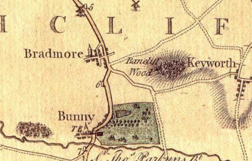
Bradmore is positioned on the A60, once the turnpike road between Nottingham and Loughborough, in the South Nottinghamshire Farmlands Character Area. The neighbouring villages of Bunny and Ruddington lie 1 mile to the south and 1½ miles to the north respectively. The surrounding landscape consists principally of large arable fields with views to the south of the Nottinghamshire Wolds and wooded areas of Rancliffe Wood and Bunny Old Wood.


Bradmore’s location on a gentle hilltop provides expansive views of the Nottinghamshire countryside. The village is surrounded by agricultural land, contributing to its rural charm and reinforcing its historic identity. The network of narrow lanes, mature trees, and open spaces within the settlement enhance its character and provide a sense of continuity with its past. The proximity to Bunny, where Bradmore’s villagers historically attended church services after the fire, also highlights the interconnection between these communities.
The Parish Paths Partnership scheme, a collaboration with Nottinghamshire County Council and the Countryside Commission developed an initiative that improved the village’s network of footpaths, with stiles, signposts, and waymarks installed for better accessibility.
2.1 The Bradmore Conservation Area
This small Conservation Area was only designated as recently as October 1994 and includes 19 Listed Buildings or structures (all Grade 2). The uniform 18th century character of Bradmore’s buildings is the result of a devastating fire in 1705 which destroyed much of the historic core of the village. In the years that followed Sir Thomas Parkyns of Bunny Hall took it upon himself to rebuild Bradmore. The characteristic designs of this gifted amateur architect now act as a reminder of the historic link between the communities of Bradmore and Bunny.
- Conservation Area Boundary covers: 10.11 hectares (approximate)
- Number of Grade I listed buildings: 0
- Number of Grade 2* listed buildings: 0
- Number of Grade 2 listed buildings: 19
A full list of Bradmore Conservation Area’s Listed buildings can be found in Appendix 1. Details accurate as of January 2024.
3 Historical Contexts
3.1 Location Historic Activities
Bradmore has roots dating back to the medieval period and was once a thriving agricultural community. Its name originates from the now-drained “broad mere,” or shallow post-glacial lake, that it once overlooked. Historically, the village was largely self-sufficient, with farmers supported by a wide range of tradespeople, including butchers, bakers, millers, blacksmiths, and alehouse keepers. Several cottages also housed “Stockingers,” who worked as stocking knitters on framework machines. In the past, Bradmore had two alehouses, though none remain today.
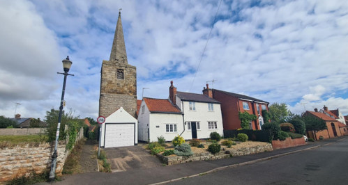
The village’s ecclesiastical history is marked by its medieval church, originally built in the 13th century with a square tower. In the 14th century, it was enhanced with an octagonal spire. However, a devastating fire in 1705 destroyed much of the village, including the church, with only the tower and spire surviving.
The fire, fuelled by dry thatched roofs and strong winds, wiped out 12 houses, barns, stables, workshops, and essential goods within two hours. Relief efforts were initiated locally and nationally, with donations from places as distant as Knights Enham, Hampshire, and Little Saxham, Suffolk. Despite the destruction, the church’s tower and spire remained as lasting landmarks.
In 1881, a Mission Hall was built adjacent to the remaining church tower. Initially used for occasional services, the hall later became a men’s institute and recreation facility. Between 1705 and 1830, when the Wesleyan Methodist Church was constructed, there was no regular place of worship in Bradmore. The Methodist Church, along with its Sunday School Room, remains central to the village today, continuing to host services and community activities.
In 1957, after an earth tremor damaged the spire, repairs were carried out, including refurbishing the tower room for monthly Communion services.
Due to its elevated position and being surrounded by open countryside, Bradmore’s agricultural economy was further supported by two windmills. The last known windmill, a post mill located at the top of Far Street, was built before 1832 but fell into disrepair by the 1870s. It was destroyed by fire on November 5th, 1880.
The village’s historic character is reflected in several of its street names. "Ramper" or "Rampart" is of uncertain origin, though it appears in historical records, despite no evidence of earthworks in the vicinity. "Donkey Lane" is believed to have been a place where travellers kept their animals. Other streets, such as Farmer Street, Main Street, and Far Street, have more straightforward origins, while Littlemoor Lane was named only in 1996. Modern housing developments, such as Manor Farm Close, have been named after the farms that previously occupied those sites.
In the 18th century, Sir Thomas Parkyns, the eccentric "wrestling Baronet" of Bunny Hall, contributed to the design and construction of several red brick barns, houses, and farmhouses in Bradmore. His unique architectural style links the two communities of Bunny and Bradmore.
A notable historical legal case in Bradmore involved William Barnes (or Burn), who in 1765 was sentenced to seven years’ transportation to America for fraudulently obtaining six pence by pretending to be disabled. Another recorded incident, from the Borough of Nottingham records (1399–1485), involved Ellen Scott of Bradmore, who was accused of “regrating” in 1482, though no record of her punishment survives.
A comprehensive historical study of the village, undertaken as part of the millennium celebrations, documented the families, residences, and fields of Bradmore. This research is now archived at the Nottingham Record Office.
3.2 Archaeology
No archaeological excavation has been conducted at the site of the Church. There is no dedicated churchyard, as the building is surrounded by houses and a footpath to the west. The only potential churchyard area is the path leading to the porch. There is no evidence of burials, though they may exist beneath surrounding buildings and gardens.
The potential beneath the meeting room/nave floor is rated MODERATE-HIGH, with evidence of 18th-century demolition and medieval layers below. The area beneath the intact tower is considered to have HIGH-VERY HIGH potential for surviving archaeology, particularly medieval features. The medieval west tower’s standing fabric is also considered to have HIGH-VERY HIGH potential for preserving archaeological evidence. Burial numbers remain unknown.
3.3 Historical Mapping
4 Spatial Analysis
The relationship between open spaces and the built form within a conservation area can be central to its character. This section describes the layout of the village, highlights the significant views, landmarks and historical focal points. The contribution of open green spaces, trees and other natural elements to the conservation area’s character is also described within this section.
4.1 Plan, Form and Layout
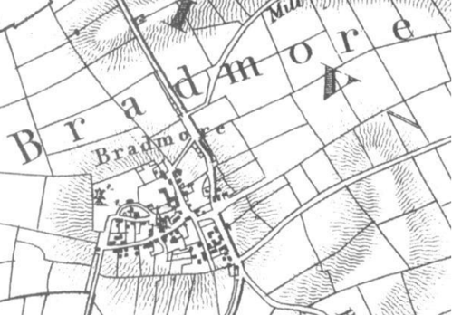
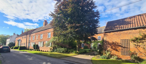
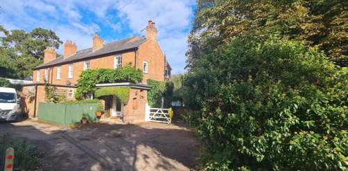
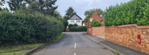
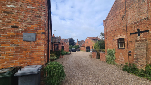
Bradmore has a simple layout with four main streets. The first is the A60 Loughborough Road, which runs roughly north to south. On the western side of the road, traditional farm buildings are located close to the edge of the roadway, while the eastern side features modern detached houses set back behind front gardens.
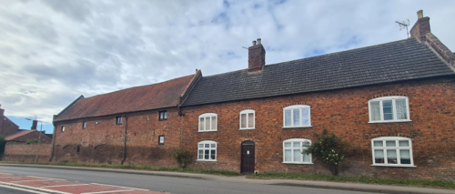
To the west of the A60 is Farmer Street, which runs roughly parallel to the road (the northern part of which is locally known as the Ramper). Far Street and Main Street branch off from Farmer Street and loop back to the west. Most of the traditional buildings in the village are located along Farmer Street, the western side of Loughborough Road, and the southern side of Main Street. More modern buildings can be found along Far Street and the northern part of Main Street, with additional examples of modern infill development scattered throughout the village.
Houses in Bradmore typically have their main facades facing the road, while the traditional farm buildings, which are more elongated, are often arranged in a way that forms courtyards.
Below is a map that describes the current plan, form and layout of the village/town.

This map is reproduced from Ordnance Survey material with the permission of Ordnance Survey on behalf of the Controller of Her Majesty’s Stationary Office © Crown Copyright. Unauthorised reproduction infringes Crown Copyright and may lead to prosecution or civil proceedings. Rushcliffe Borough Council - 100019419
4.2 Landmarks, Focal Points and Views
The most striking historic feature of the village is the Bradmore Steeple, a surviving spire of the church that got destroyed in the Great Fire of Bradmore in 1705. The church was never rebuilt, leaving the tower and spire as a solitary landmark thanks to its elevated position at the centre of the settlement.
The lower section of the tower is constructed from rubble, while the upper section and spire are made of ashlar stone. The spire remains a local landmark and has been well-maintained by the village, undergoing repairs in the early 20th century.
Over time, the site of the former church and graveyard was repurposed for private uses, including a pigsty, coal shed, and gardens. In the 1880s, a small brick mission hall was built against the tower to serve as a place of worship. However, by the time of World War II, it had been converted into a barn.
Within the village there are frequent views of the spire. Other significant views include those of buildings along Farmer Street and Loughborough Road.
Views of the surrounding countryside are limited from the core of the Conservation Area and can only be seen from specific points on the edges of the village (for example but not limited to Little Moor Lane, outside of the Conservation Area boundary) and along the more open Loughborough Road boundary of the Conservation Area.
Appendix 2 - Conservation Area Boundary and Townscape Appraisal Map illustrates these key views and other views which link the village to the adjacent countryside.
4.3 Open Spaces, Trees and Landscape
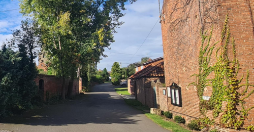
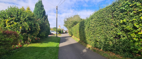
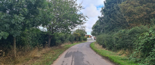
Bradmore has only a limited number of significant trees and is characterised more by its grass verges, hedgerows and private gardens. Verges provide a rural feel to the street scene of the village. Along Farmer Street and Loughborough Road these counteract the almost urban feel created by the positioning of buildings close to the roadway.
Open spaces encircled by hedgerows and trees such as the garden of The Old Hay Barn on the northern end of Farmer Street, and the rear garden of No 7 Manor Farm Close (as visible from the top of Donkey Lane are both prominent features and add to the village’s rural character.
Farm Close as seen from the top of Donkey Lane.
The hedge lined road and grass verges along The Ramper (a local name for the northern stretch of Farmer Street). There are also two memorial trees in the village, both on the Ramper section linking to the A60 at the north end of the village.
can be seen to identifiy one of the memorial trees.
Areas of open green space which make a positive contribution to the character of the Conservation Area are shown in Appendix 2 - Conservation Area Boundary and Townscape Appraisal Map.
4.3.1 Open Spaces, Trees and Landscape SWOT Analysis
Strengths - what are the positives of the open spaces, trees, and landscape
- Wide verges on the Ramper with trees and hedgerows.
- Wide pavements on Main Street almost from top to bottom.
- Mature trees, hedges and shrubs in many residents’ front gardens.
- Open area outside the Methodist Church.
- Open area where Main St, Littlemoor Lane and Far St join together.
- The bridle path to Bunny.
- ‘Pond’ and surrounding copse in the field below Littlemoor Lane.
Weaknesses - what are the negatives of the open spaces, trees, and landscape
- Roadside parking with cars obstructing access and destroying verges.
- The loss of grassed front gardens to car parking spaces.
- Mismanagement of trees, hedges and shrubs in gardens leading to overgrowth
Opportunities – what could make the open spaces, trees, and landscape better?
- Using open spaces i.e. in front of the Methodist Church for a variety of events for villagers to congregate.
Threats - what would make open spaces, trees and landscapes worse?
- The grass verges on the Ramper are now being eroded by large passing vehicles and vehicles frequently parking on them. There is a threat of this worsening if permission for building on the field to the south is opened up to building three new houses.
Works to Trees
You must contact the Local Planning Authority (LPA), Rushcliffe Borough Council before any works (cutting OR pruning) are carried out to trees within the Bradmore Conservation Area.
Six weeks’ notice is required before any works to trees within the Conservation Area is carried out, even if they are not protected by a Tree Preservation Order (TPO).
If there is a tree which undergoes annual maintenance, include this information with the notice. It may be possible, upon agreement with the tree officer, that only one notice is required to cover the future annual maintenance.
Standard notification forms (a section 211 notice), further information and contact details.
A flow chart of the decision-making process regarding works to trees.
4.4 Public Realm
Boundary treatments within the village include grass verges, hedgerows, timber fencing, masonry walls and informal planting. In addition, a number of the village’s older houses front directly onto the pavement, negating the need for any boundary definition.
Brick or stone walls are used sporadically throughout the village while hedgerows and verges are a particular feature of Loughborough Road and Farmer Street.
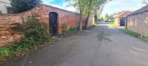
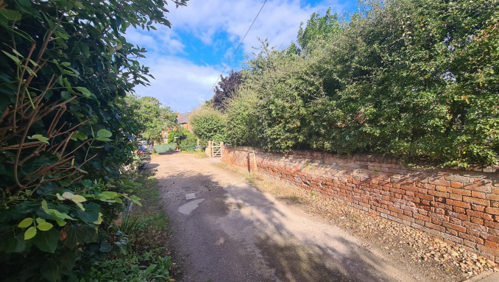
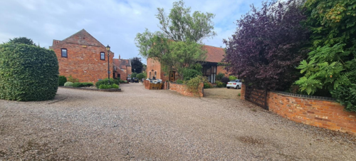
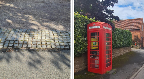
figure 20 – K6 phone box, now used for a defibrilator
Bradmore’s roads and pavements are surfaced with asphalt, but many private drives use gravel which is more sympathetic to the village’s rural character (see Figure 19).
5 Buildings of the Conservation Area and Key Characteristics
5.1 Building Types and Activity
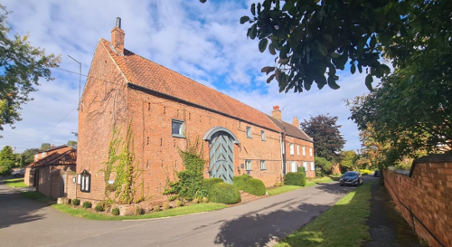
Apart from the surviving medieval church tower, three other dwelling houses constructed earlier than 1700 have survived the Bradmore fire of 1705.
Two of the three believed to have survived the fire include Town End Cottage, number 23 Far Street which was originally built in the 17th century, c.1650, and the other, Mill Cottage, number 25 Far Street (named after 1985) is early 17th century. Both can be seen on the map below which shows the occupiers of the farm premises in Bradmore around 1792.
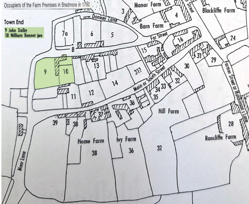
Historical records indicate that the group of properties collectively known as Town End was originally purchased by William Smith, a framework knitter formerly living on Main Street. Both he and his wife are believed to have worked from home. The roadside property at No. 25 Main Street (later known as Mill Cottage) had been subdivided into two separate dwellings, while No. 23 Main Street (Town End Cottage) was set back to the south, screened from the road, and remained a single residence. The entire group was referred to as Town End until 1940, when William Smith’s son, George Smith—also a framework knitter—inherited No. 23. The two roadside dwellings at No. 25 were sold separately during the Bunny Estate sale in 1910. The third residential dwelling which escaped the fire was Innisfree, 15 Main Street - Grade 2 Listed dated 17th century from Listing Entry. Present-day it is blocked in from Main Street by later Parkyns inspired buildings and cottages. Like buildings at Town End it was on the very edge of the then townscape in 1705 and would have escaped the worst ravages of the fire.
The other buildings in Bradmore were built no earlier than 1705 and consist of a mixture of different sized farmhouses, cottages, elongated barns and outbuildings. Many of these can be seen on the historical maps shown in 4.1. There are also examples of 20th and 21st century semi-detached and detached dwellings throughout the village.
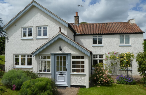
Rufford Lodge is a Grade 2-listed group dating to circa 1700, incorporating a main house, barn, and outbuildings. Commissioned by Sir Thomas Parkyns during his post-fire redesign of Bradmore, it embodies key architectural traits—mullioned stone windows, pantile roofing, ashlar detailing—typical of Parkyns' style. Its later outbuildings reflect rural domestic evolution.
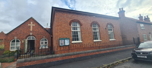
Bradmore Methodist Church, originally a Wesleyan Methodist Church, was built in 1830. It stands in a central location on Farmer Street, alongside a Sunday School Room. Before its construction, there was no regular place of worship in the village from 1705, when the fire destroyed much of the village and the church (see the remains of the church in Figure 25), until 1830.
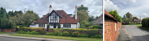
Orchard House (38 Farmer Street, see Figure 26) and 113 Loughborough Road (see Figure 27 and Figure 28), share architectural features that creates a dialogue along Farmer Street. Both properties, built around 1922/1923 by local builder John Attewell, display elements of Arts and Crafts styles, including timber framing and black-and-white detailing. Their visual connection between each of the properties contributes to the streetscape’s cohesion, reinforcing the area’s historic identity. 113 Loughborough Road was included within the boundary in recognition of its collective significance.
Orchard House (38 Farmer Street, see Figure 26) and 113 Loughborough Road (see Figure 27 and Figure 28), share architectural features that creates a dialogue along Farmer Street. Both properties, built around 1922/1923 by local builder John Attewell, display elements of Arts and Crafts styles, including timber framing and black-and-white detailing. Their visual connection between each of the properties contributes to the streetscape’s cohesion, reinforcing the area’s historic identity. 113 Loughborough Road was included within
the boundary in recognition of its collective significance.
Blackcliffe Farm Mews, located off Loughborough Road, is a development of four converted barns dating back to 1777. These barns, including "The Granary," have been sympathetically converted while retaining period features.The development is situated near Blackcliffe Farmhouse, which was designed and built around 1700 by Sir Thomas Parkyns of Bunny Hall.

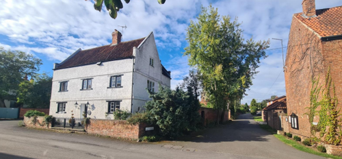
No. 15 Far Street, known as The Rookery (above), is the last remaining block of framework knitters’ cottages in the village, with occupation records dating back to the 1830s.
5.1.1 Building types and Activity SWOT Analysis
Strengths - what activities/places can you go that make the village/town great?
- Large number of listed buildings in a good state of repair.
- The Methodist Church, Community Hall and the Spire Room provide venues for both village events and external groups.
- Community spirit is fostered by opportunities being offered for all to engage in many village events which are organised and supported by villagers.
- The community hall has been renovated to a high standard in recent years and provides a comfortable venue with very good facilities.
- There are many country walks starting from the village and linking the village to the surrounding area.
Weaknesses - what activities/places exist that detract from making the village/town great?
- Lacks a village green.
Opportunities - what activities/places could exist that would village/town even better?
- None identified
Threats - what activities/places would make village/town worse?
- The Church spire is falling into disrepair and becoming a danger as a result of the lack of funding.
- Footpath signs are sometimes affected by developments and not replaced thus causing confusion to walkers
5.2 Key Characteristics and Building Materials
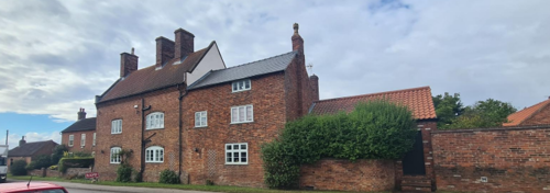
Traditional building materials were largely locally sourced. Bricks for example, were not transported far from where they were made, with most villages having their own brick pit and yard. This lead to interesting village-specific sizes, colours and styles of brickwork. Based on the names of two fields in the village (Brick Kiln Close 1 and 2) there was a brick works in Bradmore.
Prior to the fire of 1705, roofs would have been made from local materials such as thatch. Following this, clay pantiles became popular.
The traditional building materials within the Conservation Area are as follows:
Walls: Dominated by orange/red brick (sometimes with blue brick details). Some examples of earlier stone walls. There are also examples of pebble dash, white painted brick and whitewashed lime render. The larger buildings have brick string courses, corbelled eaves and load bearing brick arches visible just above foundation level, an intriguing construction detail apparently favoured by Sir Thomas Parkyns. The larger buildings have brick string courses, corbelled eaves and load bearing brick arches visible just above foundation level, an intriguing construction detail apparently favoured by Sir Thomas Parkyns.
Roofs: Dominated by orange clay pantiles with some examples of plain clay tiles and Welsh slate. Gable ends either have parapets or are plain close verge where the tiles run to the edge of the brick gables. Corbelled brickwork is often found under the eaves.
Windows: A few houses have retained their traditional timber framed windows, and have timber Yorkshire sliding sashes with segmental headers. Arched brick lintels are most prominent. Barns generally have far fewer and much smaller windows. These are usually single pane, square and timber framed.
Doors: On some recently converted barns there are also examples of large timber and glass barn doors which create a strong design statement.
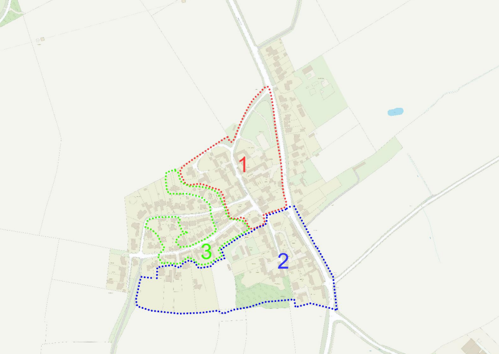
5.2.1 Key Characteristics: Entrance and Current Settlement - Zone 1
Materials:
Walls: Dominated by orange/red brick. Some examples of white painted brick and whitewashed lime render.
Roofs: Dominated by orange clay pantiles with some examples of plain clay tiles and Welsh slate.
Key Characteristics / Architectural Features:
Village centre with large residential properties, Methodist Chapel and converted farm buildings forming courtyards. Grass verges, hedgerows and some brick walls, large private gardens.
Views out into countryside and across open fields. Reinforces the rural character of the area.
5.2.2 Key Characteristics: Zone 2
Materials:
Walls: Some examples of earlier stone walls. While orange/red brick is common within this character area, there are a number of white painted brick and whitewashed lime render.
Roofs: Dominated by orange clay pantiles with some examples of plain clay tiles and Welsh slate.
Key Characteristics / Architectural Features:
Groups of farmhouses and converted barns with extensive gardens and gravel drives. Some infill development in the form of modern detached dwellings. Views over open countryside to the south, grass verges. Grounds of former village riding school with paddock and rustic stables.
Despite the A60, the architectural character of the buildings reinforces the agricultural heritage of the area.
5.2.3 Key Characteristics: Zone 3
Materials:
Walls: Predominantly orange/red brick. The larger buildings have brick string courses, corbelled eaves and load bearing brick arches visible just above foundation level, an intriguing construction detail apparently favoured by Sir Thomas Parkyns.
Roofs: Dominated by orange clay pantiles with some examples of plain clay tiles and Welsh slate.
Key Characteristics / Architectural Features:
Traditional brick-built houses and some converted farm buildings. Prominent tower of Bradmore church. Modest private gardens and many properties fronting directly onto the highway.
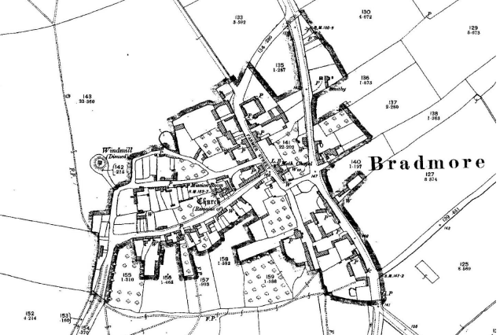
Character Zone Map
5.2.4 Key Characteristics SWOT Analysis
Strengths:
Distinctive estate village architecture of Sir Thomas Parkyns.
Many properties within the village benefit from elevated positions, offering long-range views across the surrounding open countryside.
The village contains a diverse mix of properties representing architectural styles from the 17th century onwards. Many retain original external features, which contribute significantly to the village’s historic character and architectural interest.
Although the village lies adjacent to the busy A60, the historic core is set back from this main route along quieter village streets, which experience minimal traffic.
Weaknesses:
Some of the newer properties are not in keeping with the characteristics of the village and detract rather than enhance the environment.
Opportunities - none identified
Threats - none identified
5.3 Listed buildings
Buildings on the Government’s List of Buildings of Special Architectural or Historic Interest are called “Listed” buildings and are protected by law. Consent is required from Rushcliffe Borough Council before any works of alteration, extension, or demolition can be carried out on any listed building.
Further information can be found in Rushcliffe Borough Council’s publication Listed Buildings in Rushcliffe.
The complete list of the Secretary of State’s Statutory List of Buildings of Special Architectural Interest or Historic Interest.
Names of the Listed Buildings and structures in Bradmore Conservation Area (correct as of January 2024) are detailed in Appendix 1. All Listed Buildings are shown on the Townscape Appraisal plan, but some smaller structures such as gravestones may not be shown.

17th century with 20th century alterations. Timber box frame,
brick infill, rendered at rear.
Contribution to the established character of the place can also come from buildings which are not recognised via listing, or are not old. A plan with all of the positive contributions to the area can be found in Appendix 2 - Conservation Area Boundary and Townscape Appraisal Map
The Bradmore Conservation Area includes a number of unlisted buildings that make a positive contribution to the character and appearance of the Conservation Area. This may be because of their age, architectural style, former function, or general contribution to the variety of the townscape. Key unlisted buildings are highlighted in the Townscape Appraisal in Appendix 2 and some examples of these are shown in the photographs below. However, it is important to stress that nearly all the buildings within a Conservation Area
can make a positive contribution to the townscape in some way.
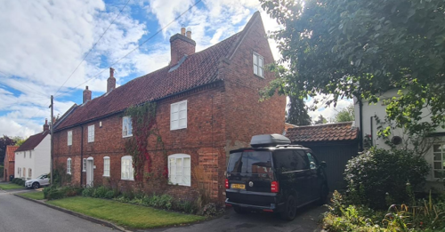
Over 60 unlisted cottages, farmhouses and outbuildings have been identified on the Townscape Appraisal map as having a positive impact on the character of the Conservation Area. The majority of these date to the 18th and 19th centuries but there are also occasional examples of 17th century construction. The coherent character of the village derives from the use of similar materials and construction details, even though the buildings are of individual design.
Around 30 unlisted cottages, farmhouses and outbuildings have been identified on the Townscape Appraisal map as having a positive impact on the character of the Conservation Area. The majority of these date to the 18th and 19th century.
6 Generic Management Plan for Conservation Areas in Rushcliffe
6.1 Introduction
In carrying out its planning functions, the Borough Council is required in law to give special attention to the desirability of preserving or enhancing the character or appearance of Conservation Areas. The Management Plan for a Conservation Area is a tool to ensure the special character of the area is preserved and enhanced. The management plans aim to:
- Outline a strategic management proposal for the preservation and enhancement of the Bradmore Conservation Area.
- Act as a guide for professionals and residents alike regarding:
- features of value, worthy of preservation;
- characteristics worthy of preservation;
- opportunities for enhancement;
- development proposals which preserve and enhance the special character of the area.
- Inspire community commitment to conservation principles and reporting.
6.2 National and Local Policies and Guidance
There is a duty to formulate and publish management plans setting out policies and proposals for the preservation and enhancement of Conservation Areas. Many of these policies and proposals are common to all Conservation Areas, and these are set out in this document. The Central Government Guidance and Local policies applicable to Conservation Areas include:
- Rushcliffe Local Plan Part 1: Core Strategy, with a specific focus on:
- Design and Enhancing Local Identity [in part]
- Historic Environment
- Rushcliffe Local Plan Part 2: Development Policies, with a specific focus on:
- Conserving and Enhancing Heritage Assets
- Development Affecting Archaeological Sites
- The National Planning Policy Framework (NPPF), particularly, but not exclusively the chapter on Conserving and Enhancing the Historic Environment.
- The National Planning Practice Guidance (NPPG) (updated 2021 and subject to continual review)
- By Design: Urban Design in the Planning System – Towards Better Practice (2000)
- The Planning (Listed Buildings and Conservation Areas) Act 1990
- Historic England “Historic England Advice Note 1: Conservation Area Designation, Appraisal and Management”
The council will utilise the full range of strategic policy and guidance documents to ensure that development in Bradmore Conservation Area is of a standard that enhances the amenity of the local area. The council will always look to use the most up-to-date versions of the document.
Supplementary documents may be issued for individual Conservation Areas where specific policies or proposals are needed.
6.3 Article 4 Directions
There are extra consents required in Conservations Areas. For example, in addition to the general control of development, you will
need to get permission for
- Any additions or alterations to the roof (for example, dormer windows)
- The installation of satellite dishes on chimneys, roofs or walls fronting a highway
- Any extension which extends beyond the side of the original dwelling house
- Any extension of more than one storey that extends beyond the rear wall of the original dwelling house
- Cladding the exterior of the dwelling
- Any demolishing of a building or part of a building that has a volume over 115 cubic metres
Article 4 of the Town and Country Planning (General Permitted Development) Order 2015, allows planning authorities to restrict
some permitted development rights within particular areas. This does not necessarily prevent development or change taking place
but enables the Local Authority to manage the design and detailing of the works, and potentially grant permission subject to appropriate conditions. The use of Article 4 Directions will be proposed where it is considered appropriate following the completion of each Area Appraisal across the borough.
Details of Article 4 Directions for Bradmore Conservation Area
There are currently no Article 4 Directions for Bradmore Conservation Area.
6.4 Building Design
Mimicking the local vernacular is not the only way to ‘fit in’ with the character of a conservation area. National policy makes clear that contemporary designed, provided it is sympathetically designed, cannot be dismissed as an option. Therefore, good contemporary design will be encouraged where it respects the context’s character, scale and massing. This must be demonstrated in the Design and Access Statement submitted with any planning application.
Extensions to buildings in Conservation Areas should respect:
- The key characteristics of the original building, including scale, mass, materials and proportions
- The contextual setting and character of the Conservation Area
Copying like for like can devalue and destroy the ability to “read” historic change, and dilutes our historic heritage. Pastiche designs, incorporating poor imitations of other styles, will be resisted, particularly where they incorporate details which are not locally appropriate. Careful high-quality replication may be required in a few very sensitive locations.
In particularly sensitive locations, such as uniform terraces, exact replication may be necessary to maintain compositional unity. In that case, attention to details, choice of materials and high-quality workmanship are the keynotes. However, in some cases, a direct relationship is not impossible. For example, Flemish Bond brickwork cannot be replicated in cavity walls, and narrow lime mortar joints cannot be replicated in modern metric brickwork.
Where new building is appropriate, on infill sites or where an existing building detracts from the character of the area, the opportunity should be taken to re-establish the streetscape, reinforce enclosure, open up distant vistas or views of landmarks or hide unsightly views.
“New and old buildings can coexist happily without disguising one as the other, if the design of the new is a response to urban design objectives” (DETR – “By Design”, p19). As with extensions, good contemporary design which respects local character, and the context of the site will be encouraged.
All new buildings should respond appropriately to the existing frontage and normally follow the established building line. Development or redevelopment will normally be resisted if: “it blocks important views identified in the individual appraisals, uses important open spaces identified in the appraisals, adversely affects the setting of any Listed or key buildings, fails to maintain or re-establish the streetscape where appropriate dominates its Conservation Area background fails to recognise the context of the site destroys important features identified in the individual appraisals such as boundary walls, fences, hedgerows or trees”
Where the quantity of contemporary schemes in a small area becomes significant and outnumbers older buildings within the area, further contemporary schemes could fundamentally shift the architectural character of the area and thus be harmful, even if well designed as an individual project.
New development that stands out from the background of buildings may be appropriate in exceptional circumstances if it contributes positively as a landmark to enhance the street scene, to highlight a corner or to signal a visual change of direction such as along a curving vista.
Any external lighting should be carefully designed and sited to minimise light pollution.
Energy producing or saving devices are generally welcomed by the Council, but careful consideration is required when these are to be located in a Conservation Area and some may require planning permission. In particular, they should be positioned to minimise their impact on the building and on the local amenity.
6.5 Publicity and Knowledge Transfer
Ambiguity about additional controls within a Conservation Area raises the likelihood of inappropriate developments occurring which may damage the integrity of the conservation area designations.
Efforts have been made to engage local community groups in the development and review of the character appraisals. Empowering
communities to define the special architectural and historic interest of the Conservation Area aims to raise awareness
Whether the appraisal took a community-led or a council-led approach, upon reviewing all Conservation Areas, the public were invited to ask questions and comment during a public consultation.
A consultation event also aimed to diminish any ambiguity about restrictions within a Conservation Area and increase the likelihood of
sensitive and appropriate developments, maintaining the character of the area.
The council recognise the potential issues of turnover in residency and ownership of properties in the conservation area. Therefore,
Rushcliffe Borough Council will periodically use their media outlets to highlight conservation area designations and the significant,
related planning controls.
The approach taken within Bradmore Conservation Area was Council Led The consultation period took place between the following dates 19/2/2025 and 16/03/2025.The date of the Consultation Event 03/03/2025.
If there are any queries about conservation areas, please email conservationareas@rushcliffe.gov.uk
6.6 Public Realm
General maintenance and upkeep to the public realm may include fixing damage to roads and pavements, and fixing issues with street lighting. Issues such as these can impact the quality of the Conservation Area.
The council aims to encourage works to the public realm that are in keeping with, or actively enhance the conservation area. Rushcliffe Borough Council can only advise on work within the public realm that does not require planning permission (for example work completed by statutory undertakers, such as the Highways Authority). In these instances, Rushcliffe borough council cannot prevent such work.
Nottinghamshire County Council are responsible for repairs to roads, pavements and street lighting. Report issues of repairs to roads, pavements and street lighting to Nottinghamshire County Council online.
Rushcliffe Borough Council will continue to undertake their duties in maintaining the public realm. Vandalism, fly tipping and street cleaning are all the responsibility of Rushcliffe Borough Council. Report issues of vandalism, fly tipping, and street cleaning to Rushcliffe Borough Council online.
Works to Trees
You must contact the Local Planning Authority (LPA), Rushcliffe Borough Council, before any works (cutting OR pruning) are carried out to trees within the Bradmore Conservation Area
Six weeks’ notice is required before any works to trees within the Conservation Area is carried out, even if they are not protected by Tree Preservation Order (TPO).
Standard notification forms (a section 211 notice) - further information and contact details.
A flow chart of the decision-making process regarding works to trees.
6.7 Boundary Treatments
Where there is a proposal for a new boundary treatment to be installed, the council would encourage the use of boundary treatments within the area.
Within conservation areas, planning permission is required to alter, maintain, improve, take down or build any new gate, fence, wall or other enclosure with:
- A height of one metre or more if next to a highway (including a public footpath or bridleway), waterway or open space; or
- A height of two metres or more elsewhere.
Where planning permission is required to remove a wall, Rushcliffe Borough Council will aim to protect those boundary walls and fences that have been identified as positively contributing to the area.
Hedgerows are significant habitats for wildlife in lowland Britain. Regulations are intended to protect important hedges in the countryside. The policy applies to hedges that are more than 20 metres long, (or less if connected to another hedge) on or adjacent to:
- Land used for agriculture or forestry, including the keeping of horses or donkeys
- Registered common land and village greens
- Local Nature Reserves and Sites of Special Scientific Interest.
The policy does not apply if the hedge is within or on the boundary of the curtilage of a house.
6.8 Buildings at risk
A few of the important buildings across the various Conservation Areas are currently vacant or not in regular use, which may lead to some being “at risk” of neglect or decay.
The Council will encourage and advise on renovation and repair work that is sensitive to the original or traditional historic character of the building and retains original features. The council will monitor the opportunity and potential for grant aid schemes to encourage the basic maintenance work necessary to ensure that key buildings within the conservation area are structurally sound and weather tight. However, given the current financial climate and outlook, such schemes are unlikely in the short to medium term.
There is a presumption against the demolition of buildings which contribute to the character of the area unless there are exceptional circumstances. It would benefit both the physical form and the function of the Conservation Area if these buildings were repaired, maintained and brought back into use.
Where the poor condition of a building or structure is as a result of neglect and lack of maintenance by its owner there is no requirement for the Borough Council to take its deteriorated condition into account when deciding whether demolition is appropriate. This is to avoid rewarding the deliberate neglect of buildings by representing such action as a way to obtain planning permission for demolition and redevelopment.
6.9 Enforcement
Rushcliffe Borough Council will, from time to time, assess and monitor changes in the appearance and condition of Bradmore Conservation Area. This will ensure that where necessary enforcement action can be taken promptly to deal with problems as they arise.
Where co-operation cannot be gained by any other means, Rushcliffe Borough Council may take formal action if the condition of any building (listed or unlisted) which makes a positive contribution to the character of the Conservation Area is considered to be at risk.
The council will work in accordance with their enforcement policy, which aims to provide an efficient enforcement service in support of the Council’s statutory planning service. Rushcliffe Borough Council’s enforcement actions will remain transparent, consistent, and proportionate, as it is recognised that effective controls over unauthorised development assists in conserving the natural and built environment whilst helping to protect the quality of people’s lives and maintaining the Council’s integrity.
7 Appendix 1 – Listed Buildings (as of January 2024)
Grade: 2
Listing entry number: 1248689
National grid reference: SK 58454 31274
Location: 15, Farmer Street
Barn Behind Number 17 (Blackcliffe House) Farmer Street
Grade: 2
Listing entry number: 1277782
National grid reference: SK 58501 31287
Location: Barn Behind Number 17 (Blackcliffe House) Farmer Street, Loughborough Road
Grade: 2
Listing entry number: 1277779
National grid reference: SK 58459 31253
Location: Blackcliffe Farmhouse, 17 Farmer Street
Grade: 2
Listing entry number: 1248690
National grid reference: SK 58487 31209
Location: Weslyan Methodist Chapel, Farmer Street
Grade: 2
Listing entry number: 1248691
National grid reference: SK 58495 31194
Location: 27 Farmer Street
Grade: 2
Listing entry number: 1248692
National grid reference: SK 58416 31262
Location: 28 Farmer Street
Stafford House and Adjoining Barn
Grade: 2
Listing entry number: 1277781
National grid reference: SK 58446 31240
Location: Stafford House and Adjoining Barn, Farmer Street
Rufford Lodge and Adjoining Outbuildings and Barn
Grade: 2
Listing entry number: 1248693
National grid reference: SK 58466 31204
Location: Rufford Lodge and Adjoining Outbuildings and Barn, Farmer Street
Tower and Spire of Former Church
Grade: 2
Listing entry number: 1277785
National grid reference: SK 58397 31168
Location: Tower and Spire of Former Church
K6 Opposite Outbuildings at Rufford Lodge
Grade: 2
Listing entry number: 1272368
National grid reference: SK 58444 31171
Location: K6 Opposite Outbuildings at Rufford Lodge, Main Street
Grade: 2
Listing entry number: 1248697
National grid reference: SK 58425 31153
Location: 1 Main Street
Grade: 2
Listing entry number: 1248988
National grid reference: SK 58405 31136
Location: Southwell House, 7 Main Street
Grade: 2
Listing entry number: 1248698
National grid reference: SK 58363 31105
Location: Innisfree, 15 Main Street
Grade: 2
Listing entry number: 1248842
National grid reference: SK 58520 31101
Location: Rancliffe Farmhouse, Farmer Street
Grade: 2
Listing entry number: 1248694
National grid reference: SK 58537 31058
Location: The Old Barn, Farmer Street
Barn 10 metres East of Rancliffe Farmhouse
Grade: 2
Listing entry number: 1277780
National grid reference: SK 58541 31095
Location: Barn 10 metres East of Rancliffe Farmhouse, Farmer Street
Grade: 2
Listing entry number: 1248932
National grid reference: SK 58568 31137
Location: Debdale and Adjoining Barn, 118 and 120 Loughborough Road
Grade: 2
Listing entry number: 1277784
National grid reference: SK 58599 31094
Location: Tofts Farmhouse, 126 Loughborough Road
Number 130 and Adjoining Range of Outbuildings
Grade: 2
Listing entry number: 1248976
National grid reference: SK 58608 31069
Location: Number 130 and Adjoining Range of Outbuildings, 130 Loughborough Road
*The titles of these listings may not make it clear that all listed buildings always include all attached structures and extensions, regardless of age, and all detached outbuildings built before 1 June 1948 which are, or were at the time of listing, ancillary to the function of the primary listed building and were in the same ownership at the time of listing.
For example, when a house is listed, the listing will apply to extensions, porches, detached historic stables, barns, wash houses, privies etc. Such outbuildings and extensions are only exempt from the provisions of listing where the listing specifically excludes them. Appendix 2 - Conservation Area Boundary and Townscape Appraisal Map.
8 Appendix 2 – Conservation Area Boundary and Townscape Appraisal
Map

The Bradmore Townscape Map above shows:
- Conservation area boundary - red line
- Locations of listed buildings (red)
- Locations of key unlisted buildings (purple)
- Open space
- Locations of trees, hedges, and significant hedges and fences
- Viewpoints
Conservation Areas
- Bingham Conservation Area
- East Bridgford Conservation Area
- East Leake Conservation Area
- Hawksworth Conservation Area
- Hickling Conservation Area
- Ruddington Conservation Area
- Thoroton Conservation Area
- Wiverton Conservation Area
- Langar Conservation Area
- West Leake Conservation Area
- Whatton in the Vale Conservation Area
- Costock Conservation Area
- Sutton Bonington Conservation Area
- Upper Saxondale Conservation Area
- Wysall Conservation Area
- Bradmore Conservation Area
- Car Colston Conservation Area
- Scarrington Conservation Area
- Orston Conservation Area
- Flintham Conservation Area
- Edwalton Conservation Area
- Aslockton Conservation Area
- Bunny Conservation Area
- Granby Conservation Area
- Keyworth Conservation Area
- Thrumpton Conservation Area
- Normanton on the Wolds Conservation Area
- Upper Broughton Conservation Area
- Kneeton Conservation Area
- Colston Bassett Conservation Area
- Cropwell Bishop Conservation Area