Hickling Parish Neighbourhood Plan
Hickling Parish Neighbourhood Plan 2011 - 2028
Adopted March 2022
Contents
- Introduction
- Rural Character
- Heritage and Design
- Housing
- Services, Facilities and Infrastructure
- Traffic and Parking
- Employment
- Grantham Canal
Appendix 2: Biodiversity Opportunity Mapping
Appendix 3: Local Green Spaces: Summary of Reasons for Designation
Appendix 4: Features of Local Heritage Interest
1. Introduction
Neighbourhood Plans
1.1 The 2011 Localism Act has given communities the right to draw up a Neighbourhood Plan. This right is aimed at giving local communities genuine opportunities to influence the future of the places where they live.
1.2 The Hickling Parish Neighbourhood Plan will allow people, who live, work and have a business in the Parish to have a say where they think new houses and businesses should be located and what they should look like. A Neighbourhood Plan can also identify and protect important Local Green Spaces, conserve local heritage and protect areas of nature conservation interest. The Hickling Parish Neighbourhood Plan will be a statutory plan which means that once it has been finalised, it will be used to determine planning applications in the Parish.
The Hickling Parish Neighbourhood Area
1.3 The Hickling Parish Neighbourhood Area (Map 1) comprises the Parish of Hickling which is located within the Rushcliffe Borough Council area of Nottinghamshire. Hickling is a rural parish (1,158 hectares) in the Vale of Belvoir with a population of 511 and 224 homes (2011 Census). It is located on the border with Leicestershire, approximately 13km (8 miles) northwest of Melton Mowbray.
1.4 The Parish contains the settlements of Hickling and Hickling Pastures:
Hickling
1.5 Hickling is the larger of the two settlements and has strong farming connections. Hickling is a linear village containing around 206 homes and several working farms. The surrounding countryside flows seamlessly to Main Street, providing stunning views outwards. The Grantham Canal passes through the northern end of the village, alongside the pub. The canal basin on the eastern side of Main Street creates a key village focal point.
Hickling Pastures
1.6 Hickling Pastures is in the western half of the Parish and contains about 56 homes - mainly large, detached properties. Just over half of these (29) straddle the A606 whilst the remaining are scattered across the rural landscape and include eight farms, which are largely pastoral, and one vineyard.
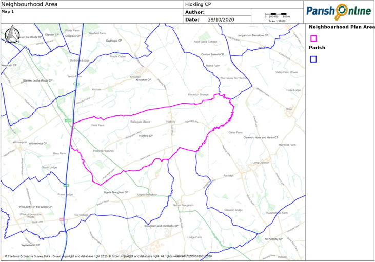
1.7 Hickling Parish was designated as a Neighbourhood Area on 23 February 2017. The Plan is being prepared by Hickling Parish Council, supported by the Hickling Neighbourhood Planning Steering Group. The Plan covers the period to 2028.
1.8 The Hickling Parish Council website (www. hicklingnotts.org) provides information and updates about Neighbourhood Plan preparation and its progress.
Basic Conditions
1.9 Only a draft Neighbourhood Plan that meets each of a set of basic conditions can be put to a referendum and be adopted. This means that there is not an entirely free hand over how the Plan is prepared. In particular, a Neighbourhood Plan must have regard to the National Planning Policy Framework (NPPF) and the Development Plan for the area.
Rushcliffe Local Plan
1.10 The relevant Development Plan for the area is the Rushcliffe Local Plan. For the purposes of this Neighbourhood Plan, the relevant parts of the Local Plan 2011 - 2028 (our Neighbourhood Plan covers the same period) are:
Local Plan Part 1: Core Strategy
1.11 The Core Strategy adopted on 22 December 2014, provides the vision and spatial strategy for Rushcliffe Borough. Most new development will be directed to the main built up area of Nottingham and the Key Settlements of Bingham, Cotgrave, East Leake, Keyworth, Radcliffe on Trent and Ruddington.
1.12 Neither Hickling nor Hickling Pastures are expected to accommodate development other than to meet local needs.
Local Plan Part 2: Land and Planning Policies
1.13 The Local Plan Part 2: Land and Planning Policies Document was adopted on 8 October 2019. The Local Plan Part 2 identifies non-strategic allocations and designations and sets out more detailed policies for use in the determination of planning applications. The Local Plan Part 2 runs to 2028 to align with the plan period of the Core Strategy.
Greater Nottingham Strategic Plan
1.14 Rushcliffe Borough Council is preparing the Greater Nottingham Strategic Plan with Broxtowe Borough, Gedling Borough and Nottingham City Councils to help guide future development, including new housing, across our combined areas to 2038. The Strategic Plan will eventually replace the Rushcliffe Local Plan Part 1: Core Strategy.
1.15 Consultation on the Growth Options document, which is the first stage of preparing the Strategic Plan, ended on Monday 14 September 2020. The consultation asked a number of questions relating to housing development, employment development, the Green Belt, climate change and carbon neutrality, city and town centres, the natural environment, urban design, the historic environment, safe and healthy communities and infrastructure provision. The Growth Options document does not include draft policies at this stage or identify how or where future development will take place.
1.16 The comments received will inform the preparation of the draft Strategic Plan, which will be published in 2021, when there will be a further opportunity to comment.
What has been done so far?
1.17 In Autumn 2016, the Hickling Neighbourhood Planning Steering Group undertook initial consultation at the Scarecrow Weekend, Church Coffee morning, Village Breakfast and Pub Quiz night. 487 comments were made. Feedback from this consultation helped us to identify the key issues that our Neighbourhood Plan needs to address.
1.18 In the Summer of 2017, we undertook a questionnaire survey to seek views on these issues, including how much housing to plan for. ‘Drop in’ sessions were arranged to enable local people to learn more about the Neighbourhood Plan and help us identify potential sites for development and important areas for protection. There were 199 responses to the questionnaire and the preliminary findings of the surveys were circulated to local households in September 2017.
1.19 The feedback from consultation events, the questionnaire results and information about the area have helped us prepare a (Pre-Submission) Draft version of the Hickling Parish Neighbourhood Plan. Under Regulation 14 of the Neighbourhood Planning (General) Regulations 2012, a pre-submission consultation period of no less than six weeks on the proposed Neighbourhood Plan for Hickling Parish ran from 1 February to 18 March 2019.
1.20 A copy of the Pre-Submission Draft of the Plan was made available to download, along with supporting documentation, on the Neighbourhood Plan Webpage of the Parish Website. A hardcopy of the Plan was available for inspection at Hickling Village Hall, the Plough Inn and St. Luke’s Church, Hickling. A copy was also available on request from the Parish Clerk. A ‘drop-in session’ at the Village Hall was arranged on Saturday 8 February 2019 between 10:00 and 13:00 where copies of the Draft Plan were available and members of the Parish Council and the Steering Group were be on hand to help with any questions. A leaflet publicising the Pre-Submission Draft of the Plan was delivered to all premises within the Parish.
1.21 Many of the representations received related to proposals for the redevelopment of the AE Faulks Ltd plant-hire business at The Wharf, Main Street, Hickling. Matters relating to this and the need for new housing proved difficult to resolve and so a further questionnaire survey was undertaken in summer 2020 to help find an acceptable solution. There were 253 responses and the results are also available on the Neighbourhood Plan Webpage of the Parish Website.
1.22 Throughout the plan preparation process, local people have been informed of progress through the website, presentations at Parish Council meetings and newsletters.
1.23 All representations and comments received on the Pre-Submission Draft Neighbourhood Plan and the questionnaire survey results have been considered by Hickling Parish Council and used to amend the Draft Plan. A Consultation Statement, including a summary of all comments received and how these were considered, is available on the Neighbourhood Plan Webpage of the Parish Website.
1.24 In February 2021, the Plan was submitted to Rushcliffe Borough Council for publication and, under Regulation 16 of the Neighbourhood Planning (General) Regulations 2012, a further six-week public consultation took place before it was sent to an Independent Examiner to carry out an independent examination of the Plan.
1.25 The Examiner published his report on 8 July 2021. The Examiner recommend a number of modifications to the Plan and concluded that, once modified, the Plan should proceed to referendum. On 11 January 2022, Rushcliffe Borough Council accepted all but two of the recommendations of the Examiner. This decision enabled a referendum to take place for the Plan.
1.26 The referendum took place on 3 March 2022 and there has a majority vote in favour of the Plan. Rushcliffe Borough Council issued its decision to make (adopt) the Plan on 4 March 2022.
Status of the Neighbourhood Plan
1.27 Planning applications are decided in accordance with the development plan, unless material considerations indicate otherwise. When the Plan is adopted (‘made’), it will form part of the development plan alongside the Rushcliffe Local Plan. Rushcliffe Borough Council will continue to be responsible for determining most planning applications.
Note, when considering a development proposal, ALL the relevant policies of the Neighbourhood Plan will be applied.
Sustainable Development
1.28 The Plan must contribute to the achievement of sustainable development. There are three dimensions to sustainable development: economic, social and environmental. These dimensions give rise to the need for the planning system to perform several roles:
- an economic role – contributing to building a strong, responsive and competitive economy, by ensuring that sufficient land of the right type is available in the right places and at the right time to support growth and innovation; and by identifying and coordinating development requirements, including the provision of infrastructure;
- a social role – supporting strong, vibrant and healthy communities, by providing the supply of housing required to meet the needs of present and future generations; and by creating a high quality built environment, with accessible local services that reflect the community’s needs and support its health, social and cultural well-being; and
- an environmental role – contributing to protecting and enhancing the natural, built and historic environment; and, as part of this, helping to improve biodiversity, use natural resources prudently, minimise waste and pollution, and mitigate and adapt to climate change including moving to a low carbon economy.
1.29 This Plan shows what sustainable development in Hickling Parish means in practice.
Key Issues
1.30 Feedback from community consultation has identified the key issues that the Hickling Parish Neighbourhood Plan needs to address (in order of importance with most important first):
- Maintaining the rural character of the area
- The impact of vehicular traffic on Parish life
- Protecting green areas of the Parish
- Protecting the countryside
- Maintaining tranquillity
- Improving or retaining local services and facilities
- Preventing Hickling from becoming a dormitory village
- Conserving local heritage
- Meeting local housing needs
- Retaining the Parish's agricultural links
- The restoration of the Grantham Canal
- Better public transport
- More employment opportunities for local people
- Supporting an accessible countryside
These are explored in greater detail in the following chapters.
Vision
1.31 In setting out the aims for the Plan it is vital to consider how the Parish should be at the end of the plan period. The plan needs to be aspirational, but realistic. The vision set out on the next page has helped guide the preparation of the Hickling Parish Neighbourhood Plan and makes it clear what the Plan is aiming to achieve. After each of the Plan’s policies we set out how the policy contributes to achieving this vision.
Our Vision of Hickling Parish in 2028
- Heritage is conserved
- Reduced impact of traffic
- Housing development reflects local needs
- Local services and facilities are retained
- A working community with farming roots
- The character of the countryside is safeguarded
- The canal makes a positive contribution to village life
2. Rural Character
2.1 Hickling is a rural parish consisting of largely undeveloped open farmland. Both Hickling and Hickling Pastures lie within attractive, rolling countryside.
2.2 Local people value the intrinsic character and beauty of the countryside. Our 2017 Questionnaire showed that 72% of respondents thought that maintaining the rural character of the area was one of the most important issues to be addressed by the Neighbourhood Plan. Maintaining views, wildlife habitats, trees and hedgerows, village boundaries and existing open spaces are extremely important to local people as they help to preserve the rural characteristics of the area.
Landscape Character
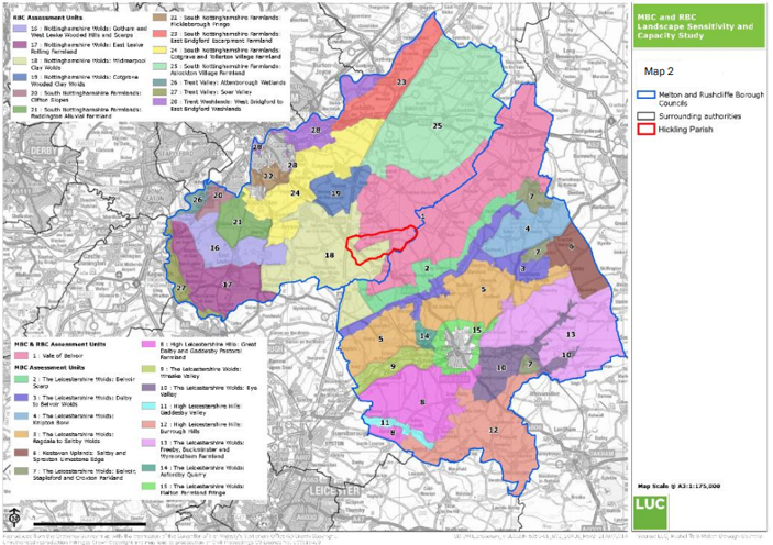
2.3 The Greater Nottingham Landscape Character Assessment (2009) provides a county-level classification of landscape character types and areas across six local authority areas, including Rushcliffe, set broadly within the framework of National Character Areas. Five landscape character areas have been identified within Rushcliffe Borough, which are sub-divided into 14 Draft Policy Zones (DPZs). The south and east of the Parish, including Hickling village, lies in the Vale of Belvoir Draft Policy Zone. Hickling Pastures straddles the Nottinghamshire Wolds: Widmerpool Clay and Vale of Belvoir Draft Policy Zones (Map 2).
Vale of Belvoir
2.4 The Vale of Belvoir is an area of natural beauty on the borders of Leicestershire, Nottinghamshire and Lincolnshire in England. The name derives from the Norman-French for ‘beautiful view’. The Vale has a predominantly flat, low-lying landform with very gentle undulations, enclosed by rolling hills such as the Belvoir Ridge in Leicestershire to the south. The Grantham Canal is a local feature and an ongoing restoration project.
2.5 The Vale of Belvoir has a mostly remote, tranquil and undeveloped character, with occasional views to scattered villages and individual farms. The main land use is arable farmland although, closer to the village fringes, smaller pasture fields become more apparent, often used as horse paddocks. A more continuous tract of permanent pasture is found between Colston Bassett, Kinoulton and Hickling. There is a tradition of dairy farming in the area and the Vale is the historic centre for Stilton cheese production.
2.6 Winding narrow lanes thread across the area linking the scattered villages. Hickling is located on relatively low ground (45 metres above sea level) at the foot of The Standard (105 m). Extensive views over the village and the wider Vale are available from The Standard, in which churches form important landmarks.
Nottinghamshire Wolds: Widmerpool Clay Wolds
2.7 The Widmerpool Clay Wolds has a rolling landscape which forms part of a wider glacial plateau of chalky boulder clay overlying lower lias and Rhaetic beds. Undulations in the landscape are formed by small streams and tributaries which have cut through softer mudstones and clays.
2.8 The area has a remote rural character. Land use is a mixture of arable and pasture although pasture becomes more dominant approaching Widmerpool and Willoughby-on-the-Wolds. Field boundaries are almost all hedgerows which are generally intact and comprise mostly hawthorn although blackthorn, field maple and hazel are present in places.
2.9 The Roman built A46 (Fosse Way) and the Old Dalby Test Railway border the Parish and these are visible for a few locations in Hickling Pastures. The A606 Melton to Nottingham road provides the main service route to the Parish.
2.10 A clay ridge runs through the centre of Hickling Pastures which allows spectacular views to the north-east over the Vale of Belvoir and beyond towards Lincoln and to the south-west over the Leicestershire Wolds to the upland tract of Charnwood Forest.
The Countryside
2.11 The countryside that we enjoy is managed by farmers and other land managers. They look after the environment through activities such as woodland and hedgerow management, conserving and restoring wildlife habitats, preserving features of importance to the local landscape and maintaining drainage systems. The rural setting is highly valued by local people so, within the countryside, development will be limited to agriculture, forestry, recreation, tourism and other developments that are suitable for a rural location in accordance with Rushcliffe Local Plan Part 2 Policy 22 (Development within the Countryside).
Policy H1: Countryside
For the purposes of Rushcliffe Local Plan Part 2 Policy 22 (Development within the Countryside), the Countryside is land outside the Hickling Limits to Development as defined on the Policies Maps.
- The character and beauty of the countryside is safeguarded
Important Views
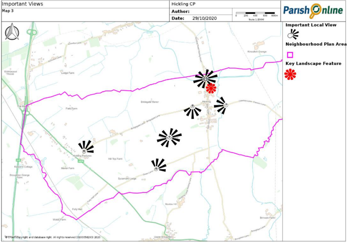
2.12 Both Hickling and Hickling Pastures have a linear form which allows the surrounding countryside to have a very strong relationship with both settlements. Therefore, in addition to important views from key viewpoints like The Standard, we want to protect the views of the surrounding countryside and important landmarks from within the two settlements.
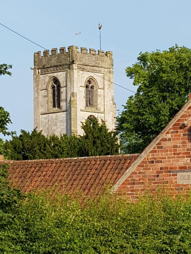
2.13 St Luke’s Church tower is a local skyline landmark that can be seen from much of the Parish and beyond. The church contributes to the historic character and scenic quality of the area and it is important that it remains the key landmark feature.
2.14 In our 2017 Questionnaire, we invited local people to identify important views. There are lots of views that people valued, the most important are set out in Appendix 1. It is important to note that the significance of any vista cannot be realised in text and images. Seasonal changes as well as exact location can significantly impact on the focal point of the vista.
Policy H2: Locally Important Views
Development should safeguard and, where possible, enhance the following important views and vistas:
- Views from The Standard
- Along the canal from Main Street, Hickling
- The canal basin from Main Street, Hickling
- From the top of Green Lane, Hickling Pastures looking towards Hickling and The Standard
- From Bridegate Lane, Hickling looking south
- From the top of Bridegate Lane, Hickling Pastures looking north-eastwards towards Colston Bassett
- View from Clawson Lane, Hickling Pastures looking west
Development should protect public views of St Luke's Church, Hickling.
- The character and beauty of the countryside is safeguarded
- The canal makes a positive contribution to village life
Tranquillity
2.15 Tranquillity is a critical part of local quality of life. Tranquillity is important for our mental and physical well-being, but it is also important to the local economy – because one of the main reasons why people visit Hickling Parish is to head out of towns and cities to ‘get away from it all’.
2.16 But getting away from it all is becoming harder and harder to do. Aircraft, cars, roads and major building developments are all eroding the tranquillity which means so much to residents and visitors alike.
2.17 Tranquillity is not just about noise – it also covers light. Dark, star-filled night skies are an important part of tranquillity, but light pollution is an increasing problem. Some of this light is necessary, in order to keep people safe – but much of it is wasting energy, increasing light pollution and disrupting local people’s sleep. Our quality of life is being reduced by light pollution.
Policy H3: Tranquillity
Planning applications for industrial, commercial, large-scale agricultural, leisure or recreation and sporting activities will only be permitted where it can be demonstrated that they will not result in any significant loss in local tranquillity. Development requiring floodlights, security lights and street-lights resulting in excessive, misdirected or obtrusive uses of light will not be permitted.
- The character and beauty of the countryside is safeguarded
Renewable Energy
2.18 Increasing the amount of energy from renewable and low carbon technologies will help ensure the UK has a secure energy supply, reduce greenhouse gas emissions to slow down climate change and stimulate investment in new jobs and businesses. Planning has an important role in the delivery of new renewable and low carbon energy infrastructure in locations where the local environmental impact is acceptable.
Solar Farms
2.19 Solar farms (sometimes known as solar parks or solar fields) are the large-scale application of solar PV panels to generate green, clean electricity. Solar farms can cover anything between 1 acre and 100 acres or more. In our 2017 Questionnaire, 34% of respondents supported solar farms.
Wind Energy
2.20 One of the key factors determining the acceptability or otherwise of wind turbines is their potential impact on the local landscape – this is due to their height and the movement they introduce into the landscape (i.e. rotating blades). In June 2015, Rushcliffe Borough Council adopted a Wind Energy Supplementary Planning Document that assists the interpretation and application of those policies within the Core Strategy that concern wind turbine proposals. The Supplementary Planning Document refers to the Melton and Rushcliffe Landscape Sensitivity Study (MRLSS) as important in determining the acceptability of different types of wind turbine development within the Borough. The landscape sensitivity assessment indicates that the Vale of Belvoir landscape would be particularly sensitive to turbines over 50m to tip and highly sensitive to turbines over 75m in height. It also notes that the landscape is likely to be highly sensitive to clusters of more than three turbines. The Widmerpool Clay Wolds landscape is likely to be particularly sensitive to turbines over 75m and highly sensitive to turbines over 110m. The Widmerpool Clay Wolds landscape is likely to be highly sensitive to clusters of more than two to three turbines.
2.21 National planning policy now allows local people to have the final say on wind farm applications. When determining planning applications for wind energy development involving one or more wind turbines, local planning authorities should only grant planning permission if the development site is in an area identified as suitable for wind energy development in a Local or Neighbourhood Plan. In our 2017 Questionnaire, only 15% of respondents supported wind turbines.
Microgeneration Technologies
2.22 Many microgeneration technologies projects, such as domestic solar PV panels, ground source and air source heat pumps are often permitted development which means they do not require planning permission providing certain limits and conditions are met. Most of the respondents to our 2017 Questionnaire (81%) supported small-scale renewable energy technologies.
Policy H4: Renewable Energy
Ground-mounted solar photovoltaic farms will only be supported where:
- They are on previously developed (brownfield) or non-agricultural land;
- Their location is selected sensitively and well planned so that the proposals do not impact on any features of local heritage or wildlife interest;
- The proposal’s visual impact has been fully assessed and addressed in accordance with Planning Practice Guidance on landscape assessment (Planning Practice Guidance ref: 5-013-20150327); and
- The installations are removed when no longer in use.
Proposals for the development of wind turbines will only be supported where these are compatible with environmental, heritage, landscape and other planning considerations.
- The character and beauty of the countryside is safeguarded
Ecology and Biodiversity
2.23 Although there are no nationally designated ecology sites, there are several wildlife sites in Hickling Parish. There is also a high concentration of ponds in an area bordered by Hickling, Keyworth, Willoughby and the county boundary with Leicestershire. Data suggests that this may be particularly important for Great Crested Newts.
2.24 The Neighbourhood Plan provides an opportunity to protect other broad habitat types, such as other wetlands, grasslands and woodland. 90% of respondents to our 2017 Questionnaire thought that our Neighbourhood Plan should identify, protect and where possible enhance local biodiversity.
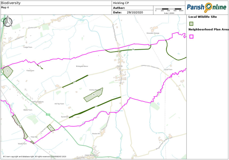
Local Wildlife Sites
2.25 Local Wildlife Sites (previously known as Bio Sincs) are identified and selected locally using robust, scientifically-determined criteria and detailed ecological surveys. These special and often secret spaces have a huge part to play in the natural green fabric of our countryside. There are eight Local Wildlife Sites in Hickling Parish:
- Crossroads Meadow: A large, species-rich hay meadow
- Broughton Wolds Grasslands: A series of species-rich neutral grasslands
- Folly Hall Lane Meadow: A very species-rich grassland
- Green Lane verges: Species-rich verges
- Standard Meadow: An unimproved, neutral and species-rich calcareous grassland
- Bridegate Lane verges: A significant area of unimproved grassland along a roadside verge
- Track and bank: A species-rich hedgerow with associated features
- Grantham Canal: An excellent example of a disused canal with a rich aquatic plant community and zoological interest
Biodiversity Opportunity Mapping
2.26 Nottinghamshire Biodiversity Action Group has produced Biodiversity Opportunity Maps for much of Nottinghamshire. The maps identify opportunities for improving habitat condition and connectivity across Nottinghamshire, and the outcomes of the project will help to underpin the wider work of Nottinghamshire Biodiversity Action Group, the Local Biodiversity Action Plan partnership for Nottinghamshire.
2.27 The mapping project has been undertaken in sub-areas of the county where funding has been made available. To date a biodiversity opportunity map has been created for Ashfield, Broxtowe, Rushcliffe, Sherwood and the Trent Valley. The Biodiversity Opportunity Mapping that is relevant to Hickling Parish is set out at Appendix 2.
Biodiversity net gain
2.28 Biodiversity net gain is an approach to development that leaves the natural environment in a measurably better state than it was beforehand. Net gain is an umbrella term for both biodiversity net gain and wider environmental net gain. The Neighbourhood Plan set out a suitable approach to biodiversity net gain in Hickling parish. It sets out the areas that present the best opportunities to deliver gains identified by the Biodiversity Opportunity Map for Rushcliffe as well as relatively small features that can achieve important benefits for wildlife.
Policy H5: Ecology and Biodiversity
Development should not harm the network of local ecological features and habitats which include (as shown on the Policies Map):
- Crossroads Meadow
- Broughton Wolds Grasslands
- Folly Hall Lane Meadows
- Green Lane verges
- Standard Meadow
- Bridegate Lane verges
- Track and bank
- Grantham Canal
Planning conditions or obligations should, in appropriate circumstances, be used to ensure that new development provides for works that will measurably increase biodiversity. The local priorities are the enhancement of existing and the create new ecological corridors and features (such as grassland, watercourses, verges, hedgerows and woodland), having regard to Biodiversity Opportunity Mapping (Appendix 2). All new houses should integrate features such as bat boxes, bird boxes and hedgehog highways to support biodiversity.
- The character and beauty of the countryside is safeguarded
- The canal makes a positive contribution to village life
Trees and Hedges
2.29 Mature hedgerows line Main Street, Hickling as it enters the village from both the north and south directions. A long stretch of mature hedgerow also runs along both sides of the road where Bridegate Lane meets Main Street and, as with the open spaces, brings a countryside character to the centre of the village.
2.30 There are many significant mature trees in the village and these all play a role in framing key buildings, softening the built fabric and enhancing the special character of the village. The most significant clusters of trees are in the grounds of the Church of St Luke, in the open space where Clawson Lane meets Main Street and along Long Lane and the wooded areas around it.
2.31 Most of Hickling village lies within a Conservation area and consequently, any tree over 75mm in diameter at 1.5m above ground level is given automatic protection. No cutting, removal, wilful damage or destruction of such trees is allowed without giving prior notification to Rushcliffe Borough Council.
2.32 Trees, hedgerows and the grass verge along Melton Road are also a defining feature of Hickling Pastures. There is a continuous hedgerow through the settlement on both sides of the road.
2.33 Most (93%) of the respondents to our 2017 Questionnaire wanted to see important trees protected.
2.34 The call for a Tree Charter was initiated in 2015 by the Woodland Trust in response to the crisis facing trees and woods in the UK. In July 2018, Hickling Parish Council signed The Charter for Trees, Woods and People – or Tree Charter for short – which sets out the principles by which trees and people in the UK can stand stronger together.
Policy H6: Trees and Hedges
Planning applications involving the potential loss of significant trees or hedgerows should be accompanied either: (a) by a survey that establishes the health and longevity of any affected trees and hedgerows as well as their role in the local ecosystem; or (b) by a statement explaining why such a survey is not thought necessary, having regard to the scale or character of the proposals and the overall objectives of this policy. Development that damages or results in the loss of ancient trees, or hedgerows or trees of good arboricultural and amenity value, will only be supported in principle where the benefits of the development are considered to outweigh the harm involved. In these circumstances, native species replacements should be planted in locations where they would have the opportunity to grow to maturity, increase canopy cover and contribute to the local ecosystem.
- The character and beauty of the countryside is safeguarded
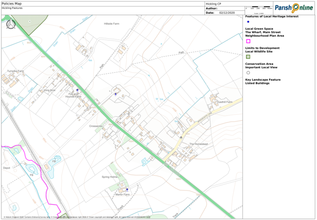
Local Green Spaces
2.35 National policy makes provision for local communities to identify green areas of importance to those communities, where development will not be permitted except in very special circumstances. The importance of these Local Green Spaces is summarised in Appendix 3.
Policy H7: Local Green Spaces
The following sites have been designated as Local Green Spaces:
- Canal basin, Hickling
- St Luke’s churchyard, Hickling
- Walker's Green, Hickling
- Cemetery, Clawson Lane, Hickling
- Land between Glebe Cottage and Waterlane Farm, Hickling
- Land opposite the junction of Clawson Lane and Main Street, Hickling
- Strip of land between Harles Acres and Pudding Lane, Hickling
- Land north of The White House, Main Street, Hickling
Development that would harm the openness or special character of a Local Green Space (as designated on the Polices Map) or its significance and value to the local community will not be permitted unless there are very special circumstances which outweigh the harm to the Local Green Space, such as:
- Provision of appropriate facilities to service a current use or function; or
- Alterations or replacements to existing building(s) or structure(s) provided that these do not significantly increase the size and scale of the original building(s) or structure(s).
- Heritage is conserved
- The character and beauty of the countryside is safeguarded
- The canal makes a positive contribution to village life
3. Heritage and Design
Historical development
3.1 The landscape of the Vale of Belvoir is superficially a creation of the enclosure movement of the 16th, 17th and 18th Centuries, modified by the requirements of the post 1945 economy and modern farming techniques. Behind this, however, stands over 3,000 years of settlement and land use which through the generations have influenced the development of the early 21st century countryside. From late prehistory to the end of the 18th century, this region was consistently part of the most densely settled and economically strong area of pre-industrial Nottinghamshire.
3.2 There is evidence of early prehistoric activity (flint tools) and during late prehistory the Vale of Belvoir became extensively settled. When the Romans arrived in the middle of the 1st Century AD, they found an already well settled and developed landscape. It appears that the Vale of Belvoir was an agricultural hinterland to the Roman towns of Margidunum, near Bingham, and Vernemetum, near Willoughby on the Wolds, and to settlements in Leicestershire. The result of this history was the clearance of the natural woodland and the development of an agricultural landscape of arable and pasture fields. The landscape was likely to have remained in a similar state up until the 8th or 9th centuries.
3.3 The Scandinavian invasions in the 9th and 10th centuries brought changes to the landscape, with the dispersed settlement pattern being replaced by nucleated villages with people grouping together around the farm of the local lord, or at other geographically favourable sites.
3.4 Hickling appears to have been a particularly important community, possibly because of important Anglo-Scandinavian landowners. Village formation was well advanced by 1086, when the Domesday Book was drawn up and the Vale of Belvoir was part of the most densely settled and cultivated areas of Nottinghamshire. This well-developed agricultural countryside continued throughout the middle ages, with little evidence of woodland.
3.5 The Church of St Luke as it stands today dates to the 14th Century and contains one of only two priest brasses in the county dated 1521.
3.6 The Black Death (1349) and subsequent Plagues and epidemics brought a swing away from arable production and towards grasslands and grazing. By the late 18th Century the Vale of Belvoir was recognised for the breeding and fattening of cattle.
3.7 The enclosure act of the 16th Century introduced more hedgerows and the pattern of the areas field systems was therefore laid out between 1500 and 1820. The rebuilding of the villages in brick took place during the 18th and 19th centuries. This began with the houses of the nobility and gentry and by the late 18th century it was usual for the humblest of new dwellings to be built in brick. Gradually, during the 18th and 19th centuries, the old styles of buildings with timber frames or of mud-and-stud construction and thatched roofs were replaced, or encased, in brick with pantile and some plain tile roofs. Local clay pits and brick kilns were often the source of bricks. Stone building is a less common feature of the area.
3.8 The Grantham Canal arrived in the late 18th Century, which brought with it the canal basin, Lengthman’s hut and canal warehouse, all of which remain today. The canal would have also brought building materials that were not available in the immediate locality.
3.9 Hickling Pastures first developed as a small hamlet in the 1930’s and 40s around the Fox and Hounds PH on the west side of the Melton Road.
Listed Buildings
3.10 A listed building is a building which has been designated because of its special architectural or historic interest. The older a building is, the more likely it is to be Listed. All buildings built before 1700 which survive in anything like their original condition are Listed, as are most of those built between 1700 and 1840.
- Grade I buildings are of exceptional interest, nationally only 2.5% of Listed buildings are Grade I
- Grade II* buildings are particularly important buildings of more than special interest; 5.5% of Listed buildings are Grade II*
- Grade II buildings are of special interest; 92% of all Listed buildings are in this class and it is the most likely grade of listing for a home owner.
3.11 There are 31 Listed buildings in Hickling Parish. They include the Grade I Church of St Luke along with several tombs and headstones in the churchyard. There are also several buildings and structures associated with the Grantham Canal that are listed.
Hickling Conservation Area
3.12 A conservation area is an area which has been designated because of its special architectural or historic interest, the character or appearance of which it is desirable to preserve or enhance. Hickling was first designated as a Conservation Area in 1990. The Conservation Area was extended in 2007 and now includes most of the buildings in the village and their grounds.
3.13 Hickling Conservation Area is supported by an Appraisal and Management Plan and a Townscape Appraisal. Both are material consideration in deciding planning applications.
3.14 We expect all planning applications within the Hickling Conservation Area to include details of scale, layout and appearance.
Non-designated Features of Local Heritage Interest
3.15 The above places have already been designated and offered protection through national and local planning policies, however there are other buildings and sites in the parish that make a positive contribution providing local character and sense of place because of their heritage value. Although such heritage features may not be nationally designated, they may be offered some level of protection through the Plan. The Plan includes information about local, non-designated heritage features to guide decisions.
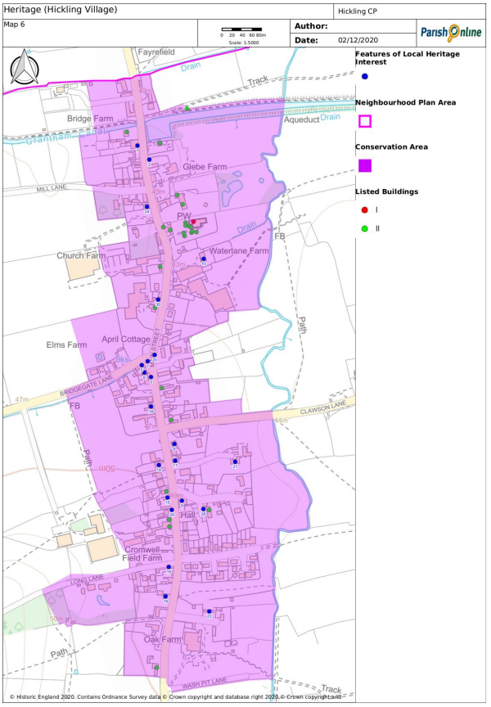
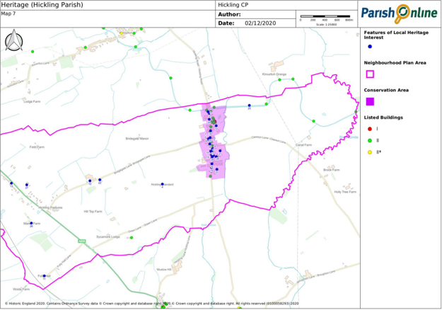
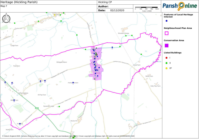
Policy H8: Features of Local Heritage Interest
The determination of planning applications which would affect features of local heritage interest (as shown on the Policies Map and listed below) will balance the need for, or public benefit of, the proposed development against the significance of the asset and the extent to which it will be harmed:
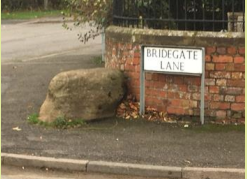
- Devil’s stone, junction of Bridegate Lane and Main Street, Hickling
- Weigh Office, Main Street, Hickling
- Telephone Box, Main Street, Hickling
- Trig point, The Standard
- The Chapel (former Wesleyan Methodist chapel), Main Street, Hickling
- The Old School House, Main Street, Hickling
- The Plough Inn, Main Street, Hickling
- Weir House, Main Street, Hickling
- Village Hall, Main Street, Hickling
- Waterlane Farm, Main Street, Hickling
- Folly Hall, Folly Hall Lane, Hickling Pastures
- Lincoln Lodge, Bridegate Lane
- Fox and Hounds Farm, Hickling Pastures
- Forge Cottage, Main Street, Hickling
- Glebe Cottage, Main Street, Hickling
- Burnetts, Main Street, Hickling
- Duisdale, Main Street, Hickling
- Beech House, Main Street, Hickling
- The Yews, Main Street, Hickling
- Village Sign, Main Street, Hickling
- The Manor House, Main Street, Hickling
- The Blossoms, Bridegate Lane
- 1 & 2 Jacks Croft, Pudding Lane, Hickling
- Heritage is conserved
Design
3.16 We expect all development to contribute positively to the creation of well-designed buildings and spaces. Through good design we want to maintain and enhance the unique character of Hickling and Hickling Pastures and create places that work well for both occupants and users and are built to last.
3.17 The results of our 2017 Questionnaire show that 86% of respondents wanted to see design guidance included in our Neighbourhood Plan. Based on the Hickling Conservation Area Appraisal and Management Plan, we have prepared a Design Guide. The Deign Guide describes the distinctive character of Hickling parish and highlights the qualities valued by its residents. From these qualities, design principles have been drawn up to guide development.
Policy H9: Local Design
All new developments should reflect the distinctive character of Hickling or Hickling Pastures as appropriate. Development in >Hickling village should reflect the guidance set out in the Hickling Design Guide (Appendix 5). Development must also:
- Be in keeping with the scale, form and character of its surroundings;
- Protect important features such as traditional walls, hedgerows and trees;
- Protect spaces between buildings that allow for views of the surrounding countryside from within the built-up areas of Hickling and Hickling Pastures;
- Not result in the loss of residential garden space to the detriment of the character of Hickling or Hickling Pastures;
- Not significantly adversely affect the amenities of residents in the area, including daylight/sunlight, privacy, air quality, noise and light pollution;
- Not significantly increase the volume of traffic through the Parish’s settlements; and
- Have safe and suitable access.
- Heritage is conserved
4. Housing
Local Plan Part 1: Core Strategy
4.1 The Hickling Parish Neighbourhood Plan must be in general conformity with the strategic policies of the Rushcliffe Core Strategy and it should not promote less development or undermine its strategic policies.
4.2 The Core Strategy plans for 13,150 new homes over the period 2011 to 2028. Most of this new development is directed to the edge of the built-up area of West Bridgford and the Key Settlements of Bingham, Cotgrave, East Leake, Keyworth, Radcliffe on Trent and Ruddington. In other settlements, except for Newton and the redevelopment of the former RAF Newton, development will be for local needs only.
4.3 Neither Hickling nor Hickling Pastures therefore, are expected to accommodate development other than to meet local needs.
Meeting Local Housing Needs
4.4 Since 2011, three houses have been built (net of demolitions) in the Parish (to 31st March 2017) and a further five homes had planning permission.
4.5 In our 2017 Questionnaire, we invited local people to set out how many new homes we should plan for. The results were:
- None - 21
- 1 to 5 - 38
- 6 to 10 - 22
- 11 to 15 - 10
- 16 to 20 - 13
- 21 to 25 - 4
- More than 25 - 3
4.6 We also asked parishioners to identify any housing needs over the coming years. 33 residents said that someone in their household expect to need to move within the Parish within the next ten years.
4.7 Taking account of duplicate responses, 26 households said that they, or someone in their current household, expected to need to move within the Parish within the next ten years. 93% wanted a two or three bed house- none wanted a house of more than three bedrooms. This need came from all age groups. 11 wanted to move because their existing house was too large, eight were from young people looking to live independently. In most cases this need could be met by market housing or self-build housing. Only two households wanted Local Authority or Housing Association housing.
4.8 Not all this housing need must be met in Hickling Parish. Some younger people will move away for work or to study, while housing for older people could free-up existing homes for new households. Nonetheless, up to ten new homes are needed over the period to 2028 and our 2017 Questionnaire shows that many local people support small-scale development.
4.9 Around ten new homes have been granted planning permission since this survey was undertaken. However, most are larger properties or agricultural dwellings that do not meet the need for smaller housing suitable for downsizers or first-time buyers.
4.10 Issues concerning how to meet the local need for new housing have been difficult to resolve and there is no consensus on the way forward. A further questionnaire survey was undertaken in Summer 2020 to help find a solution. There were 253 responses, and our housing policies reflect the survey results.
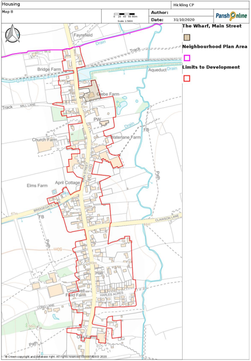
4.11 58.8% of respondents thought that our Neighbourhood Plan should try to meet local housing needs. However, most would prefer not to meet this need over the allocation of a housing site. Therefore, to meet the need for new homes, our Plan allows for the conversion of existing rural buildings, infill housing development and the redevelopment of the brownfield part of the Faulks depot in Hickling. To clarify where infill development would be acceptable, our Neighbourhood Plan defines Limits to Development for Hickling village which takes account of the character of the village. In the remainder of the Parish new residential development will normally be limited to the conversion of existing buildings. This includes Hickling Pastures where the lack of services and facilities makes the settlement an unsuitable place for new house building.
Question: Please place the following housing options in order of preference? The number of responders is listed in preference 1 to 4.
The redevelopment of the Faulks' site with a small greenfield extension
- 76
- 34
- 24
- 14
The Orchard, Long Lane
- 20
- 58
- 31
- 35
The development of greenfield sites elsewhere
- 17
- 22
- 40
- 58
Do not meet the housing need
- 114
- 25
- 39
- 31
Policy H10: Housing Provision
Housing development within the Hickling Limits to Development, as defined on the Policies Map, will be supported. Outside the Hickling Limits to Development, permission for housing development will be limited to:
- The development of previously used (brownfield) land that is well-related to the settlement of Hickling Pastures, in principle, having regard to the other policies in the neighbourhood plan;
- The re-use and adaptation of redundant rural buildings in accordance with Policy H12 (Residential Conversion of Rural Buildings);
- The subdivision of an existing dwelling;
- A dwelling that, in accordance with the National Planning Policy Framework, is of exceptional design quality, in that it:
- is truly outstanding or innovative, reflecting the highest standards in architecture, and would help to raise standards of design more generally in rural areas; and
- would significantly enhance its immediate setting, and be sensitive to the defining characteristics of the local area;
- Replacement dwellings in accordance with Policy H13 (Replacement Dwellings);
- Rural worker accommodation in accordance with Policy H17 (Rural Worker Accommodation); and
- Rural exception site development where need has been demonstrated through an up-to-date housing needs survey.
- Housing development reflects local needs
The Wharf, Main Street, Hickling (NOT AN ALLOCATED SITE FOR HOUSING)
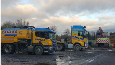
4.12 AE Faulks Ltd operate a plant-hire business from The Wharf, Main Street, Hickling. The site contains an industrial building containing a workshop, storage and office. On three sides, there is an open yard area for parking and storage along with two above-ground fuel tanks. The site accommodates up to 14 heavy goods lorries, four trailers and other heavy plant and equipment. Over the years, the company has been the subject of numerous complaints regarding noise and disruption caused by heavy vehicles passing through the village. In our 2017 Questionnaire, 63% of respondents said there was a problem with HGVs in the area.
4.13 In 2007, a planning application was submitted for the redevelopment of this site for six dwellings, but the application was withdrawn.
4.14 The National Planning Policy Framework encourages the re-use of brownfield sites like this and redevelopment will help limit the pressure for new housing in the countryside. The redevelopment would remove HGV traffic through the village and provide an opportunity to plan for the mix of housing local people need. We also believe that by removing existing depot buildings and replacing them with well-designed new homes, there is an opportunity to enhance the character of the Conservation Area and the setting of nearby Listed Buildings. To achieve this, the development will need to have regard to important views of the listed St Luke’s Church from the canal towpath, the setting of other Listed Buildings including Wharf House and Glebe Farm and the need to retain important Conservation area features such as trees, hedgerows, walls and other structures of special architectural or historic character. 69.8% of respondents to our 2020 Questionnaire Survey supported the relocation of the Faulks' plant hire business.
4.15 The company is receptive to redevelopment as it would facilitate the business’ relocation to Station Road, Old Dalby where it has had planning permission for a new depot. However, the company has made it clear that it will not redevelop the site without an element of greenfield land and wants a greenfield extension of almost 50m. The Neighbourhood Plan Steering Group considered this to be excessive and many residents object to the idea of allowing any extension of the site onto the fields behind the site.
4.16 Illustrative proposals for ‘The Wharf’ site in Hickling, Nottinghamshire were produced by AECOM as part of a Locality led, Government-funded neighbourhood planning support programme. AECOM were of the view that an element of greenfield development is needed to mitigate the constraints of the site. For example, a public sewer runs through the site which cannot be built over. The encroachment onto the undeveloped greenfield land to the rear of the site would have an average depth of 10m and be used as garden space.
4.17 65.9% of respondents to our 2020 Questionnaire Survey did not support AECOM’s illustrative proposal and consequently the allocation has not been made and is therefore revoked. However, 60.1% do support the redevelopment of just the brownfield part of the site for housing. Policy H11 (The Wharf, Main Street, Hickling) reflects the community’s preference for the redevelopment of the site to be limited to brownfield land.
Policy H11: The Wharf, Main Street, Hickling (not a housing allocation)
Although not allocated for housing development, the redevelopment of some 0.36 hectares of brownfield land at The Wharf, Main Street, Hickling, shown on the Policies Map, for housing will be supported subject to the following criteria:
- The development shall not extend beyond the lawful limits of the existing business;
- The development shall accord with Policy H14 (Housing Mix);
- The redevelopment shall have regard to the amenities of neighbouring residents, especially overlooking;
- The design of the development should seek to enhance the character of Hickling Conservation Area, the setting of Listed Buildings and other heritage assets. Any less than substantial harm to heritage assets should be weighed against the public benefits of the proposal as identified by this Plan;
- All existing buildings and structures associated with the plant-hire business shall be removed prior to the commencement of any development;
- Any contamination present shall be safely remediated prior to the commencement of any development;
- A landscaping scheme should be implemented to include the planting of trees and hedgerows along the boundaries of the site and the creation of links to the Grantham Canal green corridor; and
- The neighbouring Local Wildlife Site should not be adversely affected, and the development should deliver net-gains in biodiversity in accordance with Policy H5 (Ecology and Biodiversity).
- Reduced impact of traffic
- Housing development reflects local needs
Residential Conversion of Rural Buildings
4.18 On 6 April 2014, new permitted development rights were introduced which allow for the conversion of agricultural buildings to dwellings without the need for planning permission. However, various conditions and restrictions apply and before starting development, there is a requirement to apply to the local planning authority for prior approval. The rules mean that not all rural buildings benefit from these permitted development rights so, in accordance with local support, our Plan provides further flexibility for the conversion of rural buildings to residential use.
4.19 Many buildings in the countryside are attractive, frequently constructed from local materials and often reflect the local vernacular, which in turn contribute significantly towards the character and diversity of the Parish. The conversion of these rural buildings to provide new homes can make the best possible use of existing buildings and reduce the demand for new buildings in the countryside.
4.20 Not all buildings in the countryside are suitable for conversion or adaptation to housing as they may be of modern materials, poorly designed or constructed. Redundant buildings proposed for re-use should be structurally sound to ensure they are able and appropriate for conversion. This should be demonstrated through an up to date structural survey submitted with any planning application. Extensive works should not be required to make the building habitable. Demolition should be avoided to retain the character of traditional buildings.
4.21 Any extensions or alterations should respect the form and character of the existing building and not extend beyond the existing curtilage. Modern additions which detract from the scale and form of the existing building will be resisted.
Policy H12: Residential Conversion of Existing Rural Buildings Situated Beyond the Limits to Development
Where planning permission is required for the re-use and adaptation of redundant or disused rural buildings for residential use, this will be supported where:
- The building is structurally sound and capable of conversion without significant rebuild or alteration;
- The development will maintain the character of the building, including the retention of important features;
- The use of the building by protected species is surveyed and mitigation measures are approved where necessary; and
- Any proposed extension(s) or alterations are proportionate to the size, scale, mass and footprint of the original building and situated within the original curtilage.
- Heritage is conserved
- A working community with farming roots
- The character and beauty of the countryside is safeguarded
Replacement Dwellings
4.22 It is recognised that the replacement of a dwelling in the rural area can result in significant benefits to the local area. It can lead to improved architectural appeal and modern construction standards leading to better energy efficiency. It can also overcome poor construction techniques employed with the original dwelling and can provide accommodation and facilities which more appropriately accord with modern life.
4.23 Due to these significant potential benefits, where development would result in an enhancement to the area, replacement dwellings in the rural area will often be acceptable. However, where dwellings are replaced, the new dwelling should be sympathetic to the size and appearance of the original. Modest increases in size from the original dwelling will normally be acceptable but we are keen to ensure that the limited stock of small and single-storey housing is not reduced. It is also important that the replacement dwelling is compatible with its surroundings in terms of size, scale, mass and footprint and sited within the pre-existing residential curtilage. To manage the future impact on the landscape and rural character of the area, it may be necessary to impose a condition to the planning permission to remove permitted development rights to prevent replacement dwellings from being extended disproportionately in the future.
4.24 Any proposals to replace a dwelling should not lead to an increase in the number of residential units on the site. Conditions will be attached to any planning permission for replacement dwellings to ensure that demolition of the existing dwelling is carried out.
Policy H13: Replacement of Existing Dwellings Situated Beyond the Limits to Development
Proposals for the demolition and rebuild of an existing dwelling will be supported where:
- It does not lead to a reduction in the stock of smaller or single-storey dwellings;
- The new dwelling is proportionate to the size, scale, mass and footprint of the original dwelling and situated within the original curtilage.
- Housing development reflects local needs
- The character and beauty of the countryside is safeguarded
Housing Mix
4.25 In planning for new homes, the type of housing should meet the needs of people living locally. New housing should take into consideration the housing profile of the area and the views of local people:
- There is already a high proportion of detached dwellings - 84% of dwellings in the Parish are detached compared with 46% in Rushcliffe Borough and 22% in England (2011 Census).
- Significant levels of under-occupancy currently exist - 89% of dwellings in the Parish have an occupancy1 rating of 2+ compared with 68% in Rushcliffe Borough and 50% in England (2011 Census).
- House prices are high - The average property value in Hickling is £365,876 (Zoopla October 2020)
- The people in need want smaller houses - 53% of household needing to move within the Parish within the next ten years say they need a 2 bed property. 34% want a 3 bed home.
- Local people would like to see a mix of housing types and sizes - Responses to our 2017 Questionnaire showed that the top three priorities for new housing were:
- 3 bed houses (e.g. for families with children)
- 2 bed houses (e.g. for couples, smaller families, single parents, singles with child access and frequent visitors)
- 2/3 bed bungalows for downsizing older people
Note:
Occupancy rating provides a measure of whether a household's accommodation is overcrowded or under occupied. The ages of the household members and their relationships to each other are used to derive the number of rooms/bedrooms they require, based on a standard formula. The number of rooms/bedrooms required is subtracted from the number of rooms/bedrooms in the household's accommodation to obtain the occupancy rating. An occupancy rating of -1 implies that a household has one fewer room/bedroom than required, whereas +1 implies that they have one more room/bedroom than the standard requirement.
4.26 Hickling Parish Council will review the evidence of housing need once local data from the 2021 Census has been published and thereafter every five years to ensure that the Plan continues to meet the needs of people living locally. Evidence of a significant change in circumstance may trigger a full or partial review of the Plan.
4.27 Policy H14 makes clear that new houses of more than three bedrooms require special justification for planning permission to be granted. However, alterations affecting only the interior of the building do not require planning permission. To help detect potential abuse of Policy 14 through the development of over-sized ‘three-bed’ dwellings which are later altered to become four-bed (or more), new dwellings of Gross Internal (floor) Area of more than 84 square metres will be subject to special scrutiny. The requirements of Policy H14 could also be circumvented by using ‘permitted development rights’ to increase the size of new homes once they have been built, without the need for planning permission. Therefore, permitted development rights may be withdrawn for a temporary (e.g. three-year) period to deter this abuse.
Policy H14: Housing Mix
Applicants for the development of new dwellings will need to demonstrate how their proposals will meet the housing needs of older households and/or the need for smaller, affordable homes for sale or rent. The development of housing with more than three bedrooms will normally only be supported if it is necessary to make best use of a redundant or disused rural building in accordance with Policy H12 (Residential Conversion of Existing Rural Buildings Situated Beyond the Limits to Development).
- Housing development reflects local needs
Affordable Housing
4.28 Affordable housing is housing for sale or rent, for those whose needs are not met by the market (including housing that provides a subsidised route to home ownership and/or is for essential local workers). Affordable housing can include affordable housing for rent, starter homes, discounted market sales housing and other affordable routes to home ownership.
4.29 Our 2017 Questionnaire identifies a need for local housing, but this need can largely be met by market housing. There were only two households that said that their housing needs could only be met by Local Authority or Housing Association property to rent or for shared-ownership. The limited need for additional affordable homes means that there is no immediate requirement to allow planning permission to be granted for affordable housing on a ‘Rural Exception Site’, i.e. a site that would not normally be released for private market housing. In our 2017 Questionnaire, 51% of respondents said that they would not support a Rural Exception Site for affordable housing.
5. Services, Facilities and Infrastructure
5.1 The National Planning Policy Framework promotes the retention and development of local services and community facilities in villages, such as local shops, meeting places, sports venues, cultural buildings, public houses and places of worship. However, the provision of such services and facilities in Hickling Parish is limited. Hickling village has a church, pub, village hall and a cricket club. There are no such services in Hickling Pastures.
5.2 Hickling Pastures is served by the Centrebus Number 19 bus service between Nottingham, Melton Mowbray and Oakham. This is a two-hourly, daytime service with no evening nor Sunday service. Hickling village is served by the NottsBus 853 service that provides three off-peak journeys to and from Morrisons store at Gamston. There is also one journey in each direction to West Bridgford where passengers can access regular bus services to Nottingham. Community transport services are provided in the Hickling area by Rushcliffe CVS.
5.3 Our 2017 Questionnaire showed that most (71%) local people would like to see a general store.
5.4 The loss of even the limited services and facilities that residents currently enjoy can have a significant impact on people’s quality of life and the overall viability of the community. With an increasing proportion of older people in the population, access to locally based services will become increasingly important due to lower mobility levels. Almost all the respondents (94%) to our 2017 Questionnaire supported the retention of services and facilities.
Policy H15: Community Services and Facilities
Development that would result in the loss of the Plough Inn, Hickling or Hickling Village Hall will not be supported, unless it can be demonstrated that:
- All reasonable efforts have been made to preserve the facility, but it has been demonstrated that it would not be economically viable, feasible or practicable to retain the building for its existing use;
- The property has been marketed for a 12month period and that there is no realistic interest in its retention for the current use or for an alternative community use; and
- It is no longer needed by the local community or that the facility is being replaced by equivalent or better provision in terms of quantity, quality and location.
- Local services and facilities are retained
St Luke's Church, Hickling
5.5 St Luke's Church, Hickling is a Grade I listed parish church. It was built in the 14th century. The chancel was rebuilt in 1845, and the tower in 1873. A general restoration was carried out in 1886. It is part of the benefice which includes three churches- Hickling, Kinoulton, and Upper Broughton.
The Plough Inn, Hickling
5.6 The Plough at Hickling is an attractive village pub, just opposite Hickling Basin in the heart of Hickling. A good range of food served lunch time and evenings. The Plough Inn was designated as an Assets of Community Value (AVC) in June 2018 so that we can then use the Community Right to Bid if it ever comes up for sale. This means that the community can have up to six months to raise the funds to bid for it and at the end of the period, the owner may sell it to whoever and at whatever price they choose. The Old Wharf Tea Rooms is also an AVC.
Hickling Village Hall
5.7 Hickling Village Hall was once the village school. The building is used by Hickling Pre-School which caters for children from 2 to 5 years old and has strong links to Kinoulton Primary School.
Hickling Cricket Club
5.8 Hickling Cricket Club founded in 1864 is a member of the Nottinghamshire Cricket League and the Belvoir Evening League. The picturesque cricket ground is on Bridegate Lane.
Infrastructure
5.9 Developers may be asked to provide contributions for infrastructure in several ways. This may be by way of the Community Infrastructure Levy and planning obligations in the form of section 106 agreements and section 278 highway agreements. Developers will also have to comply with any conditions attached to their planning permission. We must ensure that the combined total impact of such requests does not threaten the viability of the sites and scale of development identified in our Plan.
5.10 There are specific circumstances where contributions for affordable housing and tariff style planning obligations (section 106 planning obligations) should not be sought from small-scale and self-build development. As we are not planning for anything other than small-scale development, our Plan does not set-out policies for seeking planning obligations towards infrastructure provision.
6. Traffic and Parking
6.1 Traffic (particularly HGVs), road safety, speeding and inconsiderate parking were all concerns for local people.
Traffic
6.2 There are particular traffic problems in Hickling Pastures which is on the busy A606 Melton Road. Most respondents from Hickling Pastures (85%) thought that speeding traffic was a problem despite the various measures in place to control speeds there and 85% were concerned that there were too many lorries and HGVs. There have been four recorded accidents along this stretch of road over the period 2012-2016, including one serious accident involving four vehicles. There have also been two serious accidents on Bridegate Lane between Hickling Pastures and Hickling.
6.3 80% of the respondents to our 2017 Questionnaire from Hickling village were concerned with speeding traffic and 60% thought there were too many lorries and HGVs. There have been no recorded accidents in Hickling village over the period 2012-2016. Issues concerning HGVs could be partially resolved by the redevelopment of The Wharf site on Main Street (Policy H11). Nonetheless, local concerns about through traffic and HGVs will remain given the level of growth that is planned in nearby communities, especially Long Clawson.
Parking
6.4 Parking issues in Hickling Pastures are not a concern. Almost half (49%) of the respondents to our 2017 Questionnaire who were from Hickling Pastures said that they had not experienced problems associated with inconsiderate parking and only 18% had experienced problems in Hickling Pastures.
6.5 Parking at Hickling Basin was a concern for 50% of respondents living in Hickling village and 48% had experienced problems associated with inconsiderate parking elsewhere on Main Street. Policies H11 and H18 aims to address some of the concerns associated with parking at Hickling Basin. It is quite possible that on-street parking contributes to lower vehicle speeds in the village.
7. Employment
Economic Activity
7.1 The 2011 Census shows that of the 373 Parish residents aged 16 to 74, 260 were economically active. Of those economically active, 45% were in full-time employment, 20% were in part-time jobs and 31% were self-employed. In September 2020, the Job Seekers Allowance claimant count in Nevile and Langar Ward was 15.
7.2 The 2011 Census shows that a particularly high proportion of working residents were managers, directors or senior officials– 59 people or 23% compared with 14% in Rushcliffe Borough.
7.3 Historically, agriculture provided the bulk of local employment and it remains part of village life and the local economy. However, in 2011 (Census) only 8% of the Parish’s workers were employed in agriculture, forestry or fishing.
7.4 17 local businesses responded to our 2017 Questionnaire. Almost all (94%) were micro-businesses employing less than ten people. The largest business sector was primary e.g. agriculture (38%) followed by construction (24%). For 91% of businesses their premises were also their home. More than half (55%) had been established for more than 20 years.
7.5 Not many residents are intending to set-up new businesses. Although there is limited demand for new business space, we want to support small-scale economic growth in Hickling Parish to create jobs and prosperity, reduce the need for people to travel to work by car, and provide opportunities for the expansion and growth of local enterprise. We want to maintain our farming heritage.
Home Working
7.6 Planning permission is not normally required to home work or to run a business from home, provided that a house remains a private residence first and business second. Rushcliffe Borough Council is responsible for deciding whether planning permission is required and will determine this based on individual facts. Issues which they may consider include whether home working or a business leads to notable increases in traffic, disturbance to neighbours, abnormal noise or smells or the need for any major structural changes or major renovations. Our 2017 Questionnaire showed that 88% of respondents supported home working.
Business Conversion of Rural Buildings
7.7 We want to expand the diversity of the rural economy while preserving and enhancing the environment of the countryside. Our 2017 Questionnaire demonstrates that local people support (75% of respondents) the conversion of existing rural buildings to business use. However, the proposed uses must be appropriate in scale, form, impact, character and siting to their location in the countryside. To allow farming to accommodate change and support the rural economy our Plan gives more flexibility over the reuse of rural buildings for business rather than residential purposes.
Policy H16: The Re-use of Rural Buildings for Business Use
The re-use, adaptation or extension of rural buildings for business use will be supported where:
- The existing buildings are suitable for the proposed new use(s);
- Any enlargement is proportionate to the size, scale, mass and footprint of the original building;
- The development would not have a detrimental effect on the fabric, character and setting of historic buildings;
- The development respects local building styles and materials;
- The use of the building by protected species is surveyed and mitigation measures are approved where necessary;
- The proposed development would not generate traffic of a type or amount harmful to local rural roads, or require improvements which would detrimentally affect the character of such roads or the area generally; and
- The proposed development would not materially harm the character of the surrounding rural area.
- A working community with farming roots
- The character and beauty of the countryside is safeguarded
Rural Worker Accommodation
7.8 In recognition of the importance of rural businesses to the Parish, our Plan allows new homes to be built for rural workers in the countryside. This policy relates to workers of rural enterprise and not just land-based agricultural businesses. The term rural enterprise is wide-ranging and employees relevant to this policy could include the following:
- A farmer or farm worker;
- Workers relating to equestrian activities;
- Kennel and cattery workers.
7.9 The application will need to be examined to determine if the requirement for a new dwelling is essential for the proper functioning of the enterprise. The essential need will vary from business to business depending on each enterprise’s requirements. The essential need does not refer to the personal aspirations of an applicant. Such a requirement may arise if workers are needed to be on hand day and night such as where the welfare of animals depends on the ability to respond quickly to events which might put the interests of an enterprise at risk.
7.10 To minimise isolated homes in the countryside and ensure the most sustainable use of resources, applicants must also demonstrate that there are no existing dwellings or buildings suitable for conversion either on site or within the Parish which could fulfil the functional need.
7.11 To prevent dwellings which are unusually large or expensive in relation to the functional need of the rural enterprise, any new dwelling permitted under this policy will be restricted in size and scale appropriate to the requirements of the enterprise to properly function.
7.12 Applications for the provision of new rural worker accommodation will be required to be supported by a rural enterprise appraisal that demonstrates the special circumstances which justify the proposal in terms of the essential need for it, and the economic sustainability of the associated enterprise or activity.
7.13 This policy has been designed to enable rural worker accommodation to be facilitated only where it is necessary and relevant whilst preventing the proliferation of isolated homes in the countryside and avoid abuse of the planning system, in line with national policy.
7.14 To ensure the use of the dwelling remains related to the rural enterprise and kept available for the proper functioning of the enterprise we expect occupancy conditions to be placed onto the permission. This policy relates only to the needs of established enterprises and not prospective or newly established enterprises.
Policy H17: Rural Worker Accommodation
The provision of rural worker accommodation will be supported where:
- It is essential for one or more workers to be readily available at most times for the proper functioning of the rural enterprise and the worker(s) are in full time, permanent employment which directly relates to the rural enterprise;
- The rural enterprise is economically sustainable and has a clear prospect of remaining so;
- There are no available existing dwellings or buildings suitable for conversion to residential on the site of the enterprise or within the local area; and
- The proposed dwelling is of a size, scale and location appropriate to the proper functioning and needs of the rural enterprise. Dwellings permitted under this policy will be subject to an occupancy condition restricting its occupation to a person who is directly employed by the rural enterprise on a permanent full time basis.
- Housing development reflects local needs
- A working community with farming roots
8. Grantham Canal
8.1 The Grantham Canal is approximately 33 miles long. It runs from its junction with the River Trent in Nottingham to Grantham, at Earlsfield Lane. Its route takes it near the villages of Cotgrave, Cropwell Butler and Cropwell Bishop before meandering through Kinoulton, Hickling, Harby, Plungar and Redmile in the Vale of Belvoir.
8.2 The Bill proposing the canal was passed by Parliament in 1793. Building work proceeded with the canal being fully navigable by 1797.
8.3 The canal formed an important trading link allowing the easy shipment of coal, coke, lime, building materials and groceries. It meant agricultural products from Lincolnshire could be marketed at reduced cost in Nottingham. The canal continued to be heavily used until the mid-nineteenth century when it met competition from the newly opened Nottingham to Grantham railway line. Gradually the amount of traffic using the canal reduced until it was officially ‘abandoned’ by an Act of Parliament in 1936 although the canal was never allowed to run dry as the water was needed for local agriculture. It is now officially designated ‘A Remainder Waterway’.
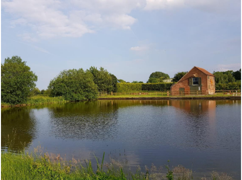
8.4 The canal became a focal point for Hickling, not only for trade but also for social events and up to the 1920s pleasure trips by boat were available. Many of the Parish activities were based around two wharves, one on the basin side, which is still called ‘The Wharf Yard’ and the other over the road which is now the front lawn of ‘Bridge View’ but was once the Navigation Inn. The old warehouse built in 1797, when the canal was opened, and basin are indicators of the former prosperity and volume of trade carried on here.
8.5 Today, the Grantham Canal is an important recreational, landscape and wildlife resource. Fully restored thanks to local campaigners in the 1990s, the basin features traditional canal side architecture and with The Old Wharf tearoom and The Plough Inn, it acts as a good starting point for walks, and is popular with anglers.
8.6 In our 2017 Questionnaire, 60% of respondents supported the possibility of Hickling Basin becoming a focal point for visits to the Grantham Canal. The majority (90%) thought that the Grantham Canal should be promoted as a route for walking, cycling and nature conservation. The restoration of the Grantham Canal to make it navigable for boats was supported by 59%.
Policy H18: Grantham Canal and Hickling Basin
The restoration of the Grantham Canal to make it navigable for boats is supported. Only development that is compatible with the quiet, recreational enjoyment of the Grantham Canal and Hickling Basin, will be supported where:
- Proposals have appropriate regard for the significance of the heritage assets of the canal, basin and their setting, and do not prejudice future restoration of the canal to navigable status;
- Proposals protect and enhance the ecological value of the canal and its landscape features;
- Traffic implications are fully assessed and addressed. Related measures that will need to be considered include traffic management and car parking improvements; and
- Residential amenities are protected, with full account being taken of the need to protect tranquillity, in accordance with Policy H3.
- Heritage is conserved
- The character and beauty of the countryside is safeguarded
- The canal makes a positive contribution to village life
Appendix 1: Important Views
The following views have been identified as important in defining the character of the Parish. The views highlight the open countryside and extensive vistas enjoyed across the Parish. The varied landscape of arable and pasture land; meadows over rolling countryside, streams and ponds are all deemed by Parishioners as important in providing recreational benefits for walking, cycling and enjoying the outdoors.
View 1
Views from The Standard
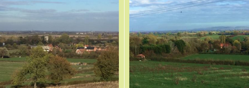
View 2
Along the canal from Main Street, Hickling
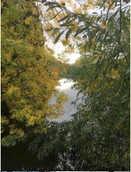
View 3
The canal basin from Main Street, Hickling
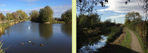
View 4
From the top of Green Lane, Hickling Pastures looking towards Hickling and The Standard
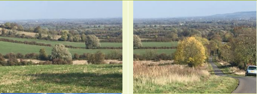
View 5
From Bridegate Lane, Hickling looking south
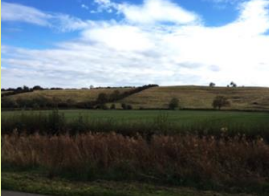
View 6
From the top of Bridegate Lane, Hickling Pastures looking north-eastwards towards Colston Bassett
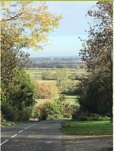
View 7
View of Church and village from Clawson Lane with Hickling Pastures in the distance
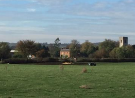
Appendix 2: Biodiversity Opportunity Mapping
The following pages show extracts of the Biodiversity Opportunity Mapping that is relevant to the Hickling Neighbourhood Plan. The maps show the same mapping and data that is presented in the Rushcliffe Biodiversity Opportunity Map; however, the maps are much more detailed and focus in on Hickling parish.
The first three maps illustrate the biodiversity opportunities identified for woodland, wetland and grassland habitat within the parish. Each area highlighted in the habitat maps has an accompanying comment in the Biodiversity Opportunity Mapping report and these comments are set out below.
The final map shows the biodiversity focal areas (South Rushcliffe Pondscape) identified in the Biodiversity Opportunity Mapping report that relates to Hickling parish.
Woodland
004 - Possible planting along the ridge, to link remnant woodlands.
012 - New woodland to link existing fragmented woods to Borders Wood. Borders Wood is an important site for woodland butterflies.
014 - Woodland creation to link fragmented woods on steep hillsides.
016 - The woodland that is part of Kinoulton Marsh SSSI doesn’t seem to be marked but exists. Enhance the condition of this woodland.
020 - Potential for riparian woodland planting to help reduce nutrient inputs and manage flood risk - slow flows.
024 - Dalby Brook connecting riparian woodland planting similar to W22.
025 - The woodland that is part of Kinoulton Marsh SSSI doesn’t seem to be marked but exists. Hedges between here and Kemp's Spinney create an opportunity to make better woodland linkages.
Wetland
005 - Pondscape - could connect with West Rushcliffe. Enhance existing ponds, create a better connection between ponds by creating new ponds.
006 - Improve condition of Kinoulton Marsh SSSI.
009 - Work with responsible bodies to ensure good habitat.
013 - Pondscape 'phase 2' survey and pond restoration, water shrews, include amphibians, inverts etc. (there are more ponds than picked up by connectivity map).
016 - Ponds created during the A46 widening. Influence their management.
022 - Watercourse suffers from cattle poaching with increased sediment downstream. Could install cattle drinks and install river restoration techniques.
026 - Buffer Kinoulton Marsh SSSI with wetland habitat.
031 - Fairham Brook restoration project - river restoration/enhancement, and associated habitat creation.
041 - Pond cluster around Roehoe Wood/Jericho farm. Improve and create new ponds.
042 - Pondscape around Willoughby - improve.
Grassland
002 - Opportunity for keeping unimproved grasslands alongside the canal - some still unimproved sections at the moment.
007 - Good site to link/make bigger.
014 - Good site to link/make bigger.
017 - Improve connectivity along railways test track - scrub management.
026 - Grantham canal - could we improve the grass verge by changing mowing regime to allow cowslips etc in the spring.
032 - Create new grassland and manage/enhance existing grasslands.
033 - Create new grassland and manage/enhance existing grasslands.
035 - Create new grassland and manage/enhance existing grasslands.
057 - Protect and enhance test track if it becomes available.
075 - Willoughby Lodge, 2 tiny patches of woodland surrounded by grassland. New owners creating a livery and may be eschewing herbicides and fertilisers. Owner is sympathetic to Biodiversity.
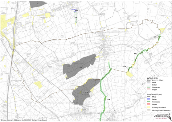
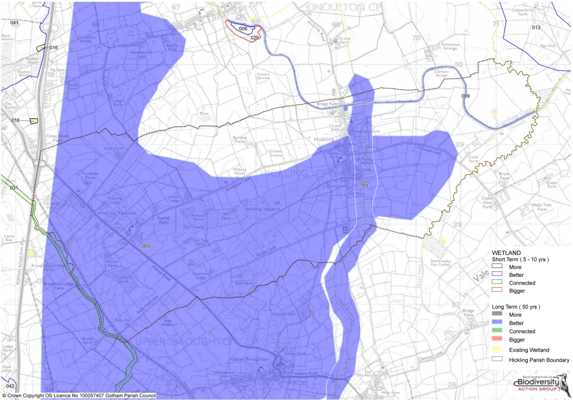
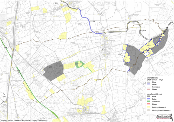
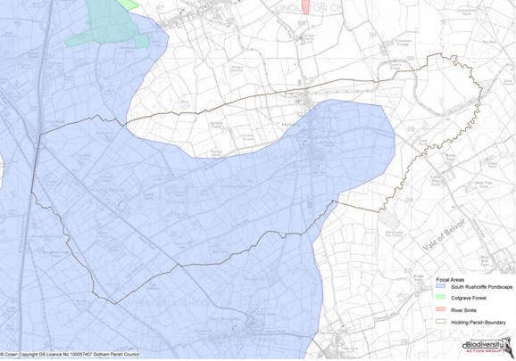
Appendix 3: Local Green Spaces: Summary of Reasons for Designation
The Local Green Space designation will not be appropriate for most green areas or open space. The designation should only be used:
- where the green space is in reasonably close proximity to the community it serves;
- where the green area is demonstrably special to a local community and holds a particular local significance, for example because of its beauty, historic significance, recreational value (including as a playing field), tranquillity or richness of its wildlife; and
- where the green area concerned is local in character and is not an extensive tract of land.
1. Canal Basin, Hickling
- Green space is in reasonably close proximity to the community it serves
- Green area is demonstrably special to a local community
- Green area concerned is local in character and is not an extensive tract of land
- Holds a particular local significance, for example because of its beauty
- Holds a particular local significance, for example because of its historic significance
- Holds a particular local significance, for example because of its recreational value
- Holds a particular local significance, for example because of its tranquillity
- Holds a particular local significance, for example because of the richness if its wildlife
The Grantham Canal built in 1797 and now a remainder waterway, passes under the village Main Street where there is a large expanse of water known as Hickling Basin. This would have facilitated the turning, loading and mooring of barges when the canal was in full use. The basin is now a thriving wild life habitat and attracts a substantial population of swans and ducks. It provides a tranquil green space and recreation area for walkers, cyclists and fishermen.
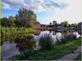
2. St Luke's Churchyard, Hickling
- Green space is in reasonably close proximity to the community it serves
- Green area is demonstrably special to a local community
- Green area concerned is local in character and is not an extensive tract of land
- Holds a particular local significance, for example because of its beauty
- Holds a particular local significance, for example because of its historic significance
- Holds a particular local significance, for example because of its tranquillity
- Holds a particular local significance, for example because of the richness if its wildlife
- Holds a particular local significance, for any other reason
A churchyard is much more than a garden around a church or burial ground, it also a place of quiet reflection, a habitat for rare plant and animal species, and the setting of the church building. There has been a Church on this site for over 900 years though the present church dates for the 14th century. The Churchyard is rectangular with the 14th Century church offset towards the eastern side. Rebuilt in 1845 it is part of the joint Parishes of Kinoulton and Broughton Sulney. It has magnificent views to the East across the Vale of Belvoir. The boundaries comprise mature hedges, shrubs, and trees including a rare Black Poplar. The churchyard contains a very fine selection of grade 11 listed gravestones and there are also several fine examples of the 'Belvoir Angel' carved grave-markers which date from the 18th century and 14th century cross slab depicting ‘the Tree of Life’.
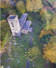
3. Walker's Green, Hickling
- Green space is in reasonably close proximity to the community it serves
- Green area is demonstrably special to a local community
- Green area concerned is local in character and is not an extensive tract of land
- Holds a particular local significance, for example because of its recreational value
This is an important green space to the North of Bridegate Lane junction as you enter the village. It is part of the historic agricultural landscaped evident since the Middle Ages. This portion of land, which through generous donation by the Walker family, now encompasses the children’s play area, plays an important part during annual events such as scarecrow weekend when it allows for craft stalls and amusement activities.
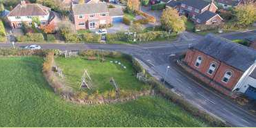
4. Cemetery, Clawson Lane, Hickling
- Green space is in reasonably close proximity to the community it serves
- Green area is demonstrably special to a local community
- Green area concerned is local in character and is not an extensive tract of land
- Holds a particular local significance, for example because of its tranquillity
- Holds a particular local significance, for example because of the richness if its wildlife
- Holds a particular local significance, for any other reason
The original cemetery was sold to the Parish in the 26th March 1953 by Wilfred Morse with the intention that it should be used as a cemetery. The cemetery was first (and partially) consecrated in May 1955 and is the only site that can accept full burials. The original section was fully consecrated in 1982. The Churchyard at St Luke’s remains open for ashes interment. A further section of land was purchased from the adjacent landowner in 1976 but remained as agricultural land, primarily for grazing of dairy herds until 2011 by Waterlane Farm. It was sectioned off and consecrated by the Diocese of Southwell. The entrance still has the original gates that were installed in the 1950s. There are two benches that are sited in the cemetery for use by visitors.
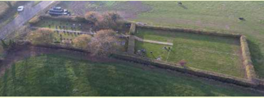
5. Land between Glebe Cottage and Waterlane Farm, Hickling
- Green space is in reasonably close proximity to the community it serves
- Green area is demonstrably special to a local community
- Green area concerned is local in character and is not an extensive tract of land
This area of land incorporates Glebe land as owned by the Church (Southwell Diocese) and the gardens of Water lane Farm. As with the Church there are spectacular views Eastwards towards Belvoir Castle in the distance. When the Glebe cottage hedge is maintained, this green space and views come directly into Main Street breaking the built form and emphasising the rural nature of the village.

6. Land opposite the junction of Clawson Lane and Main Street, Hickling
- Green space is in reasonably close proximity to the community it serves
- Green area is demonstrably special to a local community
- Green area concerned is local in character and is not an extensive tract of land
The open space where Clawson Lane meets Main Street, with its two distinctive mature Chestnut trees, wooden fence and horse paddock is particularly attractive creating a wonderful view to Hickling Standard and the escarpment to the West. In previous years this open space has played a significant part in the social history of the village providing an area for horse shows and gymkhanas.
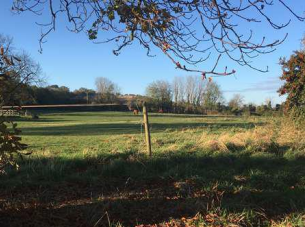
7. Strip of land between Harles Acres and Pudding Lane, Hickling
- Green space is in reasonably close proximity to the community it serves
- Green area is demonstrably special to a local community
- Green area concerned is local in character and is not an extensive tract of land
This is an important green finger of land leading from the open countryside beyond directly onto Main Street helping break the linear development along Main Street.
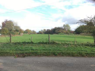
8. Land north of The White House, Main Street, Hickling
- Green space is in reasonably close proximity to the community it serves
- Green area is demonstrably special to a local community
- Green area concerned is local in character and is not an extensive tract of land
The Land North of the White House is one of the important fingers of Green Space that breaks up the building line of the linear village, identified in the Conservation Area Management Appraisal document. It is located opposite the Grade II listed Old Rectory and is in the line of sight from the tower of St. Luke’s Church which is a Grade I listed building. The paddock has been used for rearing calves and the barn was still in use until the 198os. The barn is one of the few remaining examples of traditional barn buildings which haven’t been developed in the village and can be seen from the road. It is mentioned in the Conservation Management Appraisal document as a significant building. The Paddock has been in the Parkes’ Family for over a century, and they still farm in the village to this day.
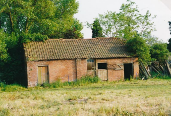
Appendix 4: Features of Local Heritage Interest
A two-step approach has been taken to define non-designated heritage assets:
Step 1: Identify candidate non-designated heritage assets
A list of potential non-designated heritage assets was prepared using the following resources:
- Nottinghamshire Historic Environment Record
- Hickling Conservation Area Appraisal and Management Plan 2008
- Responses to the Upper Broughton Neighbourhood Plan questionnaire 2017
- Map of Hickling 1884
Step 2. Determine whether candidate assets should be designated a non-designated asset in the Neighbourhood Plan
Each asset identified in Step 1 was then assessed by its ability to meet the following criteria:
- Must meet both criteria C1 and C2; and
- Must possess qualities that contribute positively towards the amenities of its locality, i.e. have at least two of policy of criteria C3 – C8
- C1 The asset is largely intact or retrievable example of its architectural style innovation and craftsmanship or period or build
- C2 The asset is prominent or visible by virtue of its position within the townscape or landscape
- C3 The Building is the work of a particular architect of regional or local note.
- C4 It has qualities of age, style, materials or any other characteristics which reflect those of at least a substantial number of buildings in the wider settlement.
- C5 It relates by age, materials, or in any other significant way to adjacent listed buildings and contributes positively to their setting.
- C6 Individually, or as part of a group, it serves as a reminder of the gradual development of the settlement in which it stands, or an earlier phase of growth.
- C7 It has a significant historic association with established features of a settlement such as road layout, open spaces, a town park or a landscape feature.
- C8 The building has a landmark quality or contributions towards the quality of recognisable spaces, including exteriors or open spaces within a complex of public buildings.
1. Devil’s Stone, junction of Bridegate Lane and Main Street, Hickling
- C1
- C2
- C7
- C8
Sited at the junction of Bridegate Lane and Main Street outside the converted Methodist Chapel, this huge stone is surrounded in mystery. Various theories exist that it was a mounting block or dropped by the Devil. It could have been a way marker but whatever its origins they are lost in the mists of time. It has however become a feature of the village and part of its character.
2. Weigh Office, Main Street, Hickling
- C1
- C2
- C4
- C5
- C6
- C7
- C8
Where loads being sent by canal were registered. This small building, now used as a village notice board, has been in the grounds of The Wharf House at the Canal Basin since the opening of the canal. Outside the Weigh Office there would have been a large weighing machine on the ground so the horse and carts could be driven over for weighing before and after loading. The building remains as part of the Canal Basin and Wharf history and is used by residents as a community notice board.
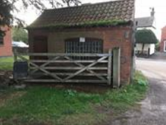
3. Telephone Box, Main Street, Hickling
- C1
- C2
- C3
- C6
- C7
- C8
The red telephone box was designed by Sir Giles Gilbert Scott (1880- 1960) and, along with the red post box and the red London bus, is an instantly recognizable symbol of Britain. This box is valued by the residents of Hickling who once staged a ‘sit in’ when it was threatened with removal so it must therefore be worthy of recognition as a heritage asset. It now houses one of the village defibrillators still meeting the needs of the community.
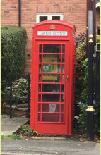
4. Trig point, The Standard
- C1
- C2
- C3
- C6
- C7
- C8
Trig points are the common name for "triangulation pillars". These are concrete pillars, about 4' tall, which were used by the Ordnance Survey in order to determine the exact shape of the country. They are generally located on the highest bit of ground in the area, in this case on The Standard, so that there is a direct line of sight from one to the next. By sitting a theodolite (an accurate protractor built into a telescope) on the top of the pillar, accurate angles between pairs of nearby trig points could be measured. This process is called "triangulation".
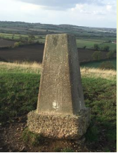
5. The Chapel (former Wesleyan Methodist chapel), Main Street, Hickling
- C1
- C2
- C7
- C8
The Wesleyan Chapel was rebuilt in 1848 in the red brick traditional in the village. The date is visible on the stone plaque on the front gable. It is on the corner of Bridegate Lane (formerly Chapel Lane). The chapel attracted a congregation of 70 or more from Hickling and surrounding villages. There was a Sunday school room, rented out for various meetings; the Parish Council, The Cricket Club Annual meeting and other village social activities such as art classes. Maggie's Memories the Welfare Clinic was also held here. It remained in use until approx. 1976. It is now a private residence.
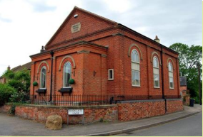
6. The Old School House, Main Street, Hickling
- C1
- C2
- C6
- C8
The Old School House was built alongside the Wesleyan Methodist chapel in the same red brick. It was the home of the school teacher. It is now a private residence.
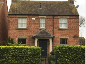
7. The Plough Inn, Main Street, Hickling
- C1
- C2
- C4
- C5
- C6
- C7
- C8
This was one of 4 public houses in the village in the 19th/early 20th century.
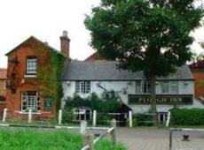
8. Weir House, Main Street, Hickling
- C1
- C2
- C4
- C5
In 1848 a Mr John Featherstone bought Weir House and opened the Weir House Academy a fee-paying school.
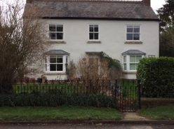
9. Village Hall, Main Street, Hickling
- C1
- C2
- C6
- C8
The Village Hall was built in 1874 as a village school on what was formerly the village green. Hickling School was closed by the Local Education Authority in 1966. The building is now the village hall, complete with bell tower but with a later extension on the north side for modern toilet facilities.
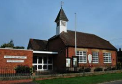
10. Water Lane Farm, Main Street, Hickling
- C1
- C2
- C4
- C6
- C8
The current house located at Water Lane Farm was built in 1868. The original house on the site was believed to have been built in the 1700s and adjoined the brick barns that are still standing on the property today, crossing across the orchard to the front of the current house. The two houses are shown in the 1884 OS map of Hickling but by the production of the 1900 OS map, only the existing house remained plus the associated brick barns. The old brick farm buildings still contain many of the original features and there is an original water pump which sits to the front of the existing house which is fed by a well. The foundations of the old house in the orchard were uncovered during the laying of the new drains system in the mid-1990s. The addition of the modern farm buildings commenced in 1970 and continued until 2013 when the newest barn was built. The farm remains a working dairy farm and is one of six dairy farms still operating in the parish.
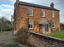
11. Folly Hall, Folly Hall Lane, Hickling Pastures
- C1
- C2
- C6
- C7
It was built as a farm house in 1802, probably with less than 100 acres; it presently has 8 acres. The dining room used to be the dairy where cheese was made. The original footprint was a rectangular house about 45’ x 30’; it had 4 downstairs rooms and 4 bedrooms plus an attic room (full staircase into the attic). Since then a porch, utility room and conservatory have been added. There are 3 wells including one in the cellar (accessed via stairs from the kitchen with the remains of the pump to take water up to the kitchen), one in the front garden about 14-15’ deep, and one next to the garage.
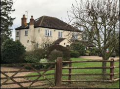
12. Lincoln Lodge, Bridegate Lane
- C1
- C2
- C4
- C8
The building dates from 1894 (as noted above the front door), so it is of the Victorian era with red brick-built walls and red tiled floors. Originally built with 4 bedrooms upstairs and four rooms downstairs, no indoor toilet. Still has hooks in the pantry for hanging meat/birds. It has since been extended with a kitchen at the rear and a bathroom was installed upstairs in the 1950s. The house has always been a farm-house and there are various outbuildings associated with it – the oldest being brick built and being of the same age as the house. Others have been built over the years to house stock and machinery.
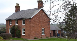
13. Fox and Hounds Farm, Hickling Pastures
- C1
- C2
- C4
- C8
The deeds date the house at 1867 when it was known as The Fox and Hounds Inn. It traded as a public house for 55 years. It was built with three lower rooms plus the ale store and three bedrooms. In 1922 it was sold and used for farming with around 40 acres of land – name changed to Fox and Hounds Farm. The ale store was converted to a dairy.
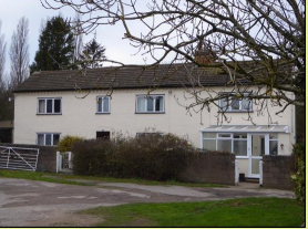
14. Forge Cottage, Main Street, Hickling
- C1
- C2
- C4
- C6
The forge was built circa 1780 out of bricks on a stone boulder foundation. It was originally two separate cottages, which now serves as one house and an adjacent Forge and stables which now serve as a garage and outbuildings.
The house was at one time a public house with the lounge being the bar area. Still in the deeds there is a requirement that if the premises was reopened as a public house then it must sell Apollo soft drinks and Home Ales which leads to the assumption that the property was once owned by the brewery.
Inside the building all wood beams are exposed, the floor is original handmade tiles laid over the soil and the ceilings are constructed with reed and plaster made from lime and horsehair.
Outside the building there are two wells, one which is a well dug to collect surface water used for washing and serving the forge, the other is a fresh water well with a working pump which was installed in 1814, the water table rests 12 feet below ground level.
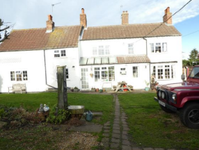
15. Glebe Cottage, Main Street, Hickling
- C1
- C2
- C5
- C6
- C7
Glebe Cottage is one of the oldest properties in the village, appearing on the 1884 map and is still owned by The Church of England. In postcard photos taken in 1904, the building is shown to have a brick façade with a thatch roof. Later photos from the late 1920s/1930s, show that tiles have replaced the thatch and rendering covering the brick. It is believed that the Cottage originally provided staff accommodation for those working at the Rectory, although between 1951 and 1976, the incumbent Rector resided part of the time at Glebe Cottage and moved there permanently prior to The Rectory being sold in 1979. The extension to the rear was added in the late 1970s. The descendants of the Rector are still tenants of the Cottage to date. The Cottage is registered on the Notts Historic Environment Record.
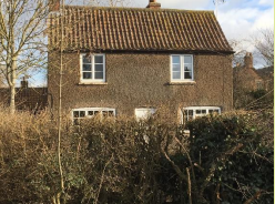
16. Burnetts, Main Street, Hickling
- C1
- C2
- C4
- C7
- C8
Burnetts incorporates a rectangular two-storey property facing Main Street and attached to this there is a lower, more irregular, range of buildings up the side of the lane.
The Burnett family ran a building, wheelwrights, blacksmiths, decorating and undertaking firm from this premises.
It is understood that the Burnett firm built the house on the corner, while the range of buildings at the rear is much older and housed the paint shop and building premises. This part of the house contains 17th Century timber beams and timber-framed partitions and has ash lime floors.
The brickwork to the more recent front elevation is in header and stretcher bond, with the headers being in a buff brick while the stretchers are in orange brick to create a subtle pattern. The front elevation is symmetrical, and there was originally a centrally placed front door which has since been bricked-up. The windows were originally Yorkshire sliders with arched brick lintels.
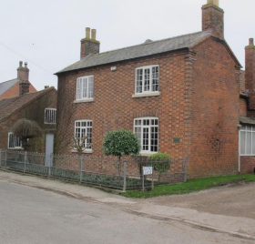
17. Duisdale, Main Street, Hickling
- C1
- C2
- C4
- C6
Duisdale is one among the distinctive group of traditional properties facing Main Street. The building dates from Victorian times.
The symmetrical front elevation is in brickwork and is most attractive. The central timber-panelled front door has a semi-circular fanlight and a carved, white painted timber door surround and lead covered canopy supported by carved, scrolled timber brackets. Either side there is a bay window with vertically sliding slash windows and stone window sill. At first-floor a vertically sliding slash window, with stone sill and lintel, is placed above each bay. The brickwork to the front elevation is in header and stretcher bond, with the headers being in a bluish buff brick while the stretchers are in an orange brick to create a subtle pattern.
The simple pitched roof is covered with clay pantiles with a brick chimney stack at each gable end. The house is set back from the front boundary 5-6m and a mature holly hedge sets off the property beautifully.
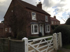
18. Beech House, Main Street, Hickling
- C1
- C2
- C4
- C6
- C8
Beech House is one of the larger old farmhouses of Hickling although it is now a family house. The large range of farm buildings to the left is now in separate ownership and the converted in to a house (The Olde Barn).
The current owners believe that the rear parts of the house, which are more irregular, date form the 1750s while the double-fronted part dates from the 1850s.
The symmetrical front elevation has been rendered although it would have been brickwork. Despite the rendering the house is still characteristic in scale and proportions of the traditional farmhouses of Hickling which face Main Street.
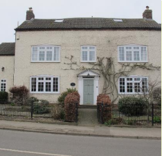
19. The Yews, Main Street, Hickling
- C1
- C2
- C4
- C6
- C8
The Yews is a two-storey rectangular brick farmhouse, although no longer used as such, and has a range of outbuildings to the rear. The Yews has a symmetrical brickwork façade which is simple Georgian style, similar to other of the older Hickling houses. The front Elevation faces Main Street and is set back from the road by about 12m. The pleasant open aspect of the property is enhanced by an open field opposite. The exterior of the house has changed little except that the sash windows were originally divided into the traditional Georgian pattern of 3 panes horizontally by 4 panes vertically. The original clay pantile or slate roof has been replaced with concrete interlocking tiles.
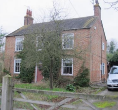
20. Village Sign, Main Street, Hickling
- C1
- C2
- C6
- C8
The Village sign is a traditional emblem with origins dating back to the medieval village cross. The impressive Hickling village sign stands at the T-junction where Bridegate Lane meets Main Street. It was designed and made by Richard Collishaw a local farmer to celebrate the Millennium. The Collishaw family have lived and worked in the village since records began in 1640. The sign which represent village life in Hickling. At the top is the Belvoir Angel, a symbol which can be found on many headstones in the local churchyard. Next is a swan – these are found on the canal and basin, breeding every year. The village church, corn dollies for the agricultural farming community and the harvest plus the cow for the dairy farmers.
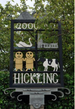
21. The Manor House, Main Street, Hickling
- C1
- C2
- C4
- C6
Manor House is a large detached house situated within a spacious residential curtilage and accessed directly off Main Street via a private driveway.
22. The Blossoms, Bridegate Lane
- C1
- C2
- C4
- C6
- C8
Originally built circa 1830 before other neighbouring properties. It was built for a lady from Nottingham as a country cottage. It enjoys some very interesting corbelling and brick features. Extensions have been added during its lifetime. Previous use has included a haulage yard in the early 1900s before becoming a farm and latterly returning to a private residence again. The current owners have been in occupation since 1986. Outhouses and stable have been added to earlier outhouses and the current owners ensured the new garage complex built in 2018 respected the original house with complimentary brickwork and corbelling. Apparently, there used to be a doorway in the left-hand gable end, which was bricked up long ago.
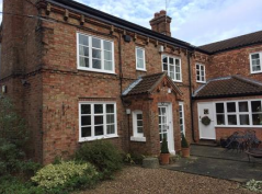
23. 1 & 2 Jacks Croft, Pudding Lane, Hickling
- C1
- C2
- C4
- C6
These were originally 4 farm workers cottages which shared an outside copper. The mains of the copper still exist. There is also brick work evidence of the outside lavatory. An Insurance plaque is visible on the front wall of the cottages below the roof tiles.
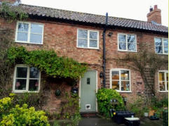
24. Ivy House, Main Street, Hickling
- C1
- C2
- C4
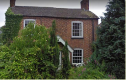
25. Lengthsman's Hut
- C1
- C2
- C6
- C7
- C8
Although the Lengthman’s Hut is located outside the Conservation Area, this building also plays an important part of Hickling’s canal heritage and is mentioned in the Conservation area appraisal and Parish Plan. It is currently under re-construction by Canal and Rivers Trust as it is one of the only remaining sleeper built lengthsman’s huts on the canal system. The lengthsman’s hut was a refuge for the lengthsman and store for tools. The lengthsman kept a stretch of the waterway free from weeds to make it navigable.
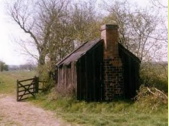
26. Manor Farm, Hickling Pastures
- C1
- C2
- C6
- C8
This substantial 3 storey house with 4 double bedrooms was originally built in the early 1700s and was first known as Hickling Manor. It has always existed as a farm, now comprising 300 acres. It has been in several ownerships during its life. The current owner was born in Spring Holme cottage (a small dwelling located in the grounds) whilst his grandparents lived in the main house, following their purchase in 1921. He took up residence of the main house in 1948. A previous owner, a Mr Greaves, actually signed one of the windows. The original brickwork from the 1700s is conventional in layout, although it is possible the brickwork on the front of the house was in disrepair as this one elevation was rendered following creation of dormer windows in the roof to replace previous smaller ones. The design of the dormer windows is unusual as shown in the adjoining photo. There are a substantial number of outbuildings, indicative of the period, including a brick building housing the bread oven, stone-built copper and stone cheese press.
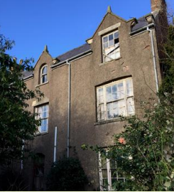
27. Hickling Lodge, Hickling Pastures
- C1
- C2
- C4
- C6
- C8
It was built as a farm house in stages and the internal layout shows the character and interest as additional rooms have been added over time. The age is not known but is estimated as being mid-1800s.
A heavy wooden front door leads into the tiled hallway where a large claymore greets visitors; left is the grand lounge and right the dining room, to the rear is the snug.
One set of stairs leads down to the small cellar with brick archways. Two sets of stairs, one front (overlooked by stained glass window) and one rear, lead up to the first floor. There are three bedrooms at the rear, a fourth is used as a dressing room, and the master bedroom is at the front connecting through a dressing room to the main bathroom with views over the Vale to the rear and gardens to the front.
A further set of stairs at the rear leads to the second floor to two further rooms used as an office and the 6th bedroom.
The kitchen is at the rear of the house and beyond is attached further quarters with a sitting room, small kitchen with bedroom and bathroom upstairs.
There are gardens all round; pumped water flows through two small waterfalls. A total of 21 chimneys can be counted on the main house. The original barn has been converted into another house.
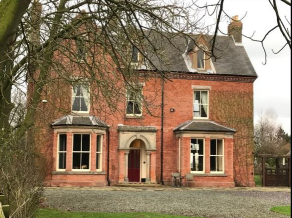
28. 1-3 The Green, Hickling
- C1
- C2
- C4
- C5
The cottages built circa 1850 were originally 6 cottages and later arranged into 3 dwellings. It is believed that these were farm cottages and were once sold at auction for £200. The handmade floor tiles still remain, and the ceilings are solid constructed from the cement of the 1850s.
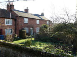
29. Letterbox, Main Street, Hickling
- C1
- C2
- C8
Post box on Main Street bearing the Royal Cypher of King George VI, who reigned for 16 years from 11 December 1936 to 5 February 1952. It is still in regular use although it is often necessary to fold letters to get them in the narrow opening. Roadside wall boxes first appeared in 1857 as a cheaper alternative to pillar boxes, especially in rural districts.
Between 1866 and 1879 the hexagonal Penfold post box became the standard design for pillar boxes and it was during this period that red was first adopted as the standard colour.
30. Yew Tree House, Main Street, Hickling
- C1
- C2
- C4
- C5
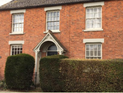
Appendix 5: Design Guide
Forward
This Design Guide has been prepared as part of Hickling Parish Neighbourhood Plan with the aim of setting guidelines to assist professionals, developers and householders to use in the preparation of proposals both for new development and in achieving good practice when altering, extending and maintaining existing properties. It will promote good design practice by all those involved in the development process.
Introduction
The Design Guide is intended to positively shape the siting, appearance and character of developments within the Parish of Hickling. Although it contains no policy statements it is intended that its provisions will be implemented through (Policy H8), and others, in the Hickling Parish Neighbourhood Plan and Rushcliffe Borough Council Local Plan (emerging Local Plan policies 1, 28, 30 31).
The Design Guide focuses mainly on residential properties but is equally applicable to commercial and other developments.
At present Hickling Parish retains many buildings and arrangements of buildings which establish and reflect its character as a moderately prosperous Parish set within a rural area. In recent years the character of the village has been challenged by the enlargement of existing buildings, the construction of new properties utilising non-traditional materials such as contemporary render, timber cladding and aluminium not previously much used in the area. The village has a strong linear character with buildings set either side of the main street with fingers of open countryside coming into the village helping to gain views out and maintaining the open character.
Harles Acres is a small development at the Southern end of Main Street, built in the 1960s and incorporated into the revised 2008 Conservation Area. It has a design and character differing from the historic core of Main Street.

Hickling Pastures has a different character from the village of Hickling with a collection of properties, consisting of agricultural and residential buildings located in generous plots along the A606 Melton Road. The buildings are set back from the street with well-defined mature boundary treatments. The buildings are mainly red brick with tile roofs and are glimpsed through the trees and hedges.
Following a series of Hickling Parish Neighbourhood Plan consultation events with residents we know that a Design Guide aimed at promoting the use of traditional materials, traditional design features and design layouts is a high priority for the plan.
The provisions within the Design Guide will apply equally to all new development proposals. Good design and creating a sense of place are at the heart of good planning [National Planning Policy Framework (revised) 2018 (paras 124-127)]. The uses of layouts and materials which reinforce the sense of place, the character and the history of the locality are at the core of this concept. Integration into the natural, built and historic environment is very important and that local distinctiveness should be maintained. A part of the neighbourhood plan area has been designated as a Conservation Area (Heritage Plan – P27 of Hickling Neighbourhood Plan); the Design Guide is intended to complement the aims for designation and to maintain the significance attaching to the structures and setting of the Conservation Area.
This Design Guide is aimed at putting the broad National policies of the NPPF and the Conservation Areas and Listed Buildings Act (1990) into a local context. (In accordance with paragraph 59 of the NPPF), The Design Guide concentrates principally on scale, density, layout, materials and access rather than the details of architectural design. However, several local architectural features are included as examples to help prospective developers appreciate and understand the character of the buildings in the parish. It is strongly recommended that prospective developers and their architects discuss their plans, designs, use of materials and layouts with Rushcliffe Borough Council and Hickling Parish Council, at the earliest stages to avoid expensive redesign or rejections, at a later stage in any project.
This Design Guide applies to the whole Parish, it has regard to the Conservation Area Appraisal prepared by Rushcliffe Borough Council September 2008 and follows advice set out in National Planning Practice Guidance and Hickling Parish Neighbourhood Plan Policy H9 (Local Design). The Design Guide contains background material describing factors which have influenced the current form of Hickling; a series of examples of the architectural designs and features which characterise the parish are also provided (principally through photographs, but with explanatory text where necessary); it also provides sections on materials, external treatments, and the layout of individual and groups of buildings.
What is a design guide and who is it for?
A Design Guide sets out clear and simple advice for the design of all development in a parish based on its character. It will not stop change happening but it can influence how new buildings fit into the village. A Design Guide is intended to ensure that new development is in harmony with its setting and makes a positive contribution to the parish environment.
Changes are brought about not just by new buildings but also, on a smaller scale, by alterations to existing houses, open spaces, walls, hedges and street furniture. The guide seeks to encourage everyone to look carefully at the impact of what they propose to do in the village and the landscapes as a whole.
The Parish of Hickling
Design within the parish
Presented in this section are examples of architectural details found within the village which are intended to strongly inform the design of new buildings.
Attention is drawn to the use of appropriate materials in the construction of new buildings, extensions or re-development. The brickwork predominant in the village has a strong orange red colour although not necessarily uniform, having some variations often referred to in the building trade as a “multi” brick and a suitable match should be carefully selected.
Compliance with this Design Guide will help speed up the planning process by reducing the chance of objections due to poor design. The guide provides supporting information to the Hickling Parish Neighbourhood Plan and, as such, is a material consideration in all planning decisions which involve building work in Hickling Parish. It carries weight in decision making, having been arrived at through the Neighbourhood Plan process. Planning proposals would be expected to refer to the Design Guide.
The Design Guide seeks to help achieve well designed houses and extensions, for development to be sustainable, of high quality and appropriate for their context. This can be achieved by taking inspiration from the surrounding architecture and by paying attention to their scale, proportion, massing and the use of materials.
When designing a new house or extension, careful attention needs to be paid to the size, scale and mass of the building so that it fits in with the local character or context of the site. The scale, height and mass of a new house should respect that of adjoining or adjacent buildings. Height is particularly important in determining the impact of a development on views and skylines. The following section summarises the context of the village and provides design guidance to assist the design process.
Contextual Analysis of Hickling Parish
Street scene – Hickling Village
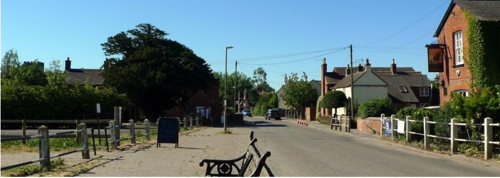
The basin, former wharf building and pub form an attractive entrance to the village from the North. There are three other entrances to the village from the surrounding countryside each giving access to the Main Street, where the roofs, chimneys and massing of the buildings form a welcoming view.
Street scene – Hickling Pastures
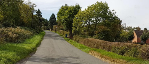
Hickling Pastures is formed around the A606 Nottingham/Melton Road and as such it’s street scene tends to be dominated by the road. Houses are set well back in large tree sheltered plots. It stretches off the Nottingham/Melton Road, down Bridegate Lane towards the village of Hickling.
The Neighbourhood Area stretches beyond Hickling village and Pastures into open countryside where scattered farms and housing are found of broadly traditional design.
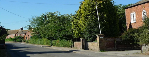
In the village of Hickling the houses are set in gardens with mature trees and brick walls giving height and texture to the street. New development should be orientated to follow the arrangement of surrounding development where possible. The scale of new houses relative to the landscape and to the size of the plot is imperative to their success in fitting in with their surroundings. Overlarge buildings that dominate landscape features or views will be resisted.
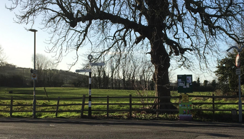
The open aspect of the village is provided by the fields penetrating right into the village at various locations giving wide expansive views out into the countryside.
Houses facing each other down the main street of the historic area of the village give a strong linear character. The walls and railings add to the linear nature of the village and give a feeling of simplicity to the street scene.
Modern housing can appear to overwhelm its traditional neighbours if a deep plan form is adopted. Massing can be broken down to traditional proportions using gabled projections, modest single storey additions and using double pitched roofs
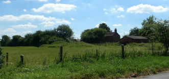
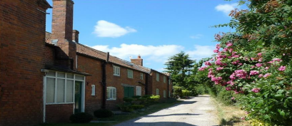
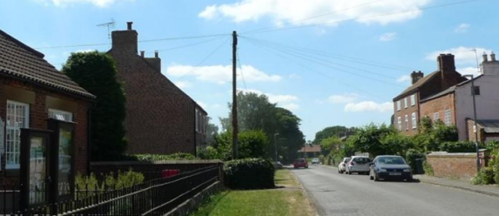
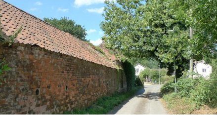
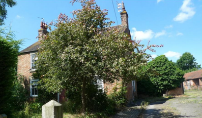
Roofs and Chimneys
Roofs in Hickling village are generally of slate or Clay pantiles. Chimneys generally reflect the building materials of the walls. Good honest design is encouraged – if there’s a chimney it should have a function and not simply be a decorative afterthought. The roof height and shape are heavily influenced by the span of the building, its type of construction and limitations of the roof material. Generally, the buildings have 45 pitch and they are mostly symmetrical. The traditional cottages tend to have low eaves height, a feature that should be carried through in new buildings to ensure height and proportions are appropriate. Hipped roofs are less common and flat roofs should be avoided.
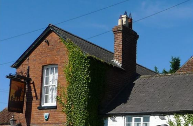
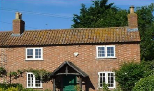
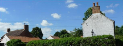
Doorways and porches
Doors are an important feature, particularly to a front elevation. They relate the building to both the human scale and to the ground floor outside. Main elevations without doors look very unsatisfactory. The favoured style of door in Hickling is generally traditional painted timber panelled, some with glazing replacing the top panels. Most Porches are a simple canopy supported by brackets, some of them ornate. Other doors including garage doors, are usually vertically slatted timber.
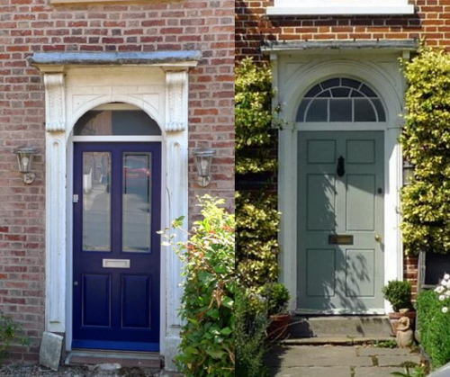
Windows
Windows are an important consideration when designing a new building or an extension. Inappropriate, poor quality windows can easily erode traditional features on historic buildings and the character of the area.
The sash is a mainstay of Georgian and Victorian housing in the parish and is still widely used on traditional-style, new buildings. Sizes are typically not standard, but windows need to be in proportion to the house, so are often bespoke. Properties often had smaller windows towards the top of the property, with larger windows on the ground floor. Sash windows usually have multiple glazing bars.
Another traditional option (historically and in the 20th century), open-out casements are available in a variety of formats. Split casements for cottage-style designs and small glazed units are most common.
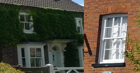
Usually it is not good to match different styles on the same property.
Timber windows are encouraged in the Conservation Area. In addition to keeping window period appropriate, timber windows are more environmentally friendly than plastic windows. Timber windows also have a longer lifespan, meaning that they are often cheaper in the long-term. There are, however, some very good alternative products with a timber effect that can reproduce the pattern and detailing of traditional windows.
Even in the simplest, most functional building types, the lintels and arches over the doors and window openings are elaborate, often subtly, but nevertheless providing an important element of detail. The addition of a substantial sill below the window and an obvious arch, lintel or cornice above, emphasised its height and elegance, reducing the visible gap between the window above.
Walls/boundaries
Boundaries characteristically are either brick walls or hedges or the tradition post and rail fence found at open locations along Main Street and Hickling Pastures. Generally, the walls and hedges provide a strong emphasis to the street scene, with the trees in gardens adding height and interest.
The enclosure of external areas, such as car parks and gardens, can be an effective means of integrating a site with its surroundings, visually enhancing a development and can screen activity and parked cars. Boundaries are also used to contain activity, protect privacy and provide security.
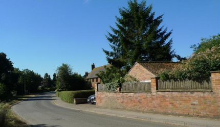
The type of boundary treatment, whether it be brick walling, fencing or hedging, should be informed by considering what forms the local distinctiveness of the area and what the boundary treatment is aiming to do, for example, screen car parking, provide shelter or provide privacy.
Where a brick wall is built it is important that the brick selected matches the building and care is taken in designing the height and use of coping stones to secure a suitable finish to the boundary. Hedges are a common boundary treatment in the village and for them to continue to thrive, an appropriate species needs to be used, and the hedge needs to be carefully planted.

Materials and finishes
Walls in Hickling are predominantly a soft orange red colour, with examples of Flemish bonding where the headers of the bricks are lighter in colour giving a pleasant chequered board effect.
Painted brick or the use of render on external walls has in the past had both a functional and aesthetic use. The uses have been employed to protect brickwork from the elements or to cover up damage or crumbling of the brick face. It is imperative that where render or painting of external walls is used it is maintained to make sure it continues to perform a protective function and to maintain an acceptable appearance.
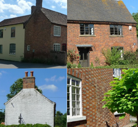
Pointing is the finish of the joints between the bricks, after the brickwork has been completed or during maintenance works to repair old pointing that has failed or eroded. Pointing is very important, not only does it make brickwork look good, but it adds to the resistance to weather, which will add to the brickwork’s longevity. Pointing should be undertaken with care and it is important that the pointing should have a flush or slightly indented finish, it must not be smeared on the edge or face of the brickwork. Pointing that has been poorly undertaken can damage the visual appearance of a building. The use of power tools to extract old mortar must be used with caution to avoid damaging the edges of the bricks. A useful reference is Historic England - Repointing Brick and Stone Walls Guidelines for Best Practice – January 2017.

Identifying Development Constraints and Opportunities
When planning a new development, it is essential to take into account local character, opportunities and the characteristics of a site and its setting with the surrounding neighbourhood and landscape that might influence design, and this should be done early in the design process.
Issues to be considered should include:
- The character of Hickling and Hickling Pastures as small village settlement in a rural setting
- Physical aspects of the site, for example, the location in the village, orientation of the sun, drainage, local micro climate
- Important existing features to be retained, for example, trees, hedges, ponds, buildings, walls
- Views into and out of the site
- Access points and routes into and across the site from surrounding areas
Responding to the setting
The centre of Hickling is designated as a Conservation Area and there are 24 listed buildings in the parish. The Design Guide seeks to ensure that these heritage assets are both conserved and enhanced.
Listed Building Consent is needed to alter or to extend a listed building in any way that affects its architectural or historic interest and any planning application in a Conservation Area is required to ensure that the proposals do not detract from its character.
Establishing the structure of new development
In Hickling attention should be paid specifically to the traditional ambience of the village, to the rural character of the place and the linear layout interspersed with open areas allowing views through to the countryside.
The Design Guide is not concerned with the internal layout of new buildings but the layout of the buildings within their plots and how they relate to the existing buildings in the village and how any new development forms links via footpaths and roads are important considerations in maintaining and enhancing the character of the area.
Key Design Principles:
- The development itself should have an obvious character and integrate well with its surroundings
- Important viewpoints should be identified beyond the development but also within it to green spaces, turns and curves and ends of streets
- Footways and paths should be linked to reflect the character of existing paths in the village
- Car parking should not be a dominant visual feature but requires realistic space for residents and visitors
- Hedges and trees are important features to include as they create natural environment and a link to existing surroundings
Landscape and Planting
The design of the public realm, landscaping and external areas around buildings is at least as important as the design of the buildings themselves in defining the character and quality of places. When the design of hard surfaces, boundaries and planting (which should include indigenous species such as Alder, Hazel, Holly, Dog Rose) is done well it can make all the difference in creating a distinctive character for new places so that they fit in their surroundings.
Existing landscapes can be used to form the structure and character of new development and to create shelter and windbreaks and can also provide instant ‘maturity’ that can be a valuable asset to a development site.
Key design principles:
- Planning applications for anything other than minor developments should be accompanied by a 3D visualisation or artist’s impression showing the relationship of the proposal to the surrounding buildings. These should clearly demonstrate the effect on views out from the village and from views into the approach to the village.
- The open green spaces between buildings and groups of buildings should be retained as a key part of the neighbourhood character.
- Existing property boundaries, trees and hedges are important and should be retained or, if removed by necessity, replaced
- New boundaries should be constructed in bricks to match the local brick. Railings, if used, should be of a local style and hedges should be of indigenous species. Standard panelled or lap fencing and metal/concrete post and rail are not characteristic features.
New Buildings and Architectural Features
Architectural detailing to buildings in the parish is varied adding to the interest and quality of the buildings. The principal features are the windows, the doors, roofs, chimneys and the coursing of the brickwork which add to the appearance and interest of the buildings. The characteristics of the village buildings reflect local and regional building traditions. There are limited examples of render being used and some painted brickwork which retains the texture of the brickwork and could be utilised in new developments if used in moderation. The windows, doors, fanlights, porches and chimneys give additional character to buildings and contribute to the diversity of the historic village streetscapes.
Key design principles:
- New developments should reflect local architectural styles and materials but avoid over-enthusiastic use of conflicting vernacular styles on any single building
- Modern interpretations of traditional forms may be acceptable although early discussion between architect and the local authority is recommended
- Materials used in new buildings should respect the surrounding buildings and reflect the traditional materials used in the area
- Extensions and renovations should harmonise with those that are dominant in the existing house
- Architectural detail such as windows, doors, roofs, porches and brickwork should reflect the local character
Innovative, contemporary design and that which incorporates energy-saving or generating features will be welcomed where it respects and enhances its surroundings. If we want to create a better quality of life, now and for future generations, we need to build more sustainably. To achieve this aim, design needs to become more integrated. It needs to include factors such as resources, carbon emissions, waste, health, culture and habitat and how these work together to shape new developments.
All extensions should harmonise with the parent building. An extension should respect the dominance of the original building and be subordinate to it in terms of its size and massing. Setting back the new section from the building line and keeping the eaves and ridge lower than the parent building will normally help. It may be possible to add a well-designed extension in a modern style provided it is in harmony with the original building and does not diminish its quality or integrity.