Solar Farm Guide
Solar Farm Guide 2022
Published November 2022
Contents
National Planning Policy & Guidance
Compliance with Green Belt Policy (where relevant)
Best Most Versatile Agricultural Land (BMV)
Open Space, Green Infrastructure Network & Other Recreational Uses
Grid Connection & Potential Generating Profile
Decommissioning and Restoration
Amenity, Pollution, Glint and Glare & Safety
Site Security (fencing and CCTV)
1. Introduction
1.1 In 2019, the Government set a legally binding target to bring carbon emissions in the UK to net zero. It considers that a fourfold increase in the use of ‘clean electricity generation’ from renewable technologies such as solar photovoltaics will be essential to underpin the delivery of the net zero target (Energy White Paper, December 2020).
1.2 Renewables now account for over one third of UK electricity generation (up from seven per cent in 2010), as a result of the increased deployment of wind, solar and biomass technologies. Electricity demand is predicted to double in the UK by 2050, driven in part by the electrification of vehicles and the increased use of clean electricity replacing natural gas for heating. As a result, electricity could provide more than half of the final energy demand in 2050, up from 17% in 2019.
1.3 The Government has committed to closing all coal fired power stations no later than 2025 and expects future low-cost, net zero consistent electricity to be made up of predominantly onshore and offshore wind and solar, complemented by technologies which provide power, or reduce demand, when the wind is not blowing, or the sun does not shine, including nuclear, clean hydrogen and long-duration storage (Energy White Paper, December 2020).
1.4 In its recent British Energy Security Strategy, the Government has indicated that it will consult on amending planning rules to strengthen policy in favour of ground mounted solar developments on non-protected land, but will ensure communities continue to have a say and environmental protections remain in place.
1.5 Over the last ten years the Council has granted planning permission for a small number of modest sized solar farms across the Borough. Generally, these developments have had site areas below 25 hectares and generating capacities not exceeding 12.4MW. More recently the Council has started to receive a number of planning applications and applications for Environmental Impact Assessment screening opinions for much larger, ‘utility’ scale solar farms with site areas up to 80 hectares and generating capacities of up to 49.9MW (megawatts).
2. Purpose and scope of Guide
2.1 This document is intended to provide broad guidance on:
- the planning policy context in respect of major, stand-alone ground mounted solar photovoltaic panel developments (hereafter referred to as ‘major solar farm developments’) that do not exceed 50 megawatts (MW) generating capacity;
- the key material planning considerations likely to be relevant to the determination of planning applications for major solar farm developments within the Borough; and
- examples of the information/documents that the Council expects should be submitted with planning applications for major solar farm developments
2.2 The guidance does not identify any preferred sites for major solar farm development within Rushcliffe or cover planning advice for smaller building mounted solar energy systems.
2.3 Major solar farm developments with a generating capacity of 50MW or less are typically determined by the Council under the normal planning regime, whereas larger ‘utility scale solar farm developments’ (i.e.: those exceeding 50MW capacity) are considered to be Nationally Significant Infrastructure Projects and as such are determined by the Secretary of State for Business, Energy & Industrial Strategy, under a particular planning process known as a Development Consent Order.
2.4 For the purposes of this guidance major solar farm developments are those with a site area of 1 hectare or more, as defined in the Town and Country Planning (Development Management Procedure) England Order 2015 and a generating capacity not exceeding 50MW.
3. Planning Policy Context
3.1 By law, all planning applications must be determined in accordance with the development plan, unless there are material considerations that indicate otherwise. This document builds upon and provides more detailed guidance on relevant policies in the development plan.
Local Planning Policy
3.2 The development plan relevant to solar farm development covering Rushcliffe Borough consists of the following:
- The Rushcliffe Local Plan Part 1: Core Strategy 2014 (LPP1);
- The Rushcliffe Local Plan Part 2: Land and Planning Policies 2019 (LPP2);
- Nottinghamshire Mineral Local Plan, 2021; and
- Adopted Neighbourhood Plans covering an application site, or part of it.
3.3 The key strategic policy within the development plan that is relevant to major solar farm developments is Policy 2 (Climate Change) of the LPP1. This sets out the Council’s overarching aim that all development will, amongst other things, be expected to mitigate against the effects of climate change and comply with national and local targets on reducing carbon emissions. The policy also supports the development of new decentralised, renewable and low carbon energy generation, including from solar, where they are compatible
with environmental, heritage, landscape and other planning considerations.
3.4 Policy 16 (Renewable Energy) of the LPP2 sets out the policy requirements for renewable energy developments within the Borough and confirms that planning permission will be granted for such developments, providing they are acceptable in terms of the 16 criteria listed in the policy.
3.5 Depending on the location of the application site, other development plan policies of relevance to the determination of planning applications for major solar farm developments may also include:
Local Plan Part 1: Core Strategy (LPP1)
- Policy 1 (Presumption in Favour of Sustainable Development)
- Policy 4 (Nottingham-Derby Green Belt)
- Policy 10 (Design and Enhancing Local Identity)
- Policy 11 (Historic Environment)
- Policy 16 (Green Infrastructure, Landscape, Parks and Open Spaces)
- Policy 17 (Biodiversity)
Local Plan Part 2: Land and Planning Policies (LPP2)
- Policy 1 (Development Requirements)
- Policy 17 (Managing Flood Risk)
- Policy 18 (Surface Water Management)
- Policy 19 (Development Affecting Watercourses)
- Policy 21 (Green Belt)
- Policy 22 (Development within the Countryside)
- Policy 28 (Conserving and Enhancing Heritage Assets)
- Policy 29 (Development affecting Archaeological Sites)
- Policy 34 (Green Infrastructure and Open Space Assets)
- Policy 36 (Designated Nature Conservation Sites)
- Policy 37 (Trees and Woodlands)
- Policy 38 (Non-Designated Biodiversity Assets and the Wider Ecological Network)
- Policy 40 (Pollution and Land Contamination)
- Policy 42 (Safeguarding Minerals)
National Planning Policy & Guidance
3.6 The overarching National Policy Statement for Energy (NPS EN-1) and National Policy Statement for Renewable Energy Infrastructure (NPS EN-3) set out national policy for the delivery of nationally significant energy infrastructure, including renewable energy, although currently neither explicitly covers large scale solar electricity generation or battery storage.
3.7 Paragraph 5 of the National Planning Policy Framework July 2021 (NPPF), states that NPS’s are part of the overall framework of national planning policy and as such may also be a material consideration in making decisions on planning applications. The NPS’s set out assessment principles for judging impacts of energy projects and are material considerations when considering development proposals.
3.8 With particular regard to applications for major solar farm developments that are close to the 50MW capacity threshold, both NPS EN-1 and NPS EN-3 are likely to be material considerations. The National Policy Statement for Electricity Networks Infrastructure (NPS EN-5) may also be relevant where new overhead electricity lines and associated infrastructure are proposed to connect the solar farm to the grid.
3.9 The NPPF is also a material consideration, in particular where the development plan is silent on a matter or the policies within the development plan expressly defer to the NPPF (for example Policy 21 of the LPP2). The NPPF talks generally about renewable energy generation within the context of planning for climate change but makes no specific reference to solar farm developments. Notwithstanding this the NPPF favours sustainable energy systems as long as any impacts are (or can be) made acceptable. It advises
that local planning authorities should promote these as part of a positive strategy for tackling climate change. Paragraph 158 states that local planning authorities should not require the overall need for renewable energy to be demonstrated and approve planning applications for renewable energy developments if its impacts are (or can be made) acceptable.
3.10 The Government’s online Planning Practice Guidance (PPG) provides guidance on the specific planning considerations that relate to large scale ground-mounted solar PV farms. At paragraph 013 it states:
“The deployment of large-scale solar farms can have a negative impact on the rural environment, particularly in undulating landscapes. However, the visual impact of a well-planned and well-screened solar farm can be properly addressed within the landscape if planned sensitively.
Particular factors a local planning authority will need to consider include:
- encouraging the effective use of land by focussing large scale solar farms on previously developed and non-agricultural land, provided that it is not of high environmental value;
- where a proposal involves greenfield land, whether:
- the proposed use of any agricultural land has been shown to be necessary and poorer quality land has been used in preference to higher quality land; and
- the proposal allows for continued agricultural use where applicable and/or encourages biodiversity improvements around arrays. See also a speech by the Minister for Energy and Climate Change, the Rt Hon Gregory Barker MP, to the solar PV industry on 25 April 2013 and written ministerial statement on solar energy: protecting the local and global environment made on 25 March 2015.
- that solar farms are normally temporary structures and planning conditions can be used to ensure that the installations are removed when no longer in use and the land is restored to its previous use;
- the proposal’s visual impact, the effect on landscape of glint and glare (see guidance on landscape assessment) and on neighbouring uses and aircraft safety;
- the extent to which there may be additional impacts if solar arrays follow the daily movement of the sun;
- the need for, and impact of, security measures such as lights and fencing;
- great care should be taken to ensure heritage assets are conserved in a manner appropriate to their significance, including the impact of proposals on views important to their setting. As the significance of a heritage asset derives not only from its physical presence, but also from its setting, careful consideration should be given to the impact of large scale solar farms on such assets. Depending on their scale, design and prominence, a large scale solar farm within the setting of a heritage asset may cause substantial harm to the significance of the asset;
- the potential to mitigate landscape and visual impacts through, for example, screening with native hedges;
- the energy generating potential, which can vary for a number of reasons including, latitude and aspect.
The approach to assessing cumulative landscape and visual impact of large scale solar farms is likely to be the same as assessing the impact of wind turbines. However, in the case of ground-mounted solar panels it should be noted that with effective screening and appropriate land topography the area of a zone of visual influence could be zero.”
4. Environmental Impact Assessments (EIA)
4.1 Industrial installations for the production of electricity where the development site area exceeds 0.5 hectares, falls under Schedule 2 to the Town and Country Planning (Environmental Impact Assessment) Regulations 2017. As such applications for major solar farm developments may need to be screened by the Council to determine whether they constitute EIA development.
4.2 Applicants are advised to apply to the Council for an EIA Screening Opinion before submitting their planning application. If a particular development proposal is considered to be EIA development, the planning application must be accompanied by an Environmental Statement that has been prepared in accordance with Regulation 18 of the EIA Regulations 2017 (as amended).
4.3 Further advice as to the scope and level of detail of the information that is to be provided in an Environmental Statement can be requested by submitting an EIA Scoping Opinion to the Council.
5. Community Engagement
5.1 Solar farm developers will be required to demonstrate that they have undertaken a high standard of public pre-application activity in line with the Council’s Statement of Community Involvement (SCI, Effective pre-application engagement allows local communities and others to gain a better understanding of the project and its potential impacts. It also allows local communities to make suggestions which the developer can consider when developing and finalising their planning proposals. Local knowledge of the area can help developers to omit unsuitable options and minimise impacts on the local community where possible. Community engagement will also be strongly encouraged during the construction period and operational life of the solar farm to develop strong local relationships between the operator and the local community
5.2 The Council can provide general advice on who, when and how to engage with the local community. Further guidance is also contained in BRE NSC (2015) Community Engagement Good Practice Guidance for Solar Farms.
6. Key Material Planning Considerations
6.1 The following section outlines some of the key planning considerations (as set out in Policy 16 of the LPP2) that are likely to be relevant when determining planning applications for major solar farm developments. Applicants are advised to ensure that these matters in particular are adequately addressed when submitting planning applications for major solar farm developments to the Council. This includes any associated infrastructure and/or buildings that might be necessary, such as substations, transformers, battery storage
facilities, power cables, fencing, access tracks, construction and operational compounds, and connection to the National Grid.
6.2 The Council may consider the use of planning conditions to mitigate the impacts of major solar farm developments, where it considers that conditions could make the development acceptable and providing the conditions can satisfy all of the tests set out in the NPPF (paragraph 56). Compliance with Green Belt policy (where relevant)
6.3 Sites that are either wholly or partially within the Green Belt are required to be determined in accordance with Green Belt policy. Applicants should be aware that this can be a significant constraint on major solar farm developments.
6.4 Policy 21 of the LPP2, requires that all development within the Green Belt complies with national Green Belt policy, as set out in the NPPF (chapter 13). Paragraph 151 states that elements of renewable energy projects are likely to be classed as ‘inappropriate development’, and therefore can only proceed if ‘very special circumstances’ (VSC) can be shown.
6.5 Inappropriate development is, by definition, harmful to the Green Belt and such harm must be afforded substantial weight in the planning balance (as must any other harm or harms that might be identified). Whilst the NPPF (paragraph 151) acknowledges that VSC’s may include the wider environmental benefits associated with increased production of energy from renewable sources, in order for planning permission to be granted any such potential benefit(s) must clearly outweigh any ‘definitional’ harm that might be caused as well as any other potential harm(s) that might be caused by the development (such as adverse effects on landscape, heritage or ecological assets).
6.6 It will be insufficient for any potential VSC’s to merely outweigh any definitional harm or other harm(s) to the Green Belt. The VSC’s must be shown to clearly outweigh the harm or harms of development.
6.7 Applications for major solar farm developments that fall within the Green Belt should be supported by a statement that appraises the impact of the proposed development on the Green Belt (and its five purposes), setting out specifically the VSC’s that are to be relied upon by the applicant to clearly outweigh any harm or harms to the Green Belt that might be caused by the proposed development.
6.8 Rushcliffe’s predominantly rural landscape is a key part of the Borough’s character and provides an attractive backdrop for its residents, visitors and investors to live and work. Such landscapes also form an important part of the Green Infrastructure network within the Borough. The landscape and visual effects of major solar farm developments are likely to be one of the most significant impacts arising from such development. Therefore, it is vital that due consideration is given to these impacts at the earliest possible stage in the site selection process and formulation of the design/layout of any proposal.
6.9 Policy 16 of the LPP1 sets out the strategic approach for the protection and enhancement of existing Green Infrastructure as well as for the delivery of new Green Infrastructure. The approach requires, amongst other things, that:
- existing Green Infrastructure corridors and assets are protected and enhanced;
- where a development has an adverse impact on existing Green Infrastructure the need for and benefit of the development will be weighed against the harm caused; and,
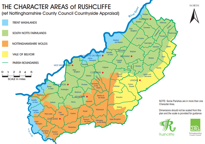
- landscape character is protected, conserved or enhanced in line with the recommendations of the Greater Nottingham Landscape Character Assessment 2009 (GNLCA). The GNLCA divides the Rushcliffe into four Regional Landscape Character Areas (shown at Appendix 1).
6.10 Policy 22(2)(i) of the LPP2 supports renewable energy developments within the Countryside (i.e.: land outside of the Green Belt), providing the appearance and character of the landscape, including any historic and/or ecological features/local distinctiveness is conserved and enhanced.
6.11 All applications for major solar farm development will be expected to be supported by an appropriate assessment in the form of either a Landscape and Visual Assessment (LVA) or Landscape and Visual Impact Assessment (LVIA), if the proposal is EIA development. Ideally such assessments should be compiled following the guidance set out in the Guidelines for Landscape and Visual Impact Assessments 3rd edition (GLVIA3) produced by the Landscape Institute.
6.12 When assessing the significance of impacts a number of criteria should be considered including:
- the sensitivity of the existing landscape, having regard to its condition and strength (as identified in the relevant detailed and summary descriptions at appendix 9 of the GNLCA - see Appendix 2), and
- the magnitude of the predicted change to the existing landscape character from the proposed development.
6.13 Proposals that would involve the removal of significant sections of existing field boundaries, such as hedgerows/trees, are unlikely to be considered acceptable as they would be likely to irrevocably alter the character of the existing landscape.
6.14 The PPG states that in assessing the impact on visual amenity, factors to consider include establishing the area in which a proposed development may be visible, identifying key viewpoints, the people who experience the views and the nature of the views. These factors should be clearly assessed within the LVIA or LVA submitted with the planning application.
6.15 Further guidance on the information that should be included within an LVIA or LVA can be found at Appendix 3.
6.16 As stated above, Rushcliffe’s predominantly rural landscape is a key part of the Borough’s character and provides an attractive backdrop for its residents and visitors alike. Additionally, this landscape supports a variety of ecological assets that contribute to the biodiversity of the area.
6.17 Whilst large scale solar farm developments have the potential to provide biodiversity enhancements that might otherwise not be secured on agricultural land (for example the planting of additional trees and wildflower meadows that can improve conditions for insects and other species), such developments also have the potential to negatively impact existing ecological assets (for example from habitat loss, fragmentation or displacement of species). The nature and extent of such potential impacts will depend upon the scale of the proposed development and the specific characteristics of the site and its surrounding area.
6.18 Policy 17(1) of the LPP1 sets out a number of measures intended to increase biodiversity within the Borough over the plan period (currently to 2028). These measures include, amongst other things:
- seeking to ensure new development provides new biodiversity features, and improves existing biodiversity features wherever appropriate;
- supporting the need for the appropriate management and maintenance of existing and created habitats through the use of planning conditions, planning obligations and management agreements; and
- ensuring that where harm to biodiversity is unavoidable, and it has been demonstrated that no alternative sites or scheme designs are suitable, development should as a minimum firstly mitigate and if not possible compensate at a level equivalent to the biodiversity value of the habitat lost.
6.19 Policy 17(3) is also clear that development on or affecting non-designated sites or wildlife corridors with biodiversity value will only be permitted where it can be demonstrated that there is an overriding need for the development and that adequate mitigation measures are put in place.
6.20 In terms of ecology, Policy 1(6) of the LPP2 states that planning permission will be granted for developments providing that there are no significant adverse effects on important wildlife interest and where possible, the application demonstrates net gains in biodiversity, known as Biodiversity Net Gain (BNG). Policy 36 of the LPP2 seeks to protect designated nature conservation sites, differentiating between national and local designations. Development that adversely affects a Site of Special Scientific Interest (either
directly or indirectly), will not normally be permitted unless the benefits of the development’s location clearly outweigh both the impacts that it is likely to have on the features of the site that make it of special scientific interest and any broader impacts on the national network of Sites of Special Scientific Interest.
6.21 Similarly, at a local level, development that is likely to have a significant effect on a Local Wildlife Site (LWS), a Local Geological Site (LGS), a Local Nature Reserve (LNR) or Irreplaceable Habitats (such as ancient woodlands or ancient/veteran trees) will not be permitted unless it can be clearly demonstrated that there are reasons for the development that outweigh the need to safeguard the essential nature conservation value of the site. Policy 37 of the LPP2 also specifically seeks to prevent adverse impacts upon mature trees from development as well as the loss of ancient, semi-natural woodland and ancient/veteran trees.
6.22 In terms of biodiversity, Policy 38 of the LPP2 sets out an expectation that all development will preserve, restore and re-create priority habitats and the recovery of priority species to achieve net gains in biodiversity. Developments that significantly affect a priority habitat should avoid, mitigate or as a last resort compensate any loss or effects. Additionally, development within a Biodiversity Opportunity Area (BOA) should retain and sympathetically incorporate locally valued and important habitats, including wildlife corridors
and steppingstones and be designed in order to minimise disturbance to habitats and species. Outside of BOA’s developments should seek to achieve net gains to biodiversity.
6.23 It is recommended that all planning applications for large scale solar farm developments are supported by a detailed ecological survey, which should be used to guide the site selection and site design process. The assessment should also identify any ecological site mitigation measures and opportunities for ecological enhancement and BNG in line with the policies refer to above. Impacts from the development on any protected species and their habitats should be avoided. Where they cannot be avoided (for example by locating to
an alternative site with less harmful impacts), they must be adequately mitigated or, as a last resort, compensated for.
6.24 From November 2023, it will be a legal requirement that all developments meet the ‘Biodiversity gain objective’. That means the biodiversity value attributable to the proposed development exceeding the pre-development biodiversity of the onsite habitat by at least 10%. Prior to this date, it is strongly recommended that applications for large scale solar farm developments seek to achieve at least 10% BNG onsite. It is also strongly recommended that pre-biodiversity and post-biodiversity assessments of the onsite habitat are carried out and submitted with the planning application.
6.25 In addition, a site management plan should be prepared and submitted that demonstrates how the land around the proposed solar panels will be managed, including providing a minimum of 10% BNG. This could include enabling some low intensity animal grazing, the continued agricultural use of the site or the creation of new habitats to improve on-site ecology. An ecological monitoring programme may also be required to monitor any impacts upon existing on-site flora; upon any particular features likely to support species (e.g. bats, birds, reptiles, amphibians) and to inform any changes that may be needed to the other particular habitats and species recorded on or adjacent to the site and to inform any necessary changes to the site management arrangements. The site management plan should include maintenance and stewardship arrangements for the site covering both landscape and ecology matters. This will help to ensure that appropriate management and maintenance arrangements/funding mechanisms are identified at an early stage.
6.26 The BRE National Solar Centre Biodiversity Guidance for Solar Developments provides further guidance on how to support biodiversity on large scale solar farms: NSC - Biodiversity Guidance (bre.co.uk).
Best Most Versatile Agricultural Land (BMV)
6.27 The NPPF states that planning policies and decisions should contribute to and enhance the natural and local environment by recognising the intrinsic character and beauty of the countryside, the wider benefits from natural capital and ecosystem services, including the economic and other benefits of the best and most versatile agricultural land.
6.28 As mentioned at paragraph 3.10 above, the PPG advises that the deployment of large-scale solar farms can have a negative impact on the rural environment. As such it advises that effective use of land should be encouraged by focussing large scale solar farms on previously developed and non-agricultural land (provided that it is not of high environmental value).
6.29 Given the rural nature of the Borough, it is acknowledged that there may not be sufficient brownfield land available to accommodate large scale solar farm developments. However, where the use of greenfield land is proposed, the PPG advises that consideration should be given to whether the use of any agricultural land has been shown to be necessary and poorer quality land (i.e.:
grades 3b, 4 and 5) had been used in preference to higher quality land; and the proposal allows for continued agricultural use where applicable and/or encourages biodiversity improvements around the arrays.
6.30 Similarly, Policy 1(12) of the LPP2 requires that proposed development has regard to BMV agricultural land, with a preference for the use of lower quality over higher quality agricultural land and minimising soil disturbance as far as possible. Policy 16 d) of the LPP2 also requires that renewable energy schemes are acceptable in terms of BMV agricultural land.
6.31 Applications for major solar farm developments will be expected to be supported by a site specific assessment of the BMV of the application site and include appropriate justification/mitigation if any higher quality land (i.e.: grades 1, 2 and 3a) is to be used.
6.32 Further guidance on assessing development proposals on agricultural land can be found on GOV.UK - agricultural land access proposals.
6.33 As well the historic environment being a fundamental part of both national and local planning policy considerations, the Council also has a statutory duty to ensure that it is conserved and protected, with great weight being given to its conservation. Major solar farm developments have a significant potential to impact the historic environment, affecting heritage assets both above and
below the ground. Heritage assets can be either ‘designated’ or ‘non-designated’.
6.34 Designated heritage assets are nationally important assets and include scheduled monuments, listed buildings, registered parks and gardens, and conservation areas. In Rushcliffe there are currently:
- 682 listed buildings, including 35 Grade I and 22 Grade II* and 625 Grade II;
- 27 Scheduled Monuments;
- 4 Registered Parks and Gardens; and
- 30 Conservation Areas.
6.35 Non-designated heritage assets are identified by the Council as assets of local and regional importance. This category can include buildings, archaeological sites, monuments, gardens and landscapes identified as having a degree of significance meriting consideration in planning decisions, but which are not formally designated heritage assets. The Conservation Area Appraisal and Management Plans that have been produced for the majority of the conservation areas in Rushcliffe may identify key unlisted buildings, as well as
important vistas and panoramic views and features which might be considered, non-designated heritage assets.
6.36 Policy 11 of the LPP1, states that proposals that conserve and/or enhance the historic environment and heritage assets and their settings will be supported. Policy 28 of the LPP2 explains that proposals that affect heritage assets and/or their setting will be required to demonstrate an understanding of the significance of the asset(s) and their setting(s); identify the impact of the proposed development upon them; and provide a clear justification for the development in order that a decision can be made as to whether the merits of the proposals for the site bring public benefits which decisively outweigh any harm arising from the proposals. The supporting text to Policy 28 also provides further information as to the criteria the Council will use when determining whether a particular feature is a non-designated heritage asset.
6.37 Similarly, Policy 29 of the LPP2 requires that applications for developments affecting known or potential archaeological sites be supported by an appropriate archaeological assessment and evaluation. Planning permission will not be granted without adequate assessment of the nature, extent and significance of the remains present and the degree to which the proposed development is likely to affect them. The footnote to paragraph 200 of the NPPF indicates that non-designated assets of archaeological interest that are
demonstrably of equivalent significance to scheduled monuments should be subject to the policies for designated heritage assets, as non-designated heritage assets can also contribute to the character of the area.
6.38 All applications for major solar farm developments will be expected to be supported by a detailed heritage assessment undertaken by a suitably qualified heritage person/organisation. The assessment should identify any designated heritage assets along with any non-designated heritage assets located within, immediately adjacent or in the wider setting of the application site. Ideally the assessment should include a search area of a minimum of 1km radius from the site boundary, in certain cases a larger area, for instance where there may be an impact on long distance views.
6.39 In line with Policy 29, the heritage assessment should also include a desk based archaeological assessment to identify any possible archaeological remains of historical importance, with reference to the Historic Environment Record, and propose further investigation, recording and mitigation as necessary. This may include the preservation of archaeological interest in situ, through recording or a mixture of these elements.
6.40 Further advice on historic environment issues relating to different types of commercial renewable energy development proposals, including solar photovoltaics (PV) is available from Historic England - images and books - commercial renewable energy.
6.41 Public Open Spaces (POS) and other recreational routes, such as Public Rights of Way (PROW), are important local amenities for local communities within the Borough, that help to promote healthy lifestyles and wellbeing. As such applications for large scale solar farm developments that would adversely affect or result in the loss of POS or PROW’s, are unlikely to be acceptable.
6.42 In setting the strategic approach to the delivery, protection and enhancement of green infrastructure, Policy 16 of the LPP1 states that where any new development would have an adverse impact on green infrastructure (such as open spaces), alternative scheme designs that have no or little impact should be considered before mitigation is provided. Moreover, the need for and benefit of the development will be weighed against the harm caused.
6.43 Similarly, Policy 34 of the LPP2 seeks to protect green infrastructure assets, including amenity space, nature conservation sites, rights of way and woodlands from development that adversely affects their function, unless the need for the asset is proven to no longer exist and the benefits of the development in that location outweigh the adverse effects on the asset.
6.44 Policy 35 of the LPP2 requires that development within identified Strategic or Local Green Corridors should ensure the primary functions of the network are maintained and enhanced and opportunities to create additional green infrastructure assets which enlarge the network should be taken. Development on the edge of the main urban area (the urban fringe) must incorporate accessible infrastructure that provides recreational opportunities, wildlife benefits and enables pedestrian and cycle access to the wider countryside, where possible.
6.45 Applications for major solar farm developments will need to demonstrate to the satisfaction of Nottinghamshire County Council, in its capacity as the local highway authority, that all PROW’s impacted upon by a proposal will remain accessible to the general public and convenient for their use. Any PROW running through the application site should be appropriately integrated into the proposal so that it remains usable, retains its recreational amenity value both during the construction phase and throughout the lifetime of the development. In the event that a PROW is affected by the proposed development, details of all works necessary to ensure its continued availability during and post construction should be submitted with the planning application. In those circumstances it is recommended that the views/advice of the Rights of Way Team at Nottinghamshire County Council are sought in advance the submission of any planning application.
6.46 Furthermore, if any PROW has to be temporarily or permanently diverted, then no development should commence on site until an Order securing the diversion of the existing definitive right of way has been agreed with both the Borough and County Councils and the new route has been constructed and is available for public use.
6.47 Ideally access to the site should be achieved of a surfaced road. However, where a site is isolated from a highway, the upgrading of an unsurfaced track (unsurfaced road, by-way or bridleway) may be required to provide access for construction and maintenance vehicles. This is likely to require physical improvements to the access route which may change the appearance of the track and the character of the area. Care should be taken to ensure changes to the surface, width, boundaries and additional security features (which deter potential fly-tipping and other criminal activity) along the access route complement and do not significantly harm the character of the surrounding area, especially in rural locations and where the route is also a public right of way.
6.48 Equally, the same care should be taken to ensure changes to the surface and width of internal access routes avoid the unnecessary urbanisation of site.
6.49 Where new and upgraded access routes provide opportunities to improve public accessibility (linking public rights of way etc.) around the site, these should be taken.
Grid Connection & Potential Generating Profile
6.50 Typically, electricity generated by a major solar farm development will be linked via a cable to a transformer, which converts it to a higher voltage before it enters the grid at a substation. Whilst the NPS EN-1 advises that ensuring a suitable grid connection is the responsibility of the applicant, the Council may need to be satisfied that there is no reason why, in principle, a grid connection would not be possible. This can be demonstrated by submitting evidence of a formal offer of a connection from the service provider, such as Western Power Distribution (WPD) or similar relevant organisation, with the planning application. Ideally, WPD (or similar) should be consulted prior to the submission of a planning application, so that any technical constraints in regard to grid connection can be considered and addressed to ensure the development of the site is planned in the most effective way.
6.51 Applications for major solar farm developments should provide details of all transformer/substation infrastructure required along with an indication of the route of the cabling required to connect the development to the national grid. The nature and extent of such cabling (e.g.: whether overhead or underground) should be indicated. Such cabling should avoid areas of high landscape, ecological or archaeological sensitivity, and should be designed so as not to be extensive or visually intrusive. Where connection to the grid risks
causing an accumulation of overhead wiring in sensitive areas the cumulative impact may need to be assessed.
6.52 Details of the electricity generating potential and profile of the proposed development should also be provided with the application. This should include information to demonstrate that the proposed panel layout maximises coverage on the plot and optimises performance of the panels from both an orientation and angle of panel perspective.
6.53 It is important that major solar farm developments are as sympathetic to the existing environment as possible, with minimal disruption during the construction and operational phases of any development. Intrusive groundworks, such as trenching and foundations, should be minimised and the use of concrete avoided where possible.
6.54 Policy 10 of LPP1 requires that all new development is designed to make, amongst other things, a positive contribution to the public realm and sense of place; create an attractive, safe, inclusive and healthy environment; reinforce valued local characteristics; and be adaptable to meet evolving demands and the effects of climate change. The policy also requires that outside of settlements new development should conserve or where appropriate, enhance or restore landscape character and proposals will be assessed with reference to the GNLCA (see Landscape and Visual Impacts section above and appendix 2).
6.55 Policy 1 of the LPP2, states that planning permission for new development will be granted provided that certain criteria, where relevant, are met. Criteria 1, 2, 4, 6, 7, 8, 9, 10, 11 and 12 in particular are likely to be relevant to planning applications for major solar farm developments. Policy 16(j) also requires renewable energy developments to be acceptable in terms of their form and siting.
6.56 Details of the scale and specification of the solar PV panels will be required when assessing planning applications for major solar farm developments. The extent of the array(s) and their angle(s) of repose should be specified, along with the maximum height above ground level and the parameters of any ‘tracking’ element (for those panels that change angle to follow the path of the sun), including the range of any height variation.
6.57 Ideally site levelling/re-grading and similar groundworks should be kept to a minimum. Any such work that might be required to facilitate a major solar farm development should be clearly detailed within the planning application, for example by being shown on a series of existing and proposed cross section drawings through the site.
Decommissioning and Restoration
6.58 The PPG2 identifies, as a particular planning consideration, that large scale solar farms are normally temporary structures and advises that planning conditions can be used to ensure that the installations are removed when no longer in use and the land restored to its previous use. However, in most cases the operational life span of such installations can range between 20-40 years. Policy 16 (k) of the LPP2 requires all renewable energy developments to be acceptable in terms their decommissioning and the reinstatement of the land at the end of their operational life. As such if planning permission for a major solar farm development is granted, it is likely that the Council will seek to impose a condition limiting the operational life of the development. Any future proposal to extend the operational life of an approved development would require a separate planning permission.
6.59 In addition, planning applications for major solar farm developments should include details of how the site will be restored to its previous use / landform (if altered) at the end of the operational life of the development, retaining any landscape and biodiversity enhancements and/or community benefits that may have been provided. Access routes should also be returned to their previous condition. The details should outline the process and timescale for removing all above ground structures, bases and foundations and equipment from the land (including all security infrastructure and access tracks/roadways) and the propose the restorative measures, such as the reseeding or re-profiling of the land to its previous form. In order to assist decommissioning, construction of the site should avoid unnecessary use of concrete and asphalt. If planning permission is granted, it is likely that the Council will seek to impose a
condition requiring that the site is restored to its previous condition in a timely manner at the end of the operational life of the development.
6.60 Individually, large scale solar farm developments can give rise to certain effects on the environment however the cumulative effect of such developments in combination with the effects from other similar developments in the vicinity of the site can also be a key concern to the Council and is likely to be a material planning consideration in the determination of any planning application for large scale solar farms.
6.61 The PPG provides guidance for developers specifically in relation to the production of LVIAs in respect of wind energy development and states that the same guidance can also be applied to assessing cumulative impacts of large scale solar farms too. The PPG also recommends that cumulative landscape impacts and cumulative visual impacts are assessed separately. It also sets out what type of information should be put together to inform an LVIA.
6.62 Ideally, all applications for large scale solar farm developments should be supported by a Cumulative Impact Assessment (CIA), that assesses the effects of the proposed development in combination with the effects of any existing, permitted and proposed development (those likely to be determined before or at the same time as the proposal) within the vicinity of the application site that are likely to result in significant cumulative effects on the environment.
The CIA should also include an assessment of any relevant developments in the vicinity of the site that lie outside the Council’s administrative area. The =applicant is advised that their CIA may need to be updated and revised during the consideration of their application where new development proposals emerge that could give rise to further cumulative effects in combination with their proposed development.
6.63 As a minimum the guidance on cumulative effects set out in the PPG should be followed. Additionally, the Planning Inspectorates Guidance Note No.17 provides useful guidance on the approach to producing a robust CIA and should be considered as a starting point when preparing planning applications for large scale solar farm developments, particularly those that are close to the 50MW generating capacity threshold.
Amenity, Pollution, Glint and Glare & Safety
6.64 Solar panels themselves do not generally make any significant noise when generating electricity, although ancillary equipment, such as invertors, transformers or sub-stations may produce noise. Any such noise generating equipment should be carefully sited so as not to adversely affect any nearby noise sensitive receptors (e.g.: people or wildlife).
6.65 In order to protect the amenity of residents, depending on their proximity to the site and access routes, conditions may be required that restrict the hours of construction and routes that construction lorries may take.
6.66 Generally, solar panels are designed to absorb as much light as possible rather than reflect it. Nevertheless, there is the potential for glint and glare effects. ‘Glint’ refers to a momentary flash of light produced as a direct reflection of the sun whilst ‘glare’ is a more continuous source of brightness relative to the ambient lighting. These effects can have a visual impact on the landscape and can act as a potential hazard or distraction for motorists, pilots, pedestrians and occupiers of nearby properties.
6.67 Policy 1 of the LPP2 requires all new development to achieve noise attenuation and Policy 40 of the LPP2 stipulates that planning permission will not be granted for development that would result in an unacceptable level of pollution or is likely to result in unacceptable exposure to sources of pollution or risks to safety. In line with the PPG due consideration must be given to the impact of glint and glare from proposals for solar farms.
6.68 All planning applications for major solar farm developments will be expected to be accompanied by a Glint and Glare Assessment that considers the potential impact of glint and glare from the solar panels upon landscape/visual amenity, aircraft, rail and road safety, local residents and users of public rights of way.
When developing proposals applicants are strongly advised to undertake pre-application engagement with any relevant authorities (such as MAG East Midlands Airport, the Military Aviation Authority, Network Rail, Highways England and/or the Highways Authority at Nottinghamshire County Council) to agree the scope of the assessment where the development has the potential to affect such infrastructure.
6.69 Where a battery energy storage is proposed on the development site, a management plan will be required to demonstrate how this facility will be constructed and operated safely.
6.70 Given the surface area created by a rows of solar panel arrays clustered together, major solar farm developments have the potential to effect the way surface water runs off a site, particularly where the land was previously an open field, and as such have the potential to increase flood risk.
6.71 Policy 17 of LPP2 is supportive of development proposals that are within areas where a risk of flooding or problems of surface water disposal exist, providing that the Sequential and Exception tests are applied and satisfied in accordance with the NPPF and PPG. The policy also states that development proposals within areas of flood risk will only be considered when accompanied by a site specific flood risk assessment and such proposals will be expected to include mitigation measures which protect the site and manage any residual flood risk.
6.72 Policy 18 of the LPP2 requires that all development proposals identify opportunities to incorporate a range of deliverable Sustainable Drainage Systems, appropriate to the size and type of development. The choice of drainage systems should comply with the drainage hierarchy within the PPG.
6.73 In line with Policies 17 and 18 of the LPP2, it is recommended that planning applications for major solar farm developments within Flood Zones 2 and 3 or within areas where surface water flooding is known to be a problem should be accompanied by a site specific flood risk assessment that addresses all potential sources of flooding. In addition, the management of surface water needs to be considered carefully and regard had to all of the criteria (where relevant) set out at Policy 18(2) of the LPP2.
6.74 Policy 42 of LLP2 sets out that development will not be permitted which would sterilise mineral resources of economic importance or pose a serious hindrance to future extraction in the vicinity. Where development proposals are located within minerals safeguarding areas, prior extraction of such minerals will be encouraged, subject to whether this is practicable or economically feasible.
Site Security (fencing and CCTV)
6.75 The Council recognises that major solar farm developments may need to be to secure from unauthorised access and for health and safety reasons. The level of security required for a particular solar farm development will depend to a large extent on the location and the scale/extent of the site. Security measures, depending on their nature have the potential to have an impact on the landscape and visual amenity. Therefore, applicants should ensure that any security measures, such as fencing, lighting installations or CCTV, used
as part of their proposal must be designed and located to minimise any landscape and visual impacts.
6.76 Applications should seek to preserve open site lines across the countryside, wherever possible. Where stronger boundary treatments are not visually compatible with the existing landscape character, consider combining deer type fencing with suitably monitored CCTV or Perimeter Intrusion Detection Systems (PIDS) may provide a compromise solution.
6.77 The further guidance on the use of site security measures can be found in the BRE Planning Guidance for the development of large scale ground mounted solar PV systems.
6.78 Applications for major solar farm developments will be expected to minimise the use and height of security fencing and seek to make use of any natural site features such as field hedges and trees, where possible. Applications should include full details of all site security measures and features such as perimeter fencing, CCTV cameras and lighting with significant consideration given to mitigating their impact on wildlife and ecology. Applicants will be expected to outline arrangements and specifications of site lighting with an
appropriate assessment of how any impact on landscape, ecology and nearby communities will be minimised. Where fencing is proposed, these should include suitable open sections at the bottom to allow small mammals identified in the area to pass through. Any fencing should ensure it does not pose an increased safety risk to all the PROW users, including equestrians and cyclists.
7. Planning Obligations
7.1 Policy 19 of the LPP2 requires that all development will, amongst other things, be expected to contribute to the delivery of necessary infrastructure to enable the cumulative impacts of developments to be managed, including identified transport infrastructure requirements and provide for the future maintenance of facilities provided as a result of the development.
7.2 Some cases may require financial contributions, other cases may require the details of mitigation measures to be included in an agreement so that a robust legal mechanism is in place to ensure appropriate mitigation is carried out.
7.3 Other matters may be more appropriate to be covered by conditions. Each site will be considered on its own merits and engagement will be had with the relevant applicant/ stakeholders to identify such cases.
8. Appendices
Appendix 1 Plan of Regional Landscape Character Areas in Rushcliffe
Appendix 2 Information to be included in a Landscape and Visual Impact Assessment
Appendix 3 Appendices from Greater Nottinghamshire Landscape Character Assessment (2009)
Appendix 1 Plan of Regional Landscape Character Areas in Rushcliffe
Appendix 2 Information to be included in a Landscape and Visual Impact Assessment
Information to be included within an LVIA or LVA
1. Description of the development
- The need for the development set within local, regional and national strategies;
- The timescale for construction, operation and decommissioning.
- The site’s location and overall layout;
- Solar panel design and specification, method of construction/installation;
- Reasonable estimates of quantity and type of traffic which will be generated through construction and operation of the development.
2. Site Description
- Description of the main reasons for the site selection and any alternatives in site design or layout which have been considered;
- Area of proposed land which the panels will occupy, clearly described and indicated on a map or diagram;
- Illustrated description of the land use of the surrounding area;
- Description of the policies plans and designations which are relevant to the site;
- Evaluation of the direct, indirect, secondary and cumulative, short medium and long term effects resulting from the existence of the development.
3. Landscape Baseline Conditions
- The current condition of the landscape;
- Use Greater Nottingham Landscape Character Assessment to provide the framework landscape character information, supplemented by a study to assess the specific impact of the development;
- Relationship of the site to any designated areas of landscape at a national, regional or local level, and to areas of landscape value or scenic quality.
- Description of all baseline date sources, and methods used to supplement this information;
- The landscape baseline should be evaluated in relation to its sensitivity and importance. The sensitivity evaluation of each landscape element should reflect its quality value, contribution to landscape character and the degree to which the particular element or characteristic can be replaced or substituted.
4. Predictions of Impact
- Assessment of the scale, or magnitude of change to the landscape and visual elements as a deviation from the baseline conditions. Consideration will need to be given to visitor and resident populations, and seasonal variations;
- Provide a Zone of Theoretical Visibility (ZTV) diagram for the development indicating as a minimum 1km, 2km, and 4km radii from the site;
- The methods used to establish the magnitude should be clearly described and be appropriate and reasonable in relation to the importance of the landscape and visual impact;
- Where assumptions or unsupported data has been used in the predictions, these should be highlighted and accompanied by an indication of the reliability / confidence of those assumptions or data;
- Evaluation of the direct, indirect, secondary and cumulative, short medium and long term effects resulting from the existence of the development.
5. Impact Significance
- Clearly describe the judgements which underpin the attribution of significance;
- The assessment of significance should consider the impact’s deviation from the established landscape baseline condition, the sensitivity of the landscape and receptors and the extent to which the impact will be mitigated or is reversible;
- The range of factors which are likely to influence the assessment of significance should be clearly identified;
- Provide detail of how these variables will affect the significance of the impacts over the life of the development;
- Identify the significance of impacts that remain following mitigation.
6. Mitigation
- Describe the measures proposed to avoid, reduce and if possible, remedy significant adverse impacts on both landscape character and visual amenity;
- Provide an indication of the effectiveness of the stated measures;
- Clearly indicate how the mitigation measures will be implemented.
7. Presentation of the Landscape and Visual Impact Assessment
- The document should be clear and logical in its layout and presentation and be capable of being understood by a non–specialist;
- It should be a balanced document providing an unbiased account of the landscape and visual effects, with reasoned and justifiable arguments;
- A glossary of all technical terms and full reference list should be provided;
- Plans, diagrams and visual representations should be provided to assist in the understanding of the development and its impact, and should be clearly labelled with all locations reference in the text.
8. Non-Technical Summary
- A stand-alone document to be available to a non-specialist reader, to enable them to understand the landscape and visual impacts of the proposal;
- To include a summary description of the development; the aspects of landscape character and visual amenity likely to be significantly affected; the likely significant effects; the mitigations measures to be implemented;
- Include as a minimum the plans, maps and other visual representations which illustrate the location of the application site, the footprint of the development, and the location of key features.
Source: Appendix A of the BRE ‘Planning guidance for the development of large scale ground mounted solar PV systems’
Appendix 3 Appendices from Greater Nottinghamshire Landscape Character Assessment (2009)
Nottinghamshire Wolds
DPZ (Draft Policy Zones) within this Regional Character Area:
- NW01 Gotham and West Leake Wooded Hills and Scarps
- NW02 East Leake Rolling Farmland
- NW03 Widmerpool Clay Wolds
- NW04 Cotgrave Wooded Clay Wolds
Key Characteristics
- Defined by a low boulder clay plateau traditionally known as ‘wolds’ (elevated tracts of open land);
- Closely associated with a dissected glacial plateau comprising variable thicknesses of boulder clay overlying Lower Lias and Rhaetic Beds;
- Broad area of low hills which extend to the Soar Valley thinning out to a series of hills in the north. Gotham and West Leake are the most prominent;
- Rhaetic beds provide a low steeply inclined escarpment which forms a continuous boundary above Cropwell Bishop broken only by the valleys of Fairham Brook and other minor streams;
- Soils are predominantly strong clayey matrix containing chalk stones and lenses of fine loamy material which are difficult to cultivate although loamy coarse soils are present to the west of the region;
- Erosion by streams has stripped away covering glacial drift to create a series of deep valleys separated by ridges of higher ground. The most prominent is Kingston Brook, a narrow corridor flanked by steeply rising hills;
- Most streams flow west towards the River Soar except Fairham Brook which flows north to the River Trent;
- Distinctive rural character and feeling of seclusion from urban centres;
- Small red brick and pantile roofed villages interconnected by narrow winding country lanes;
- Larger commuter settlements with residential estates on their fringes and small older centres within the northern and western parts of the region;
- Red brick and pantile roof farmsteads are common within the area although many farms contain larger modern buildings constructed in metal or timber;
- Industrial influences have a localised effect on the area such as Ratcliffe on Soar Power Station, and gypsum works at East Leake and Gotham;
- Narrow lanes bordered by hedgerows and frequent hedgerow trees (mostly ash with some oak);
- Extensive areas of continuous pasture and arable farming;
- Well defined and recognisable pattern of hedged fields and woodland;
- Medium to large scale regular and semi-irregular field pattern, this is less distinctive in arable fields; older smaller field patterns are present in pastoral fields close to village fringes;
- Ridge and furrow present within pastoral fields;
- Hedgerows are mostly hawthorn, most are well maintained and intact although around arable fields their condition is more variable;
- Broad-leaved woodland is variable across the area and ranges in size creating areas of high and low enclosure; the most prominent and mature is on high ground covering the hills to the north at Gotham and West Leake and around Cotgrave;
- Smaller woodland copses and coverts are common and exert a localised influence particularly where present on high ground;
- Hills characterised by large regular blocks of mature broad-leaved woodland, scarp grasslands and pasture and long arable fields which extend down the slopes;
- Pockets of wooded parkland provide an element of formality and enclosure within the landscape such as Stanford Hall and Kingston Hall;
- Small streams notable through the presence of willows and riparian shrubs; and
- Willow pollards are common within this area.
Guidelines and Recommendations
- Enhance the broad-leaved character of existing woodlands;
- Identify opportunities for new woodland planting on suitable sites;
- Conserve the sparsely settled rural character of the landscape;
- Conserve the traditional built form character and pattern of rural settlements;
- Conserve all areas of permanent pasture particularly where present close to villages and along streams;
- Promote measures for conserving and enhancing the historic features such as ridge and furrow;
- Conserve the historic pattern of hedgerows along rural lanes;
- Conserve the semi-irregular small to medium scale field pattern around villages and medium to large scale field pattern throughout remainder of the area;
- Restore the traditional pastoral character and diversity of scarp grasslands;
- Promote measures to enhance the semi-natural appearance of scarp woodland;
- Conserve the balance of woodland and farmland on scarp hills;
- Conserve the riparian character of stream corridors through retention and replanting of streamside trees and scrub;
- Conserve willow pollards where present along stream corridors;
- Conserve the character of village side pastoral landscapes; and
- Promote measures for achieving a better integration of new and existing development in the countryside.
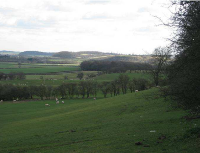
NW01 Gotham And West Leake Hills And Scarps
Context
Regional Character Area: Nottinghamshire Wolds
LDU Reference: 113, 128, 66, 425, 251, 252 ,187, 258
DPZ Reference: NW01
Characteristic Features
- Series of prominent individual hills with steep sometimes scarp slopes and broad plateaus
- Hills are the dissected northern extent of a low boulder clay plateau extending from Leicestershire traditionally known as ‘The Wolds’
- Rural character although urban elements such as villages, power station, industry and quarrying are frequent in the landscape
- Kingston Brook is a localised feature on low ground between hills characterised by riparian woodland and some grazing pasture at its margins
- Land use is a mixture of woodland, arable and pasture. Arable is on the lower and more gentle slopes, pasture close to rivers, settlements and scarp grassland where the land is steeply sloping precluding machinery from working the land
- Field pattern is mostly modern although pockets of older field systems such as irregular geometric and geometric and those reflecting open fields are present
- Field pattern in places sweeps down the slopes and is a distinctive feature
- Field boundaries are mostly hedgerows on the slopes with fences often present on higher ground
- Woodland is generally on high ground across the hills although there are smaller pockets of woodland on lower ground as establishing scrub and along village fringes/areas of former quarry
- Prominent extensive woodland plantation covers the slopes and high ground, often on steep scarps
- Rides and areas of open land are interspersed between plantation woodland
- Wooded tracks with spring flowering understorey planting along tracks up hills
- Large commuter settlements such as Gotham and East Leake and smaller settlements such as West Leake are nestled at the base of the hills on the fringes of the DPZ
- Infrequent individual farms within the character area often on the slopes or high ground. A row of individual modern houses is present along Ash Lane. One distinctive red brick and pantile roof farmstead on Bunny Hill is set within gardens with a small orchard
- Buildings are mostly red brick with older properties having red pantile roofs
- Church towers and spires are prominent within a uniform village skyline
- Overhead lines are prominent on low ground between hills
- Small former spring (Wheldon Spring) on Gotham Hill is a localise feature characterised by a depression in the ground and establishing scrub
- Enclosed channelled views on low ground between hills with extensive panoramic views across towards Nottingham City and beyond from high ground
Landscape Analysis
Condition
A series of distinctive wooded hills with arable fields on lower and gentler slopes and pasture and pockets of grassland on the steeper
slopes. Views are extensive and often over long distances from the high ground although become more enclosed from lower ground. Urban elements are frequent with views of Ratcliffe on Soar Power Station and the gypsum works. Some villages such as Gotham village are characterised by modern edges and a small older core with a distinctive church spire. Others such as West Leake are small and distinctive focused along a single street with small working farms and lack of modern development.
Land use is a mix of plantation woodland, arable farming and pasture. Fields are mostly medium to large in size with the majority of arable farming being a modern field pattern; although at Gotham there is evidence of older irregular geometric patterns. Pockets of fields reflecting open field system and regular geometric patterns are present on lower slopes or pockets of high ground. Older field patterns are generally used for pasture.
Woodland comprises large geometric field sized blocks of both broadleaved and conifer woodland. On West Leake Hill a large woodland is used for commercial forestry with rides and various belts of different species within woodlands. Other vegetation includes smaller frequent copses at the base of slopes and around settlements. Frequent hedgerow trees and intact hedgerows are
present across the area. Pockets of regenerating scrub are often around village fringes or on the base of slopes.
The landscape condition is GOOD. Hedgerows and woodland are well managed, although there is some evidence of field boundary fragmentation in places. Where hedgerows have been replaced, the timber fencing is usually in good condition. The agricultural land is well managed and features are intact with little sign of decline.
Landscape Strength
This DPZ is a distinctive series of hills which are prominent within the surrounding area. They often form a backdrop to views from the
southern edges of Nottingham. From high ground within the DPZ there are open expansive views to the centre of Nottingham and
lower-lying farmland at Ruddington and Bunny.
The strength of character is STRONG. The hills are distinctive and consistent features across the landscape and exert their influence
within the surrounding area. The pattern of arable, pasture and woodland is also consistent with moderate sized villages and some
expanding commuter villages present on low ground.
The landscape condition is GOOD. The strength of character is STRONG. The overall landscape strategy is CONSERVE.
Landscape Actions
Landscape features
- Conserve the distinctive pattern of hills with large blocks of woodland on high ground
- Conserve the older field patterns within the character area such as those reflecting open systems and the irregular
and regular geometric patterns - Conserve the balance of arable farming on lower slopes and pasture on steeper and higher slopes
- Conserve field patterns which sweep down the hills
- Conserve the landform of the former Wheldon Spring
- Conserve the diversity of broadleaf and large-scale woodland plantations on hills
- Ensure new conifer planting includes belts of broadleaf woodland and woodland edge along its fringes
- Any new woodland planting should be small in scale along the base of slopes becoming larger and of field size on
higher slopes - Conserve the small rides and various ages of woodland within the character area
- Conserve the wooded tracks along the ridgelines
- Conserve hedgerows and encourage infill planting within gaps rather than erection of timber fencing
- Conserve areas of rough grassland where present on steeper scarp slopes
Built form
- Conserve the frequency of small farmsteads and outbuildings throughout the landscape; any new barn developments should be small scale and fit within the existing pattern and vernacular styles
- Conserve the small linear and vernacular character of West Leake
- Conserve the uniform roofline of villages with prominent church spires
- Encourage the use of red brick and red pantile roofs for new buildings and extensions
- Conserve the nucleated character of larger villages
- Minimise the influence of larger settlements such as East Leake through small-scale woodland planting to reduce the scale and frequency of urban edges within views
Other development/ structures in the landscape
- Conserve the winding character of rural lanes with expansive channelled views between hills
- Ensure any new industrial development is nestled on low ground and has well wooded boundaries which integrate with woodland on higher ground to reduce its visibility
NW02 East Leake Rolling Farmland
Context
Regional Character Area: Nottinghamshire Wolds
LDU Reference: 268, 247, 186, 365, 364
DPZ Reference: NW02
Characteristic Features
- Rolling landscape which forms part of the wider glacial plateau of chalky boulder clay overlying lower lias and Rhaetic beds
- Undulations in the landscape are formed by small streams and tributaries which have cut through softer mudstones and clays; Kingston Brook is the most distinctive
- Localised man-made earthworks present around Ratcliffe Power Station which have a localised influence on character
- Frequent watercourses which are often demarcated by clusters of riparian willows along their course; where trees are not present watercourses are generally not visible in the landscape
- Rural character present across the area although there are views towards urban elements such as Ratcliffe on Soar Power Station visible above hills, a gypsum works and village fringes
- Land use is arable and some pasture. Pasture becomes more prominent around East Leake where it is mostly horse grazing and around Rempstone where sheep grazing is more common
- Field pattern includes small, medium and large-scale fields recognised within the Historic Landscape Characterisation as being a mix of ages including regular, semi-regular geometric and irregular field patterns. Arable field pattern tends to be of modern origin
- Oldest field enclosures are often concentrated around watercourses and smaller settlements
- Field boundaries are almost all hedgerows which are generally intact and comprise mostly hawthorn; around horse grazing areas electric and timber and wire fencing is present which has a localised influence in character particularly along the southern fringe of East Leake
- There are few hedgerow trees within the landscape; this in combination with low hedgerows creates an open character to fields. Hedgerow trees tend to be concentrated around smaller pastoral fields
- Relatively low level of woodland cover comprising prominent geometric blocks of woodland on high ground, infrequent hedgerow trees, and clumps along watercourses including willow pollards. The most significant blocks of woodland are at Stanford Hall and the formal lake and entrance at Kingston Hall around the parkland margins which includes ornamental species
- Parkland is a distinctive feature around Kingston Hall and Stanford Hall where permanent pasture and parkland trees are prominent
- Prominent halls framed by vistas of trees such as lime avenues. Formal brick wall boundaries define the edges of parkland
- Small estate cottages at Kingston on Soar and lodge houses are features in these areas
- One large nucleated commuter settlement is at East Leake; the southern edge of the village is prominent within views
- Costock is a small linear settlement with a pocket of prominent new development concentrated along the western edge
- New apartment buildings for Nottingham Trent University are a localised urbanising feature within the landscape and contrast with other smaller-scale buildings
- Network of farms each often contains a large red brick and pantile roofed farmstead with modern timber or metal outbuildings; older red brick barns are also frequent
- Views vary from enclosed and channelled views from lower ground along watercourses to open often expansive views from higher ground, particularly to the south and beyond the borough boundary
- Views are rural in character, with frequent dispersed villages and open farmland; small woodland blocks are a feature on high ground
- A sand and gravel quarry has a localised influence on the landscape character of the DPZ
- Roads through the area often have narrow grassed ditches on either side
Landscape Analysis
Condition
This area is characterised by its gently rolling landform with a prominent river corridor along Kingston Brook. It has a rural character with open views across mostly arable farmland with localised enclosure along smaller pastoral fields. Small villages, frequent farmsteads and two parkland estates are features.
Fields are a mixture of small fields close to watercourses and large-scale fields which are mostly arable with some pasture farming. These include both modern and older enclosures. Older enclosures are around the watercourse and village fringes.
The area has a low level of woodland cover. Woodland tends to be small broadleaved geometric blocks on high ground which gives them greater prominence in the landscape. Other woodland is concentrated within parkland around the fringes of halls and contains coniferous and ornamental species. Parkland trees are also distinctive in these areas.
The landscape condition is MODERATE. Features are generally well maintained although there is evidence of fragmentation where fields have expanded and where fields are subdivided for horse grazing using electric tape and fencing. The man-made landform changes around the power station have an influence.
Landscape Strength
Views are often over quite long distances due to the undulating landform. On high ground views extend to Ratcliffe on Soar Power
Station and the hills surrounding it and across rolling farmland towards Leicestershire. The character of this landscape extends into
Leicestershire so when viewed from outside the area is seen in this context; it is screened to the north by Bunny Hill, Gotham Hill and
West Leake Hill.
The strength of character of the area is STRONG. The area has a strong intact rural character with arable and pasture farming, prominent small woodlands, villages and a network of farmsteads key features. A minor amount of fragmentation is present in the
north of the area where land has been altered adjacent to the power station.
The landscape condition is MODERATE. The strength of character is STRONG. The overall landscape strategy is CONSERVE and ENHANCE.
Landscape Actions
Landscape features
- Conserve the older field patterns within the character area such as those reflecting open systems and the semi-regular geometric patterns.
- Conserve the prominence of woodlands on high ground.
- Conserve and enhance the regular dispersal of small geometric broadleaved copses and woodlands often on high ground.
- Conserve the rural character with built form infrequent in views.
- Conserve hedgerows and where present ensure that infill planting is undertaken where gaps occur rather than infilling or replacement with fencing.
- Enhance the distribution of hedgerow trees by encouraging greater planting of trees within hedgerows. Species used should be a mostly ash with some oak.
- Conserve the formal parkland and pasture within Kingston and Stanford Halls.
- Conserve the ornamental broadleaved woodlands around the parkland fringes enclosed by red brick walls.
- Conserve the framed vistas towards the halls from adjacent roads.
- Conserve areas of permanent pasture where present in the DPZ and ensure that hedgerows and hedgerow trees at the boundaries are maintained.
- Restore hedgerows and encourage planting of new hedgerow trees to provide unity between more open land at East Leake and the more enclosed and wooded pasture fields.
- Conserve and enhance the character of watercourses through retention of willow pollards and planting of new riparian vegetation.
- Conserve and enhance the small scale field pattern present along watercourse fringes; where arable farming is present encourage new tree planting to integrate the fields with smaller pastoral fields.
Built form
- Conserve the estate character of Kingston on Soar and the estate lodges at entrances to halls.
- Conserve the regular distribution of built form and villages within the DPZ.
- Enhance the fringes of the new apartment buildings at University of Trent through localised woodland planting.
- Conserve the rural scale and vernacular style of buildings in smaller villages through restricting new development. Where development occurs it should make a positive contribution to the local vernacular, scale and massing of the village.
- Conserve the use of red brick and pantile roofs within farmsteads, barns and properties in villages.
- Minimise the influence of larger settlements such as East Leake through small-scale woodland planting along fringes.
Other development/ structures in the landscape
- Conserve and enhance the character of hedgerow trees lining roads through the landscape.
- Ensure that on completion of quarrying that hedgerow trees, hedgerows and small woodlands are encouraged within the restoration proposals to ensure that the land integrates with the surrounding land.
- Conserve grassed ditches along the edge of roads.
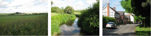
NW03 Widmerpool Clay Wolds
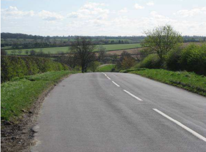
Context
Regional Character Area: Nottinghamshire Wolds
LDU reference: 187,191
DPZ reference: NW03
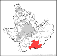
Characteristic Features
- Rolling landscape which forms part of the wider glacial plateau of chalky boulder clay overlying lower lias and Rhaetic beds.
- Undulations in the landscape are formed by small streams and tributaries which have cut through softer mudstones and clays.
- Distinctive steep slopes present along the western edge of the DPZ.
- Frequent watercourses which are often demarcated by landform and riparian trees along their course.
- Remote rural character present across the area although there are views towards the urban edge of Keyworth in the north.
- Land use is a mixture of arable and pasture although pasture becomes more dominant approaching Widmerpool and Willoughby-on-the-Wolds where the land is continuous pasture and is particularly distinctive.
- Field pattern includes medium to large scale regular, semi-regular geometric and irregular field patterns. An area reflecting one of the earliest forms of enclosure within Nottinghamshire is present as a cluster around Thorpe-in-Glebe.
- Field boundaries are almost all hedgerows which are generally intact and comprise mostly hawthorn although blackthorn, field maple and hazel are present in places.
- Around larger fields, hedgerows show some sign of fragmentation and replacement with timber post and wire and stockproof fencing. In places parkland style fencing provides an element of formality along roads.
- Areas of ridge and furrow are locally distinctive.
- Woodland comprises a mix of small linear belts, geometric copses and coverts on high ground and around large farmsteads and halls on village fringes.
- Wooded impression created through frequent blocks of small woodland, hedgerow trees and mature hedgerows.
- The railway is a prominent wooded feature within the landscape.
- Prominent Roman road (Fosse Way) is visible within the landscape, traffic movement on it provides a slight urbanising feature.
- Frequent small nucleated villages which have a remote and rural character with concentrations of distinctive vernacular buildings and some more modern additions.
- Farmsteads are frequent within the landscape, and they often contain a large red brick and pantile roofed farmstead with modern timber or metal outbuildings; older red brick barns are also frequent.
- Some villages are set on slightly higher ground and are visible within the landscape. Woodland and trees along the boundaries reduces their prominence and edges are often seen as individual or small clusters of buildings.
- Thorpe Le Glebe, a former medieval village site is discernible through undulations within the ground.
- Wooded formal parkland present around Widmerpool is a local feature of the landscape.
- Views vary from enclosed and channelled views from lower ground to open often expansive views from higher ground.
- Views are rural in character with dispersed village fringes and small woodland blocks a feature on high ground.
- Distinctive long distance views along western edge of DPZ on the A606 across the adjacent Vale of Belvoir flat farmland.
Landscape Analysis
Condition
This area is characterised by its gently rolling landform dissected by frequent small wooded streams. The DPZ has a strongly rural and
remote character with a mix of arable and pasture farmland and a regular dispersed pattern of small copses and coverts often on higher ground.
Fields are a mixture of medium to large scale fields and include pasture and arable farming with both modern and older enclosures. Around Thorpe in Glebe the field pattern is much smaller and regular and represents one of the oldest patterns in the county. The land has a slightly more enclosed character within this area.
The area has a wooded impression although relatively low woodland cover. Woodland comprises small geometric shaped coverts and copses and some smaller linear blocks on the edges of fields. Most is broadleaved and on high ground. A small area of ornamental and conifer woodland is present around Widmerpool Hall to the south west of Widmerpool.
The landscape condition is GOOD. Features are generally well maintained although there is a minor amount of fragmentation where fields have expanded in the south and north of the area.
Landscape Strength
Views are either local short distance views from low ground or expansive long distance views from higher ground over rolling landform with frequent woodland and farmsteads. There is a particularly distinctive view along the A606 from the plateau to lower ground in the Vale of Belvoir. The escarpment on the eastern edge of the character area forms a backdrop to views within the Vale of Belvoir.
The character strength of the area is STRONG. The area has a strong intact rural character with arable and pasture farming and
pockets of woodland key features. There is a minor amount of fragmentation where fields have expanded in the south and north of
the area. In these places hedgerows trees in fields are a remnant of a former pattern.
The landscape condition is GOOD. The strength of character is STRONG. The overall landscape strategy is CONSERVE.
Landscape Actions
Landscape features
- Conserve the older field patterns within the character area such as those reflecting open systems and the semi-regular geometric patterns.
- Conserve and maintain open views along A606 from high ground to the Vale of Belvoir.
- Conserve the regular dispersed patterns of small geometric broadleaved copses and woodlands often on high ground.
- Conserve the rural character with built form infrequent in views.
- Conserve hedgerows and where present ensure that infill planting is undertaken where gaps occur rather than infilling with fencing.
- Conserve the regular distribution of hedgerow trees and ensure that where over-mature and senescent that a programme for replacement is undertaken. Species used should be mostly ash with some oak.
- Conserve ridge and furrow and the earth mounding of the deserted medieval village at Thorpe in Glebe.
- Conserve the formal wooded parkland adjacent to Widmerpool.
- Conserve areas of permanent pasture to maintain the pastoral character of the DPZ.
Built form
- Conserve the rural character of villages within the DPZ through ensuring any infill respects the key characteristics and local built form vernacular.
- Conserve the sparse distribution of built form and villages within the DPZ.
- Conserve the small scale and vernacular style within smaller villages through restricting new development. Where development occurs it should make a positive contribution to the local vernacular, scale and massing of the village.
- Conserve the use of red brick and pantile roofs within farmsteads, barns and properties within villages.
- Conserve the dispersed nature of village edges through retention and new planting to maintain the appearance of individual or small groups of properties.
- Minimise the influence of larger settlements such as Keyworth through small-scale woodland planting along fringes.
Other development/ structures in the landscape
- Conserve the narrow winding, rural and remote character of lanes through the DPZ.
- Industry is not present or visible within this landscape and this should be conserved through careful consideration of siting of development and planting works.
NW04 Cotgrave Wooded Clay Wolds
Context
Regional Character Area: Nottinghamshire Wolds
LDU Reference: 188,189,190
DPZ Reference: NW04
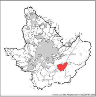
Characteristic Features
- Gently undulating broad plateau and escarpment which forms the northern extent of a glacial plateau of chalky boulder clay overlying lower lias and Rhaetic beds.
- Distinctive steep slopes present along the northern edge of the DPZ.
- Watercourses flow through the area and have a local influence on landform.
- Rural character present across the area although there are views towards urban edges of Keyworth, Cotgrave and properties on A606.
- Land use is mostly arable although pockets of pasture are present around village fringes.
- Field pattern includes medium to large sized geometric field patterns. Much of the enclosure is of modern origin but there are pockets of older enclosure around Clipston and adjacent to the A46.
- Field boundaries are almost all hedgerows managed at a low height. They comprise mostly hawthorn although blackthorn, field maple and hazel are present in places.
- Around larger fields, hedgerows show some sign of fragmentation and replacement with timber post and wire and stockproof fencing.
- Woodland comprises two distinctive large plantations on high ground: Clipston Wood and Cotgrave Forest; and Borders Wood. This is plantation woodland; the conifers are distinctive and contrast with smaller broadleaved woodlands found elsewhere across Rushcliffe. The plantation pattern still retains the former field pattern; small rides within the woodland often are along former field boundaries.
- Small linear belts and clumps of woodland are present along village fringes and along watercourses. Willow is common in these locations.
- Woodland on the escarpment is on higher ground and is prominent along the northern fringes of this DPZ.
- Few hedgerow trees and low hedgerows provides a contrast between enclosed woodland and open farmland.
- Prominent Roman Road (Fosse Way) is visible from high ground and traffic movement on it provides a slight urbanising feature.
- Large nucleated villages although their fringes are screened and filtered by small linear blocks of woodland.
- Smaller linear settlements also present such as Clipston.
- Some villages are set on slightly higher ground and are visible as a single line of individual properties dispersed within trees.
- Few large farmsteads which are often of modern design and construction with large modern barns.
- Farmsteads constructed from red brick with red pantile and clay tile roofs are common.
- Views vary from short distance views enclosed by woodland to open views over gently rolling land from higher ground.
- Views are rural in character, although urban elements such as village fringes and the A46 reduce the sense of seclusion and tranquillity.
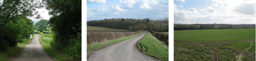
Landscape Analysis
Condition
This area is characterised by its gently undulating plateau, steep escarpment to the north and large prominent blocks of conifer
plantation woodland and arable fields.
Fields are a mixture of medium to large scale fields which are mostly arable with pasture present in small amounts close to village fringes. Field pattern includes both modern and older enclosures. The oldest areas of enclosure are on steeper slopes to the south of Cotgrave and south of Clipston.
Woodland is large and prominent in this landscape comprising two large blocks of conifer plantation of roughly uniform age. It is distinctive and contrasts with the small broadleaved woodlands around village fringes and the riparian willows and poplars along small streams. There are few hedgerow trees present which creates an open character between woodlands.
The landscape condition is MODERATE. Features are generally well maintained although there is evidence of fragmentation where fields have expanded for intensive arable farming.
Landscape Strength
Views are generally quite open and towards woodland and village fringes. Close to the woodlands views are foreshortened and more
enclosed. The large blocks of woodland and escarpment are prominent features particularly to the north where they form a backdrop to views over lower-lying gently undulating farmland.
The character strength of the area is MODERATE. The area has a rural character with arable farming and pockets of woodland as key
features. There is a minor amount of fragmentation where fields have expanded in the south and north of the area and increases in
urban elements and alterations to roads exert an increasingly urbanising influence.
The landscape condition is MODERATE. The strength of character is MODERATE. The overall landscape strategy is ENHANCE.
Landscape Actions
Landscape features
- Conserve the older field patterns within the DPZ such as those reflecting open systems and the irregular geometric patterns.
- Encourage planting of small-scale broadleaved woodland along village fringes.
- Enhance the fringes of conifer plantations with belts of native locally appropriate broadleaved woodland and woodland edge species.
- Conserve the rural character with built form infrequent in views.
- Conserve hedgerows and where present ensure that infill planting is undertaken where gaps occur rather than infilling with fencing.
- Conserve existing hedgerow trees and ensure that where over-mature or senescent, a programme for replacement is undertaken. Species used should be mainly ash with some oak.
- Conserve areas of permanent pasture to maintain the pastoral character on the village fringes.
- Restore hedgerows and encourage planting of new hedgerow trees to provide unity between more open arable land and the more enclosed woodland.
Built form
- Enhance village fringes through woodland planting and maintaining the appearance of dispersed development along the fringes.
- Conserve the linear character of villages such as Clipston.
- Conserve and enhance the character of Clipston through use of red brick and pantile roofs and maintain its connection to farming through retaining working farms.
- Conserve the dispersed nature and vernacular style of smaller villages through restricting new development. Where this occurs development should make a positive contribution to the local vernacular, scale and massing of the village and not make built form more prominent within the wider landscape.
- Encourage the use of red brick and pantile roofs within farmsteads, barns and properties within villages.
Other development/ structures in the landscape
- Reduce the prominence of traffic movement along the A46 through planting of hedgerow trees and small belts of woodland to reduce its appearance in views.
South Nottinghamshire Farmlands
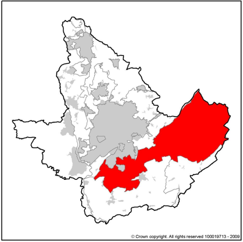
DPZ (Draft Policy Zones) within this Regional Character Area:
- SN01 Clifton Slopes
- SN02 Ruddington Alluvial Farmland
- SN03 Mickleborough Fringe
- SN04 Cotgrave and Tollerton Village Farmlands
- SN05 East Bridgford Escarpment Farmlands
- SN06 Aslockton Village Farmlands
Key Characteristics
- This is a large tract of land between the southern edge of Greater Nottingham and the urban fringes of Newark.
- It is closely associated with a belt of Triassic rocks to the south of the River Trent and is the largest single geological formation within Nottinghamshire.
- The geology is mostly Mercia Mudstone which comprises reddish mudstones with occasional hard sandstone (Skerries). This is less
developed than elsewhere in Nottinghamshire and creates a fairly uniform gently rolling lowland landform. - A low escarpment is present on the south eastern boundary where the uppermost beds of Mercia Mudstone pass onto Rhaetic beds.
- Alluvium is present in hollows and depressions laid down as a result of gypsum solution in the upper layers of the land surface. This formed low-lying alluvium separated by narrow mudstone ridges which are 5-10metres above the alluvium.
- The highest land is along the edge of the Trent Valley where a line of hills falls sharply to the low-land of the Trent Washlands region.
- The land is dissected by streams in the north creating two prominent hills at Wilford and Clifton.
- Small nucleated settlements tend to be concentrated on traditionally high mudstone ridges; there is a lack of built form on lower alluvium basins.
- Closer to Nottingham, villages have expanded considerably which exerts an urbanising influence on the landscape.
- Arable farmland is predominant although pasture is present along some stream margins, escarpment slopes and village fringes.
- Uniform sometimes monotonous character created by large tracts of arable farmland with few other notable features.
- Strong pattern of medium to large-scale hedged fields with smaller village side pasture.
- Low-lying alluvium ‘basins’ such as Ruddington Moor, Bennington Fen and along the Rivers Smite and Devon are characterised by intensive arable farming with frequent ditches and drainage dykes. There is little woodland or hedgerows present in these areas.
- Hedgerows are of variable condition, they tend to be intact along lanes and in pasture fields and less intact, smaller and often fragmented around arable fields.
- Hedgerow trees are mostly ash with some oak and willow. Frequent young lime and horse chestnut trees have been planted along roads and are a notable feature.
- General lack of woodland within the area with few hedgerow trees enables open extensive views across the area.
- Where present woodland tends to be small geometric plantations, the general lack of woodland means these are prominent features.
- Pockets of isolated mature parkland are prominent wooded features; remnant parkland exists where land has been ploughed for arable farming.
- Trees and woodland along fringes of villages creates an impression of higher tree cover than actually exists; and
- Frequent overhead lines and pylons are prominent vertical features, their scale emphasised by the lack of other vertical structures such as woodland.
Guidelines and Recommendations
- Conserve and enhance the overall structure and traditional agricultural character of the landscape;
- Conserve and strengthen the simple pattern of medium to large hedged fields;
- Identify opportunities for enhancing the structure and unity of the landscape through new tree and woodland planting;
- Conserve the character and setting of village settlements;
- Promote measures for achieving better integration of new and existing features in the countryside;
- Conserve the character of areas of pasture where present particularly along village fringes;
- Conserve the remote undeveloped character of low-lying alluvium areas;
- Conserve parkland where present and retain the character of parkland pasture with frequent individual specimen trees;
- Conserve woodland; and
- Enhance visual unity between arable and pastoral farming through small-scale woodland planting and, where appropriate, by strengthening the traditional pattern of hedged fields.
SN01 Clifton Slopes
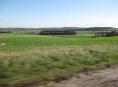
Context
Regional Character Area: South Nottinghamshire Farmland
LDU Reference: 254,255
DPZ Reference: SN01
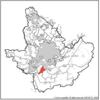
Characteristic Features
- Distinctive escarpment bordering the River Trent with a steep slope to the river and gentler slopes down to alluvial farmland at Ruddington Moor.
- Prominent Mercia Mudstone outcrop.
- Open large scale field pattern of both modern origin with fragmented hedges Remnants of former field boundaries in the form of undulations, tracks or areas left unploughed can be seen.
- Clifton and Barton Moor are an area of land which was not subject to the enclosures act and has remained open in character since the Sanderson’s Map from 1835.
- A smaller scale pattern is present close to the urban fringe which is an older enclosure pattern reflecting former open systems and semi-regular and regular geometric enclosure identified from the historic landscape characterisation.
- Pocket of pasture present close to the urban edge of Clifton.
- A distinctive narrow wooded lane to Barton in Fabis although other routes are mostly open with long distance views.
- Much of the urban fringe is nestled and obscured by boundary vegetation and landform although new retirement apartment development is a prominent feature on high ground bordering open farmland.
- Regular dispersal of prominent geometric blocks of broadleaved woodland, its prominence is heightened by the lack of vertical features within farmland.
- Prominent linear wooded bluff on steepest sloping land adjacent to River Trent is a distinctive feature.
- Combination of linear woodland on slopes and a few geometric blocks of woodland creates a strong sense of enclosure along Clifton urban fringe.
- Almost no hedgerows or hedgerow trees within the landscape, around pastoral fields close to the urban fringe hedgerow trees and hedgerows are more common creating a degree of enclosure.
- Built form limited to a few large farms with brick farmsteads and a couple of modern farm buildings.
- Extensive and distinctive views from A453 through the area with wooded blocks and extensive views across the flat farmland to the ridgelines and hills beyond. It creates a distinctive route into Nottingham.
- Mast in the form of a false conifer tree is locally prominent on the approach into Nottingham.
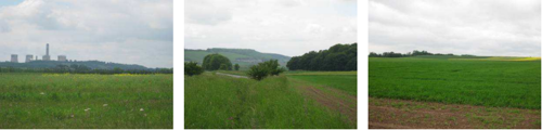
Landscape Analysis
Condition
A wide expansive sloping escarpment. The land is mostly under arable cultivation with few field boundary features. Around the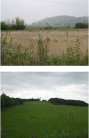
urban fringe the land is mostly pasture and frequent woodland creates a stronger sense of enclosure.
Land use is almost entirely arable farming, which where present is extensive; large fields with no field boundary vegetation create an expansive and open landscape. This is both of modern origin and includes land which has never been enclosed. Some scrub is establishing on margins close to Barton in Fabis and along the edge of Clifton at Fox Covert Lane which is more enclosed and intimate in character.
Woodland comprises geometric blocks of woodland whose prominence is increased by the lack of hedgerow trees or other features within farmland. Other woodland includes a cluster of woodland blocks at Clifton and a mature wooded bluff on the steepest escarpment slopes. This woodland is a prominent feature along the River Trent and from Barton in Fabis.
The landscape condition is MODERATE. There are few boundary features and a strong evidence of decline and fragmentation of woodland edges (particularly close to arable fields) and remaining hedgerow boundaries. Pockets of land still retain a historic connection having never been enclosed such as Clifton Pasture and Barton Moor.
Landscape Strength
Views within this DPZ are a mix of open expansive views across Ruddington Moor to the ridgelines of the Leicestershire Wolds and
more enclosed views close to the edge of Clifton where there is a concentration of woodland. The area is visible as sloping land with
woodland on the highest land from the wider landscape to the south with traffic along the A543 often prominent. The woodland
on the escarpment forms a distinctive backdrop to views along the River Trent and from within and adjacent to Barton in Fabis.
The character of the area is MODERATE. This is a distinctive escarpment however it has a number of different land uses particularly close to the urban fringe.
The landscape condition is MODERATE. The strength of character is MODERATE. The overall landscape strategy is ENHANCE.
Landscape Actions
Landscape features
- Seek to restore hedgerow boundaries and hedgerow trees in arable fields where they no longer exist.
- Conserve existing hedgerow trees and hedgerows which are important landscape features.
- Conserve the prominent woodland blocks on higher ground and encourage new woodland planting particularly along urban edges.
- Conserve the intact long linear wooded bluffs along the steepest slopes adjacent to the River Trent.
- Conserve, where possible, the open unenclosed character of Clifton Pasture and Barton Moor.
Built form
- Enhance the nestled and screened urban edges and ensure new development does not increase the prominence of built form within the landscape.
- Enhance urban fringes and prominent development through localised geometric woodland planting to soften their appearance within the landscape.
Other development/ structures in the landscape
- Conserve the open and distinctive views from A453 across farmland on the approach into Nottingham.
- Conserve the narrow sloping wooded character of New Road into Barton in Fabis.
SN02 Ruddington Alluvial Farmland
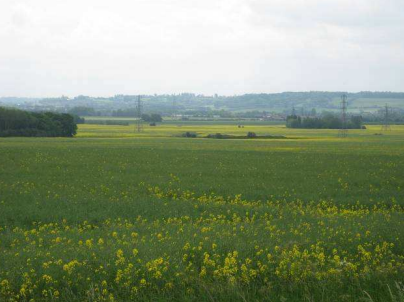
Context
Regional Character Area: South Nottinghamshire Farmlands
LDU reference: 266
DPZ Reference: SN02
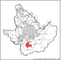
Characteristic Features
- Large expanse of flat alluvial land characterised by arable farming.
- Low-lying alluvial land subject to waterlogging.
- Frequent streams such as Fairham Brook, drainage ditches and dykes often with engineered uniform banks. Ditches are mostly in straight lines and form field boundaries.
- Rural farming character although there are frequent urban elements such as urban fringe at Clifton and large villages visible within the landscape.
- Large-scale arable farming with large sometimes expansive monotonous modern field patterns.
- Most field patterns are of modern origin although there are older patterns close to Barton Moor which are semi-regular and irregular geometric patterns.
- There is a small amount of pasture used as horse present close to village fringes such as the edge of Bunny.
- Infrequent woodland, where present, tends to be small geometric plantations or coverts along streams, the railway or around village and farm fringes. Where present woodland is prominent.
- Close to Bunny there are frequent ash, willow and poplar trees close to farmsteads and along hedgerow field boundaries.
- Field boundaries are either drainage ditches, dykes or hedgerows which are generally fragmented or the remnants of former field patterns.
- There is limited built form is in the DPZ comprising a few farmsteads which are large in size.
- Nucleated villages such as Gotham, Bunny and Bradmore are on the fringes of the DPZ on higher ground. These are characterised by older distinctive cores, prominent church spires and scrub along their fringes.
- Bunny contains a cluster of distinctive red brick buildings such as Bunny Hall, the Old Vicarage, Ivy Cottage, the Rancliffe Arms public house, the Post Office and the former Schoolhouse within its centre all designed by the same architect Sir Thomas Parkyns which creates a uniform and distinctive character.
- Red brick and red pantile roofs are common building materials.
- Inaccessible character with few tracks or roads through the character area.
- Lanes and roads within the area are often bordered by drainage ditches and rough grassland which emphasises the expansive and open character.
- There are open expansive views across the character area due to the general lack of trees, built form and infrequent hedgerows to filter views.
- Views are enclosed by a series of hills to the west at Gotham and West Leake, south at Bunny and north at Sharphill Wood and Mickleborough Hill.
- Overhead lines are prominent vertical features within the landscape.
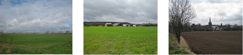
Landscape Analysis
Condition
A wide expansive open and low-lying landscape. The land is mostly under arable cultivation with fields bounded by drainage ditches and
fragmented hedgerows. Infrequent built form which comprises large farms and nucleated villages are on the fringes of the area.
Land use is almost entirely extensive arable farming. Field boundaries are formed by ditches which often give the impression of wide expansive and continuous fields. Mostly a modern field pattern with pockets of older enclosure close to Barton Moor.
Woodland is relatively infrequent with small geometric plantations, riparian woodland along streams and some hedgerow trees. There are copses of scrub and woodland along village fringes. Lombardy poplar used for screening urban fringes and farmsteads is particularly prominent within the DPZ.
The landscape condition is POOR. The agricultural landscape shows evidence of removal of hedgerows for field expansion resulting in expansive fields with few features. Where hedgerows are present they are often fragmented.
Landscape Strength
The land is enclosed on all sides by hills and scarps which limit the extent of views of the area. There are open expansive views from
adjacent high ground and open views within the DPZ due to a general lack of trees or woodland. The most prominent and distinctive views are from the A453 across the farmland to the hills beyond at Bunny.
The character strength of the area is MODERATE. The expansive farmland is the main characteristic of the area. Other landscape
features are less apparent and the pattern and distribution of features often varies around village fringes where the land becomes
more enclosed. Urban features are apparent and noticeable in the landscape. The landscape pattern shows evidence of hedgerow loss
and fragmentation which weakens the character.
The landscape condition is POOR. The strength of character is MODERATE. The overall landscape strategy is ENHANCE AND RESTORE.
Landscape Actions
Landscape features
- Enhance field boundaries through the replacement/infilling of fragmented hedgerows and planting of riparian vegetation along ditches and streams.
- Enhance the condition of existing hedgerows through planting with appropriate native species and possibly re-laying to improve their density and appearance.
- Conserve and enhance the field pattern, particularly where evidence of older semi-regular and irregular geometric field patterns remains.
- Enhance the pattern of woodland to provide interest and break up the expansive and monotonous character of the landscape through small-scale planting around farms, the railway and streams.
- Conserve and enhance the pattern of hedgerow trees where present and ensure a programme of replacement for older trees.
- Conserve and maintain pockets of pasture which are a remnant of the land’s former use for livestock and haymaking until the land could be cultivated to arable.
- Recreate areas of low-lying wet pasture, moor and fen where possible along lower-lying parts of the DPZ close to watercourses.
- Conserve expansive views across the area contained by wooded ridgelines and hills by carefully siting of planting and any new development.
- Enhance the continuity of Fairham Brook through planting of small-scale groups of riparian trees and scrub to denote its position within the landscape.
Built form
- Conserve the impression of a lack of built form within the DPZ ensuring any new development is close to village fringes and does not make built form more prominent within the landscape.
- Conserve the impression of villages on slightly higher ground than the low-lying farmland.
- Enhance village fringes through localised woodland copse and scrub planting to soften their appearance within the landscape.
- Conserve the distinctive core within Bunny and ensure any new development or change reflects this character and uses appropriate materials such as red brick.
Other development/ structures in the landscape
- Conserve and enhance the infrequent small tracks and lanes within the DPZ and the general absence of more major roads to maintain a sense of seclusion and remote character.
SN03 Mickleborough Fringe
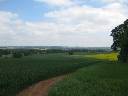
Context
Regional Character Area: South Nottinghamshire Farmland
LDU Reference: 423,424
DPZ Reference: SN03
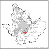
Characteristic Features
- Two distinctive hills on the southern fringe of Nottingham which are prominent above the surrounding gently undulating farmland.
- Narrow cutting of former railway with steep sided wooded embankments.
- Wooded streams have a localised influence on the area; denoted mostly by the change in landform.
- Marginal rural character with frequent views across the lower-lying fringes of Nottingham.
- Land use is mostly arable with large to extensive field pattern around Sharphill Wood with trees a remnant of a former field pattern.
- Field patterns to the north of Ruddington are slightly smaller and narrower; all field patterns are of modern origin with a single field of older irregular geometric enclosure pattern.
- Field boundaries where present are mostly hedgerows; these are of variable condition and height.
- Sharphill Wood is a prominent woodland and is a managed local nature reserve. It shows evidence of regular use by local residents.
- Other woodland is present around Wilford Hill Cemetery, Mickleborough Hill and as linear belts and strips within two golf courses and the former railway cutting.
- Avenues of trees are present on approaches to larger properties and to the golf lodges.
- One stream is within the area and is characterised by mature woodland along its fringes.
- The area contains mostly large detached properties set within mature gardens; these are generally of modern styles and use a variety of buildings materials.
- A Garden Centre and small industrial park contribute to an urban fringe character to the landscape.
- Built form adjacent to the area in West Bridgford is largely red brick modern suburban homes set on gently sloping land; the housing and roofline are relatively uniform.
- Ruddington is a large village on the fringe of the DPZ, characterised by large and small red brick properties set around a network of small roads and a village green. The village contains a number of the Grade II Listed Buildings, which were former framework knitters’ workshops, provide a distinctive character to the village.
- Busy dual carriageways bordered by embankments with young woodland planting; busy roundabout junctions and traffic are a feature of the DPZ.
- Extensive views are possible from higher ground across gently undulating farmland to the ridgeline at West Leake Hill, Gotham Hill and Bunny Hill.
- Extensive views north across Nottingham City with the castle, St Mary’s Church, Wollaton Hall and County Hall prominent features within the city. The two football grounds, Trent Bridge and Colwick Woods are also prominent.
- The land forms a small buffer between West Bridgford and Ruddington.
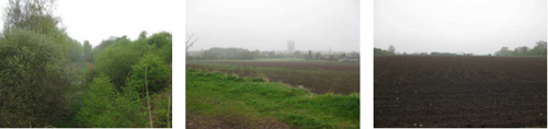
Landscape Analysis
Condition
This DPZ has a rural/urban fringe character with extensive views over the suburban edge of Nottingham; The two hills are prominent
distinctive features and woodland on higher ground is also a feature. The land use is varied and reflects its proximity to the urban edge; there are two golf courses, Wilford Hill Cemetery, a small cutting (former railway) and large to extensive arable fields. Hedgerow boundaries are of variable height and condition and contain few hedgerow trees.
Woodland is limited within the DPZ but is in prominent locations on the highest ground on the hills and along the fringes of the cemetery and golf courses. Wooded belts along the roads help to contribute to the impression of a reasonably well wooded landscape.
The condition of this landscape is considered to be MODERATE. Many of the features show signs of decline or fragmentation such as loss of field pattern and fragmentation of hedgerows. However woodlands are managed.
Landscape Strength
This area contains two distinctive hills which obscure the urban edge of West Bridgford from the wider countryside. They also form a prominent wooded backdrop to views to the south. There are extensive views from high ground across Nottingham and across the countryside to the south. Nearly all views from the DPZ contain built form which is a reminder of the close proximity to West Bridgford.
The character strength of the area is WEAK. Whilst the hills are distinctive features, other features are less distinctive with varied urban uses and pressures exerting a strong influence on the character. Small changes in land use could have a significant effect on landscape character.
The landscape condition is MODERATE. The strength of character is WEAK. The overall landscape strategy is ENHANCE AND RESTORE.
Landscape Actions
Landscape features
- Enhance the open and distinctive views from high ground across farmland to the south and Nottingham City to the north.
- Seek to restore hedgerow boundaries and hedgerow trees in arable fields where boundaries no longer exist.
- Conserve and enhance existing hedgerow trees and hedgerows which are important landscape features.
- Conserve and enhance the prominent woodland blocks on higher ground.
- Enhance the naturalistic character of routes through woodland.
Built form
- Where possible create new woodland copses along urban fringes to reduce their prominence in the landscape.
- Conserve the strong transition from urban to rural landscape and ensure new development does not increase the prominence of development within the wider landscape to the south beyond Sharphill and Mickleborough Hill.
- Enhance the fringes of prominent development through localised woodland planting to soften their appearance within the landscape and ensure they appear as single or small groups of properties.
- Enhance the boundaries around the garden centre and industrial buildings through new woodland planting; development which appears as single large dwellings or farms could help reduce the scale of this area.
- Maintain a buffer between West Bridgford and Ruddington to preserve the sense of separation between the two settlements.
- Conserve the distinctive village character within the centre of Ruddington.
Other development/ structures in the landscape
- Conserve the open and extensive views from roads within the area.
- Reduce the prominence of roads and junctions within the area through augmentations of woodland and hedgerow planting.
- Enhance and create street tree planting along roads and at junctions to soften and ‘green’ their appearance.
SN04 Cotgrave and Tollerton Village Farmlands
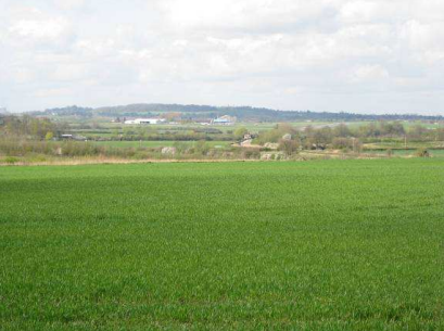
Context
Regional Character Area: South Nottinghamshire Farmlands
LDU Reference:395,421,426
DPZ Reference:SN04
Characteristic Features
- Gently undulating landform with localised steeper areas around watercourses at Upper Saxondale and localised plateaus.
- Man-made hill formed from former mining operations is prominent around Cotgrave.
- Undulations in the landscape are formed by small streams and tributaries which have cut through softer mudstones and clays.
- Frequent watercourses which are often demarcated by landform and small amounts of riparian vegetation such as willows and scrub. Where trees are not alongside, watercourses are generally not visible in the landscape.
- Disused Grantham Canal is a local wooded feature in the landscape, with a mix of riparian trees, reeds, wetlands and open water.
- Rural character present across the area although there are frequent urbanising elements providing a reminder of the proximity of built form such as large villages, Nottingham, industry and large farm buildings.
- Land use is mostly arable although pasture is common around village fringes and along watercourses.
- Fields are mostly medium to large in size and pattern includes predominantly modern field patterns. Older enclosure is present around village fringes particularly around Tollerton and larger tracts of fields reflecting open systems and semi-regular enclosure to the south of Radcliffe on Trent.
- Field boundaries are almost all hedgerows which are of variable condition, along roads they are almost always intact but within fields there is evidence of fragmentation. Along A46 hedgerows have been removed to enable road widening.
- Scrub and rough grassland is present around field margins particularly close to West Bridgford.
- There is a relatively low level of woodland cover; concentrations around Ruddington Country Park, Cotgrave Country Park, golf courses, settlements and watercourses creates the impression of higher woodland cover than actually exists.
- Areas of restored land, now country parks, are characterised by young structure planting, areas of open water and wetlands, grassland and natural regeneration.
- Few hedgerow trees which tend to be present as small clusters along field boundaries and along roads.
- Frequent large nucleated commuter settlements such as Bingham, Radcliffe on Trent, Ruddington and Cotgrave and smaller nucleated settlements at Plumtree, Normanton on the Wolds and Tollerton.
- Long distance views towards the centre of Nottingham possible across farmland and from high ground at Cotgrave Colliery.
- Urban edges of West Bridgford are locally visible above a narrow belt of woodland along Gamston Lings Bar Road.
- Smaller villages often have belts of woodland along their fringes; woodland along the railway limits views of Plumtree.
- Small areas of parkland to the north east of Tollerton and at Ruddington Hall; wooded boundaries reduce their prominence in the landscape.
- Rising roofline present within smaller villages with prominent church spires.
- Older centres of villages are characterised by red brick and pantile roofs; modern buildings use a variety of materials and are more uniform in layout, orientation and layouts are denser.
- Large industrial buildings at the airfield and large agricultural buildings are prominent within the landscape.
- Frequent overhead line routes are prominent within the landscape.
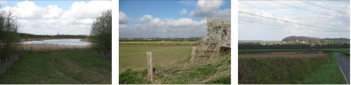
Landscape Analysis
Condition
This area is characterised by very gently undulating landform with contrasting areas of restored land. Large villages and farmsteads are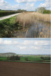
frequent within a predominantly arable landscape which has a uniform character.
Fields are a mixture of medium to large scale fields which are mostly of modern origin. Patterns of older enclosure remain close to village fringes and to the south of Bingham where fields are smaller and of irregular and semi-regular shape.
The area has a low level of woodland cover. Woodland blocks are concentrated around restored land forming country parks and is relatively immature. As it matures woodland cover in the landscape will increase. Other woodland includes a linear belt along the railway and disused canal, riparian belts along watercourses and around parkland to the north east of Tollerton. Scattered hedgerow trees also contribute to woodland cover.
The landscape condition is MODERATE. There is evidence of hedgerow fragmentation and in areas scrub encroachment and rough grassland due to a lack of management. In other areas land is well managed.
Landscape Strength
Views are often over quite long distances due to the undulating landform and low woodland cover. Views always contain urban
features such as industry and large villages with modern fringes. Farmsteads and large farm buildings are also common. Views into
the DPZ are from high ground such as Sharphill Wood and higher land around Clipston.
The strength of character of the area is MODERATE. The area has a relatively uniform character of arable fields with prominent village
fringes. Urban elements are frequent and exert a strong influence. Man-made elements and landform have a localised influence on
character.
The landscape condition is MODERATE. The strength of character is MODERATE. The overall landscape strategy is ENHANCE.
Landscape Actions
Landscape features
- Conserve the older field patterns within the DPZ such as those reflecting open systems and the semi-regular geometric patterns in the north.
- Enhance field boundaries through planting of new hedgerows and hedgerow trees to reinforce field pattern.
- Enhance the distribution of hedgerow trees by encouraging planting of trees within hedgerows. Species used should be mostly ash with some oak.
- Conserve areas of permanent pasture around village fringes.
- Restore hedgerows and encourage planting of new hedgerow trees to provide unity between more open arable land and the more enclosed and wooded pasture fields around village fringes.
- Conserve and enhance roadside hedgerows through replanting and planting new hedgerow trees such as ash or oak.
- Enhance woodland cover within the DPZ ensuring where implemented it is small copses, reflects surrounding field patterns and does not block longer distance views.
- Conserve and enhance the wetland fringes of the former Grantham Canal.
Built form
- Enhance village fringes through planting small linear belts and copses to break up the uniform nature of the urban edge particularly along the fringes of larger commuter settlements such as Ratcliffe on Soar and Bingham.
- Conserve the older cores of villages with red brick and pantile roofed vernacular buildings.
- Conserve the prominence of churches within village skylines.
- Any developments along village fringes should encourage the use of red brick and pantile roofs and make a positive contribution to local character and distinctiveness within each individual village.
- Conserve the tree cover and pasture which softens the appearance of smaller villages in the landscape.
- Development along village fringes should aim to provide a dispersed character rather than a sharp line and incorporate smaller fields or open spaces, woodlands and trees along roads.
Other development/ structures in the landscape
- Retain and enhance hedgerow boundaries and hedgerow tree boundaries along roads through the area.
- Conserve small ditches and narrow grass verges along roads through the DPZ.
SN05 East Bridgford Escarpment Farmlands
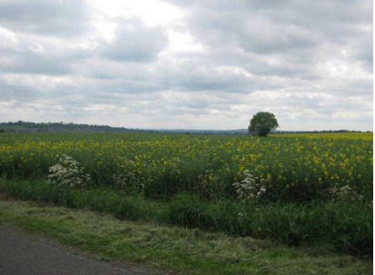
Context
Regional Character Area: South Nottinghamshire Farmlands
LDU Reference: 421
DPZ Reference: SN05
Characteristic Features
- Escarpment with a steeply sloping northern edge down to the Trent Washlands and more gentle slope to the south to the A46 forming a broad plateau either side of Kneeton Road.
- Rural character with a sense of enclosure created on high ground through limited views beyond the plateau to adjacent lower ground; on the slopes views towards the A46 and Nottingham City Centre provide an urbanising influence.
- Land use is almost totally arable although individual fields of pasture are present around the edge of East Bridgford and Kneeton.
- Fields are mostly medium to large in size and enclosure pattern includes modern field patterns to the south and around Syerston Airfield with older enclosure present at East Bridgford and Kneeton.
- Field boundaries are almost all hedgerows which are of variable condition; along roads they are almost always intact and over 1.5m in height but within fields there is evidence of fragmentation particularly around arable fields.
- There is very little woodland cover and where present it is prominent in the landscape. Woodland is generally irregular shaped blocks often with smaller fields planted with woodland. The largest wood is to the south of Syerston Airfield.
- Clumps of woodland are present around village fringes which help to reduce their prominence in the landscape although the rising roofline of Radcliffe on Trent remains locally visible in the landscape, other tree groups are present around farmsteads.
- There are few hedgerow trees and where present are often in small groups along field boundaries, often close to woodlands.
- There are few settlements; the largest is Radcliffe on Trent which is on the gentle slopes of the escarpment. East Bridgford and smaller Kneeton are nestled into the landscape often with mature boundaries helping to reduce their prominence.
- Smaller villages are characterised by small terraces and cottages of red brick with pantile roofs, individual working and converted former farms. The variety in orientation of buildings along streets provides distinction and interest. East Bridgford is also characterised by a prominent red brick wall along Kirk Hill which adds an element of formality on the approach to the village.
- Farmsteads include both old and new properties, mostly constructed from red brick. A converted mill is a distinctive feature visible on the skyline.
- An area of housing at Newton is a large isolated area of more modern housing constructed from red and brown brick. It is locally prominent in views from the A46. However elsewhere only glimpsed views of the larger buildings are possible.
- Extensive and distinctive views are possible across low-lying farmland along the River Trent and to the village of Shelford from Shelford Road.
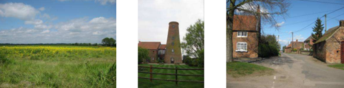
Landscape Analysis
Condition
This area is characterised by broad escarpment with a steeply sloping northern edge and more gently sloping southern edge. The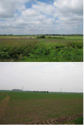
land use is fairly uniform and mostly arable fields with a few prominent woodlands. Village fringes are visible at Radcliffe on Soar and partially at Newton although mostly built form is obscured within the landscape.
Fields are a mixture of medium to large scale fields which are mostly of modern origin with older enclosure present around East Bridgford and Kneeton. Fields are bounded by hedgerows which are taller along roads and often fragmented between fields.
The area has a low level of woodland cover, individual woodland blocks where present are prominent within the landscape. There are few hedgerow trees which are often concentrated around village fringes and close to woodlands. Woodland at Syerston Airfield is the most prominent within the DPZ.
The landscape condition is MODERATE. There is evidence of hedgerow fragmentation and a loss of field boundaries to enable arable expansion.
Landscape Strength
Views are generally enclosed and restricted to within the DPZ when on higher ground. Longer views are possible across the edge of
Radcliffe On Trent to the west and distinctive views across the Trent Washlands to the north along Shelford Road. The land is only
locally visible from the surrounding countryside with the steeply sloping land a prominent feature in views from the Trent Washlands
and from higher ground to the north around Burton Joyce. There are also views across the area from the A46.
The character of the area is MODERATE. The area has a relatively uniform character of arable fields with prominent village fringes.
Views to urban elements are frequent and exert an influence on the area. There are local variations in the pattern of the landscape
around the airfield to the north and where the landform changes to the south close to Radcliffe on Trent.
The landscape condition is MODERATE. The strength of character is MODERATE. The overall landscape strategy is ENHANCE.
Landscape Actions
Landscape features
- Conserve the older field patterns within the DPZ around East Bridgford and Kneeton ensuring that fields are not expanded for more intensive farming.
- Enhance field boundaries through augmentation of hedgerows to reinforce field pattern.
- Enhance the distribution of hedgerow trees by encouraging planting of trees within hedgerows. Species used should be mostly ash with some oak. These should be carefully located to ensure that an open character is retained.
- Conserve the small pockets of permanent pasture around village fringes.
- Enhance woodland cover within the DPZ ensuring where implemented it is small in size and reflects surrounding field patterns and the character of small infrequent prominent woodlands.
- Conserve and enhance opportunities for distinctive views across the Trent Washlands from adjacent roads on higher ground through careful management of hedgerows and woodlands to retain views
Built form
- Enhance village fringes through planting small copses to break up the uniform nature of the urban edge particularly along the fringes of larger commuter settlements such as Radcliffe on Trent and Newton.
- Conserve the older cores of villages with red brick and pantile roofed vernacular buildings.
- Conserve the narrow character of roads through East Bridgford and the distinctive walled approach along Kirk Hill.
- Conserve the variety of built form and orientation of buildings along roads within villages.
- Conserve the small scale character of Kneeton and retain the connection to farming through retaining the presence of working farms.
- Any developments along village fringes should encourage the use of red brick and pantile roofs and make a positive contribution to local character and distinctiveness within each individual village.
- Development along village fringes should aim to provide a dispersed character rather than a sharp continuous built line and incorporate smaller fields or open spaces, to provide a dispersed appearance to village fringes.
Other development/ structures in the landscape
- Retain and enhance hedgerow boundaries and hedgerow tree boundaries along roads through the area.
- Conserve the small rural character of roads through the area.
- Enhance the landscape through planting of small copses and hedgerows and hedgerow trees along the A46 to reduce its prominence.
SN06 Aslockton Village Farmlands
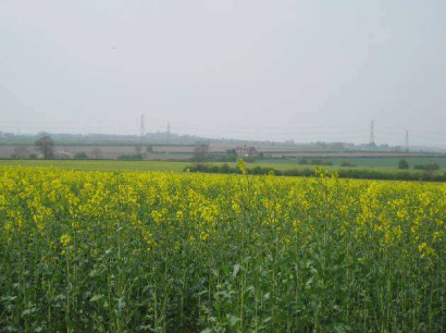
Context
Regional Character Area: South Nottinghamshire Farmlands
LDU Reference: 83, 84, 85, 134, 135, 151, 406, 407, 421
DPZ Reference: SN06
Characteristic Features
- Series of Mercia Mudstone outcrops and thin bands of lower-lying alluvial levels following rivers. The outcrops vary between 5 and 10m above adjacent levels; the most prominent being along Sutton Lane and Barnstone Lane in the south east of the area.
- A number of watercourses such as the River Smite and Devon flow through the landscape; they are lower than surrounding ground with arable fields extending to their banks and little riparian vegetation. Therefore they are not easily discernible in the landscape.
- Rural remote and tranquil character comprising arable farmlands and a regular dispersal of small rural settlements.
- Land use is mostly arable although pasture is common around village fringes. Larger tracts are present where villages are situated close to each other and pasture extends between; these tend to have a slightly more enclosed and intimate character.
- Field pattern ranges from small-scale fields around village fringes to expansive large scale fields in open countryside
- Field boundaries are almost all hedgerows which are of variable condition; they tend to be more intact around pasture fields where left to grow taller whereas in adjacent arable fields are often low and in places quite fragmented.
- There is a relatively low level of woodland cover with a regular pattern of small geometric and irregular shaped woodlands throughout; other woodland is often linear in character following the line of a former railway, around village fringes and where individual hedgerows are left to mature.
- Hedgerow trees are infrequent although clustered around pasture fields on village margins and within villages. Where hedgerows are often taller around arable fields trees tend to be less frequent. There are lots of young hedgerow trees planted as avenues along small lanes which will increase tree cover as they mature. These are mostly ash and horse chestnut.
- The combination of taller hedgerows, hedgerow trees and scattered woodlands creates a dispersed wooded character and woodland is often a key component within skyline views.
- Small parklands at Flintham, Langar, Whatton and Wiverton Hall are local wooded features.
- Dispersed small rural settlements include both linear and nucleated patterns; they are often situated on the slightly higher Mercia Mudstone outcrops. Bingham is the only large commuter settlement within the DPZ and its northern and eastern edges are locally prominent in the landscape Villages of Elton on the Hill, Granby, Sutton and Barnstone are prominent on higher ground; they are
seen mostly as a single line of dispersed housing set within trees. - Rooflines of villages are generally obscured by mature trees; where visible they appear dispersed and as individual or small groups of properties. Church towers and spires are prominent above the villages and are distinctive features within the landscape.
- Villages are particularly distinctive often containing very little modern development; they are along narrow roads often bordered by red brick walls. All villages are well wooded with many mature trees along roads within small fields and open spaces within the villages and around their fringes.
- Buildings within villages include small cottages and terraces and larger individual properties both set behind small and larger front gardens. Almost all are constructed of red brick with red pantile roofs although there is the occasional rendered or painted house. Villages often contain a few former farm buildings which are now converted to private residences.
- Churches within villages are almost all constructed from local stone and are either towers or spires and always set within mature grounds.
- Narrow winding lanes are common throughout the landscape although a few straighter roads across lower lying land are present around Orston and Granby. Roads are characterised by often large verges or pockets of grassland. In these places traditional gypsy caravans and horses grazing are sometimes present.
- Scattered farmsteads, often constructed of red brick with small out buildings and barns are throughout the DPZ although not present on the lowest lying ground.
- Pockets of rough grassland and village greens grazed by cattle are a feature of villages in the northern part of the area such as between Car Colston and Screveton.
- Many prominent overhead line routes are present within the landscape and are always visible on the skyline.
- Expansive long distance views across the landscape to the Belvoir Ridge to the south in Leicestershire.
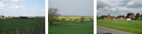
Landscape Analysis
Condition
This area is characterised by very gently undulating landform which is a series of Mercia Mudstone outcrops and narrow alluvial levels.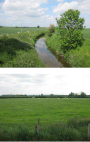
The land is mostly arable farming with pockets of pasture which are more intimate in character close to village fringes. There is a regularly dispersed pattern of small distinctive rural villages. The landscape has a strong rural tranquil character which feels remote from urban centres.
Fields are a mixture of medium to large scale which are mostly modern enclosure with some larger areas of older enclosure present around villages. Fields around Car Colston and Orston display patterns which are some of the oldest enclosures in Nottinghamshire.
The area has a low level of woodland cover; small coverts and copses are scattered throughout the landscape. Other woodland cover includes clumps and avenues along roads and parkland and linear belts along maturing hedgerows and disused railways. These combine to give a wooded impression in views.
The landscape condition is MODERATE. There is evidence of some fragmentation of features through the area such as loss of hedgerows. However there is also evidence of replanting of hedgerow trees along many of the small rural roads.
Landscape Strength
Views are often over quite long distances due to the very gently undulating landform and low woodland cover. Views are rural in
character across arable fields interspersed with linear tree belts and clusters of woodland at village fringes. Frequent church spires are
notable features. Overhead lines are prominent vertical features within the landscape. Views to the south are to the Belvoir Ridge
and on the southern fringes at the start of the Leicestershire Wolds. Views across the DPZ from outside the area are possible from
surrounding high ground and along the A46.
The character strength of the area is STRONG. The area has a relatively uniform character of arable fields, linear blocks and clumps of woodland and small distinctive rural villages. There are pockets of the landscape where there are greater or lesser levels of enclosure however these are broadly consistent across the DPZ.
The landscape condition is MODERATE. The strength of character is STRONG. The overall landscape strategy is CONSERVE AND ENHANCE.
Landscape Actions
Landscape features
- Conserve the older field patterns within the DPZ such as those reflecting open systems and the semi-regular geometric patterns in the north particularly enclosure patterns around Car Colston and Screveton.
- Enhance field boundaries through planting of new hedgerows and hedgerow trees to reinforce field pattern.
- Enhance the distribution of hedgerow trees by encouraging planting of trees within hedgerows. Species used should be mostly ash with some horse chestnut along roads which currently have low numbers of hedgerow trees.
- Conserve areas of permanent pasture and woodland clumps around village fringes.
- Restore hedgerows and encourage planting of new hedgerow trees to provide unity between more open arable land and the slightly more enclosed and wooded pasture fields around village fringes.
- Enhance woodland cover within the DPZ ensuring where implemented it is small in size and reflect surrounding field patterns and contributes to the regular dispersal of woodland within views. Planting should be focussed on the more open areas to help integrate them with the more intimate pastoral landscapes close to village fringes.
- Conserve the distinctive character of open grazing land at Car Colston.
- Conserve and enhance areas of parkland through ensuring replacement of specimen trees and retention of land as informal grazing.
- Enhance the character of rivers through the DPZ through small scale planting of clumps of riparian woodland.
Built form
- Enhance the village fringe of Bingham through planting small linear belts and copses to break up the uniform nature of the urban edge to integrate with the dispersed character of other village fringes.
- Conserve the consistent distinctive character of small villages throughout the area; any infill or alterations to buildings should make a positive contribution to local distinctiveness.
- Conserve the prominence of churches within village skylines.
- Any developments along village fringes should encourage the use of red brick and pantile roofs and make a positive contribution to local character and distinctiveness within each individual village.
- Conserve the appearance of dispersed linear settlements on higher ground.
- Conserve the tree cover and pockets of pasture, fields and small open spaces within villages.
- Conserve the narrow street pattern and variation of building orientation within villages.
- Any new development along village fringes should aim to provide a dispersed character rather than a sharp line and incorporate smaller fields or open spaces, woodlands and trees along roads to provide a dispersed appearance to village fringes.
Other development/ structures in the landscape
- Conserve the wide grass verges and pockets of grassland along the small roads within the DPZ.
- Retain the remote rural character of rural roads ensuring that any highway upgrades for safety do not affect the rural character.
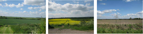
Trent and Soar Valley
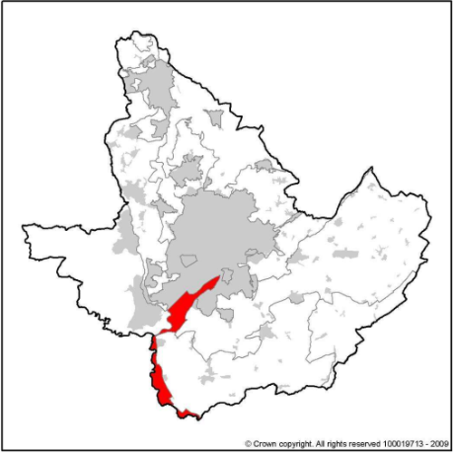
DPZ within this Regional Character Area:
- TSV01 Attenborough Wetlands
- TSV02 Soar Valley
Key Characteristics
- This regional area follows the broad valley of the River Soar to its confluence with the River Trent.
- It is defined by alluvial and river terrace drift deposits formed through deposition of a series of river-borne materials during the development of the river mostly gravels with more recent alluvium.
- The valleys have been formed through the river cutting into the Mercia Mudstone and are bordered by rising ground to the east and west of the River Soar and to the south. Rising land is less notable to the north of the River Trent.
- Both rivers are within broad valleys bordered by narrow river terraces; the most extensive vale is at the confluence of the two rivers extending to 6 kilometres wide.
- Alluvial soils comprise mottled clayey and clay loam soils developed in greyish and brownish alluvium.
- Meandering river corridors are the most distinctive feature.
- Settlement within the region has developed adjacent to the alluvium ground.
- Settlements include larger conurbations such as Clifton; Beeston; fringes of Loughborough; expanded commuter settlements such as Kegworth and small nucleated settlements such as Kingston on Soar and Normanton on Soar.
- Smaller villages and farmsteads have a distinctive character of red brick
and pantile roofs. - Land influenced by gravel extraction, industry such as Ratcliffe on Soar Power Station, urban expansion, roads and railways and overhead lines.
- Arable farmland is predominant particularly along the River Trent; along the Soar the farming is more mixed with areas of historic permanent pasture.
- Pockets of riverside pasture, alluvial meadows, reed beds, flood meadows and marsh, grassland and willow holts.
- Generally low woodland cover, although a perceived sense of woodland is created through the combination of regular riparian trees, hedgerow trees and isolated woodlands.
- Wooded enclosure tends to be greater within pastoral land along the River Soar with more open exposed land present adjacent to the River Trent where the land is under arable farming.
- Steep-sided wooded bluffs at Clifton are prominent features adjacent to the low-lying river corridor.
- Mature willows are distinctive features of the landscape.
- Large areas of wetlands and lakes formed as restoration of gravel workings. These are now used for recreation and nature conservation.
- Naturally regenerating and planted woodlands provide a strong sense of enclosure around restored workings; and
- Prominent man-made flood defence embankments are a marked contrast to the low lying landform.
Guidelines and Recommendations
- Conserve and restore the traditional pattern of hedged fields.
- Promote measures for strengthening the existing level of tree cover within arable land through increasing hedgerow trees and small woodlands at field margins.
- Strengthen the continuity and ecological diversity of stream corridors through retention and enhancement of riparian vegetation.
- Conserve pastoral character and promote measures for enhancing the ecological diversity of alluvial grassland.
- Enhance visual unity through appropriate small scale woodland planting.
- Conserve and enhance the long curvilinear pattern of hedgerows.
- Conserve and strengthen the simple unity and sparsely settled character of the landscape through maintaining a sense of separation from the urban fringes.
- Conserve and strengthen the simple unity and spacious character of the landscape through maintaining the balance between arable fields bordered by ditches and pastoral fields bordered by hedgerows.
- Identify opportunities for enhancing the overall wetland character of the landscape.
- Conserve areas of historic parkland and seek opportunities for restoring pastoral character.
- Conserve and strengthen the well-wooded character of the landscape; and
- Seek to ensure that the reclamation of gravel workings restores land to wetland habitats such as reed beds, marshland and wet meadows rather than open water.
TSV01 Attenborough Wetlands
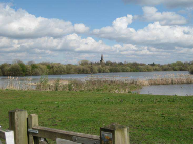
Context
Regional Character Area: Trent Valley
LDU Reference: 263 & 276
DPZ Reference: TSV01
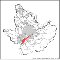
Characteristic Features
- Broad low lying river corridor enclosed by steep sided wooded ridges with an underlying geology of Mercia Mudstone.
- Range of river valley wetlands at different stages of maturity created from restoration of former sand and gravel extraction sites including large expanses of open water, reed beds and riverside pasture. Now used for recreation and nature conservation purposes.
- Continuing mineral extraction is apparent adjacent to Attenborough Nature Reserve; the land is heavily influenced by mineral extraction.
- The meandering navigable river channel of the Trent forms a distinctive feature.
- Urban fringe character is evident to the north of the area due to the influence of urbanising features such as railway lines, roads, industrial and commercial development, sewage treatment works and encroaching residential development. South of the River Trent the character is more rural.
- Farmland is predominantly large arable fields bounded by fragmented hedgerows and some ditches.
- Areas of former workings restored to agriculture using pulverised fuel ash. Hedgerows and woodland within these areas is limited.
- Small pasture fields of sheep and horse grazing are present on settlement fringes.
- Areas of scrub woodland dominated by willow, hawthorn and blackthorn are present along the river corridor.
- Larger areas of young to semi-mature native woodland associated with restoration of former mineral workings such as Attenborough. Pockets of riverside pasture, alluvial meadows, flood meadows, marsh and grassland are also present close to the river.
- The historic settlement core is predominantly large red brick traditional properties with pantile roofs, small cottages and stone churches. Within Attenborough modern urban expansion is apparent along roads and urban fringes.
- Large blocks of semi-mature to mature deciduous woodland on surrounding ridge lines enclose views however, longer views can be seen across the large expanses of open water. Views to urban features are also apparent including Ratcliffe on Soar Power Station, Attenborough village church and St George’s Church in Barton in Fabis.
- Areas of arable farmland have a open exposed character with few features.
- Man made flood defence embankments provide a contrast to the low lying fluvial floodplain with steep sided banks and no vegetation cover.
- Areas restored to wetland are criss-crossed by a wide network of recreational routes which are popular with visitors. Associated visitor infrastructure including car parking and visitor centres are also provided within several locations.
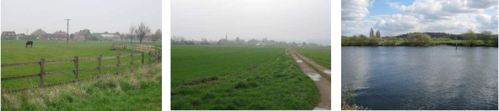
Landscape Analysis
Condition
The landscape is a low lying flat fluvial floodplain with views enclosed by woodland ridges. Large expanses of open water associated with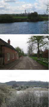 the restoration of former mineral workings are a feature. Views to features including Ratcliffe on Soar Power Station, overhead lines and industry have an urbanising influence. Urban areas are characterised by an historic core with subsequent modern expansion in some locations e.g. Attenborough.
Land use comprises a mix of agricultural landscapes and recreational facilities. Agriculture is predominantly medium to large arable fields bounded by linear fragmented hedgerows and some ditches. Localised areas of pasture can be found adjacent to villages such as Barton in Fabis where horse grazing is apparent often enclosed by timber fences. The field pattern is mostly modern although older enclosure is present north of Barton in Fabis and west of Clifton. Areas of former mineral workings restored to wetland are heavily used for recreational purposes and are covered by an extensive network of footpaths.
The landscape appears well wooded due to views to wooded ridges, linear woodland bordering the river channel and field hedgerows. Restoration of former mineral workings has typically incorporated large areas of new woodland planting and natural regeneration to create young to semi-mature native deciduous woodland habitats. Woodland species are characteristic of wetland habitats. Arable land is still influenced by wooded ridgelines although it is more open in character.
The landscape condition is MODERATE. Areas associated with open water recreational landscapes are well managed due to visitor demand. These wetland habitats are distinctive characteristics in the landscape and provide a strong sense of place. However, areas of agricultural landscape show evidence of deterioration with fragmented hedgerows and few distinctive characteristics.
Landscape Strength
The wetland features and river valley corridors are distinctive in the landscape. From the DPZ there are views to woodland ridges and
urban features such as the power station at Ratcliffe on Soar apparent on the horizon. Ridges enclose views however longer views are afforded from various locations over the larger expanses of open water and across agricultural fields. Planted and regenerating woodland around restored mineral workings provides a strong sense of enclosure.
The DPZ has a MODERATE strength of character. The River Trent and wetland habitats associated with former mineral workings create a strong sense of place and are well managed. Urban features are apparent however, they do not represent a significant detraction and are generally well integrated into the landscape. Man-made flood defences are also prominent features. The landscape pattern associated with the agricultural landscape shows evidence of hedgerow loss and fragmentation and weakens the strength of character.
The landscape condition is MODERATE. The strength of character is MODERATE. The overall landscape strategy is ENHANCE.
Landscape Actions
Landscape features
- Enhance valuable landscape habitats through ongoing management of both the landscape and visitor access.
- Undertake sensitive restoration of areas of active mineral extraction, integrating new areas into the existing landscape through native riparian tree planting, wetlands and areas of open water.
- Enhance field boundaries by replanting gaps in hedgerows to retain and reinforce field patterns.
- Restrict further expansion of agricultural field sizes to protect remaining hedgerow boundary features.
- Conserve and enhance older field enclosure pattern close to Barton in Fabis through strengthening of hedgerow boundaries.
- Encourage planting of riparian vegetation and trees along ditches and streams within arable farming to increase the sense of enclosure and provide greater integration with the river corridor and recreational restored land.
Built form
- Conserve the character of settlements by restricting urban edge expansion of both residential, industrial and commercial development.
- Conserve and enhance the rural character through ensuring that development remains dispersed and well integrated into the landscape.
- Ensure that new development is in keeping with the local vernacular of red brick properties with pantile roofs and reflects the styles and scale of built form within Barton in Fabis’ and Attenborough’s historic core.
Other development/ structures in the landscape
- Review the need for further flood defences and consider their impact on the landscape. Where required these should be carefully sited and include some riparian planting to reduce their prominence.
- Further mineral extraction should be screened from view by wooded boundaries to aid integration into the landscape.
TSV02 Soar Valley Farmlands
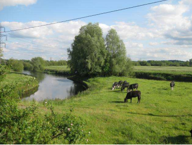
Context
Regional Character Area: Trent Valley
LDU reference: 269
DPZ Reference: TSV02
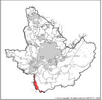
Characteristic Features
- Low-lying narrow floodplain bordering the River Soar.
- Land rises on either side of the valley creating a strong sense of enclosure.
- The River Soar is a prominent and distinctive feature within the DPZ. The river has a meandering channel and gentle often grassed meadow banks and riparian tree planting.
- Remote character created through a lack of built form. Woodland, scrub and hedgerow trees reduce the scale and frequency of built form within views.
- Urban fringe character in places conveyed by frequent views towards urban edges, the railway embankment, horse paddocks and other fringe uses.
- Land use is almost all pasture including rough grazing, rough grassland and horse paddocks. A very small amount of arable is present close to the River Soar where the field pattern changes markedly.
- Mostly an area with intact historic field enclosures. Most are semi-regular and reflect open field systems which are some of the oldest enclosures in Nottinghamshire.
- Fields are bounded mostly by hawthorn hedgerows which are often species-rich with frequent hedgerow trees which are mostly ash.
- Infrequent woodland, which where present tends to be clustered around village fringes as small copses and linear belts along field boundaries
- Frequent clusters of hedgerow trees, mostly ash or willow, along the river, tracks and field boundaries create a wooded impression.
- Regular pockets of riparian vegetation along the fringes of the River Soar which become more frequent and larger in extent where the land is pasture.
- Very little built form on low ground; villages are on higher ground with woodland and mature trees softening their appearance.
- Church spires are prominent features of rooflines e.g. Church of St Michaels.
- Built form includes distinctive ‘estate’ villages at Sutton Bonington and Kingston on Soar.
- Built form at Sutton Bonington is set on high ground with a group of conifers on the highest land around a prominent manor house.
- Views are channelled along the river valley to higher ground on the valley fringes around Sutton Bonington and Kegworth.
- Urban elements become more frequent in views towards the north of the DPZ with Ratcliffe on Soar power station and adjacent quarrying prominent.
- Overhead lines form prominent vertical features across the landscape often following the line of the river.
- The railway is a prominent man-made element set on a raised embankment which provides a local contrast to the surrounding flat land.
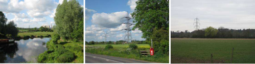
Landscape Analysis
Condition
This area is characterised by its association with the River Soar. It is low-lying mostly pastoral farmland although where arable is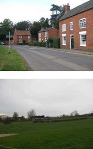
present it has an influence on the character. The DPZ is enclosed by surrounding rising landform which in combination with frequent hedgerow trees provides a strong sense of enclosure.
Land use is mostly pasture in small to medium sized fields. The HLC identifies old patterns such as those reflecting open fields (one of the earliest enclosures) around Sutton Bonington and a mix of irregular and regular shaped fields which are evidence of slightly later enclosure. Horse paddocks are a feature of village fringes with associated fencing, jumps and sub-division of fields which in places gives an untidy appearance.
Woodland is infrequent in the DPZ; small geometric copses and mature linear belts of trees are present along tracks, village fringes and field boundaries around pastoral fields. Hedgerows are generally hawthorn although are more species-rich close to the river. Close to the river, hedgerows are distinctive where they follow the meandering course of the river rather than being in straight lines.
The landscape condition is MODERATE. There is evidence of localised decline in hedgerows particularly where the land is under arable cultivation. There are also frequent urban fringe uses such as horse paddocks and sub-division of fields which create a slightly untidy appearance to the landscape.
Landscape Strength
This is a relatively self contained area with channelled views possible through the landscape along the river valley and views to settlements within pockets of woodland and trees on higher ground. There are very few views into the area from outside the DPZ due to
rising land on its fringes which screens the landscape.
The character strength of the area is MODERATE to STRONG. This DPZ is characterised by low-lying land associated with the River Soar floodplain. The land is mostly pastoral with change occurring where the land is under arable cultivation and becomes more open with fewer trees or hedgerows or along village fringes where horse paddocks are common.
The landscape condition is MODERATE. The strength of character is MODERATE to STRONG. The overall landscape strategy is CONSERVE AND ENHANCE.
Landscape Actions
Landscape features
- Conserve the older field patterns within the character area such as those reflecting open systems and the irregular and regular geometric patterns.
- Conserve areas of permanent pastoral farming along the river floodplain.
- Conserve and enhance riparian and flood meadows along field fringes and the river margins by avoiding farming to
the river edges and maintenance of smaller rough grassland buffers. - Conserve and where possible enhance the continuity of riparian trees, meandering rivers and pasture along the river.
- Enhance riparian trees through local replanting particularly in arable farming areas to improve unity with pastoral areas.
- Conserve river meadows where present along the riverbanks.
- Enhance hedgerow boundaries and ensure replacement, particularly around arable fields where they tend to be less intact.
- Conserve and enhance the pattern of hedgerows and regular hedgerow trees along lanes and tracks.
- Conserve and enhance channelled views through the DPZ through careful placement of any new vegetation or built form.
- Conserve the wooded impression of the DPZ through maintenance and planting of hedgerow and riparian trees.
- Conserve the form of curvilinear hedgerows close to the river.
Built form
- Conserve the infrequent nature of built form on lowest ground and the villages situated on rising higher ground.
- Conserve the distinctive ‘estate’ character of Sutton Bonington and Kingston on Soar.
- Ensure that any new or infill buildings respect the local built materials such as red brick, pantile roofs and red brick boundary walls.
- Conserve the linear nature of settlements within the DPZ.
Other development/ structures in the landscape
-
Conserve the narrow character of roads and tracks through the area bordered by frequent hedgerow trees.
Trent Washlands
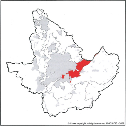
DPZ within this Regional Character Area:
- TW PZ01 Gamston and Edwalton Meadowlands
- TW PZ02 Polser Brook Meadowlands
- TW PZ03 Holme Pierrepont and Bassingfield Village Farmlands
- TW PZ04 Trent Field Meadowlands
- TW PZ05 Stoke Bardolph Village Farmlands
- TW PZ06 Bulcote Village Farmlands
- TW PZ07 Shelford Village Farmlands
- TW PZ08 Gunthorpe and Hoveringham Village Farmlands
- TW PZ26 Gunthorpe Village Farmlands
- TW PZ28 East Stoke Meadowlands
- TW PZ51 Stoke Lock Meadowlands
- TW PZ52 Thurgarton Meadowlands
- TW PZ54 Colwick Country Park
- TW PZ55 West Bridgford Recreational Fringe
Key Characteristics
- This Regional Character Area follows the broad valley of the River Trent.
- The river valley is between 2-3km in width throughout it's length.
- It is defined by alluvial and river terrace drift deposits formed through deposition of a series of river-borne materials during the development of the river. It comprises mostly gravels and more recent alluvium.
- Terraces are generally present along the edges of the valley but also occur as 'islands' within the floodplain. The most distinctive are up to 2m above the surrounding alluvium.
- The valleys have been formed through the river cutting into the Mercia Mudstone and are bordered by steep slopes, forming a shallow trench.
- Materials are predominately coarse gravels, which is mostly Bunter Pebble Bed debris and alluvium, which is finer in texture ranging from silty loam to light clay.
- The meandering river corridor is the most distinctive feature of this landscape.
- The landscape has urban fringe character with residential housing, railway lines, sewage works, formal parks and restored gravel workings (often now recreational areas).
- The urban edge of Nottingham is locally prominent in the landscape.
- Further away from the main urban centres the settlement pattern is a mix of nucleated villages and isolated farmsteads. Red brick and pantile roofs are the most common building materials.
- Modern housing is less distinctive and more uniform in character.
- Settlements are often situated on the slightly higher river terraces or along the valley margins where the land tends to be drier.
- Land is influenced by gravel extraction, industry, urban expansion, roads, railways and overhear lines.
- Network of narrow hedge-lined lanes link settlements. These run across the river terraces and in places extend to the river.
- Arable farmland is predominant across the river valley although there are narrow banks of riverside grassland which are a remnant of the previously more extensive meadows and pasture.
- Regular pattern of medium to large fields enclosed by hedgerows. Some hedgerows are well maintained although others are more fragmented allowing more open views along the river valley.
- Grasslands are an important localised feature, often close to small villages where they are distinctive and associated with small irregular fields, mature hedgerows, willow pollards and pockets of parkland. These retain a peaceful and undisturbed character.
- Small broad-leaved woodlands are scattered across the character area.
- Hedgerow trees are a key component of tree cover.
- Large areas of wetlands and lakes formed as restoration of gravel workings are now used for water sport recreation and nature conservation.
- Pockets of actively worked quarries characterised by dry voids, processing plant, earth mounds and immature woodland screening belts.
- Establishing woodland and riparian vegetation is associated with restored landscapes which provides enclosure.
- Small bands of river meadow and pasture characterised by willow holts and animals grazing, creating a strong sense of place where present.
Guidelines and Recommendations
- Conserve and restore the pattern of hedged fields, particularly around arable fields where the pattern has fragmented and become less distinctive.
- Enhance the level of tree cover within the character area through small scale woodland and hedgerow tree planting ensuring open views across the terraces are preserved.
- Conserve and enhance the extent of riparian scrub and trees through the management, natural regeneration and new planting of riparian trees and scrub particularly willow, ash and oak. This will help to strengthen the meandering character of the river and integrate the more open farmed landscape with the more traditional enclosed river meadowlands and pasture.
- Conserve the distinctive character of villages on higher river terraces and the characteristic vernacular of red brick and pantile rooks. Any new development should make a positive contribution to local distinctiveness.
- Conserve the small-scale pasture and mature hedgerows and trees along village fringes.
- Conserve pastoral character through retention of meandering river channels, alluvial meadows and riverside pasture.
- Preserve the peaceful and undisturbed character of riverside pasture.
- Conserve and enhance the pattern of long curvilinear hedgerows as field boundaries between riverside pasture and arable farming.
- Conserve and enhance the condition of hedgerows through augmentation or replacement planting where gaps have occurred.
- Conserve and in places seek to restore the medium to large scale regular and semi-irregular field patterns.
- Conserve and strengthen the nucleated character of villages interspersed with isolated farmsteads.
- Enhance and integrate land being restored from mineral workings to agricultural use within the surrounding landscape by ensuring the field patter, boundary enclosure and tree cover reflects the historic pattern and includes areas of pasture, wet pasture and meadows.
- Where land is to be restored for recreation, proposals should include wetland habitats such as meadows, reed beds and marshland rather than large expanses of open water; where open water is a necessity (for example, for water-based recreation) then this should be combined with wetland features.
TW PZ 1 – Gamston and Edwalton Meadowlands
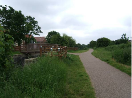
Context
Eastern edge of the City of Nottingham
NCC Landscape Sub Type: River Meadowlands
Policy Zone: TW PZ 1
Land Cover Parcel TW1 and TW2
Characteristic Features
- Flat and low lying land drained by ditches & a small watercourse
- Medium sized arable fields
- Small scale fields grazed by horses
- Remnant sections of the Grantham Canal
- Views of urban edge of Nottingham
- Golf course and other urban edge amenity land uses
The landscape condition is MODERATE. The strength of character is MODERATE. The overall landscape strategy is CONSERVE AND CREATE.
Landscape Analysis
Landscape Condition
This is a narrow swathe of land that lies either within or adjacent to the urban edge of Nottingham. It has a coherent pattern of elements with some detracting features within the PZ such as post and wire fencing, makeshift pony shelters and a short low
bridge section across the A52, which is a busy main road. Overall this gives a visually coherent area.
The Grantham Canal is no longer navigable having been severed by the A52. Lack of dredging and the maintenance of the associated canal structures, such as locks as fully operational elements, have led to a loss of cultural integrity and the remaining features are retained as relics as opposed to working structures.
The canal corridor is well maintained as a recreational route and the canal itself is a SINC site noted for its good aquatic plant community. The landscape along the canal on the edge of Gamston and within the golf course is generally in good condition with
the established tree planting and with the maintained green open space appearing well used. The ecological network is therefore described as moderate, which overall leads to a coherent functional integrity / habitat for wildlife.
A visually coherent area with coherent habitat for wildlife gives a moderate landscape condition.
Summary
- Pattern of Elements: Coherent
- Detracting Features: Some
- Visual Unity: Coherent
- Ecological Integrity: Moderate
- Cultural Integrity: Variable
- Functional Integrity: Coherent
Landscape Sensitivity
Some of the characteristic historic and ecological features of this Trent Washlands landscape are still in evidence, such as the meandering Grantham Canal and associated wetland and marsh plant communities fringing the margins of the canal. Part of the tow path along the line of the canal is now used as a footpath which connects Edwalton to Gamston. These features give the area a moderate sense of place.
The proximity to the urban edge and more recent residential development has also led to a more indistinct feel to this area. The degree of visibility is also moderate due to containment by built edges and intermittent belts of tree planting, such as that around the edges of the Edwalton Golf Course and the A52, and the gently undulating landform. There are some views beyond the PZ from the fields within the northern area to the wooded hills to the North.
A moderate sense of place with a moderate degree of visibility leads to a moderate landscape sensitivity.
Summary
- Distinctiveness: Characteristic
- Continuity: Historic
- Sense of Place: Moderate
- Landform: Apparent
- Extent of Tree Cover: Intermittent
- Visibility: Moderate
Landscape Actions
- Create new hedgerows along existing field boundaries particularly where these are currently post and wire fences.
- Conserve and enhance pattern of existing meadowland hedges, particularly primary hedgerows alongside roads, footpaths and bridleways.
- Enhance the appearance and visual unity of urban fringes and settlement edges with new tree and woodland planting to create filtered views.
- Conserve the canal side character and biodiversity of the Grantham canal and restore historical, visual and access links with the River Trent.
- Conserve pastoral character and promote measures for enhancing the ecological diversity of alluvial grassland.
- Seek opportunities to convert arable land to permanent pasture.
Policy: Conserve and Create
Character Summary
This area is made up of 2 small narrow belts of land that lie on the suburban fringes of Edwalton and Gamston to the east of the city of Nottingham. To the north the urban edge of West Bridgford forms the western boundary. The southern section contained by more recent housing development in Gamston to the east and the housing of Edwalton to the west. North of the A52 the area is flat and low lying with some medium and small scale fields grazed by ponies. Field boundaries are a mixture of post and wire, timber post and rail fence and out grown hawthorn hedgerows.
South of the A52 is a narrow stretch of land along the Grantham Canal. This canal was opened in 1797 and for over one hundred years it was used for transporting coal, lime and stone between Nottingham and Grantham. The canal is no longer navigable and in the 1970s road construction for the Gamston Lings Bar road severed the canal corridor. The canal is a SINC site that is noted for good aquatic plant life and its tow path now provides a recreational route for the surrounding residential areas of Gamston.
To the south against the A52 lies Edwalton Golf Course which has a belt of mixed woodland which screens views out into the wider landscape. The golf course is highly maintained and gently undulates over fairways to the south. There is a small piece of mature woodland and scrub to the north of Edwalton Primary School and a playing field to the south of the school.
To the north roadside hedgerows are generally in good condition, with ditches running along side slightly elevated roads such as Regatta Way. Pony shelters, jumps, and stables are found within these smaller fields. Elsewhere the suburban influence is evident with allotments, former sewage works and other recreational land use near to the housing within Gamston and Edwalton.
TW PZ02 – Polser Brook Meadowlands
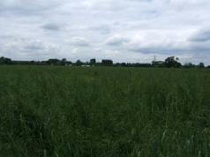
Context
A52 west of Radcliffe on Trent
NCC Landscape sub Type: River Meadowlands
Policy Zone TW PZ 2
Land Cover Parcel TW7
The landscape condition is POOR. The strength of character is LOW. The overall landscape strategy is CREATE.
Characteristic Features
- Low lying flat landscape drained by the Polser brook.
- Mixture of small fields of pasture to the north east and medium sized arable fields to the east.
- Small areas of recreational land use including a golf course and caravan park.
- Busy A52 road corridor dominated by associated structures and traffic.
Landscape Analysis
Condition
This is a narrow linear area which is dominated by the busy A52 dual carriageway which gives it a coherent pattern. Alongside the A52 lies an assortment of associated site furniture including lighting, signage and crash barriers which are all detracting features in the landscape; overall these lead to an interrupted visual unity.
A narrow belt of woodland along the northern boundary of the road forms the edge of a previously worked gravel pit and is now a SINC site known as Gamston pits. Tree cover is evident along the Polser Brook and within some hedgerows particularly around fields of pasture. The golf course is highly and intensively maintained and generally the arable land within the area tends to be more intensively treated than the smaller fields of pasture that are grazed by horses and cows; overall this is a moderate habitat for wildlife.
Cultural integrity is variable in that some of the historic features are still in evidence, such as field pattern in pasture areas, but some features have been lost due to mineral extraction and the intensification of agriculture.
A visually interrupted area with a coherent functional integrity / habitat for wildlife gives a poor landscape condition.
Summary
- Pattern of Elements: Coherent
- Detracting Features: Many
- Visual Unity: Interrupted
- Ecological Integrity: Moderate
- Cultural Integrity: Variable
- Functional Integrity: Coherent
Landscape Sensitivity
The landscape within this area is primarily influenced by the presence of the A52. Roadside furniture, lighting and small scale commercial development along with intensive arable farmland gives an indistinct feel to this area with few historic features. The limited tree cover and relatively low amount of historic built structures gives this area a weak sense of place.
The degree of visibility is moderate due to gently undulating landform and intermittent tree cover. A weak sense of place with a moderate degree of visibility leads to a low landscape sensitivity.
Summary
- Distinctiveness: Indistinct
- Continuity: Historic
- Sense of Place: Weak
- Landform: Apparent
- Extent of Tree Cover: Intermittent
- Visibility: Moderate
Landscape Actions
- Enhance the visual unity of small scale commercial and roadside developments by filtering views from the road network with small scale trees and woodland planting.
- Conserve rural character by limiting standardised treatments during highway improvement schemes.
- Conserve and enhance the tree cover through replanting and regeneration of meadowland hedgerows and hedgerow trees.
- Diversify road side character through the management and creation of flower rich grasslands on highway verges.
- Use native species of trees and shrubs suitable for Trent Washlands Regional Character Area on areas of recreational and amenity land, such as golf courses, fishing lakes and caravan parks.
- Seek opportunities for the creation and enhancement of wet alluvial grassland and meadows.
- Create new wetland and marginal habitats along the Polser Brook to enable it to function as a wildlife corridor.
- Seek opportunities to convert arable land to permanent pasture.
Policy: Create
Character Summary
This linear area lies to the east of the City of Nottingham along the A52 corridor up to the western edge of Radcliffe on Trent. To the south the area follows the line of a small water course known as Polser Brook which drains in the direction of the village of Holme Pierrepoint and eventually to the River Trent.
This is a flat and low lying landscape with some medium distance views out to low wooded skylines of the Dumble Farmlands to the north.
Tree cover is relatively limited with a maturing woodland belt to the north of the A52 which screens views out over the restored gravel pit. A line of overhanging trees runs against the brook. Hedgerow trees tend to be Ash and Willow and are found particularly within road side hedges.
In the north east of the area there is a dismantled railway line adjacent to which are medium and small fields of unimproved pasture. Larger fields of arable crops are found around the caravan park to the east. Development is limited to this caravan site, the northern section of Cotgrave golf course, a public house to the southern edge and individual dwellings such as farm buildings and a road side café against the A52.
Fields are generally small to medium-sized and the historic field pattern has largely disappeared except for a small area to the south east of semi regular shaped fields.
TW PZ03 Holme Pierrepont and Bassingfield Village Farmlands
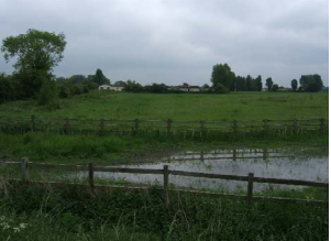
Context
Eastern edge of City of Nottingham
NCC Landscape Sub Type: Village Farmlands
Policy Zone TW PZ 3
Land Cover Parcel TW3, TW4 and TW5
The landscape condition is GOOD. The strength of character is MODERATE. The overall landscape strategy is CONSERVE AND REINFORCE.
Characteristic Features
- Flat and low lying landscape
- Recreational and amenity land uses associated with the previously worked gravel pits
- Open bodies of water close to urban edge of City of Nottingham
- Parkland around historic core of Holme Pierrepont
- Medium sized arable fields with smaller fields of pasture to the north of Radcliffe on Trent
- Grantham Canal and associated wetland marsh vegetation
Landscape Analysis
Condition
This an area with relatively few detracting features. Those that exist are pylons to the east, floodlighting to new sports pitches along Regatta Way and a short section of the A52 west of Radcliffe on Trent. There is a coherent pattern of elements which overall gives a visually unified area.
North of the A52 is a large SINC site covering worked gravel pits which is now made up of open water, marsh, scrub and woodland which is of particular value for birds. Field boundaries tend to be mixed with both fragmented and strong hedges and some mature hedgerow trees. The area forms a moderate habitat for wildlife.
The historic core of Holme Pierrepont village contrasts with the more recently modified landscape of mineral extraction of sand and gravel within a wider agricultural landscape. The cultural integrity is variable; overall this gives a coherent functional integrity / habitat for wildlife.
A visually unified area with a coherent functional integrity / habitat for wildlife gives a good landscape condition.
Summary
- Pattern of Elements: Coherent
- Detracting Features: Few
- Visual Unity: Unified
- Ecological Integrity: Moderate
- Cultural Integrity: Variable
- Functional Integrity: Coherent
Landscape Sensitivity
The area has a moderate sense of place retaining historic features characteristic of the Trent Washlands Regional Character Area. Bassingfield village has remained a small settlement in redbrick with quiet country lanes surrounding this. The only exception is the busy A52 to the north and west of this settlement.
Around Bassingfield the narrow hedge lined lanes with their ditches and verges have a distinct rural feel. Holme Pierrepont village has a strong parkland character. Although it is surrounded by worked out gravel pits, the mature tree cover and several historic buildings including the Hall give it a strong sense of time depth.
The villages of Bassingfield and Holme Pierrepont along with sections of the Grantham Canal all contribute to the Trent Washland Character Area. Only the disused railway lines and some of the larger former mineral sites and sports fields are all relatively indistinct and recent.
The degree of visibility is moderate due to gently undulating landform and intermittent tree cover. A moderate sense of place with a moderate degree of visibility leads to a moderate landscape sensitivity.
Summary
- Distinctiveness: Characteristic
- Continuity: Historic
- Sense of Place: Moderate
- Landform: Apparent
- Extent of Tree Cover: Intermittent
- Visibility: Moderate
Landscape Actions
- Conserve the character and setting of village settlements.
- Conserve the pastoral character and promote measures for enhancing the ecological diversity of alluvial grasslands.
- Diversify roadside character through the management and creation of flower rich grasslands on highway verges.
- Reinforce built character with use of vernacular materials within existing village settlements.
- Reinforce historic field pattern where this has been lost and conserve the traditional pattern of hedged fields elsewhere.
- Promote measures for strengthening the existing level of tree cover.
- Strengthen the continuity and ecological diversity of stream corridors.
Policy: Conserve and Reinforce
Character Summary
This is a low lying flat and broad area of land lying within the Trent Valley either side of the A52 to the eastern edge of Nottingham.
To the north west lies a small village made up of secluded houses set within wooded gardens as well as various farm buildings and Holme Pierrepont Hall. This Tudor house is a listed building set within parkland that was built by Sir William Pierrepont around 1509 and altered in 1790 and 1812. The village itself is dominated by red brick and pantile roofed buildings and the mature tree cover tends to filter views out into the wider landscape that has been left to open water following gravel extraction. The area also lies within Nottingham’s Green Belt.
To the east of Regatta Way are several new sports pitches and the proximity of the urban edge is evident in the recreational use of the surrounding landscape for camp sites, fishing as well as flood lit sports fields.
To the south of the A52 are medium sized arable fields with smaller semi irregular fields closer to Bassingfield. The Grantham Canal forms the southern boundary to this area which is enclosed by hedges and narrow belts of trees. This canal stretches 33 miles from the River Trent to Grantham and was constructed in the 1800s to transport coal, lime and stone by narrow boat to and from the River Trent to Grantham.
The majority of the pasture around Bassingfield is grazed by horses. Bassingfield itself is a small settlement with a mixture of 19 century properties and more recent farm buildings and houses. The surrounding lanes are enclosed and narrow being contained by Hawthorn hedges and Ash and Field Maple hedgerow trees.
To the west of Radcliffe on Trent are both medium sized arable fields and smaller fields with outgrown hedges containing Poplar, Ash, Willow and Sycamore. Birch trees and Hawthorn scrub is found along the former railway line and to the south western corner of the area there are views back to Nottingham to the north west.
TW PZ04 Trent Field Meadowlands
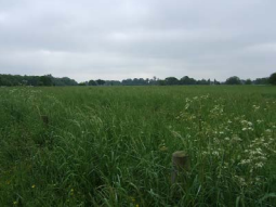
Context
NCC Landscape Sub Type: River Meadowlands
Policy Zone: TW PZ 4
Land Cover Parcel TW6
The landscape condition is GOOD. The strength of character is MODERATE. The overall landscape strategy is CONSERVE AND REINFORCE.
Characteristic Features
- Flat low lying landscape against the River Trent.
- Medium sized fields of wet meadowland and horse grazed paddocks.
- Small clumps of Willow and Alder woodland.
- Formal national water sports centre on former gravel extraction site.
- Small finger ponds and water bodies surrounded by wetland scrub and trees.
Landscape Analysis
Condition
Being close to the urban edge of Nottingham this landscape is generally used for recreational purposes with fields north of Lady Bay being either horse pasture or informal open space. The Holme Pierrepont Water Sports Centre has a mixture of signage, structures and buildings such as boat sheds, amenity blocks and viewing stands, which tend to be scattered around the western end of the formal rowing lake. To summarise it has a coherent pattern elements but some detracting features which overall make the area visually coherent.
The National Water Sports Centre is within a Country Park and much of this is designated as a SINC site noted for its mosaic of carr, scrub, marginal and open water habitats on the former gravel workings. There is some tree cover (Willow) around Adbolton Ponds, which is also a SINC site, with some Ash and Willow along the River Trent. Field boundaries tend to be either out grown Hawthorn, or post and wire fencing in areas of horse grazing. Trees are mostly within hedgerows with occasional mature trees within areas of pasture adjacent to the River Trent. A small block of mixed deciduous woodland lies to the east of the area, making this area a strong wildlife
habitat overall.
Recent housing development is in keeping with the local character. The cultural integrity is variable in that some features such as field pattern have been lost due to mineral working and recreational development but in others this has been retained.
A visually coherent area with a strong functional integrity / habitat for wildlife gives a GOOD landscape condition.
Summary
- Pattern of Elements: Coherent
- Detracting Features: Some
- Visual Unity: Coherent
- Ecological Integrity: Strong
- Cultural Integrity: Variable
- Functional Integrity: Strong
Landscape Sensitivity
The historic field pattern shown on Sanderson’s 1835 map is still in evidence to the western end but the working of the gravel pits has led to a modified landscape to the eastern side of this area, which now functions as a Water Sports Centre.
The willow and alder scrub around the worked gravel pits are characteristic of the Trent Washlands character area, as are the occasional clumps of willow holt around Adbolton Ponds and along the southern bank of the river. The area has a moderate sense of place.
The absence of development immediately along side the River Trent respects the low lying flood plain of this river. In some places existing hedgerows have become out grown and fields are often made stock proof by post and wire fencing.
The degree of visibility is moderate due to gently undulating landform and intermittent tree cover. Views out to the north tend to be of the wooded low hills around Colwick and to the west of the built skyline of the centre of Nottingham.
A moderate sense of place with a moderate degree of visibility leads to a moderate landscape sensitivity
Summary
- Distinctiveness: Characteristic
- Continuity: Historic
- Sense of Place: Moderate
- Landform: Apparent
- Extent of Tree Cover: Intermittent
- Visibility: Moderate
Landscape Actions
- Conserve the traditional pastoral character and undeveloped flood plain adjacent to the River Trent.
- Enhance the ecological diversity of the ‘river meadowlands’ character and seek opportunities to recreate wet alluvial grassland.
- Reinforce and strengthen the continuity and ecological diversity of stream and water courses.
- Conserve and enhance the pattern and special features of ‘river meadowland’ hedgerows.
- Seek opportunities to convert arable land to permanent pasture.
- Enhance visual unity through appropriate small-scale tree and woodland planting.
Policy: Conserve and Reinforce
Character Summary
This is a long swathe of land that lies south of the River Trent and south east of Nottingham. It is a low lying and flat landscape which is generally open with the low wooded ridgeline of Colwick lying to the north. To the south there are longer fragmented views across low lying fields whilst to the west there are views of the skyline of Nottingham.
Gravel extraction over the past 40 years has left several open areas of water. The largest of these was developed in to the National Water Sports Centre at Holme Pierrepont with a 2 km rowing lake dominating this area. These restored areas of water are now part of Holme Pierrepont Country Park popular with walkers, cyclists, and canoeists. The smaller water bodies such as the finger ponds to the north east are used by anglers and bird watchers.
This is a recreational landscape with Holme Pierrepont and the River Trent forming the main focus for activities such as rowing, sailing, canoe slalom, water skiing and quad biking. The river location means that this area is well used for more informal activities such as walking and cycling. To the western end are a series of sports fields with playgrounds closer to the urban edge. An equestrian centre lies partially within this area and many of the meadowlands have been divided up by post and wire fencing for the grazing of ponies.
The informal open space to the west is open grassland with small clumps of wet woodland of Willow and Alder around Adbolton Pond. This small area of woodland, and the adjacent marsh, and the majority of Holme Pierrepont Country Park are SINC sites.
TW PZ07 Shelford Village Farmlands
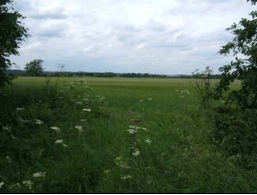
Context
NCC Landscape Sub Type: Village Farmlands
Policy Zone: TW PZ 7
Land Cover Parcel: TW11
The landscape condition is GOOD. The strength of character is MODERATE. The overall landscape strategy is CONSERVE AND REINFORCE.
Characteristic Features
- A Low lying flat landscape
- Narrow lanes with thick hedges and hedges on banks
- Medium sized arable fields
- Small mixed woodland blocks and strips
- Nucleated red brick village settlements
Landscape Analysis
Condition
Landscape condition is defined as good. There are few detracting features, which include a short section of the busy A6097 to the north east of the area and telegraph poles and wires. The visual unity is generally unified due to both few detracting features and the presence of characteristic features through out the area.
Field Dyke Lane and Shelford Manor Ponds are both SINC sites but outside of the fields surrounding the village the land is generally highly intensively farmed arable land. Most historic field boundaries are intact around village and although some hedgerows are gappy, many are tall and bushy, particularly where they surround smaller areas of pasture. There are linear blocks of deciduous woodland and small woodland blocks such as Water Furrows Plantation and Moor Close Plantation. Overall the area is a moderate habitat for wildlife. Where fields are in intensive arable production the hedgerows are fragmented or have been removed. The cultural integrity is therefore
variable.
A moderate habitat for wildlife and a variable cultural integrity leads to a coherent functional integrity / habitat for wildlife. An area which is visually unified with a coherent functional integrity / habitat for wildlife gives a good landscape condition.
Summary
- Pattern of Elements: Coherent
- Detracting Features: Few
- Visual Unity: Unified
- Ecological Integrity: Moderate
- Cultural Integrity: Variable
- Functional Integrity: Coherent
Landscape Sensitivity
Landscape sensitivity is defined as moderate. The historic field pattern is largely intact around the village with the remnants of an open field system against the eastern side of the village. However outside the village the internal historic field pattern has been removed due to the intensification of arable farming. Species are characteristic of the Trent Washlands LCA and the time depth / continuity is historic.
The majority of buildings within Shelford are 19th century red brick and clay pantile roofed houses typical of the Trent valley and which give a strong sense of place. The surrounding large arable fields are less distinctive and so give an overall moderate sense of place. There are several listed buildings and structures within the village and within the surrounding area.
Views are contained within the village and along roads where hedgerows are intact; visibility is moderate. There are longer views within the Trent valley where hedges are more fragmented.
A moderate sense of place with a moderate degree of visibility leads to moderate landscape sensitivity.
Summary
- Distinctiveness: Characteristic
- Continuity: Historic
- Sense of Place: Moderate
- Landform: Apparent
- Extent of Tree Cover: Intermittent
- Visibility: Moderate
Landscape Actions
- Conserve the historic character, nucleated pattern and setting of the village settlements – new development should respect the scale, design and materials used traditionally.
- Conserve the historic field pattern by containing new development within historic boundaries.
- Conserve existing hedgerows and seek opportunities to restore the historic field pattern with new hedgerow planting.
- Reinforce and enhance ecological diversity of riparian vegetation and manage existing Willow trees by pollarding.
- Reinforce and increase tree cover by establishing hedgerow trees in existing hedge lines.
- Conserve historic ridge and furrow features.
Policy: Conserve and Reinforce
Character Summary
This is a low lying flat landscape lying within the broad flood plain of the Trent Valley. To the south west lies the small red brick nucleated village of Shelford. Nineteenth century red brick and pantile roofed buildings tend to dominate this village though there is some more modern development within the centre. Surrounding lanes are generally narrow with grass verges and some ditches.
Arable farming is found to the north east of the village with the large modified arable fields within the centre, fields to the east of Shelford Manor being park/ garden and remnants of an open field system against the eastern side of the village. Pasture closer to the village is grazed by sheep and horses.
There are some small blocks and linear belts of mature woodland cover such as Water Furrows Plantation and Moor Close Plantation. Woodlands are mixed with beech, oak, ash, and conifer species, with hazel and hawthorn shrubs to the periphery. Hedgerow trees include ash, willow, and oak and tend to occur in stronger road side hedgerows and along tracks rather than with in the internal boundaries within arable areas.
There are some views out to the slightly higher ground to the north across the River Trent and to the rising scarp slope to the south.
TW PZ 51 Stoke Lock Meadowlands
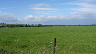
Context
NCC Landscape Sub Type: River Meadowlands
Policy Zone: TW PZ 51
Land Cover Parcel TW9
The landscape condition is Moderate. The strength of character is Moderate. The overall landscape strategy is CONSERVE AND REINFORCE.
Characteristic Features
• Flat, low lying landscape with flood alleviation embankments against the River
Trent.
• Open views from the Trent to wooded hills in the north and south.
• Intensive arable fields with pasture between the flood bunds and river.
• Abandoned gravel workings with establishing scrub vegetation.
• Some strong hedgerows particularly along farm tracks.
Landscape Analysis
Condition
The overall condition of this landscape is defined as moderate. This area lies to the east of Burton Joyce and west of Shelford. It extends south to Netherfield pits and north up to the edge of Gunthorpe. Lying directly either side of the Trent, this area is relatively undeveloped and the pattern of landscape elements is coherent. Although it has some detracting features these tend to be scattered, such as the pylons across the river bluff to the north west of Shelford, the former railway sidings and industrial unit to the south west and the caravan retail site to the west of the A6097. Overall this is a visually coherent area
There are several SINC sites within this area including Netherfield Pits (also a local nature reserve) and Gunthorpe Lakes - both areas of old gravel workings, Burton Meadows Loop and Shelford Carr. However, the intervening landscape is fairly medium to large intensive arable fields with only narrow margin of less intensive grazing pasture against the River Trent giving an overall ecological integrity of
moderate. Tree cover is generally riparian vegetation such as Willow and Ash against the river and water courses. Some woodland is also found around Stoke Lock consisting of Sycamore, Cherry, Hazel and Lime. Field boundaries tend to be variable with some intact and well maintained and others fragmented with post and rail fencing.
Gravel extraction sites have left a highly modified landscape in some areas but there are other areas that are more intact closer to settlement edges. The cultural integrity is therefore variable.
A moderate network for wildlife and a variable cultural integrity leads to a coherent functional integrity/habitat for wildlife. An area that is visually coherent with a coherent functional integrity/ habitat for wildlife has a moderate landscape condition.
Summary
- Pattern of Elements: Coherent
- Detracting Features: Some
- Visual Unity: Coherent
- Ecological Integrity: Moderate
- Cultural Integrity: Variable
- Functional Integrity: Coherent
Landscape Strength
Landscape sensitivity is defined as moderate. Settlements tend to be located on the edge of this area on slightly higher land outside the flood plain. Isolated and generally red brick houses and cottages are found to the west of the A road in Gunthorpe and to the eastern side of Stoke Bardolph, including the lock cottage at Stoke. The Holmes farm house lies within the centre of this area on a river bluff.
The absence of development immediately along side the River Trent respects the low lying flood plain of this river. Hedgerows are strong in places particularly along tracks where mixed hedges are more common. The features which give the area its local distinctiveness are characteristic of the Trent Washlands RCA and the continuity/time depth is historic (post 1600). The area has a moderate sense of place.
This is a flat landscape with some open areas of grazing next to the River Trent. This flat landscape allows longer distance views up and down the Trent Valley. To the east and west the views are contained by the low often wooded hills. The apparent / flat? landform and intermittent tree cover which leads to moderate visibility of the area from outside the PZ.
A moderate sense of place with a moderate degree of visibility leads to a moderate landscape sensitivity.
Summary
- Distinctiveness: Characteristic
- Continuity: Historic
- Sense of Place: Moderate
- Landform: Apparent
- Extent of Tree Cover: Intermittent
- Visibility: Moderate
Landscape Actions
Landscape features
- Conserve the traditional pastoral character and undeveloped flood plain adjacent to the River Trent.
- Enhance the ecological diversity of the river meadowlands and seek opportunities to recreate wet grassland.
- Reinforce and strengthen the continuity and ecological diversity of stream and water courses.
- Conserve and enhance the pattern and special features of meadowland hedges.
- Seek opportunities to convert arable land to permanent pasture
- Enhance visual unity through appropriate small-scale tree and woodland planting
Policy: Conserve and Reinforce
Character Summary
This is a flat valley landscape that is dominated by arable land use. Arable farming has generally led to the loss of internal field boundaries although there are still some smaller fields used for arable crops with strong hedgerows. There are also small areas of pasture particularly immediately alongside the River Trent which are crossed by the long distance footpath “The Trent Valley Way”
The area has the impression of being well wooded due to tall hedgerows particularly along farm tracks. However woodland tends to be actually limited to localised areas such as around Stoke Lock, west of Shelford Manor and some of the former gravel extraction sites.
Field sizes vary from small paddocks adjacent to the village of Gunthorpe and the Cocker Beck water course to larger fields in the arable areas.
The historic field pattern has largely been modified by the intensification of arable farming. The hedgerows are generally trimmed hawthorn hedges, with ash hedgerow trees.
There is some commercial development along A6097 with caravan sales and van hire to the north eastern edge of this area. However settlements tend to be located to the edge of this area outside the immediate flood plain on slightly higher ground.
TW055 West Bridgford Recreational Fringe
Context
Regional Character Area: Trent Washlands
LDU Reference: 399
DPZ Reference: TW055
Characteristic Features
- Low, flat landform associated with the River Trent
- Concrete stepped bank to the river acts as a flood defence, with railings and open timber bollards to define the top of the river bank
- The area has an urban green space character, with recreation, scrub and underused land, enclosed by surrounding urban development to the north and the south
- The River Trent flows through the central part of the area. The tree lined Victoria Embankment is to the immediate north of the river
- Large expansive recreational area set in a slightly lower bowl to collect flood water to the north of the river
- Victoria Embankment a park and formal recreational open space to the north, with children’s play area and large amenity playing fields and a paddling pool
- Victoria Embankment consists of large open areas of amenity grass land, children’s play area and an ornamental garden, containing formal shrub beds and an ornate water feature
- Formal avenues of mature plane trees line the road, promenade and central axis through the park, with the addition of pockets of ornamental trees within the park, give a wooded character along the north edge of the river
- Playing fields to the south have wooded boundaries surrounding large grass fields. Woodland belts and establishing scrub on parcels of land adjacent to the river contribute to the wooded enclosure
- Scrub vegetation is beginning to establish along the river bank and in areas of land surrounding The Becket and Nottingham Emmanuel schools, which also contribute to a wooded character
- Large red brick 1930s detached properties, face out over the river along Victoria Embankment, set in large gardens with trees and gated entrances
- Suburban residential, red brick, semi-detached properties form the northern and southern boundaries, with occasional individual distinctive properties
- Commercial buildings and a newly constructed modern secondary school are present on the south of the river bank with two distinctive seven storey, high density, residential buildings which are prominent on the skyline
- Views across the open spaces are enclosed by urban development and woodland. Key buildings in the city centre, including the castle are visible above the housing with glimpses to ridgelines to north and south. Floodlights from the sports grounds are also visible on the horizon
- There are three bridges crossing the River Trent within the area, with the A60 London Road Bridge being a busy route, linking the north and south of the city and Lady Bay Bridge and a pedestrian only suspension bridge
- The grand limestone war memorial which marks the entrance to the formal memorial gardens is a distinctive and elaborate feature along Victoria Promenade
Landscape Analysis
Condition
A low lying landform within the floodplain of the River Trent, with designed flood defences. The land is amenity parkland and recreational space associated with a water course. It is characterised by modern modified fields which form a number of urban green spaces. The area is quite open but enclosed by the urban fringes of Nottingham and West Bridgford and by woodland along the fringes of open spaces.
Land use is mainly recreation with pockets of residential and commercial buildings increasing towards the fringes of the city. The recreational parkland north of the river has a large expansive amenity open space, children’s play equipment, and a small paddling pond used in summer. An ornamental memorial garden containing formal shrub beds and an ornate knot style water feature is marked at its entrance by a distinctive limestone war memorial gate structure leading from Victoria Embankment. To the south grassland is bordered by wooded fringes.
A distinctive mature tree line avenue is an important feature within this landscape. There are plane trees along the length of Victoria
Embankment to the A60 London Road Bridge. Additional native and ornamental trees within the Victoria Embankment, emerging scrub
along the southern edge of the river bank, and woodland around the playing fields to the south, give the area a wooded character.
The landscape condition is MODERATE with localised evidence of lack of maintenance across the park. Railings to the boundary need
to be re-painted. The war memorial is in need of maintenance and there is no access over the river from one bridge which has been
closed for safety reasons. The paddling pool gives the impression of an abandoned feature throughout the winter months although it
is likely that this appearance alters through the summer.
Landscape Strength
The DPZ is enclosed by the urban fringes of Nottingham, although there are filtered views into the area from the urban edges
surrounding the area. From the north the views are filtered through the structure planting surrounding the park. There are open views
across individual open spaces and channelled views along the river, which is a distinctive feature. Views are often contained by woodland and built form. Key city buildings, including Nottingham Castle are visible in the skyline to the north.
The strength of character of the area is MODERATE. The features although regularly distributed, are not strong enough to be
distinctive or to give a highly unique sense of place except close to the river where the war memorial and river are distinctive features.
The land use varies from amenity, built development and rough scrub typical of an area of green space within an urban location.
The landscape condition is MODERATE. The strength of character is MODERATE. The overall landscape strategy is ENHANCE.
Landscape Actions
Landscape features
- Conserve the open character of the recreational amenity playing fields
- Conserve the distinctive tree lined avenue along the river embankment
- Enhance the quality and condition of the memorial garden to improve the existing vegetation and appearance of the area
- Enhance the character of the river and Victoria Embankment to provide greater unity and focus within the DPZ on the river
- Enhance the fringes of the open spaces through additional woodland
- Enhance fringes of the river through localised tree planting/natural regeneration to soften built form bordering the area
Built form
- Conserve the detached housing set within mature gardens along Victoria Embankment
- Maintain and enhance views of distinctive and prominent buildings along the River Trent such as County Hall through management of trees and development to retain and frame views
- Enhance the school grounds through planting along the boundaries to help soften them and reduce its prominence in views to the north of the river.
Other development/ structures in the landscape
- Improve and restore the condition of the War Memorial to enable the temporary security fencing to be removed
- Enhance views towards distinctive landmarks with the city, such as the City Council House, the Castle and St Mary’s church through careful siting of new development and planting to maintain a connection between the river and the city centre
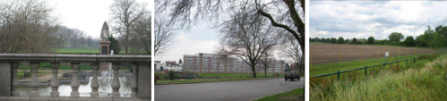
Vale of Belvoir
DPZ within this Regional Character Area:
VB01 Vale of Belvoir
Key Characteristics
- Broad low-lying clay vale extending as an elongated arc along the foot of a Jurassic escarpment, the Belvoir Ridge.
- Underlain by bluish grey mudstones and clays alternating with flaggy limestones.
- The soft Lower Lias provide subdued gently rolling landform; low hillocks are formed by the presence of thin bands of limestone.
- Transition between Lower Lias and Mercia Mudstone is marked by a narrow outcrop of dark shales known as Rhaetic beds which form a low escarpment on the character area boundary.
- Soils are a mix of clayey slowly permeable soils subject to prolonged waterlogging and lighter calcareous clay soils on limestone.
- Low escarpments provide a sense of enclosure to the western, northern and southern fringes of this character area.
- Unified character exists across this regional character area.
- Strong rural character with few settlements or scattered farmsteads.
- Villages are situated on the drier Triassic (Rhaetic) escarpment between Langar and Staunton and contain older vernacular buildings and newer architectural styles.
- Nucleated pattern of small red brick villages linked by narrow winding lanes with wide grass verges.
- Small pocket of industry around Barnstone and Langar have a localised influence on landscape character.
- Strong tradition of dairy farming which remains as a mosaic of grassland within extensive arable farmland. Where present a small to medium scale field pattern exists; the most extensive tract is between Colston Bassett, Hickling and Kinoulton.
- Smaller scale pasture is present around village fringes and is often used for horse paddocks; ridge and furrow is sometimes present.
- Medium to large scale pattern of hedged fields although field pattern becomes more irregular where pasture and mixed farming are common.
- Geometric field patterns are common where the land is farmed for arable crops.
- Hedgerow trees generally ash and oak are important components and reinforce a sense of enclosure.
- Ridge and furrow is common along the low escarpment at Hickling.
- Woodland is infrequent and where it exists is locally prominent such as on escarpments or around parkland at Colston Bassett and Staunton.
- Tree cover reduces around arable farming creating an open landscape with extensive views.
- The engineered River Smite flows through the area although it is set below the surrounding land and arable farmland extends up to its banks; infrequent riparian vegetation marks its course.
- Willow and riparian scrub are common along stream lines and ditches particularly adjacent to pastoral fields.
Guidelines and Recommendations
- Conserve and restore the traditional pattern of land use and remote rural character of the landscape.
- Conserve the strong and largely undeveloped character of the Vale.
- Ensure new buildings reflect the traditional use of red brick and pantile roofs.
- Conserve the historic settlement pattern of small nucleated rural villages on higher ground.
- Conserve the pattern of fields with frequent hedgerow trees and infrequent woodland.
- Conserve the pattern of hedged pastoral fields and frequent hedgerow trees.
- Promote measures for maintaining the ecological diversity and historic character of the Vale pasture.
- Conserve existing intact tracts of pasture particularly along rural fringes and within larger tracts to maintain continuity.
- Conserve and strengthen the historic pattern of hedgerows and wide grass verges along rural lanes.
VB01 Vale of Belvoir
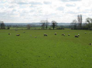
Context
Regional Character Area: The Vale of Belvoir
LDU reference: 192,193, 195,197
DPZ Reference: VB01
Characteristic Features
Landscape Analysis
- Predominantly flat low lying landform with very gentle undulations, enclosed by rolling hills such as Belvoir Ridge in Leicestershire to the south
- River Smite flows through the area; it is in set lower than the surrounding land, and is only identifiable by riparian vegetation on its steep banks
- The disused Grantham Canal is a local feature; an ongoing restoration project it is a popular recreational feature
- A remote rural character across the whole area, with occasional views to scattered villages and individual farms although mostly a remote, tranquil and undeveloped character
- The majority of land use is arable farmland although closer to the village fringes smaller pasture fields become more apparent, usually used as horse paddocks. A more continuous tract of permanent pasture is found between Colston Bassett, Kinoulton and Hickling
- Large scale regular patterned fields are common to the west of the area, although medium sized fields are present in the east. Pasture fields closer to the villages are smaller, although elsewhere integrate with the pattern and scale of arable fields. There are more trees around the pastoral fields which give a slightly stronger sense of enclosure to that of the arable fields. Closer to the Grantham Canal as the land gently slopes the field pattern becomes more irregular
- Field boundaries are predominantly maturing hawthorn hedgerows, up to 1.5m in height, especially around Colston Bassett. Field ditches are present at some boundaries usually along roads
- In the south there are very few hedgerow trees, these become more frequent towards the north of the area in the transition between the vales and the South Nottinghamshire Farmlands
- Woodland is dispersed and includes occasional blocks, clumps and linear belts. The main woodland component is formed by frequent clumps along field margins and around farms. Locally prominent woodland is found in parkland around Colston Bassett Hall
- Clumps of woodland associated with water courses, along the Grantham Canal and maturing hedgerows are prominent linear wooded features
- The medieval ploughing system of ridge and furrow is evident close to the village of Kinoulton and along the low escarpment at Hickling and is locally distinctive
- Small scattered villages through out the area include the linear settlements of Kinoulton, and Hickling and the smaller nucleated settlements of Colston Bassett and Owthorpe. Larger settlements of Langar and Cropwell Bishop are situated on the fringes of the DPZ
- The DPZ contains distinctive vernacular settlements such as Hickling
- Urban form is generally uniform and has mainly red brick properties with some larger individual rendered properties. Settlements are dispersed and tend to have rooflines visible within wooded edges
- Villages often contain one main street or a couple with a small junction including a small grassed area and trees. Many properties have small well maintained gardens with some smaller former farm buildings bordering the street. Avenues of trees are also common
- There is a linear dispersion of farms and larger farm buildings mostly situated close to roads
- Churches at Langar and Granby are prominent skyline features on high ground. Hickling church tower is prominent above a dispersed village edge
- Extensive views beyond the DPZ towards the Belvoir Ridgeline in Leicestershire with Belvoir Castle prominent on the wooded ridgeline
- Winding narrow lanes thread across the area linking the scattered villages. They have medium to wide grass verges with frequent ditches, some have very steep sides
- Overhead lines are visible over the area due to the low-lying landform
- Langar airport, with its industrial buildings and runways has a localised urbanising effect on the rural mostly undeveloped appearance of the landscape
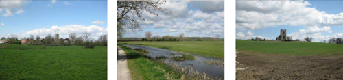
Condition
A predominantly flat, low-lying landform with gentle undulations, enclosed by surrounding rolling hills and the Belvoir Ridgeline in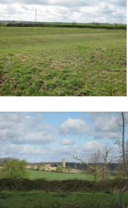
Leicestershire. It has a rural character with few urban features, where present these comprise scattered villages and isolated large farm buildings.
The area has a mixed field pattern, with medium semi-regular and irregular field patterns close to the settlement fringes and more modern larger modified field pattern across the remainder of the landscape. There is a former military airfield at Langar in the south of the DPZ now used for commercial uses.
The area has little woodland cover although linear woodland belts are found along the water courses, with riparian species, such as willow and poplar and an occasional ash. There are occasional woodland coverts and a regular dispersal of small clumps of younger trees found primarily around settlement fringes. Horse chestnut and mature hawthorn are found in avenues along roads.
The landscape condition is MODERATE. There is some hedgerow fragmentation occurring at fields boundaries, although hedgerows along roads are well maintained and in generally good condition. There is relatively little evidence of decline, and generally the area appears to be managed.
Landscape Strength
Views are over long distances across the area, although in places filtered by tall well maintained hedgerows, towards Belvoir Ridge in
Leicestershire. Views contain rooflines and prominent churches filtered by the wooded edges of the settlements, and frequent large
farm properties. Rural views with frequent grazing livestock are a feature.
The character strength of the area is STRONG. The area has a consistent rural character with few urban features. It is a flat arable
landscape with large regular field patterns and pockets of woodland. The pattern varies closer to the settlements, where smaller pastoral fields create a sense of enclosure. Land alters between arable farming which is slightly more open and the more
enclosed and intimate pastoral fields. However the rural landscape has distinctive church towers and spires which are visible above
scattered wooded edged settlements and occasional individual large farm buildings are consistent across the DPZ.
This DPZ shares some similar characteristics to Aslockton village farmlands however it differs through a greater amount of pasture
farming, smaller more dispersed settlements, more prominent wooded streams and watercourses and its low-lying land form enclosed by higher ground on all sides.
The landscape condition is MODERATE. The strength of character is STRONG. The overall landscape strategy is CONSERVE AND ENHANCE.
Landscape Actions
Landscape features
- Conserve the older field pattern particularly where there is evidence of older semi-regular and irregular pattern close
to settlement edges at Hickling, Colston Bassett and Kinoulton
• Conserve and enhance hedgerow field boundaries by infill planting where fragmentation has occurred to ensure
field pattern is maintained
• Conserve and enhance continuous expansive views towards the ridgeline in Leicestershire and Belvoir Castle
• Enhance the distribution of hedgerow trees by increasing numbers within field boundaries to increase the wooded
character of the area, particularly in arable farmed areas where the land tends to be more open
• Conserve the ridge and furrow where present particularly within fields close to Kinoulton and Hickling
• Conserve areas of pasture at settlement fringes, as these are key features within this landscape and remnants of a
once more extensive pastoral landscape
• Conserve and enhance the fringes of the watercourses, the Grantham Canal and the River Smite, through small
scale riparian planting
• Conserve the roadside hedgerows and avenues of horse chestnut and ash ensuring a programme for maintenance
and replacement where they have become senescent
• Enhance the Kinoulton Marsh and wetlands establishing along the Canal through seeking to extend the area where
possible and encourage management to retain them as local landscape features
• Conserve and enhance the informal recreational character of the Grantham Canal
• Conserve and enhance surrounding Colston Bassett Hall, ensuring replacement tree planting and return of pasture
within its grounds
• Conserve views to higher ridgelines through managing and careful placement of built form and woodland
vegetation to maintain the sense of enclosure within the landscape and framing of views
Built form
- Conserve and enhance the remote rural tranquil character of the area through ensuring built form remains
insignificant in the landscape through appropriate siting and planting
• Conserve the prominence of the village churches in the skyline
• Any developments on the village fringes should use red brick and pantile roofs and make a positive contribution to
local character and distinctiveness within individual villages
• Conserve tree cover and pasture at the village fringes which softens the appearance of villages within the
landscape Conserve the distinctive historic core of villages
Other development/ structures in the landscape
- Enhance the airfield at Langar, ensuring that new development is kept to a minimum and where required appears as
farm-scale buildings, potentially incorporating, where practical, small scale copses and clumps of trees around
fringes of the airport
• Conserve and enhance wide grass verges and distinctive ditches and wetlands along small rural roads through the
character area
• Conserve the network of small roads; any highway improvements should be carefully designed and implemented to
avoid urbanising effects