Rushcliffe 100 Walk
Contents
- Introduction
- About the Walk - sections
- Rights of Way
- Countryside Code
- Maps
- Have you walked the Rushcliffe 100?
The Rushcliffe 100 is a circular walk, 100km long, around the Borough of Rushcliffe. It was devised by a member of staff at Rushcliffe Borough Council - who has verified the route by walking it.
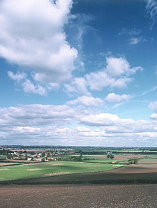
The walk climbs up and down the hills and valleys of the Wolds, follows the Rivers Soar and Trent and crosses the Vale of Belvoir. It passes through beautiful farmland, woodland and villages and crosses some of the highest land in the Borough.
The walk is largely along public rights of way, footpaths and bridleways and only uses roads where necessary. As a circular walk it has no set start or finish point and can be walked in either direction. When planning the walk the author walked it as a series of circular day walks, which, it is anticipated, is how most users will walk it.
The walk has been split into six sections, as shown below.
About the walk
- Willoughby on the Wolds to West Leake 13.6k (8.5m)
- West Leake to Thrumpton 19.1k (11.9m)
- Thrumpton to Radcliffe on Trent 19.1k (12m)
- Radcliffe on Trent to Car Colston 16.1 (10.1m)
- Car Colston to Colston Bassett 16.0k (9.9m)
- Colston Bassett to Willoughby on the Wolds 16.9k (10.6m).
Alternatively, you can download all all sections of the Rushcliffe 100 guide.
These routes are given as a guide only. To walk any part of them will require the use of your own map and a degree of planning and map reading skill.
The section maps as shown are based on the 1:50,000 Ordnance Survey maps. Walkers should use the latest Ordnance Survey 1:25,000 maps as they show much more detail and will be more up to date.
Two maps are required: OS Explorer 260 Nottingham for the northern area and OS Explorer 246 Loughborough for the southern area.
Rights of way
Public footpaths and bridleways are occasionally subject to route change. If you are certain you are in the correct place and the direction of the path on the ground appears to have changed, follow the path and hopefully you will come back on to the original or alternative route. If the path is non existent or totally blocked, check your location again, then look for a way around the problem using paths and roads. Any major problems should be reported to Nottinghamshire County Council's Countryside Access Team on 0115 977 2166.
Countryside code
Follow the Countryside Agency's advice:
- Be safe - plan ahead and follow any signs
- Leave gates and property as you find them
- Protect plants and animals, and take your litter home
- Keep dogs under close control
- Consider other people.
The land you will be walking through is farmland. As a result much of it will be growing crops, including wheat, broad beans, grass, oil seed rape and maize. It is certain that some fields will have stock in them - sheep, horses, cows, bullocks and, very occasionally, bulls. You will also see chickens, geese, hares, rabbits, foxes, ducks and swans, plus a wide range of birds, wild flowers and trees.
Whatever is in the field you are walking in, do your utmost not to damage it, frighten it or injure it. Remember what you are walking through is part of someone’s home, their place of work, their livelihood. Remember, walk quietly. Leave only footprints, take only photographs.
Maps
The Ordnance Survey mapping included within this website is provided by Rushcliffe Borough Council under licence from the Ordnance Survey in order to fulfil its public function to make available Council held public domain information. Persons viewing this mapping should contact the Ordnance Survey copyright for advice where they wish to licence Ordnance Survey mapping/map data for their own use.
Maps are reproduced based upon Ordnance Survey material with the permission of Ordnance Survey on behalf of the controller of Her Majesty's Stationary Office (c) Crown Copyright. Unauthorised reproduction infringes Crown copyright and may lead to prosecution or civil proceedings.
Have you walked the Rushcliffe 100?
Can you add to the information about the walk? If you're aware of public transport details, car parking locations, view points, places to stop for refreshments or conveniently located accommodation, we'd like to hear from you. Please tell us your story. Email media@rushcliffe.gov.uk. We'd like to know how you got on and how long it took you.